The best hikes from bus stations around Üxheim
4.4
(1876)
6,697
hikers
66
hikes
Bus station hiking trails around Üxheim navigate a landscape shaped by volcanic activity, featuring gentle hills, dense forests, and stream valleys. The region is characterized by its Volcanic Eifel topography, including volcanic cones and unique geological formations. Hikers can explore areas with maars, such as the Gemündener Maarsee, and the distinctive Dreimühlen Waterfall. The terrain offers a mix of open meadows and wooded paths along the Ahbach and Uessbach valleys.
Best bus station hiking trails around Üxheim
- The most popular…
Last updated: June 27, 2026
4.5
(327)
1,113
hikers
6.33km
01:43
90m
90m
Easy hike. Great for any fitness level. Easily-accessible paths. Suitable for all skill levels.
4.5
(25)
153
hikers
3.59km
00:56
20m
20m
Easy hike. Great for any fitness level. Easily-accessible paths. Suitable for all skill levels.

Sign up for free
4.5
(77)
258
hikers
8.07km
02:15
140m
140m
Moderate hike. Good fitness required. Easily-accessible paths. Suitable for all skill levels.
4.7
(16)
59
hikers
7.89km
02:11
140m
140m
Moderate hike. Good fitness required. Easily-accessible paths. Suitable for all skill levels.
4.6
(16)
49
hikers
Moderate hike. Good fitness required. Easily-accessible paths. Suitable for all skill levels.
Get access to more routes and recommendations from other explorers.
Sign up for free
Already have an account?
Our route recommendations are based on thousands of hikes, rides, and runs completed by other people on komoot.
Start today with a free account
Your next adventure awaits.
Login or Signup
Popular around Üxheim
Other adventures around Üxheim

Tips from the Community

Many hikers will know and share the feeling that Georg Fahrbach (who was active on the board of the Schwäbischer Albverein for a long time) describes as follows: "and every step we take awakens the blissful feeling of having earth under our feet instead of asphalt or pavement, which does not yield to our step and which makes people so tired... On the narrow meadow paths, on the heath or in the forest, the ground springs under our feet and its momentum is shared with us and our hiking companions. This gives that wonderful stride that brings the necessary relaxation and recovery to mind and spirit."
2
0
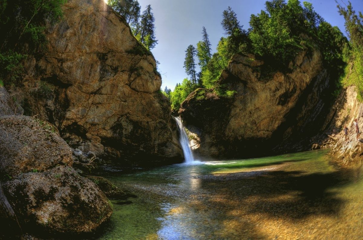
On the way to the Dreimühlen waterfall, which is well-known beyond the Vulkaneifel region and a popular excursion destination, the hiker sees the limestone rock formation towering over the water a little beforehand. It's a bit reminiscent of the Swabian Jura, as someone told me on the way today.
1
0
Some hikers who pass by here might be inspired by the existing stone figures to add another one. Perhaps even with the ambition to erect the tallest of its kind here. Others will – perhaps with a shrug – continue on without paying special attention to the small structures.
1
0

The karstified limestone cliffs are the first highlight on the path from the parking lot to the waterfall. Here, the stream has carved its way through the limestone, creating the rock face. The limestone originated as a deposit of dead marine organisms on the seabed of a shallow ocean that covered this area millions of years ago. Later, the ground was uplifted by tectonic processes. Limestone reacts with acid and is therefore dissolved by rainwater and surface water, which is slightly carbonated due to the CO2 in the air. This process creates weathered formations and caves. The formation of the Dreimühlen Waterfall is also related to this process.
5
0

Beautiful rock face to see.
5
0
Super cute stone men.
3
0
There is a bridge nowadays.
3
0
These are really beautiful waterfalls to see.
2
0
Frequently Asked Questions
How many bus-accessible hiking trails are there around Üxheim?
There are over 60 bus-accessible hiking trails around Üxheim, offering a wide range of options for all skill levels. This includes 30 easy routes, 29 moderate routes, and 9 more challenging trails.
What do other hikers say about the trails around Üxheim?
The bus-accessible trails around Üxheim are highly rated by the komoot community, with an average score of 4.4 out of 5 stars from over 1,700 reviews. Hikers frequently praise the diverse volcanic landscape, the well-maintained paths, and the scenic viewpoints.
When is the best time of year to hike around Üxheim?
The best seasons for hiking in Üxheim are spring and autumn. In spring, the meadows are vibrant with blossoms, and in autumn, the forests display stunning golden foliage. The weather during these times is generally mild and pleasant for outdoor activities.
Are there easy hiking trails accessible by bus in Üxheim?
Yes, Üxheim offers many easy hiking trails accessible by bus. For example, the Dreimühlen Castle Ruins – Dreimühlen Waterfall loop from Üxheim is an easy 3.7 km route that takes you past interesting sights. Many routes around the maars, like the Gemündener Maarsee mentioned in regional research, also offer easy, family-friendly options.
Are there any hikes from bus stations that feature waterfalls?
Absolutely! The unique "growing" Dreimühlen Waterfall is a significant natural attraction in the region. You can explore it on the Dreimühlen Waterfall – Rock face at Nohner Mühle loop from Üxheim, an easy 6.3 km trail starting from Üxheim.
Can I visit historical sites like castles on bus-accessible hikes?
Yes, you can incorporate historical sites into your bus-accessible hikes. While privately owned, Kerpen Castle (Eifel) is an impressive landmark to walk around. The Kerpen Castle (Eifel) – Former marble quarry Berndorf loop from Kerpen is a moderate 7.3 km route that allows you to experience its grandeur.
Are there trails with panoramic viewpoints accessible by bus?
The Üxheim region is known for its "Eifel Blicke" (panoramic viewpoints). The View of Leudersdorf – Leudersdorf Panorama Trail loop from Üxheim is a moderate 7.7 km route that offers expansive vistas over Leudersdorf and the Ahbach valley, showcasing the beautiful Eifel landscape.
What natural features can I explore on hikes around Üxheim?
The Üxheim area, nestled in the Volcanic Eifel, offers a dramatic landscape shaped by volcanic activity. You can explore volcanic cones, lava fields, and unique geological formations like the Rock face at Nohner Mühle. The region is also famous for its maars (volcanic lakes), extensive forests, and tranquil stream valleys.
Are there family-friendly hiking routes from bus stops in Üxheim?
Many routes in the Üxheim area are suitable for families. The easy trails around the maars, such as the Gemündener Maarsee, are particularly popular for their gentle paths and scenic picnic spots. The "Üxheim Trail" also offers varied terrain and impressive views suitable for families.
Are the bus-accessible trails around Üxheim dog-friendly?
Generally, the hiking trails around Üxheim are dog-friendly, allowing you to enjoy the natural beauty with your canine companion. It's always recommended to keep dogs on a leash, especially in nature reserves or near livestock, and to carry water for them. Specific restrictions might apply in certain protected areas, so check local signage.
Can I find places to eat or drink along the bus-accessible trails?
Yes, some bus-accessible routes offer opportunities for refreshments. For instance, the Nohner Mill Café is a highlight that can be found along certain trails, providing a convenient stop for a break and a bite to eat. Many villages also have local cafes or pubs.
Are there circular hiking routes that start and end at bus stations?
Yes, the Üxheim region features several well-signposted circular hiking routes that are easily accessible from bus stops. These routes are designed to bring you back to your starting point, making them convenient for public transport users. Examples include the "Circular hiking route 'Hillesheimer Land'" and the "Üxheim - round" hike, which offer varied terrain and wide views.
Most popular routes around Üxheim
Most popular attractions around Üxheim

Get inspired with the komoot mobile app


Explore more
Browse the best Hikes in other regions.
