Easy hikes and walks around Üxheim
4.4
(1962)
6,360
hikers
76
hikes
Easy hiking trails around Üxheim traverse a landscape shaped by ancient volcanic activity, offering a diverse topography within Germany's Vulkaneifel district. The region features gentle hills, dense forests, and open meadows, providing varied terrain for hikers. Meandering brook valleys and agricultural fields are common, with trails often leading to panoramic views across the Vulkaneifel. Notable natural features include the Dreimühlen Waterfall and various rock formations.
Best easy hiking trails around Üxheim
- The most popular easy hiking route is Dreimühlen Waterfall…
Last updated: October 3, 2026
4.5
(374)
1,217
hikers
6.34km
01:44
90m
90m
Easy hike. Great for any fitness level. Easily-accessible paths. Suitable for all skill levels.
4.5
(27)
155
hikers
3.60km
00:56
20m
20m
Easy hike. Great for any fitness level. Easily-accessible paths. Suitable for all skill levels.

4.2
(15)
79
hikers
6.36km
01:40
50m
50m
Easy hike. Great for any fitness level. Easily-accessible paths. Suitable for all skill levels.
4.8
(5)
15
hikers
Easy hike. Great for any fitness level. Easily-accessible paths. Suitable for all skill levels.
4.7
(3)
18
hikers
Easy hike. Great for any fitness level. Easily-accessible paths. Suitable for all skill levels.
Get access to more routes and recommendations from other explorers.
Already have an account?
Our route recommendations are based on thousands of hikes, rides, and runs completed by other people on komoot.
Other adventures around Üxheim

Tips from the Community

One of the pictures only shows the ford here. On our visit in September 2026, a new bridge has been built next to the ford. (the old foundations are still visible in the photo).
0
0

At the Nohner Mühle, there is the best cake in the region and everyone is always extremely friendly!
1
0

A visitor hotspot. Especially on weekends, often totally overcrowded.
0
0
Stable bridge that allows us to cross the Ahbach safely.
2
0
The historical origins of the castle are obscure, which is due on the one hand to the fact that no excavations have been carried out so far, and on the other hand, a confusion with Blankenheim Castle in documentary mentions cannot be ruled out. A first mention in a deed of donation from 1272 is therefore considered controversial for this castle. Rather, a document from 1341 is regarded as the oldest source for the castle, in which Margrave Wilhelm I of Jülich transferred "sine nuwe burch Blankenheym" to Gerhard V of Blankenheim as an hereditary fief. From then on, the castle (predominantly as a fief) remained in the possession of the Lords of Blankenheim and was administered, among others, by Friedrich von Blankenheim. In 1470, after several changes of ownership and inheritance disputes, the County of Blankenheim passed to Count Dietrich III of Manderscheid, while the castle was transferred to the Lords of Mirbach in the meantime. In 1521, Dietrich von Mirbach described Neublankenheim Castle as "destroyed" and asked his liege lord, Count Johann von Manderscheid, for help with the reconstruction. In the following years, the castle (apparently, no secure source findings) was not rebuilt due to its secluded location and the resulting lack of strategic importance. Around 1770, Duke Karl Maria Raimund von Arenberg acquired surrounding lands and also the castle ruins, so that the estate passed to the Duchy of Arenberg. After the occupation of the left-bank territories of the Rhine in 1794 by French revolutionary troops, the possessions of the Duchy of Arenberg also passed to the French state due to the provisions of the Peace of Lunéville. Neublankenheim Castle was auctioned and was subsequently in private ownership. The current owner is the Vulkaneifel district (formerly Daun district). Source: Wikipedia
4
0


Frequently Asked Questions
How many easy hiking trails are available around Üxheim?
Üxheim offers a wide selection of easy hiking trails, with over 40 routes specifically categorized as easy. The region's diverse landscape, shaped by ancient volcanic activity, provides varied terrain suitable for relaxed walks.
What kind of landscape can I expect on easy hikes in Üxheim?
Easy hikes in Üxheim traverse a varied landscape featuring gentle hills, dense forests, and open meadows. You'll encounter meandering brook valleys, agricultural fields, and often enjoy wide panoramic views across the Vulkaneifel and Gerolsteiner Land region. The area is characterized by its unique volcanic origins, offering a blend of natural beauty.
Are there any waterfalls or significant water features on easy trails?
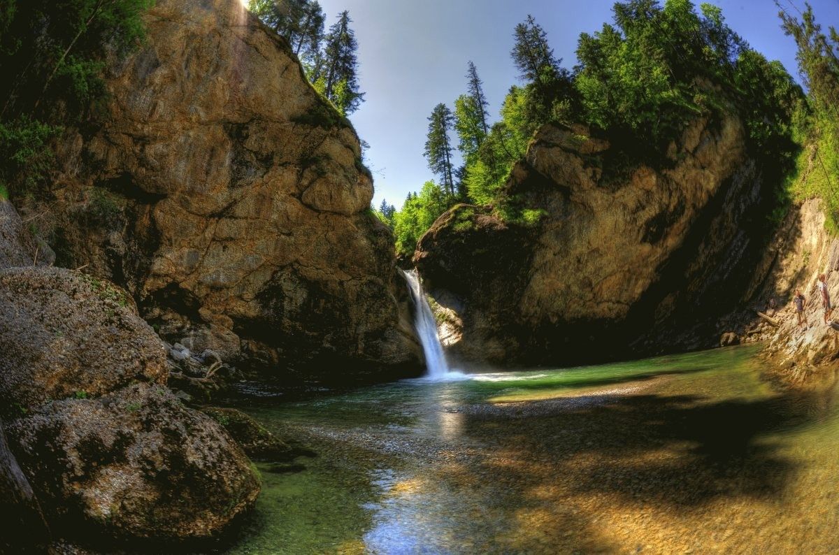
Yes, the region is known for its captivating water features. The Dreimühlen Waterfall is a notable highlight, famous for 'growing' due to limescale deposits. You can experience it on routes like the Dreimühlen Waterfall – Rock face at Nohner Mühle loop from Üxheim or the Dreimühlen Castle Ruins – Dreimühlen Waterfall loop from Üxheim. The scenic Gemündener Maarsee, a volcanic lake, is also nearby and offers opportunities for picnicking.
Can I find any interesting rock formations or caves on easy hikes?
Absolutely. The Vulkaneifel region features impressive rock formations and prehistoric rock caves. While hiking, you might encounter striking formations like those near the Nohner Mühle, as seen on the Dreimühlen Waterfall – Rock face at Nohner Mühle loop from Üxheim. The broader area also includes features like the Buchenloch Cave, once used by Neanderthals, and gorges with moss-covered sandstone walls.
Are there family-friendly easy hikes suitable for children?
Many easy trails around Üxheim are suitable for families with children. The varied terrain and natural attractions like waterfalls and castles make for engaging walks. The circular route around the Gemündener Maarsee is particularly recommended for families, offering a pleasant outdoor experience.
Are dogs allowed on the easy hiking trails in Üxheim?
Generally, dogs are welcome on the hiking trails in Üxheim. It's always advisable to keep your dog on a leash, especially in nature reserves, near livestock, or in areas with wildlife. The natural paths and open spaces provide a great environment for walks with your canine companion.
Are there easy circular hiking routes in Üxheim?
Yes, many of the easy trails around Üxheim are circular routes, offering convenient starting and ending points. Examples include the Bridge Over the Ahbach – Dreimühlen Castle Ruins loop from Üxheim and the Moss-Covered Limestone Blocks – Kerpen Castle (Eifel) loop from Kerpen, allowing you to explore without retracing your steps.
What is the best time of year for easy hiking in Üxheim?
The best times for hiking in Üxheim are spring and autumn. In spring, the meadows are in bloom, and the landscape is vibrant. Autumn offers spectacular golden foliage and pleasantly mild weather, making for particularly colorful and enjoyable walks. While possible year-round, these seasons provide optimal conditions.
Are there any short easy hikes around Üxheim?
Yes, there are several short and easy options. For instance, the Dreimühlen Castle Ruins – Dreimühlen Waterfall loop from Üxheim is about 3.6 km and takes less than an hour, while the Rock face at Nohner Mühle – Nohner Mill Café loop from Nohn is also around 3.6 km and can be completed in under an hour.
What interesting landmarks or attractions can I see near the easy trails?
Beyond the natural beauty, you can explore historical and geological landmarks. Routes often pass by sites like Kerpen Castle, which you can see on the Moss-Covered Limestone Blocks – Kerpen Castle (Eifel) loop from Kerpen. Other nearby attractions include the Lampertstal gorge and the Martins Cave, offering diverse points of interest.
Are there any cafes or refreshment stops along easy hiking routes?
Some routes offer opportunities for refreshment. For example, the Rock face at Nohner Mühle – Nohner Mill Café loop from Nohn specifically mentions a café, providing a convenient stop during your hike. Many villages in the region also have local establishments where you can find refreshments.
What do other hikers say about the easy trails in Üxheim?
The easy trails in Üxheim are highly rated by the komoot community, with an average score of 4.4 stars from over 1700 reviews. Hikers often praise the region's diverse volcanic landscapes, the well-maintained paths, and the scenic beauty of features like the Dreimühlen Waterfall and the panoramic views.
Most popular routes around Üxheim
Most popular attractions around Üxheim

Get inspired with the komoot mobile app


Explore more
Browse the best Hikes in other regions.
