The best traffic-free bike rides in Parco Regionale Dell'Aveto
4.4
(55)
669
riders
9
rides
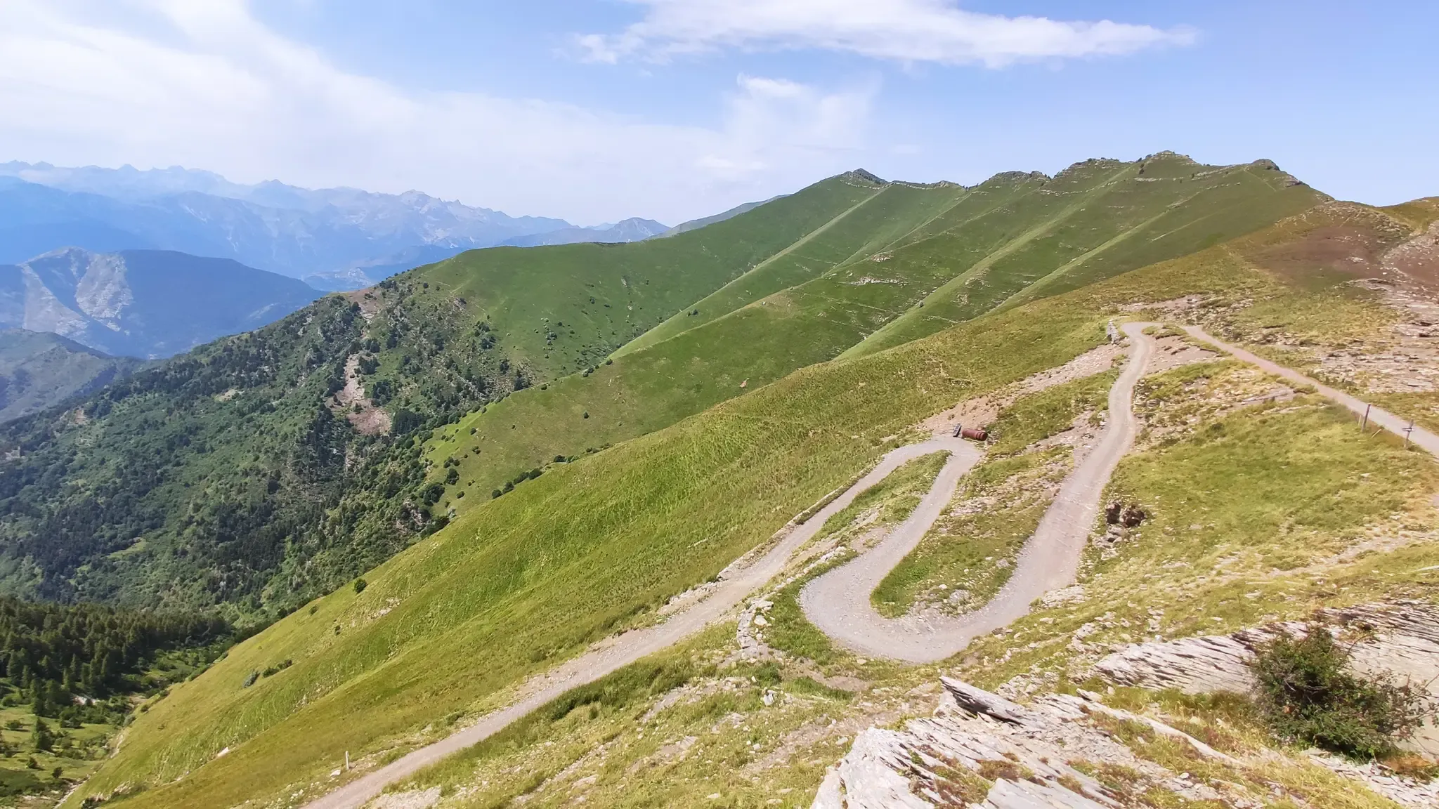
No traffic touring cycling routes in Parco Regionale Dell'Aveto traverse the Ligurian Apennines, characterized by mountainous terrain and unique ophiolite rock formations. The park features dense beech and conifer forests, several glacial lakes including Lame Lake, and diverse valleys. Elevation changes are significant, with peaks like Monte Penna and Monte Aiona shaping the landscape. The region offers varied environments for touring cyclists, from high-mountain scenery to rural landscapes.
Best no traffic touring cycling routes in Parco Regionale Dell'Aveto
- The most…
Last updated: July 10, 2026
8
riders
67.2km
06:27
2,190m
2,200m
Hard bike ride. Very good fitness required. Mostly paved surfaces. Suitable for all skill levels.
34
riders
51.1km
05:08
1,680m
1,680m
Hard bike ride. Very good fitness required. Mostly paved surfaces. Suitable for all skill levels.

Sign up for free
5.0
(3)
13
riders
34.3km
03:27
1,290m
1,290m
Hard bike ride. Very good fitness required. Mostly paved surfaces. Suitable for all skill levels.
4.3
(4)
79
riders
42.5km
03:47
1,200m
1,200m
Hard bike ride. Very good fitness required. Mostly paved surfaces. Suitable for all skill levels.
4.0
(2)
44
riders
41.4km
04:14
1,240m
1,240m
Hard bike ride. Very good fitness required. You may need to push your bike for some segments of this route.
Get access to more routes and recommendations from other explorers.
Sign up for free
Already have an account?
Our route recommendations are based on thousands of hikes, rides, and runs completed by other people on komoot.
Start today with a free account
Your next adventure awaits.
Login or Signup
Popular around Parco Regionale Dell'Aveto
Other adventures in Parco Regionale Dell'Aveto

Tips from the Community

Good spot for a stop. Easy to reach
0
0
It is easily well marked along the forest road.
0
0
Beautiful hiking structure located at 1,400 meters, surrounded by beech trees and positioned on the border with the municipalities of Bedonia and Tornolo for the province of Parma, and Santo Stefano d'Aveto for the metropolitan city of Genoa. Too bad it is never open despite the structure being recent and in good condition.
0
0
Beautiful pass of the Ligurian Apennines located at 1,468 meters. Strategic point that offers various alternatives to start a walk or a long hike.
0
0
Pass of the Ligurian Apennines located at an altitude of 1,452 m, it is reachable by car and is a crossroads where various hiking trails branch off.
0
0
Born from the recovery of old barracks, it is a beautiful refuge where you can both eat and stay overnight. The location is stunning and makes it a must-stop when visiting these areas.
0
0

Pria Burgheisa (Pietra Borghese) is a massive outcrop of mantle peridotites, among the best-known and most significant in the area. It lies on the southwestern edge of the Prato Mollo plateau, on the southern slopes of Mount Aiona, at an altitude of 1,465 m. It is a geosite of considerable petrographic, mineralogical, and regional geological interest, allowing us to study the evolution of a portion of the lithospheric mantle subsequently involved in the Apennine orogeny. The outcrop has a highly irregular shape: 30 m long, 10 m wide at its maximum, and 7–8 m high. The rocks are dark in color, ranging from blackish to brownish; the mass is affected by three main fracture systems, more or less orthogonal to each other, which fragment it into numerous square-shaped blocks. The surface of the blocks has a pitted appearance, as the pyroxene crystals, more resistant to erosion than olivine, remain prominent. At the outcrop, mantle foliation is evident, due to the presence of frequent pyroxenite bands. Source: Liguria Geosite Registry.
0
0

Situated at 717 meters above sea level, Santa Maria del Taro is a hamlet in the municipality of Tornolo (province of Parma), nestled in the heart of the Northern Apennines, near the border between Emilia and Liguria. Since the early Middle Ages, its strategic position along the ancient ridge road connecting the sea to the Po Valley has made it a transit and trade center, as well as a military and commercial control point. The name itself recalls the religious devotion that has permeated the town for centuries: the church-sanctuary dedicated to the Nativity of Mary, rebuilt in neoclassical style between 1807 and 1834, stands on an older structure and has been the spiritual center of the upper Taro Valley for centuries. The building, with its broad façade and stone bell tower, preserves a deep devotional tradition that is still alive. A short walk from the center is the Ponte dei Priori, a medieval humpbacked stone structure that once served as the only permanent access to the valley and symbolically marked the passage between the lands of the Malaspina and Fieschi families, two powerful feudal families of the Apennines. Over the centuries, Santa Maria del Taro has maintained an identity suspended between Emilian and Ligurian culture, evident in the features of its rural architecture, local dialects, and popular customs.
0
0
Frequently Asked Questions
How many no traffic touring cycling routes are available in Parco Regionale Dell'Aveto?
There are 10 dedicated no traffic touring cycling routes in Parco Regionale Dell'Aveto, offering a variety of challenging experiences for cyclists.
What kind of terrain can I expect on these no traffic touring cycling routes?
The routes in Parco Regionale Dell'Aveto traverse mountainous terrain within the Ligurian Apennines, featuring significant elevation changes. You'll encounter diverse landscapes, from dense beech and conifer forests to high-mountain scenery and grazing lands. Expect challenging climbs and descents, often on paths that are not paved, reflecting the park's natural environment.
Are there any notable natural features or landmarks to see along the routes?
Absolutely! The park is rich in natural beauty. You can encounter unique ophiolite rock formations, glacial lakes like Lame Lake and Giacopiane Lakes, and prominent peaks such as Monte Penna and Monte Aiona. Don't miss Pietra Borghese, a distinctive rocky outcrop known for its magnetic properties, or the beautiful Ciana Waterfall.
What is the best time of year to go touring cycling in Parco Regionale Dell'Aveto?
The park is ideal for touring cycling from spring through autumn. Summer offers an escape from the heat, while autumn is particularly stunning with changing foliage. Be prepared for varied weather conditions, especially at higher elevations.
Are there any circular no traffic touring cycling routes?
Yes, many of the no traffic touring cycling routes in Parco Regionale Dell'Aveto are designed as loops. For example, you can explore the challenging Monte Penna Hut – Incisa Pass loop from I Crosi or the scenic Rifugio Monte Penna – View of Lago delle Lame loop from Monte Penna.
Are the no traffic touring cycling routes suitable for families or beginners?
The no traffic touring cycling routes in Parco Regionale Dell'Aveto are generally rated as 'difficult' due to significant elevation gains and distances. While the car-free nature enhances safety, the terrain and physical demands might be challenging for beginners or very young children. Cyclists should have a good level of fitness and experience with mountain or touring bikes.
Can I bring my dog on these cycling routes?
While the park generally welcomes dogs, it's important to keep them on a leash, especially in areas with wildlife such as the wild horses. Always ensure your dog is capable of handling the route's length and difficulty, and carry enough water for both of you.
Where can I find parking for these routes?
Parking is typically available near the starting points of many routes, often in or near the villages and passes within the park. For instance, routes starting from Borzonasca or near Passo del Chiodo usually have designated parking areas. Always check specific route details for the most convenient parking options.
Are there places to eat or stay overnight near the routes?
Yes, the park has several options. You can find refuges like the Ventarola Refuge, situated amidst ancient beech woods, which serves as a gateway to paths and offers accommodation. Charming villages such as Santo Stefano d'Aveto also provide services, including places to eat and stay. Additionally, you might find smaller huts like Rifugio Malga Zanoni along some trails.
What do other touring cyclists enjoy most about cycling in Parco Regionale Dell'Aveto?
The area is highly rated by the komoot community, with an average score of 4.59 stars. Reviewers often praise the stunning natural landscapes, the tranquility of the car-free paths, and the challenging yet rewarding climbs that offer breathtaking views of the Ligurian Apennines and its unique features like the glacial lakes and wild horses.
Are there any routes that offer views of the famous wild horses?
While specific routes aren't guaranteed to spot them, the park is known for its herds of wild horses. Routes that traverse grazing lands and higher elevations, particularly around Monte Penna and Monte Aiona, offer a higher chance of observing these unique animals. Keep an eye out, especially in quieter areas.
Can I combine cycling with other activities like visiting historical sites?
Absolutely. The park is home to charming historical villages and sites. For example, Santo Stefano d'Aveto boasts a historic castle, and you can find ancient villages like Ventarola with well-preserved stone houses. While cycling, you might pass through areas that allow for short detours to explore these cultural gems.
Most popular routes in Parco Regionale Dell'Aveto
Most popular attractions in Parco Regionale Dell'Aveto

Get inspired with the komoot mobile app


Explore more
Browse the best Cycling routes in other regions.
