Sierra Azul Open Space Preserve (Closed Areas)
Sierra Azul Open Space Preserve (Closed Areas)
The best traffic-free bike rides in Sierra Azul Open Space Preserve (Closed Areas)
4.7
(77)
2,099
riders
61
rides
Touring cycling in Sierra Azul Open Space Preserve (Closed Areas) offers routes through a diverse landscape within the Santa Cruz Mountains. The preserve features varied terrain, including serpentine grasslands, oak woodlands, and deep ravines, with significant elevation changes. Key features like Mount Umunhum and Mount El Sombroso provide expansive views, while Lexington Reservoir adds to the scenic beauty. While some areas are not yet accessible, the established trails offer extensive options for touring cyclists.
Best no traffic touring cycling routes…
Last updated: July 10, 2026
11
riders
Moderate bike ride. Good fitness required. Mostly paved surfaces. Suitable for all skill levels.
7
riders
Hard bike ride. Very good fitness required. Mostly paved surfaces. Suitable for all skill levels.

Sign up for free
5.0
(1)
18
riders
17.8km
01:13
310m
310m
Moderate bike ride. Good fitness required. Mostly paved surfaces. Suitable for all skill levels.
16
riders
Hard bike ride. Very good fitness required. Mostly paved surfaces. Suitable for all skill levels.
15
riders
12.7km
01:37
560m
560m
Hard bike ride. Very good fitness required. Mostly paved surfaces. Suitable for all skill levels.
Get access to more routes and recommendations from other explorers.
Sign up for free
Already have an account?
Our route recommendations are based on thousands of hikes, rides, and runs completed by other people on komoot.
Start today with a free account
Your next adventure awaits.
Login or Signup
Popular around Sierra Azul Open Space Preserve (Closed Areas)
Tips from the Community

This is not a very exciting trail to hike. It’s pretty much a trail surrounded by thick walls of vegetation, with almost no opportunity to view your surroundings. The trail is 70% rocks/gravel, and 30% hard packed clay, so avoid wearing snickers
0
0


If you make the summit a fantastic view awaits. Be aware the road goes down then up to the road about then up again to the summit!…
0
0

A scenic stop just off the winding roads of the Santa Cruz Mountains, Lexington Reservoir County Park is a great spot to catch your breath and enjoy the view. The smooth pavement along Alma Bridge Road makes it a popular stretch for cyclists, with rolling terrain and minimal traffic. There's parking, restrooms, and shaded areas if you need a break. From here, you can loop toward Los Gatos or push deeper into the climbs of Highway 17 and Old Santa Cruz Highway.
0
0
Climbing Mount Umunhum is a tough but rewarding challenge. The road is steep, with sections reaching up to 18% grades, so pace yourself. The views from the top are spectacular, making the hard work worth it. Start early to avoid traffic and the heat, and be prepared for a long, demanding ascent.
0
0

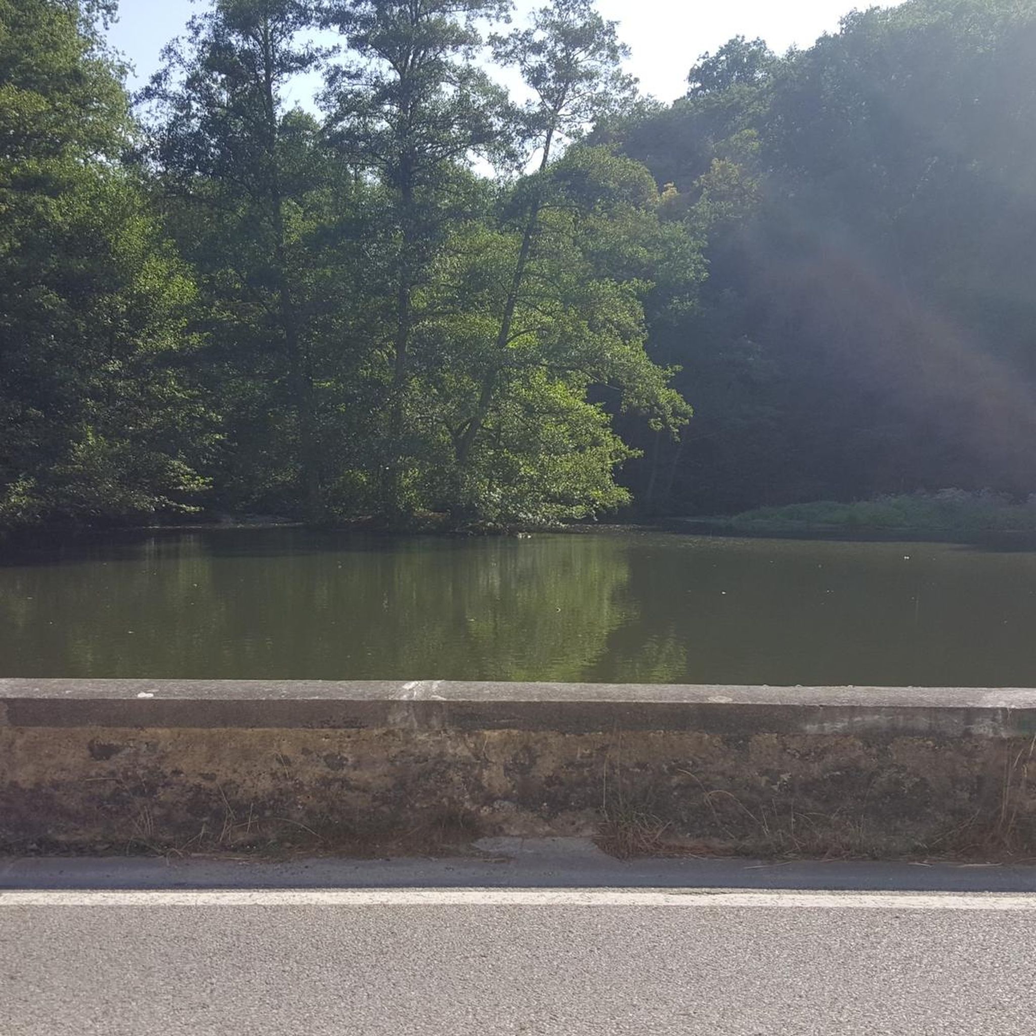
An excellent spot to take a break and enjoy the full breath of Lexington Reservoir. There is a Plaque dedicated to deputy Douglas B. Miller, who was fatally wounded while performing his duties.
0
0

The Mount Umunhum Trailhead offers some amenities, including bathrooms at both the start and summit. With parking available for about 20 cars, this trail provides great views and is a great spot for sunsets. Aim to hike early in the morning or in the evening as it can get very hot in the summer.
0
0

Frequently Asked Questions
How many no-traffic touring cycling routes are available in Sierra Azul Open Space Preserve (Closed Areas)?
There are over 50 dedicated no-traffic touring cycling routes within Sierra Azul Open Space Preserve (Closed Areas). These routes offer a diverse range of experiences, from moderate to challenging, allowing cyclists to explore the preserve's varied landscapes without vehicle interference.
What kind of terrain can I expect on these no-traffic touring cycling routes?
The no-traffic touring cycling routes in Sierra Azul Open Space Preserve offer a mix of terrain. You'll find well-paved sections, such as parts of Mount Umunhum Road, alongside gravel roads like the Los Gatos Creek Trail. Many routes also feature dirt roads, ranging from moderate to steep, so appropriate tires are recommended for a comfortable ride across varied surfaces.
Are there any family-friendly no-traffic touring cycling routes in Sierra Azul Open Space Preserve (Closed Areas)?
While many routes in Sierra Azul Open Space Preserve involve significant elevation changes, there are options suitable for families or those seeking a less strenuous ride. Look for routes categorized as 'easy' or 'moderate' difficulty. For example, the James J. Lenihan Dam – Lexington Reservoir loop from Santa Cruz Mountains is a moderate option that offers scenic views around the reservoir.
What are the best times of year to go touring cycling in Sierra Azul Open Space Preserve (Closed Areas)?
The best times for touring cycling in Sierra Azul Open Space Preserve are generally spring and fall. During these seasons, the weather is typically mild, and the natural scenery is vibrant. Summers can be hot, especially at midday, while winters may bring rain, making some unpaved sections muddy. Always check local weather conditions before heading out.
What attractions can I see along the no-traffic touring cycling routes?
Many routes offer stunning views and access to notable attractions. You can climb Mount Umunhum Road for panoramic vistas, or pass by Guadalupe Reservoir. The preserve also features diverse ecosystems, from serpentine grasslands to dense oak woodlands, and offers glimpses of local wildlife.
Are there any loop routes for no-traffic touring cyclists?
Yes, Sierra Azul Open Space Preserve offers several excellent loop routes for touring cyclists. A popular option is the Lake Ranch Reservoir – Lake Ranch Reservoir loop from Lexington Reservoir County Park, which provides a challenging ride with beautiful scenery. Another great choice is the Old Santa Cruz Highway loop from Lexington Reservoir County Park, offering a moderate challenge.
What is the difficulty level of no-traffic touring cycling routes in Sierra Azul Open Space Preserve (Closed Areas)?
The routes vary significantly in difficulty. You'll find 11 easy routes, 24 moderate routes, and 21 difficult routes. Many routes involve considerable elevation gain, especially those heading towards peaks like Mount Umunhum. For example, the Old Santa Cruz Highway – Summit Store loop from Lexington Reservoir County Park is rated as difficult due to its length and elevation.
What do other touring cyclists enjoy most about the routes in Sierra Azul Open Space Preserve (Closed Areas)?
The komoot community highly rates the touring cycling experiences here, with an average score of 4.7 stars. Reviewers often praise the challenging climbs, the spectacular panoramic views from peaks like Mount Umunhum, and the sense of immersion in nature away from traffic. The diverse ecosystems and varied terrain also contribute to a rewarding cycling adventure.
Is parking available for accessing the no-traffic touring cycling routes?
Yes, parking is available at various access points to the preserve. For routes starting near Lexington Reservoir, you can typically find parking at Lexington Reservoir County Park. It's always a good idea to check specific trailhead information for the most convenient parking options for your chosen route.
What should I bring for a no-traffic touring cycling trip in Sierra Azul Open Space Preserve?
Given the varied terrain and potential for significant climbs, it's essential to be well-prepared. Bring plenty of water, snacks, a repair kit, and appropriate gear for changing weather conditions. Sun protection is crucial, and a helmet is always recommended. For routes with mixed surfaces, consider tires suitable for gravel or dirt roads.
Are there any cafes or places to refuel near the no-traffic touring cycling routes?
While the preserve itself is a wilderness area with no services, you can find cafes and amenities in nearby towns. Los Gatos, for instance, is a popular starting point or destination for rides and offers various options for food and drinks. Plan your route to include stops in these towns if you need to refuel.
What kind of wildlife might I encounter on these routes?
Sierra Azul Open Space Preserve is home to abundant wildlife. Cyclists might spot deer, various bird species, and occasionally bobcats or coyotes. While rare, mountain lions also inhabit the preserve. Always maintain a respectful distance and be aware of your surroundings, especially during dawn and dusk.
Most popular routes in Sierra Azul Open Space Preserve (Closed Areas)
Most popular attractions in Sierra Azul Open Space Preserve (Closed Areas)

Get inspired with the komoot mobile app


Explore more
Browse the best Cycling routes in other regions.
