The best family-friendly hikes and walks in Katy Trail State Park
4.7
(38)
587
hikers
13
hikes
Family friendly hiking trails in Katy Trail State Park follow the nation's longest rail-to-trail conversion, offering a generally flat path with a crushed limestone surface. The region is characterized by its proximity to the Missouri River, providing views of the river and its dramatic limestone bluffs. Hikers can experience diverse environments, including dense woodlands, open fields, and wetlands, alongside picturesque farmland. The trail's accessible terrain makes it suitable for various fitness levels.
Best family friendly hiking trails in Katy Trail State Park
- The most popular family friendly hiking route is Katy Trail: Rocheport to Huntsdale, a 7.3 mile (11.7 km) moderate trail that takes about 2 hours 59 minutes to complete. This section offers views of the Missouri River and limestone bluffs.
- Another top favourite among local hikers is Katy Trail: North Jefferson to Hartsburg, a moderate 10.6 mile (17.0 km) path. This route features varied landscapes and views of the Missouri River and its cliffs.
- Local hikers also love the Katy Trail: Weldon Spring to Augusta, a 13.1 mile (21.1 km) trail leading through woodlands and open areas, often completed in about 5 hours 19 minutes.
- Hiking in Katy Trail State Park is defined by its flat, crushed limestone paths, scenic river views, and historic railroad features. The network offers options for different ability levels, from short walks to longer excursions.
- The routes in Katy Trail State Park are highly rated by the komoot community with an average score of 4.8 stars from more than 30 reviews. More than 500 hikers have used komoot to explore Katy Trail State Park's varied terrain.
Last updated: July 8, 2026
17.0km
04:18
30m
20m
Embark on a moderate hiking adventure along the Katy Trail from North Jefferson to Hartsburg, covering 10.6 miles (17.0 km) with a gentle elevation gain of 85 feet (26 metres). This section of the trail offers picturesque views of the Missouri River and towering bluffs, alongside expansive farmlands and lush forests. You will also pass through charming "green tunnels" where dense vegetation creates a natural canopy, providing ample shade during your estimated 4 hours and 17 minutes on the route.
For your visit, you can access the trail at the North Jefferson Trailhead, located at mile marker 143.2. The Hartsburg Trailhead, found at mile marker 15, offers convenient amenities such as seasonally available restrooms, water fountains, and a bike repair stand. Parking is generally available at both trailheads, making it easy to start or end your journey.
This segment of the Katy Trail is rich in both natural beauty and cultural history. As you hike, you are following a path that was once part of the historic Lewis and Clark expedition's route. The trail's unique blend of river views, agricultural landscapes, and shaded forest sections makes it a notable experience within Katy Trail State Park.
11.7km
02:59
30m
40m
Embark on a moderate hike along the Katy Trail from Rocheport to Huntsdale, a 7.3-mile (11.7 km) route that takes about 2 hours and 58 minutes to complete. You will experience a gentle elevation gain of just 97 feet (30 metres) as you follow the flat, crushed-stone path. This section of the trail offers diverse scenery, from canopied stretches to open views along the Missouri River. Keep an eye out for the impressive Manitou Bluffs, towering limestone formations that add to the scenic beauty. The journey provides a peaceful escape, letting you immerse yourself in the natural surroundings.
Planning your trip on the Katy Trail: Rocheport to Huntsdale is straightforward. You can find convenient parking available at both the Rocheport Trailhead and near Huntsdale, making access simple whether you start from the east or west. The trail is generally open year-round, offering a pleasant hiking experience across most seasons. Its flat, crushed-stone surface also makes it accessible for a wide range of users, including those with mobility aids.
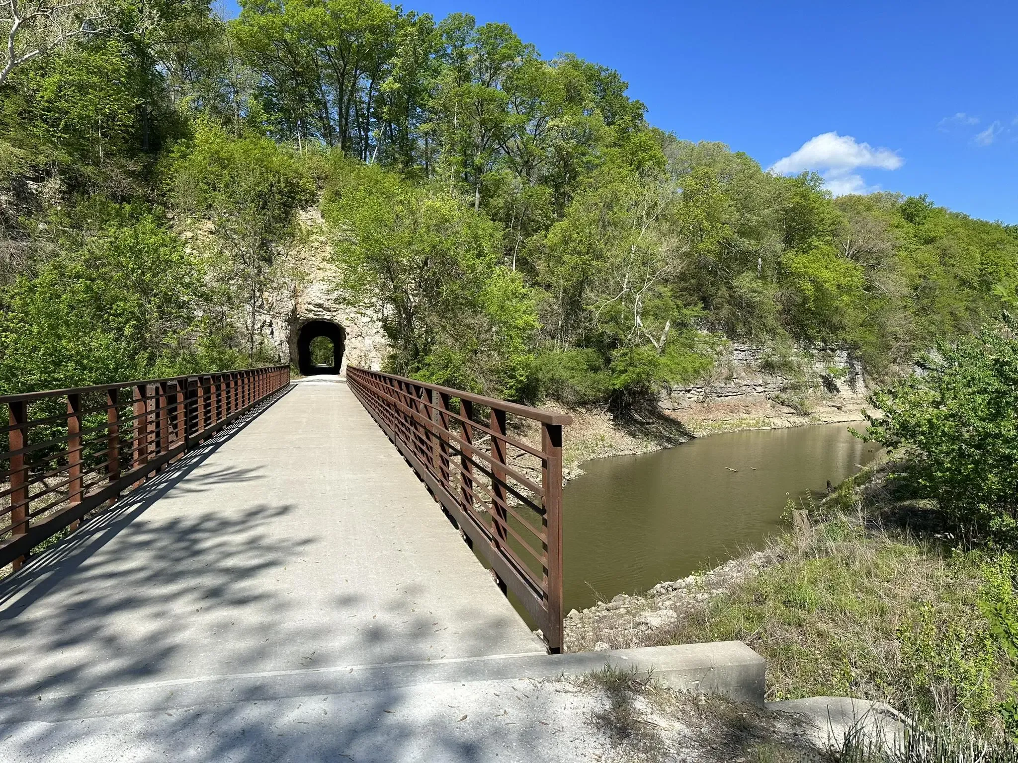
This particular stretch of the Katy Trail is notable for its historical significance and unique features. As you hike, you will pass through the Rocheport Tunnel, which is the only tunnel along the entire Katy Trail and was cut directly through solid rock. The route also features historical markers from the former MKT railroad, providing glimpses into the area's past. This blend of natural beauty and historical context makes the trail a distinctive experience within Katy Trail State Park.

Sign up for free
14.7km
03:46
70m
30m
Embark on the MKT Trail, a moderate hiking route spanning 9.1 miles (14.7 km) with a gentle elevation gain of 237 feet (72 metres). You can expect to complete this journey in about 3 hours and 45 minutes. As you hike, you will pass through diverse scenery, from open rural landscapes and farmlands along Perche and Hinkson Creeks to sections fully shaded by trees, crossing several old wooden bridges over Flat Branch Creek. Keep an eye out for attractive rock formations and the Forum Nature Area, known for its wetlands and birdwatching opportunities.
Planning your visit is straightforward, as the MKT Trail offers multiple access points. A convenient starting point is in downtown Columbia at Flat Branch Park, where you will find amenities like parking, restrooms, and water facilities. The trail features a well-packed crushed limestone surface, suitable for various activities. Be aware that parts of the trail near Flat Branch Creek can experience flooding when water levels are high, so check conditions before you go.
This accessible rail-trail is a significant feature in the region, offering a pleasant outdoor experience right in Columbia, Missouri. The MKT Trail also provides a direct connection to the much larger Katy Trail at Hindman Junction, allowing you to extend your adventure and explore an even broader network of trails. It's a great option if you are looking for a route that combines natural beauty with easy access and onward exploration possibilities.
8.25km
02:05
20m
20m
The Katy Trail offers a wonderfully accessible hiking experience, tracing a historic rail-trail that hugs the Missouri River for much of its length. You'll find yourself immersed in diverse scenery, from the tranquil flow of the river to towering bluffs and dense woodlands, all on a mostly flat, crushed limestone path. This particular section provides a taste of the trail's charm, allowing you to enjoy the natural beauty and perhaps spot some local wildlife.
Planning your visit to the Katy Trail is straightforward, with many access points and 26 trailheads along its full 240-mile span. Parking is generally available at trailheads like Pittman Hill, making it easy to start your hike. The trail's gentle terrain means it's suitable for all ages and abilities, and you'll find amenities in the charming small towns it passes through, though it's always wise to carry water, especially on warmer days.
Beyond its scenic appeal, the Katy Trail holds significant historical importance as the longest developed rail-trail in the United States, built on the former Missouri-Kansas-Texas Railroad corridor. A substantial portion is even part of the Lewis and Clark National Historic Trail, offering a unique connection to American history. It's a haven for nature lovers, with opportunities for birdwatching and wildlife sightings, making it a popular route for both local and visiting hikers.
21.1km
05:19
30m
20m
Embark on a journey along the Katy Trail from Weldon Spring to Augusta, a 13.1-mile (21.1 km) hike that offers a delightful mix of natural beauty and historical charm. You'll trek beneath a leafy canopy, catch glimpses of the Missouri River, and pass through picturesque farmlands. The route, rated difficult primarily due to its length, features a modest 83 feet (25 metres) of elevation gain and takes about 5 hours and 18 minutes to complete, making it a rewarding option for a longer day out.
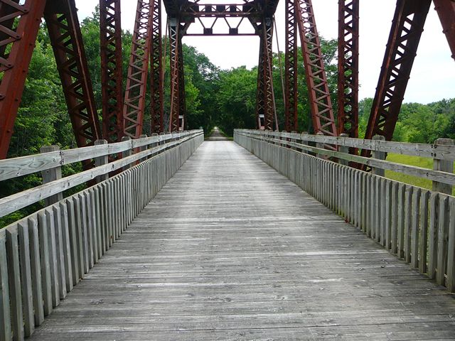
Start your adventure at the Weldon Spring trailhead, where you'll find shaded parking and facilities. As you progress, you'll encounter the historic iron bridge near Defiance and the eye-catching Sunflower Silo murals. The trail is popular in the warmer months, especially July, August, and October, and dogs are welcome on a leash. Plan for a full day to truly soak in the scenery and explore the towns along the way.
This section of the Katy Trail is a gateway to Missouri's wine country, with Augusta offering numerous wineries and breweries right off the trail. Beyond the scenic river views and charming small-town architecture, you can also access Klondike Park for additional trails and unique quarry pit views. It's a fantastic way to experience the region's agricultural heritage and enjoy a long, varied hike.
Get access to more routes and recommendations from other explorers.
Sign up for free
Already have an account?
Our route recommendations are based on thousands of hikes, rides, and runs completed by other people on komoot.
Start today with a free account
Your next adventure awaits.
Login or Signup


Tips from the Community


Tricky to get to but a great access to the KATY Trail.
0
0

This small village was named after early settler Luther D. Hart, who sold land to the Missouri–Kansas–Texas Railroad in the late 1800s. The trail runs near downtown, where you’ll spot historic buildings like the 1897 Samuel E. Hackman Building. While in-town options are limited, the Claysville Store—about 4 miles east—offers homemade meals and restrooms on weekends. Hartsburg also borders the Hart Creek Conservation Area, adding natural beauty to this quiet stretch of trail.
0
0

Flat Branch Park is where the MKT Trail starts. It’s an easy, mostly flat crushed-limestone path through shady green space that links to the Katy Trail.
2
0
On June 6, 1804, the Lewis and Clark Expedition camped on the starboard side of the Missouri River after a challenging day navigating strong currents and eroding banks. Earlier, they passed notable landmarks including Split Rock Creek and Saline Creek, the latter known for its salt springs. The day's journey was marked by the river rising a foot overnight and the crew's efforts to mend the barge's mast before setting out.
0
0
Between Rocheport and Huntsdale, the Katy Trail skirts the base of the majestic Manitou Bluffs—towering limestone cliffs shaped by the Missouri River's erosive power. These bluffs hold deep cultural significance, adorned with ancient Native American pictographs and burial mounds atop their heights. Early explorers, including Lewis and Clark, documented these sites in the early 1800s.
0
0
Just west of Rocheport, the Katy Trail passes a fascinating relic of railroad history: a stone-faced bunker built into the limestone bluffs. Constructed in the early 1900s, this structure served as a secure storage site for explosives used during the Missouri-Kansas-Texas Railroad's operations. Though now on private property, trail users can glimpse its sturdy facade from the path. This hidden feature offers a tangible connection to the region's industrial past, nestled within the scenic beauty of the Missouri River bluffs.
0
0
Just west of Rocheport, the Katy Trail offers a captivating journey through the 243-foot Rocheport Tunnel, the trail's only tunnel. Constructed in 1893 by the Missouri-Kansas-Texas Railroad, this tunnel was carved through Moniteau Bluff using manual labor and dynamite, showcasing 19th-century engineering prowess. Emerging from the tunnel, travelers cross the Moniteau Creek Bridge, a through-girder bridge spanning the serene Moniteau Creek.
0
0
Frequently Asked Questions
How many family-friendly hiking trails are available in Katy Trail State Park?
Our guide features over a dozen family-friendly hiking routes in Katy Trail State Park, ranging from easy strolls to more challenging adventures. You'll find a variety of options suitable for different ages and abilities.
What kind of terrain can families expect on the trails in Katy Trail State Park?
Katy Trail State Park is primarily known for its generally flat, crushed limestone surface, making it ideal for families, strollers, and younger children. The trail follows the former Missouri-Kansas-Texas (MKT) Railroad, so gradients are minimal. You'll hike through diverse landscapes including dense woodlands, open fields, and along the Missouri River with views of towering limestone bluffs.
Are there any specific sections of the Katy Trail that are particularly good for families with young children?
For families with young children, sections with easy access to amenities and shorter distances are ideal. The trail's flat nature makes many parts suitable. Consider routes like the shorter Katy Trail segment, which offers a gentle introduction to the park's beauty. Many trailheads also provide restrooms and picnic areas.
What interesting landmarks or natural features can we see along the family-friendly routes?
Families can discover a wealth of natural and historical sights. Don't miss the historic Rocheport Tunnel, the only tunnel on the trail. You can also spot the ancient Burr Oak Big Tree near McBaine, enjoy panoramic views from the Missouri River Overlook, or marvel at the unique Boathenge art installation. The majestic The Manitou Bluffs also offer stunning scenery.
Is Katy Trail State Park dog-friendly for family hikes?
Yes, Katy Trail State Park is very dog-friendly! Leashed dogs are welcome on all sections of the trail. Remember to bring water for your pet and dispose of waste properly to keep the trail enjoyable for everyone.
What is the best time of year to visit Katy Trail State Park with family?
Spring and fall are generally the most pleasant seasons for family hiking on the Katy Trail. Spring brings blooming wildflowers and comfortable temperatures, while fall offers spectacular foliage. Summer can be hot, so early mornings or late afternoons are best, and winter can be beautiful but requires appropriate cold-weather gear.
Are there any circular routes suitable for families in Katy Trail State Park?
While the Katy Trail itself is a linear rail-to-trail path, some sections connect with other trails or offer opportunities for out-and-back hikes that feel like a loop. For example, the MKT Trail connects to the Katy Trail at Hindman Junction, allowing for a varied experience. Many families choose to hike a section out and then turn back, enjoying the scenery from both directions.
Where can we find parking and restrooms along the family-friendly trails?
Numerous trailheads along the Katy Trail offer convenient parking and restroom facilities. Many of the towns connected by the trail, such as Rocheport, Hartsburg, and Augusta, have well-equipped trailheads. For instance, the Rocheport Trailhead is a popular starting point with amenities.
What do other hikers enjoy most about hiking in Katy Trail State Park?
The area is highly rated by the komoot community, with an average score of 4.8 stars. Reviewers often praise the trail's flat, accessible surface, the stunning views of the Missouri River and limestone bluffs, and the peaceful atmosphere. Many appreciate the historical towns and amenities available along the way, making it perfect for family outings.
Are there any longer family-friendly routes for more active families?
For families looking for a longer adventure, several moderate routes offer extended distances without significant elevation changes. Consider the Katy Trail: Rocheport to Huntsdale route, which covers over 11 km, or the Katy Trail: North Jefferson to Hartsburg section, spanning over 17 km, both offering beautiful scenery and a good workout.
Can we find food, drinks, or accommodation near the family-friendly sections of the Katy Trail?
Yes, many of the charming towns along the Katy Trail offer a variety of amenities. You'll find cafes, restaurants, and even wineries in places like Augusta and Hermann, perfect for a family stop. Several towns also provide lodging options, from quaint bed and breakfasts to hotels, if you plan an overnight trip.
Most popular routes in Katy Trail State Park
Most popular attractions in Katy Trail State Park

Get inspired with the komoot mobile app


