The best hikes from bus stations in Rheinhänge Von Burg Gutenfels Bis Zur Loreley
4.6
(22558)
82,163
hikers
391
hikes
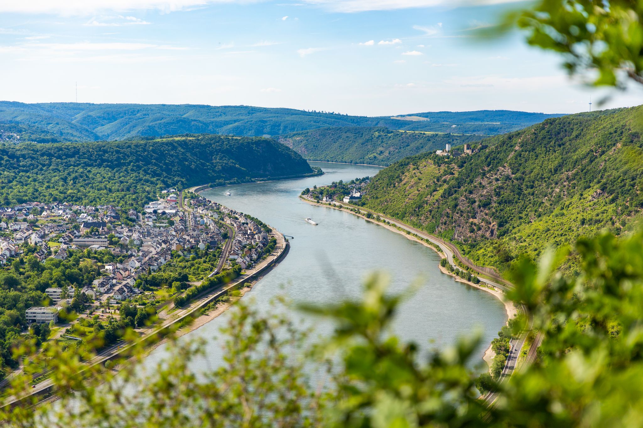
Hiking in Rheinhänge Von Burg Gutenfels Bis Zur Loreley is characterized by the dramatic landscapes of the UNESCO World Heritage Upper Middle Rhine Valley. The region features a canyon-like Rhine Valley, carved through the Rhenish Slate Mountains, with steep, vineyard-covered hillsides and striking rock formations. Hikers encounter thickly wooded mountain ridges, side valleys, and the prominent Loreley Rock, a 410-foot (125-meter) hill above the Rhine. The terrain includes xerothermic biotopes, open areas, and traditional dry stone walls.
Best bus station…
Last updated: July 9, 2026
4.7
(684)
2,272
hikers
12.8km
03:56
410m
410m
Hard hike. Good fitness required. Sure-footedness, sturdy shoes and alpine experience required.
4.8
(74)
271
hikers
7.34km
02:09
200m
200m
Moderate hike. Good fitness required. Mostly accessible paths. Sure-footedness required.

Sign up for free
4.9
(54)
182
hikers
Easy hike. Great for any fitness level. Easily-accessible paths. Suitable for all skill levels.
4.7
(129)
403
hikers
6.37km
01:55
190m
190m
Easy hike. Great for any fitness level. Easily-accessible paths. Suitable for all skill levels.
4.5
(20)
110
hikers
10.3km
02:56
220m
220m
Moderate hike. Good fitness required. Easily-accessible paths. Suitable for all skill levels.
Get access to more routes and recommendations from other explorers.
Sign up for free
Already have an account?
Our route recommendations are based on thousands of hikes, rides, and runs completed by other people on komoot.
Start today with a free account
Your next adventure awaits.
Login or Signup
Popular around Rheinhänge Von Burg Gutenfels Bis Zur Loreley
Other adventures in Rheinhänge Von Burg Gutenfels Bis Zur Loreley

Tips from the Community

The castle is currently under renovation, unfortunately only partially accessible for visits, but still worth it, 6 euros well spent
0
0

Phenomenal viewpoint above the Middle Rhine Valley! Grandiose view of the Rhine, Oberwesel and the surrounding castles. Perfect photo stop directly on the RheinBurgenWeg – a real highlight of the region.
2
0

Bacharach became Protestant in 1545 because its Palatinate authorities converted to the Reformation. This ended 150 years of profitable pilgrimage to the invented "Saint" Werner. In 1997, exemplary enlightenment was achieved with the memorial plaque at the ruins of the Bacharach Werner Chapel. In contrast, Oberwesel was under the authority of the Trier Electorate and remained Catholic to this day. It took over the pilgrimage business with its own Werner Chapel. When the Electorate finally struck the false saint from the list in 1963, Oberwesel stubbornly resisted. Only reluctantly was the chapel rededicated to the Franciscan nun Mother Rosa. https://www.komoot.com/de-de/highlight/634524
4
0

The castle near Kaub has majestically enthroned on a rocky reef in the middle of the Bacharach narrows since its construction in 1327, where the Rhine has also been called “Wildes Gefähr” or “Wilde Fahrt” since the 15th century. As a watch station, it secured the Kaub toll – a lucrative source of income for its various feudal lords. Castle Pfalzgrafenstein can only be reached from Kaub by the passenger ferry. https://tor-zum-welterbe.de/pfalzgrafenstein
0
0
The shallows and their optical and acoustic perception on the surface had been a firm component of the Rhine romanticism. Victor Hugo wrote on his Rhine journey in 1840: "The Rhine roars magnificently around Bacharach."
0
0

The legend of the Seven Virgins of Oberwesel – in detail: https://www.der-rheinreisende.de/sagenhafte-sagen/die-sieben-jungfrauen-von-oberwesel/ or here – in brief: https://www.regionalgeschichte.net/mittelrhein/oberwesel/kulturdenkmaeler/die-sieben-jungfrauen.html
0
0

The section before the Schwedenschanze was probably the most Alpine part of the track. Single trail and quite steep slopes (coming from the north). Very beautiful in dry weather with good visibility.
0
0

🏰🛡⚔️Standing defiantly over the Rhine Valley, Stahleck Castle can be found in Bacherach. The castle now houses a youth hostel.🛡 First mentioned in 1136 – destroyed in 1666 and 1689 – the castle was rebuilt in 1926 according to the original plans.🛡⚔️
1
0
Frequently Asked Questions
How many bus station hiking trails are available in Rheinhänge Von Burg Gutenfels Bis Zur Loreley?
There are over 370 hiking trails accessible directly from bus stations in the Rheinhänge Von Burg Gutenfels Bis Zur Loreley region. This includes a wide variety of routes, with approximately 178 easy, 166 moderate, and 32 difficult options to choose from.
What kind of natural features can I expect to see on these bus station hikes?
The region is renowned for its dramatic landscapes within the UNESCO World Heritage Upper Middle Rhine Valley. You'll encounter steep, vineyard-covered hillsides, striking rock formations, and xerothermic biotopes. A prominent natural landmark is the Loreley Rock, and you might also discover the Bornichbachfall, one of the Middle Rhine's largest waterfalls, descending over 20 meters in four stages.
Are there any family-friendly bus station hikes in the area?
Yes, there are many family-friendly options. For an easy and engaging walk, consider the Oberwesel Town Wall and Towers – Powder Tower, Oberwesel loop from Oberwesel. This 5.3 km route offers historical sights with minimal elevation gain, perfect for families. The region's diverse trails ensure there are suitable options for various ages and fitness levels.
Can I bring my dog on the bus station hiking trails?
Many trails in the Rheinhänge Von Burg Gutenfels Bis Zur Loreley region are dog-friendly. It's generally recommended to keep dogs on a leash, especially in nature reserves, near livestock, or in crowded areas. Always ensure your dog has access to water, particularly on longer routes or during warmer weather. Specific rules may vary by municipality, so it's good practice to look for local signage.
What are some notable viewpoints or landmarks accessible from bus stations?
The region is rich in stunning viewpoints and historical landmarks. You can visit the Felsenkanzel Viewpoint Overlooking the Rhine and the Loreley for panoramic views. The iconic Loreley Statue is also a popular spot. For historical interest, many routes offer views of impressive castles like Gutenfels Castle and Pfalzgrafenstein Castle.
Are there any challenging bus station hikes for experienced hikers?
Absolutely. For experienced hikers seeking a challenge, the region offers several difficult routes. The Seven Virgins Viewpoint – Günderode House loop from Sankt Goar is a demanding 13.1 km trail with over 400 meters of elevation gain. Another challenging option is the View of Burg Katz – View of the Loreley Rock loop from Oberwesel, covering nearly 15 km with significant ascents.
What is the best time of year to go hiking from bus stations in this area?
Spring and autumn are generally considered the best times for hiking in the Rheinhänge Von Burg Gutenfels Bis Zur Loreley. In spring, the vineyards burst into green, and wildflowers bloom. Autumn offers spectacular foliage colors and pleasant temperatures. Summer can be warm, especially on exposed trails, while winter hikes are possible but require appropriate gear for potentially icy or snowy conditions.
Are there circular hiking routes available from bus stations?
Yes, many of the bus station trails are circular routes, allowing you to start and end at the same point without needing additional transport. For example, the Swedish Redoubt – Schwedenschanze Viewpoint loop from Kaub is a moderate 7.3 km circular hike offering historical insights and scenic views.
What do other hikers enjoy most about the bus station trails in Rheinhänge Von Burg Gutenfels Bis Zur Loreley?
The komoot community highly rates the hiking experience in this region, with an average score of 4.65 stars. Reviewers often praise the stunning panoramic views of the Rhine Valley, the historical castles dotting the landscape, and the well-maintained trails that offer a diverse range of difficulty levels. The convenience of accessing these trails directly from bus stations is also frequently highlighted.
Are there any long-distance trails that can be accessed from bus stations in the region?
Yes, the region is home to segments of two renowned long-distance trails: the Rheinsteig and the RheinBurgenWeg. These trails offer challenging stages with stunning views, castles, and charming villages. Many bus stops along the Rhine provide direct access to sections of these trails, allowing you to experience a part of these epic routes as day hikes.
What kind of terrain should I expect on these bus station hikes?
The terrain is quite varied. You'll encounter steep, sometimes rocky paths, especially on trails ascending the hillsides. Many routes also feature well-trodden forest paths, vineyard tracks, and paved sections through villages. Some challenging sections, particularly on parts of the RheinBurgenWeg, may include equipped climbs with supporting irons, ropes, and ladders.
Most popular routes in Rheinhänge Von Burg Gutenfels Bis Zur Loreley
Most popular attractions in Rheinhänge Von Burg Gutenfels Bis Zur Loreley

Get inspired with the komoot mobile app


Explore more
Browse the best Hikes in other regions.
