The best traffic-free bike rides in Gimmlitztal
4.6
(1372)
6,669
riders
171
rides
No traffic touring cycling routes in Gimmlitztal traverse a landscape defined by the pristine Gimmlitz river, flowing through a designated nature reserve in the Eastern Ore Mountains of Saxony. The region features extensive forests, including spruce and mountainous spruce-fir-beech stands, alongside granite porphyry formations. This "Valley of Mills" offers well-maintained forest paths, providing a serene environment for cycling away from vehicular traffic. The area is part of a drinking water protection zone, highlighting its ecological significance.
Best no traffic touring…
Last updated: July 9, 2026
3.3
(6)
4
riders
Easy bike ride. Great for any fitness level. Mostly paved surfaces. Suitable for all skill levels.
4.5
(4)
14
riders
26.9km
02:03
420m
420m
Moderate bike ride. Good fitness required. Mostly paved surfaces. Suitable for all skill levels.

Sign up for free
4.0
(2)
7
riders
Moderate bike ride. Good fitness required. Mostly paved surfaces. Suitable for all skill levels.
5.0
(3)
7
riders
20.0km
01:27
310m
310m
Moderate bike ride. Good fitness required. Mostly paved surfaces. Suitable for all skill levels.
4.0
(2)
3
riders
13.7km
01:03
260m
260m
Moderate bike ride. Good fitness required. Mostly paved surfaces. Suitable for all skill levels.
Get access to more routes and recommendations from other explorers.
Sign up for free
Already have an account?
Our route recommendations are based on thousands of hikes, rides, and runs completed by other people on komoot.
Start today with a free account
Your next adventure awaits.
Login or Signup

Other adventures in Gimmlitztal

Tips from the Community

800 meters of elevation have been reached. The Drachenkopf peak for the 14x8000 challenge is located nearby.
0
0

Frauenstein Town Church "Our Lady" Information: It stands in the center of the market square. A memorial stone commemorates the year the first town church was built, 1491. The church was destroyed in the third town fire in 1869, and the new building, a single-nave church, was completed in 1873.
1
0

at Frauenstein market, Church of Our Lady, with Silbermann organ
0
0

The ruins of Frauenstein Castle are located on a 680-meter-high granite porphyry rock on the ridge of the Eastern Ore Mountains near the town of Frauenstein in the district of Central Saxony. See: https://de.wikipedia.org/wiki/Burg_Frauenstein_(Erzgebirge)
3
1

The Bobritzsch spring which flows into the Freiberger Mulde.
0
0
Modern construction, you can probably rent it as a holiday home
0
0
great view of Frauenstein Castle
0
0
Behind the bridge there is a nice rest area
0
0
Frequently Asked Questions
How many no-traffic touring cycling routes are available in Gimmlitztal?
There are over 170 dedicated no-traffic touring cycling routes in Gimmlitztal. These routes cater to various skill levels, with 18 easy, 75 moderate, and 81 difficult options, ensuring a suitable ride for every cyclist looking to explore the region's quiet paths.
What is the best time of year to go touring cycling in Gimmlitztal?
The Gimmlitztal is particularly beautiful for touring cycling from spring through autumn. During these seasons, the weather is generally pleasant, and the natural landscapes, including the protected wet meadows with orchids and arnica, are at their most vibrant. The well-maintained forest paths along the Gimmlitz river are ideal for cycling during these months.
Are there any family-friendly no-traffic cycling routes in Gimmlitztal?
Yes, Gimmlitztal offers several family-friendly no-traffic routes. Many paths along the Gimmlitz river are suitable for families, providing a safe and enjoyable experience. An example of an easy, family-friendly option is the Bobritzsch Spring – View of Frauenstein Castle loop from Reichenau, which is just under 6.5 km long with minimal elevation gain.
Can I bring my dog on the no-traffic cycling routes in Gimmlitztal?
Yes, many of the no-traffic cycling routes in Gimmlitztal are dog-friendly, especially those on forest paths. As the area is part of the Naturpark Erzgebirge/Vogtland and includes a nature reserve, it's important to keep dogs on a leash to protect local wildlife and respect other users. Always ensure your dog is comfortable with the distance and terrain.
What kind of natural features can I expect to see along the routes?
The Gimmlitztal is rich in natural beauty. You'll cycle through extensive forests, past the pristine Gimmlitz river, and discover protected wet meadows. Notable natural highlights include the Gimmlitz Spring, the Meandering Gimmlitz Creek, and the Orchid Meadows in the Gimmlitz Valley. The 712-meter-high rocky "Knochen" near Hermsdorf also offers expansive views.
Are there any historical or cultural attractions along the no-traffic cycling paths?
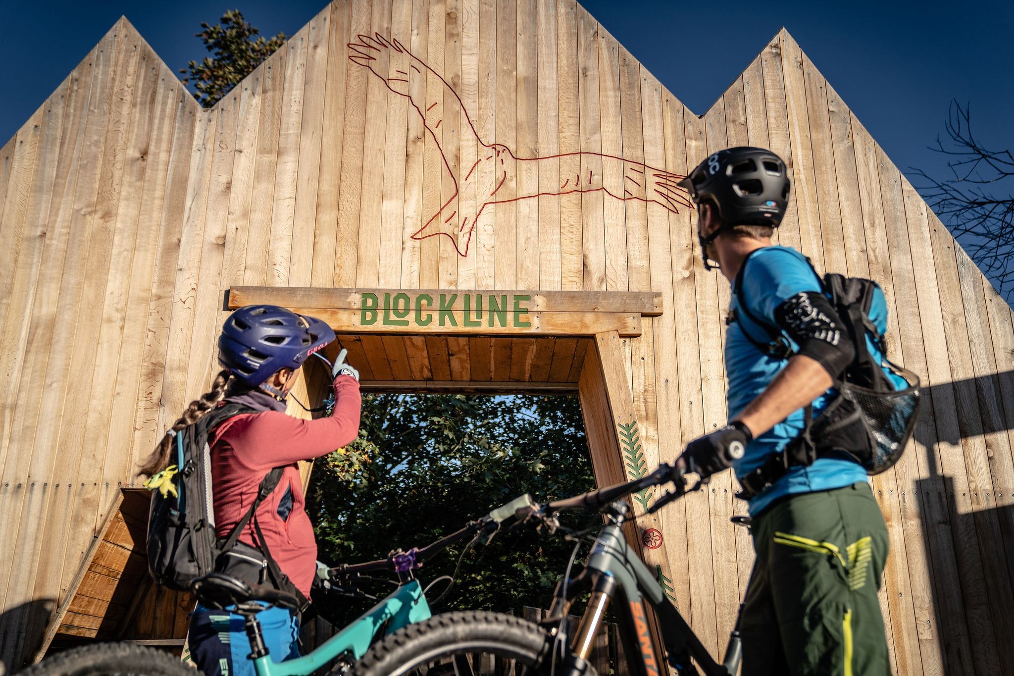
Absolutely. Gimmlitztal is known as the "Valley of Mills," and you can still find historical mills along the routes. The Illing Mill — Historic Sawmill is a notable example. The nearby town of Frauenstein features a Renaissance castle and medieval ruins, housing the Gottfried Silbermann Museum, offering a cultural detour. You might also spot the Gundi Rocket at Freie Republik Gimmlitztal or the BLOCKLINE Black Woodpecker Sculpture.
Where can I find places to rest or eat along the routes?
The Weicheltmühle is a popular excursion spot that includes a restaurant, making it an ideal stop for cyclists. Additionally, you can find resting places like the Forest Classroom Gimmlitztal, which provides informative boards and a place to pause. Several villages in the region also offer cafes and accommodations.
What is the typical surface type of the no-traffic cycling routes?
The no-traffic cycling routes in Gimmlitztal primarily utilize well-developed forest paths. These paths are generally unpaved but well-maintained, offering a natural and quiet cycling experience. Some sections may include gravel or compacted earth, suitable for touring bicycles.
Are there any circular no-traffic routes available?
Yes, many of the no-traffic routes in Gimmlitztal are designed as circular loops, allowing you to start and end at the same point. An example of a moderate circular route is the Illing Mill — Historic Sawmill – Gimmlitztal Nature Reserve loop from Hermsdorf/Erzgebirge, which covers about 16 km.
What do other touring cyclists enjoy most about cycling in Gimmlitztal?
The Gimmlitztal is highly rated by the komoot community, with an average score of 4.7 out of 5 stars from over 1,300 ratings. Reviewers often praise the region's tranquil, traffic-free paths, the pristine natural environment, and the charming historical elements like the old mills. The sense of peace and immersion in nature is frequently highlighted.
How challenging are the no-traffic routes in terms of elevation?
The routes vary in elevation gain, catering to different fitness levels. While some easy routes have minimal climbs, such as the Bobritzsch Spring – View of Frauenstein Castle loop with only 82 meters of ascent, moderate routes like the Gimmlitz Spring – Hermsdorfer Höhe loop can involve around 260 meters of climbing. There are also more difficult options with significant elevation changes for experienced cyclists.
Most popular routes in Gimmlitztal
Most popular attractions in Gimmlitztal

Get inspired with the komoot mobile app


Explore more
Browse the best Cycling routes in other regions.
