The best hikes from bus stations in Eikesdalsvatnet Landskapsvernområde
4.1
(104)
851
hikers
4
hikes
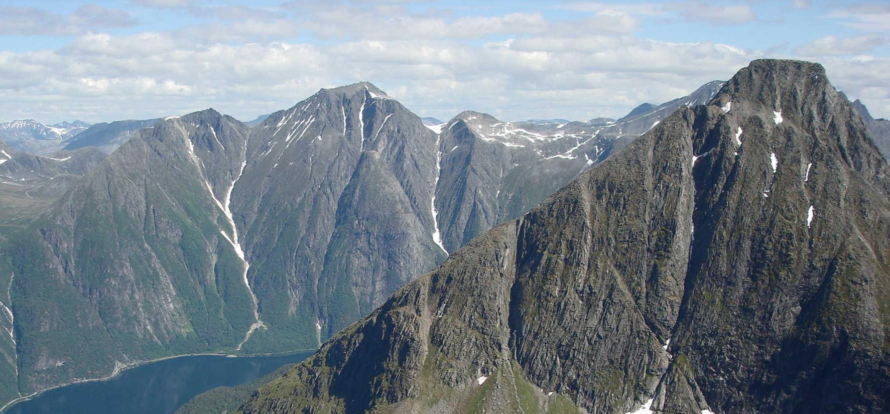
Bus station hiking trails in Eikesdalsvatnet Landskapsvernområde navigate a landscape characterized by a large, narrow lake surrounded by mountains reaching 1500 to 1800 meters. The region features the dramatic Eikesdalen valley, known for its steep mountains and rich plant life, including hazel forests. Notable natural features include the Mardalsfossen waterfall and diverse ecosystems supported by Precambrian gneiss and granite geology.
Best bus station hiking trails in Eikesdalsvatnet Landskapsvernområde
- The most popular bus station hiking route is Leads – Grytlaet loop from Tredalen, a 1.3 miles (2.1 km) trail that takes 33 minutes to complete. This easy route offers views of the surrounding valley.
- Another top favourite among local hikers is Svinberget loop from Storvikan, an easy 2.4 miles (3.9 km) path. This trail includes some elevation gain, providing varied perspectives of the landscape.
- Local hikers also love the Red Boathouses by the Lake – View of Driva River loop from Hammaren, a 4.0 miles (6.4 km) trail leading through the Eikesdalen valley and along the lake, often completed in about 1 hour 40 minutes.
- Hiking in Eikesdalsvatnet Landskapsvernområde is defined by dramatic mountain backdrops, the extensive Eikesdalsvatnet lake, and cascading waterfalls. The network offers options for various ability levels, from easy walks to more challenging ascents.
- The routes in Eikesdalsvatnet Landskapsvernområde are highly rated by the komoot community with an average score of 4.1 stars from over 90 reviews. More than 800 hikers have used komoot to explore Eikesdalsvatnet Landskapsvernområde's varied terrain.
Last updated: June 25, 2026
2
hikers
2.08km
00:33
20m
20m
Easy hike. Great for any fitness level. Easily-accessible paths. Suitable for all skill levels.
5.0
(1)
5
hikers
Hard hike. Great for any fitness level. Sure-footedness, sturdy shoes and alpine experience required.

Sign up for free
6
hikers
3.94km
01:22
210m
210m
Easy hike. Great for any fitness level. Easily-accessible paths. Suitable for all skill levels.
5
hikers
5.15km
01:19
10m
10m
Hard hike. Great for any fitness level. Sure-footedness, sturdy shoes and alpine experience required.
3.0
(1)
6
hikers
7.28km
01:56
70m
70m
Easy hike. Great for any fitness level. Easily-accessible paths. Suitable for all skill levels.
Our route recommendations are based on thousands of hikes, rides, and runs completed by other people on komoot.
Start today with a free account
Your next adventure awaits.
Login or Signup
Popular around Eikesdalsvatnet Landskapsvernområde

Other adventures in Eikesdalsvatnet Landskapsvernområde


Frequently Asked Questions
How many hiking trails are accessible directly from bus stations in Eikesdalsvatnet Landskapsvernområde?
There are currently 4 hiking trails in Eikesdalsvatnet Landskapsvernområde that are easily accessible from bus stations, offering convenient starting points for your adventure.
What is the general difficulty level of bus-accessible hikes in this region?
The bus-accessible hikes in Eikesdalsvatnet Landskapsvernområde offer a range of difficulties. You'll find 2 easy routes perfect for a relaxed stroll, and 2 more challenging routes for those seeking a greater adventure.
Are there any circular hiking routes available from bus stops?
Yes, several routes are circular, allowing you to return to your starting point without retracing your steps. For example, the Leads – Grytlaet loop from Tredalen is an easy circular option, while the Red Boathouses by the Lake – View of Driva River loop from Hammaren offers a more difficult circular experience.
What kind of natural features can I expect to see on these bus station trails?
The trails accessible by bus often showcase the region's stunning natural beauty. You can expect dramatic mountain backdrops, views of the tranquil Eikesdalsvatnet Lake, and the lush Eikesdalen Valley. Some routes might even offer glimpses of the impressive Mardalsfossen waterfall, especially between June 20th and August 20th when its flow is at its peak.
Are there family-friendly hiking options from bus stations?
Absolutely. For families looking for an enjoyable outing, easy routes like the Leads – Grytlaet loop from Tredalen or the Svinberget loop from Storvikan are excellent choices, offering manageable distances and gentle elevation changes.
Can I bring my dog on these bus-accessible hiking trails?
Many trails in Eikesdalsvatnet Landskapsvernområde are dog-friendly, but it's always recommended to keep your dog on a leash, especially in areas with livestock or protected wildlife. Always check local regulations for specific routes, but generally, the natural environment welcomes well-behaved dogs.
What is the best time of year to hike from bus stations in Eikesdalsvatnet Landskapsvernområde?
The best time for hiking is typically from late spring to early autumn (May to September). During this period, the weather is milder, trails are generally clear of snow, and the natural landscape is vibrant. Mardalsfossen waterfall is particularly spectacular between June 20th and August 20th.
What do other hikers enjoy most about the bus-accessible trails here?
The komoot community highly rates the hiking experiences in this region, with an average score of 4.1 stars. Hikers frequently praise the convenience of public transport access, the stunning fjord and mountain views, and the peaceful atmosphere of the trails.
Are there any longer, more challenging hikes accessible by bus?
Yes, for experienced hikers seeking a challenge, routes like the Red Boathouses by the Lake – View of Driva River loop from Hammaren and the Hamna – Red Boathouses by the Lake loop from Sunndalsøra offer more demanding terrain and longer durations, while still being reachable via public transport.
What are the typical distances and durations for these bus station hikes?
The distances for these routes vary, ranging from approximately 2 km for shorter, easy walks like the Leads – Grytlaet loop from Tredalen, up to about 7 km for more extensive trails such as the Furukollen Hike – Isfjorden loop from Fossavegen. Durations can range from under an hour to several hours, depending on the route and your pace.
Are there any points of interest or landmarks near the bus-accessible trails?
Many trails offer views of significant regional landmarks. You'll often find yourself hiking alongside the impressive Eikesdalsvatnet Lake, or within the dramatic Eikesdalen Valley, known for its steep mountains and rich plant life. The iconic Mardalsfossen waterfall is also a major draw in the area.
Most popular routes in Eikesdalsvatnet Landskapsvernområde

Get inspired with the komoot mobile app


Explore more
Browse the best Hikes in other regions.
