The 18 Most Amazing Peaks around Lodrino
Best mountain peaks around Lodrino are found in a region characterized by its mountainous landscape, offering opportunities for trekking and panoramic views. This area provides a variety of appealing mountain peaks and hiking experiences. The terrain includes challenging climbs, intermediate routes, and natural viewpoints. Lodrino is situated in a location that allows for exploration of diverse mountain features.
Best mountain peaks around Lodrino
- The most popular mountain peaks is Sassariente Summit, a summit from where the highest and lowest point in Switzerland can be viewed simultaneously. On clear days, the view from this location is truly remarkable.
- Another must-see spot is Cima del Gaggio, an intermediate summit. It can be reached quickly from Capanna Albagno and offers unobstructed views to the north, east, and south.
- Visitors also love Vogorno Peak, a challenging natural monument and viewpoint. It is recognized for its challenging terrain and natural beauty.
- Lodrino is known for summits, viewpoints, and challenging routes. The region offers a range of experiences, from challenging climbs to intermediate routes.
- The mountain peaks around Lodrino are appreciated by the komoot community. With 82 upvotes and 70 photos, the komoot community appreciates the diverse mountain peaks around Lodrino.
Last updated: June 24, 2026
Sassariente Summit
Highlight • Summit
Translated by Google •
Tip by

Vogorno Peak
Highlight • Summit
Sign up now to discover places like this
Get recommendations on the best single tracks, peaks, & plenty of other exciting outdoor places.
Sign up for free
Cima del Gaggio
Highlight • Summit
Translated by Google •
Tip by

Pizzo di Claro Summit
Highlight • Summit
Translated by Google •
Tip by

Turn-off to Cima dell'Uomo
Highlight • Trail
In any case, the stretch is short and not too demanding, just pay attention.
Translated by Google •
Tip by

Sign up for free to discover even more peaks around Lodrino.
Sign up for free
Already have an account?
Start today with a free account
Your next adventure awaits.
Login or Signup
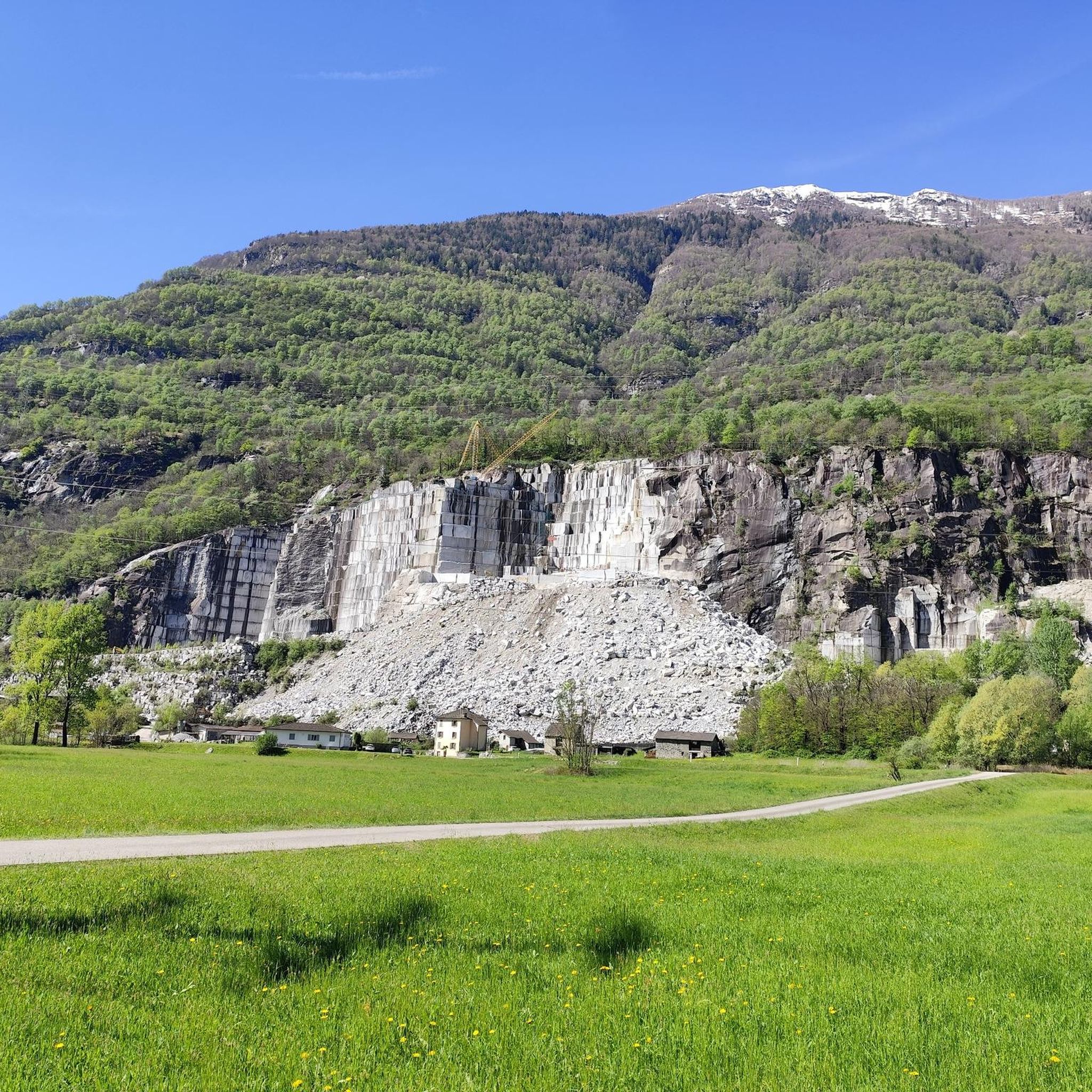
Tips from the Community

Level T4 ascent, difficult route for experienced hikers, but with few exposed sections and easily passable. Caution is advised in late summer due to snow.
2
0

An incredibly beautiful view from there. Those who want to skip the final climb can also enjoy and rest at the junction.
0
0

beautiful panoramic view - and we already have an idea of where the VAV will take us in the next few days
0
0

The summit can be reached quite quickly from the Capanna Albagno, and after arriving at the hut not too late and spending the night there, it is suitable for a short excursion, with a fantastic panoramic view of the snow-capped Alpine giants and central Ticino.
0
0

View of Lake Maggiore and the Monte Rosa mountain range
0
0

Pizzo di Claro or Visagno, at 2727 m, is a beautiful, little-frequented peak located on the border between the Swiss cantons of Ticino and Grisons. The climb from Piz de Molinera is more demanding than that of the east side.
0
0

From here, if you want to reach the top of the man you need to follow the detour. The path to the summit is on very steep, stony and unstable terrain. The canal is equipped with chains and iron steps. Better to wait until you are alone to prevent accidental falling stones or stones from injuring other people. In any case, the stretch is short and not too demanding, just pay attention.
1
0

Bike over Monte Motti, then a challenging mountain tour
0
0
Frequently Asked Questions
What are some of the most popular mountain peaks to visit around Lodrino?
Among the most popular peaks, you'll find Sassariente Summit, known for its unparalleled views where you can see both the highest and lowest points in Switzerland simultaneously. Another favorite is Cima del Gaggio, an intermediate summit offering fantastic panoramic views to the north, east, and south, especially of the snow-capped Alpine giants. Monte Guglielmo is also highly regarded for both trekking and cycling, providing 360-degree views of the plain, Lake Iseo, and the Orobie mountains.
Are there challenging mountain peaks for experienced hikers near Lodrino?
Yes, for experienced hikers seeking a challenge, Vogorno Peak presents a demanding natural monument and viewpoint. The route to Cima dell'Uomo involves a very steep, stony, and unstable path equipped with chains and iron steps. Additionally, Monte Palo offers a strenuous 12.9 km loop hike from Lodrino with a significant elevation gain of 930 meters, typically taking over 5 hours to complete.
What kind of unique natural features or viewpoints can I expect to see?
The region boasts several unique natural features and breathtaking viewpoints. From Sassariente Summit, you can witness a striking rock tooth and an incomparable panorama. Monte Guglielmo offers 360-degree views encompassing the plain, Lake Iseo, and the Orobie mountains. For a different perspective, the View of Lago di Vogorno and Verzasca Dam from Mergoscia provides a comprehensive vista of the lake and dam.
Are there any family-friendly mountain hikes or viewpoints around Lodrino?
Yes, the View of Lago di Vogorno and Verzasca Dam from Mergoscia is considered family-friendly, offering a magnificent view of the reservoir. While many peaks involve moderate to challenging terrain, some sections or lower altitude trails around peaks like Monte Guglielmo can be suitable for families, especially if focusing on the Santa Maria del Giogo mountain hut area.
What is the best time of year to visit the mountain peaks near Lodrino?
The best time to visit the mountain peaks around Lodrino is generally during the warmer months, from late spring to early autumn (May to October). During this period, the weather is more stable, trails are clear of snow, and conditions are ideal for trekking, cycling, and enjoying the panoramic views. Always check local weather forecasts before heading out.
Are there historical trails or cultural sites related to the mountains in the area?
Yes, the Cocca di Lodrino Pass features the historic 'Sentiero 3V' trail. This 8.30 km path winds through beautiful beech forests and allows you to discover old charcoal sites and traditional bird-catching structures, offering a glimpse into the region's past alongside natural beauty.
What outdoor activities, besides hiking, can I do near the mountain peaks of Lodrino?
Beyond hiking, the Lodrino area is excellent for other outdoor activities. You can explore various mountain biking trails, with options ranging from moderate to difficult, such as those found in the MTB Trails around Lodrino guide. There are also numerous running trails, including challenging routes like 'The Sentiero Riviera between Lodrino and Claro', detailed in the Running Trails around Lodrino guide. Gravel biking is another popular option, with routes like the 'Tenero–Bellinzona Cycle Path' available in the Gravel biking around Lodrino guide.
Are there any via ferrata routes in the Lodrino mountain area?
Yes, the Corna di Caspai Peak is associated with a via ferrata. It's described as a relatively easy traverse across three mountains, culminating in a more demanding D/E section with approximately 100 meters of elevation gain. This offers a beautiful and scenic experience for those interested in via ferrata climbing.
What do visitors particularly enjoy about the mountain peaks around Lodrino?
Visitors frequently praise the fantastic panoramic views, especially from summits like Cima del Gaggio, which offers unobstructed vistas of the Alpine giants. The striking natural beauty and the sense of accomplishment from challenging climbs are also highly valued. Many appreciate the diverse range of experiences, from moderate hikes to more strenuous treks and via ferrata routes.
How long do hikes to the peaks near Lodrino typically take?
The duration of hikes varies significantly depending on the peak and your chosen route. For instance, the loop hike from Lodrino to Monte Palo – Corna di Savallo is a hard 12.9 km route that typically takes around 5 hours and 2 minutes. Shorter excursions, like reaching Cima del Gaggio from Capanna Albagno, can be quicker, making it suitable for a short outing after an overnight stay.
Can I find circular hiking routes among the peaks near Lodrino?
Yes, circular routes are available for those who prefer to start and end in the same location. For example, the hike from Lodrino to Monte Palo – Corna di Savallo is designed as a challenging 12.9 km loop. When planning your trip, look for specific route descriptions that indicate a circular path to ensure you return to your starting point.
Most popular routes around Lodrino
Most popular attractions around Lodrino

Get inspired with the komoot mobile app


Explore more
See even more amazing summits around Lodrino with these guides:
