Top 5 Natural Monuments around Ducey-Les-Chéris
Best natural monuments around Ducey-Les-Chéris include diverse natural features and sites. The area is recognized for its natural beauty, holding "Station Verte" and "Ville Fleurie 3 fleurs" labels. Key natural features include the Sélune River, known for its salmon fishing and picturesque banks, and the Bois d'Ardennes, a significant wooded area offering hiking trails. These sites provide opportunities for tranquility, scenic views, and outdoor recreation.
Best natural monuments around Ducey-Les-Chéris
- The most popular natural monuments is Banks of the Sélune…
Last updated: July 6, 2026
Château d'Avranches
Highlight • Castle
Translated by Google •
Tip by

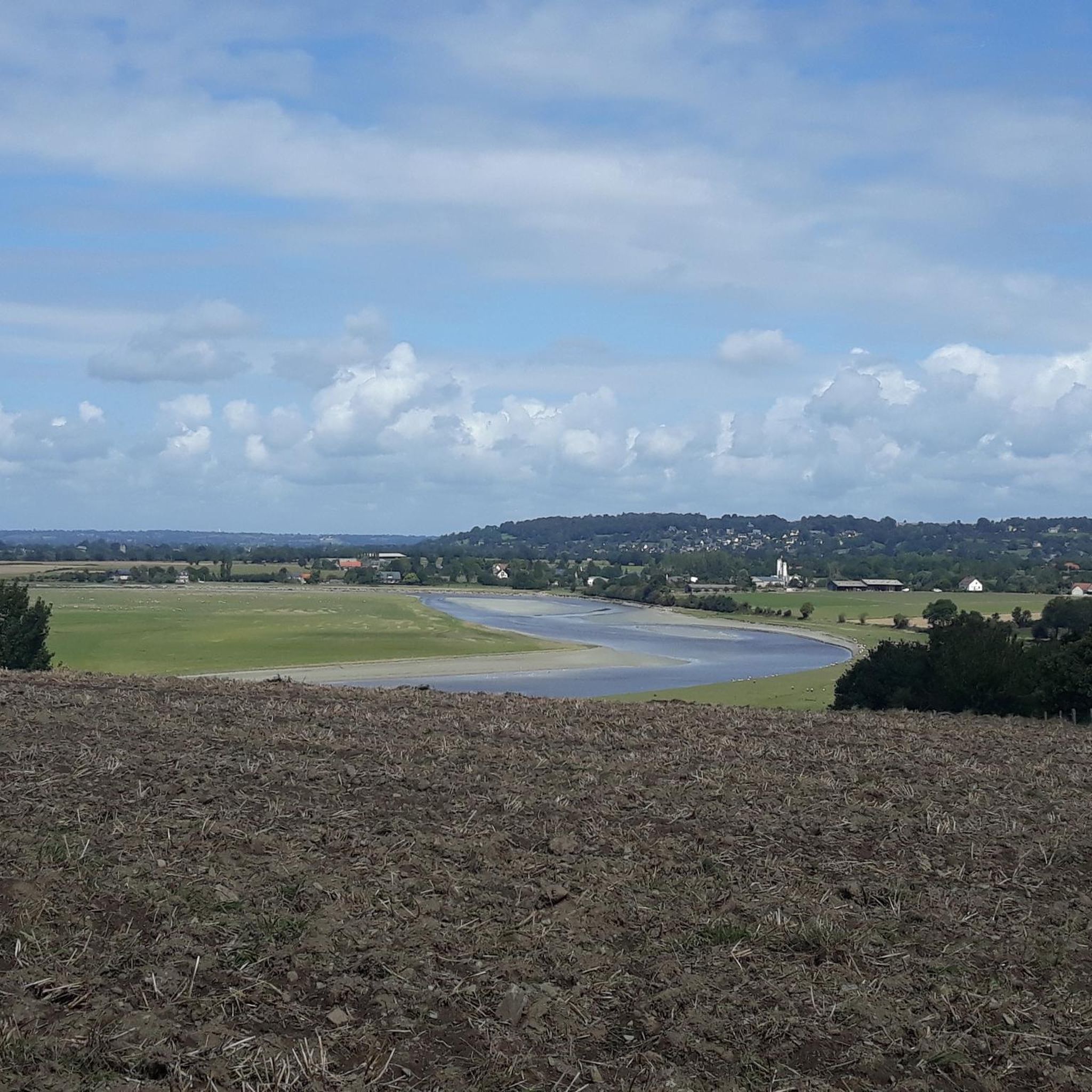
Banks of the Sélune at Pontaubault
Highlight • River
Translated by Google •
Tip by

Sign up now to discover places like this
Get recommendations on the best single tracks, peaks, & plenty of other exciting outdoor places.
Sign up for free
Sélune Estuary
Highlight (Segment) • River
Tip by

Saint-Benoît Polishing Stone
Highlight • Monument
Translated by Google •
Tip by

Start today with a free account
Your next adventure awaits.
Login or Signup
Popular around Ducey-Les-Chéris


Other adventures around Ducey-Les-Chéris

Tips from the Community

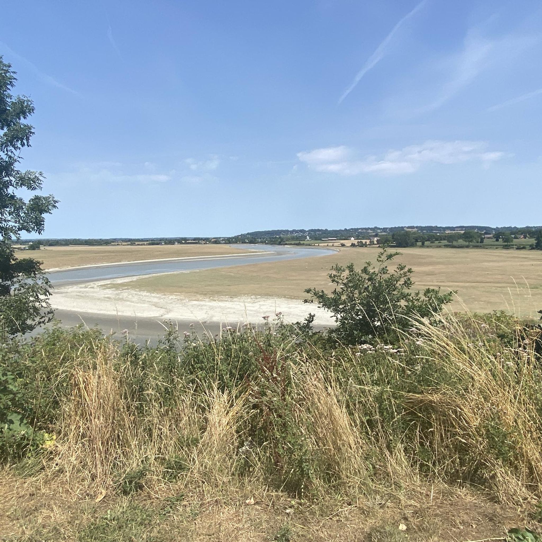
Magnificent landscape with its green pastures of salt meadows. Gradually approaching Mount Mich Mich
2
0

Nice opportunity for a break. Picnic area with a good view
2
0

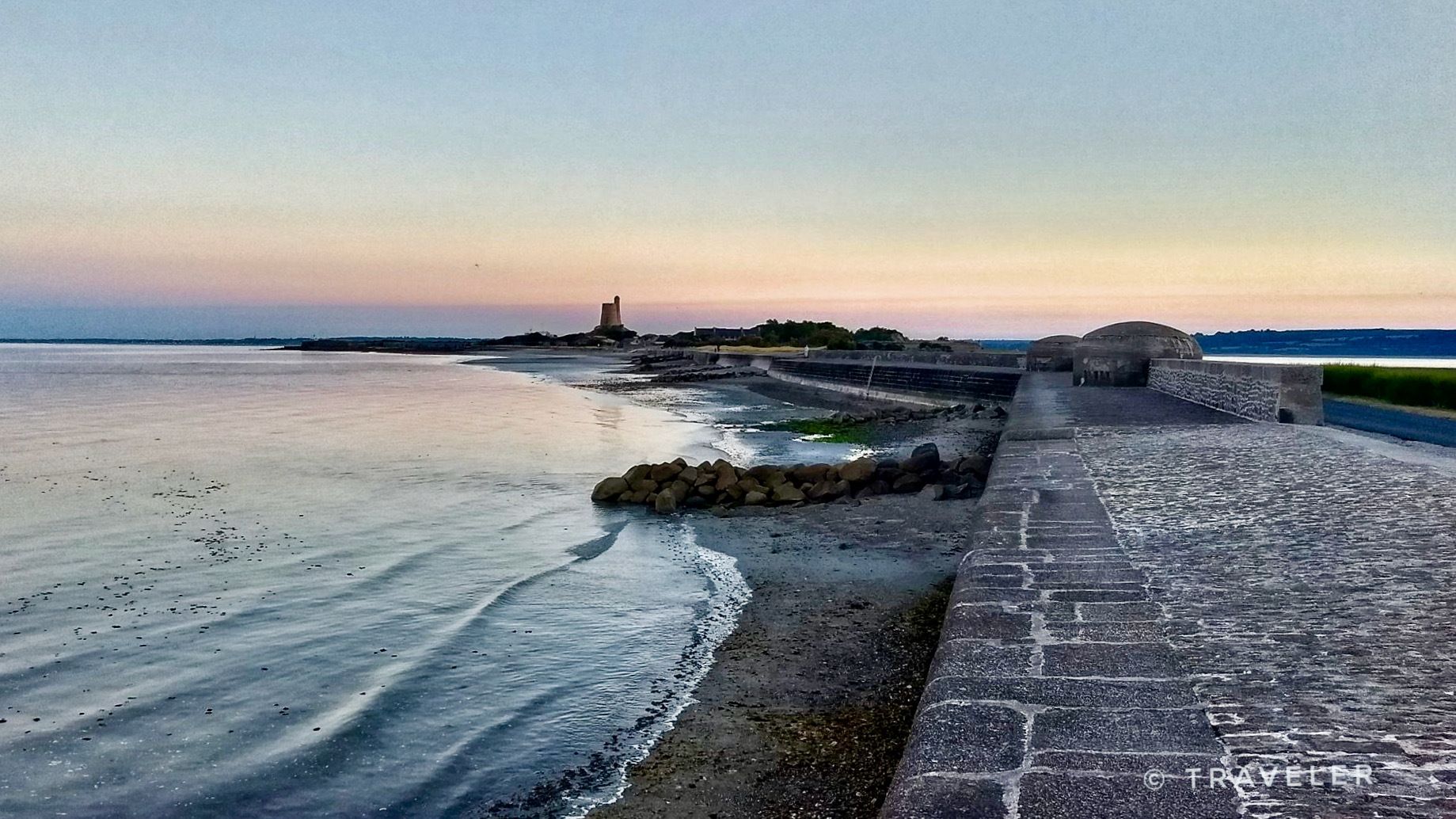
Cycle route along the Sélune estuary with a view of Mont St Michel
0
0

The route is composed of a quiet road, with a gravel cycle track alongside, for those who don't want to worry about cars.
0
0

This former fortified castle was built in the 10th century to protect the city from Breton attacks. Located on a rock, it offers beautiful views over the bay of Mont-Saint-Michel and the Sée valley.
2
0

This polisher, dating from around 4,000 BC, is a quartz block of modest size, 1.25 m by 0.50 m, barely level with the grass. On its surface, there are a dozen parallel grooves and a basin. The bowl was used to polish flints and the grooves to sharpen the edges of axes. Excavations have uncovered polished axes, one of which is jade. The place is also called "Pierre de Saint-Benoît". Because according to one of the legends attached to this monument, it would be Saint Benedict petrified: the pink veins that run through the block would be the veins of the saint and the grooves his ribs. The water in the basin is said to have curative and febrifuge properties: feverish people came on pilgrimage, sprinkled themselves with this water and placed offerings in the grooves, hoping for the cure of their ailments. It is reached by a little busy and very pleasant little road.
0
0

The Château d'Avranches was built around 950 by Onfroi Le Dane, on the remains of the old Roman walls. Located on a rock, the fortress could monitor the bay of Mont-Saint-Michel and the various invaders made no mistake and occupied it; Celts with the Abrincates, Romans, Saxons, then Franks. A succession of enclosures and ditches were added to it. The Roman keep unfortunately disappeared in the last century. The top of the curtain forms a platform at the same level as the terrace. A diagram, made by Canon Pigeon, shows how keep and curtain wall were connected. This is also verifiable in a document kept in the Calvados Archives. Another detail should be noted, it is impossible to access the terrace from inside the building. Passages were obstructed after a collapse of the upper level of the building, at an undetermined time. Today, at the top of a crenellated curtain wall, one discovers a panorama over the bay and the valley of the Sée, in the heart of the various Avranchinese districts.
8
0

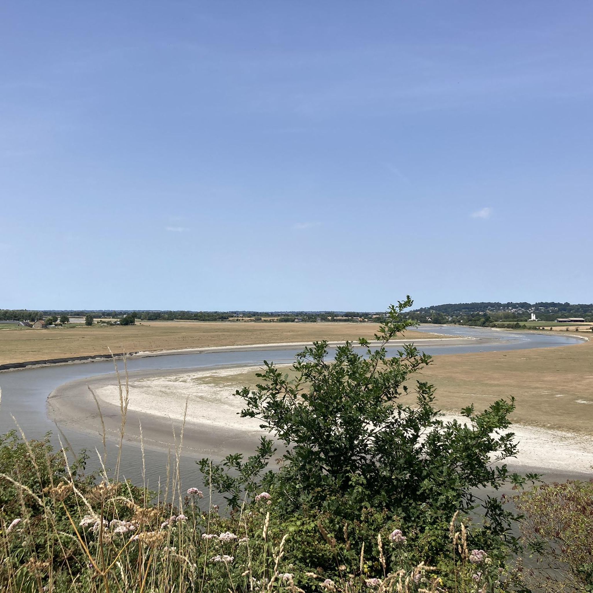
The Sélune river gradually opens from here to form a vast bay and flow into the ocean a few kilometers further. You can see the old Pontaubault bridge there.
4
1
Frequently Asked Questions
What unique natural features can I explore around Ducey-Les-Chéris?
Ducey-Les-Chéris offers a variety of natural features, including the meandering Sélune River, known for salmon fishing and picturesque banks. You can also explore the Banks of the Sélune at Pontaubault, which open into a vast bay with magnificent salt meadows and views towards Mont-Saint-Michel. The Bois d'Ardennes provides a serene wooded escape with hiking trails.
Are there any historical natural monuments in the area?
Yes, the region blends natural beauty with history. The Château d'Avranches, though a castle, is situated on a rock offering panoramic views over the bay of Mont-Saint-Michel and the Sée valley, making it a historical site integrated into the natural landscape. Additionally, the Saint-Benoît Polishing Stone is an ancient quartz block dating back to 4,000 BC, used for polishing flints and sharpening axes, with local legends attributing curative properties to its basin.
What kind of views can I expect from the natural monuments?
Many natural sites around Ducey-Les-Chéris offer stunning views. From the Château d'Avranches, you can see the bay of Mont-Saint-Michel and the Sée valley. The Banks of the Sélune at Pontaubault provide magnificent landscapes of green salt meadows with distant views of Mont-Saint-Michel. The Sélune Estuary also offers scenic views of Mont-Saint-Michel, especially along its cycle route.
Are the natural sites around Ducey-Les-Chéris suitable for families?
Absolutely! Several natural sites are family-friendly. The Banks of the Sélune at Pontaubault offer a nice picnic area and easy walks. The Sélune Estuary features a cycle route suitable for families. The Bois d'Ardennes has trails, and the 7 km 'Over the Water: Sélune' hike is specifically designed for families. The Saint-Benoît Polishing Stone also offers an interesting historical stop for all ages.
What outdoor activities can I do near these natural monuments?
The area is perfect for various outdoor activities. You can enjoy gravel biking on routes like the 'Voie verte de la Véloscénie' or explore running trails such as 'Along the Sélune – Bois d'Ardennes loop'. Mountain biking is also popular, with routes like 'Ducey – Pontaubault Bridge loop'. For more details on routes, you can check the guides for gravel biking, running, and MTB trails around Ducey-Les-Chéris.
Are there specific hiking trails recommended near the natural monuments?
Yes, Ducey-Les-Chéris boasts abundant green spaces and well-maintained hiking trails. A notable option is the 'Over the Water: Sélune' hike, a 7 km route that takes you along the Sélune River and into the Bois d'Ardennes. The banks of the Sélune River and the Bois d'Ardennes themselves offer numerous paths for leisurely strolls and more extensive hikes. You can find more hiking options in the running trails guide, which includes routes suitable for walking.
Can I cycle along any of the natural monuments?
Yes, cycling is a great way to experience the natural beauty. The Sélune Estuary features a dedicated cycle route with views of Mont-Saint-Michel. Ducey-Les-Chéris is also a notable stop on the Véloscénie, a scenic cycle route connecting Paris to Mont-Saint-Michel, offering various greenways and quiet roads for cyclists. You can explore routes in the gravel biking guide.
What is the best time of year to visit the natural monuments in Ducey-Les-Chéris?
The natural monuments around Ducey-Les-Chéris are enjoyable throughout the warmer months, from spring to early autumn (April to October), when the weather is mild and the landscapes are lush. This period is ideal for hiking, cycling, and enjoying the outdoor scenery. The area's 'Station Verte' and 'Ville Fleurie 3 fleurs' labels indicate its beauty during blooming seasons.
Are there places to eat or stay near the natural monuments?
Ducey-Les-Chéris, as a charming village, offers local amenities including cafes, pubs, and restaurants where you can enjoy regional cuisine. There are also accommodation options available within the village or nearby, providing convenient access to the natural sites. The Banks of the Sélune at Pontaubault even have a picnic area for a scenic break.
How long should I plan for a visit to these natural monuments?
The duration of your visit depends on your interests. For a quick stop at a viewpoint like the Banks of the Sélune at Pontaubault or the Saint-Benoît Polishing Stone, an hour or two might suffice. If you plan to hike or cycle through the Bois d'Ardennes or along the Sélune Estuary, you could easily spend half a day or a full day exploring the trails and enjoying the scenery.
Is there parking available at the natural monuments?
Generally, parking is available near the main natural sites and trailheads in and around Ducey-Les-Chéris. For example, the Old Stone Bridge in Ducey serves as a starting point for walks along the Sélune, and parking can typically be found nearby. When planning your visit, it's advisable to check specific access points for each location.
Are there any lesser-known natural spots worth discovering?
Beyond the main highlights, the entire Sélune River meander offers tranquil spots for exploration. La Roche Torin, located at the mouth of the Sélune, provides extensive salt meadows and polders, offering superb views of Mont-Saint-Michel away from more crowded areas. The various greenways and smaller trails through the countryside also offer peaceful discoveries.
Most popular routes around Ducey-Les-Chéris
Most popular attractions around Ducey-Les-Chéris

Get inspired with the komoot mobile app


Explore more
Extend your search for the best caves by checking out these guides of the top ones around Ducey-Les-Chéris:
