Top 20 Natural Monuments around La Victoria De Acentejo
Natural monuments around La Victoria de Acentejo offer diverse landscapes in the north of Tenerife. The region features unique geological formations, varied ecosystems, and areas of historical significance. Visitors can explore ravines, coastal cliffs, and protected forests, which are home to endemic flora and fauna. These areas provide opportunities to experience the island's natural heritage.
Best natural monuments around La Victoria De Acentejo
- The most popular natural monuments is El Bollullo Beach, a beach known for its secluded location…
Last updated: July 1, 2026
Los Roques coastal rock formation
Highlight • Natural Monument
Translated by Google •
Tip by

El Bollullo Beach
Highlight • Beach
Translated by Google •
Tip by

Sign up now to discover places like this
Get recommendations on the best single tracks, peaks, & plenty of other exciting outdoor places.
Sign up for free
Los Roques Beach
Highlight • Beach
El Toscal, Tenerife
The natural surroundings of Playa de los Roques are the real attraction here, with the rocks in the sea and the lush green …
Tip by

Cloud Forest of La Orotava Valley
Highlight (Segment) • Forest
Translated by Google •
Tip by

La Caldera Recreation Area
Highlight • Rest Area
Translated by Google •
Tip by

Sign up for free to discover even more natural monuments around La Victoria De Acentejo.
Sign up for free
Already have an account?
Start today with a free account
Your next adventure awaits.
Login or Signup
Popular around La Victoria De Acentejo
Road Cycling Routes around La Victoria De Acentejo
Hiking around La Victoria De Acentejo
MTB Trails around La Victoria De Acentejo
Cycling around La Victoria De Acentejo
Running Trails around La Victoria De Acentejo

Gravel biking around La Victoria De Acentejo
Mountain Hikes around La Victoria De Acentejo
Tips from the Community

Well, hello! The trail we wanted to hike today was unfortunately closed, and hiking was prohibited. We went in a little way and took some photos. Many people struggled through the almost overgrown path. We decided to turn back and drove to where the trail ends, but we couldn't find a parking spot. The view of the beach and the Atlantic Ocean was beautiful.
1
0

The coastal hike from PDC to Mirador San Pedro is NOT closed, as incorrectly claimed here! There is an official detour for the section near Los Roques, which is very easy to follow and well signposted!
0
1
The coastal hike from Puerto to Mirador San Perdo is NOT closed, as incorrectly claimed here. A short section near Los Roques has been impassable for some time due to rockfall – however, there has long been an excellent official alternative route to bypass the closure… very well signposted.
1
1
Well, hello! The trail we wanted to hike today was unfortunately closed, and hiking was prohibited. We went in a little way and took some photos. Many people struggled through the almost overgrown path. We decided to turn back and drove to where the trail ends, but we couldn't find a parking spot. The view of the beach and the Atlantic Ocean was beautiful.
6
0

The morning often offers the most beautiful views. Then, clouds roll in from the sea, creating a mysterious atmosphere.
0
0

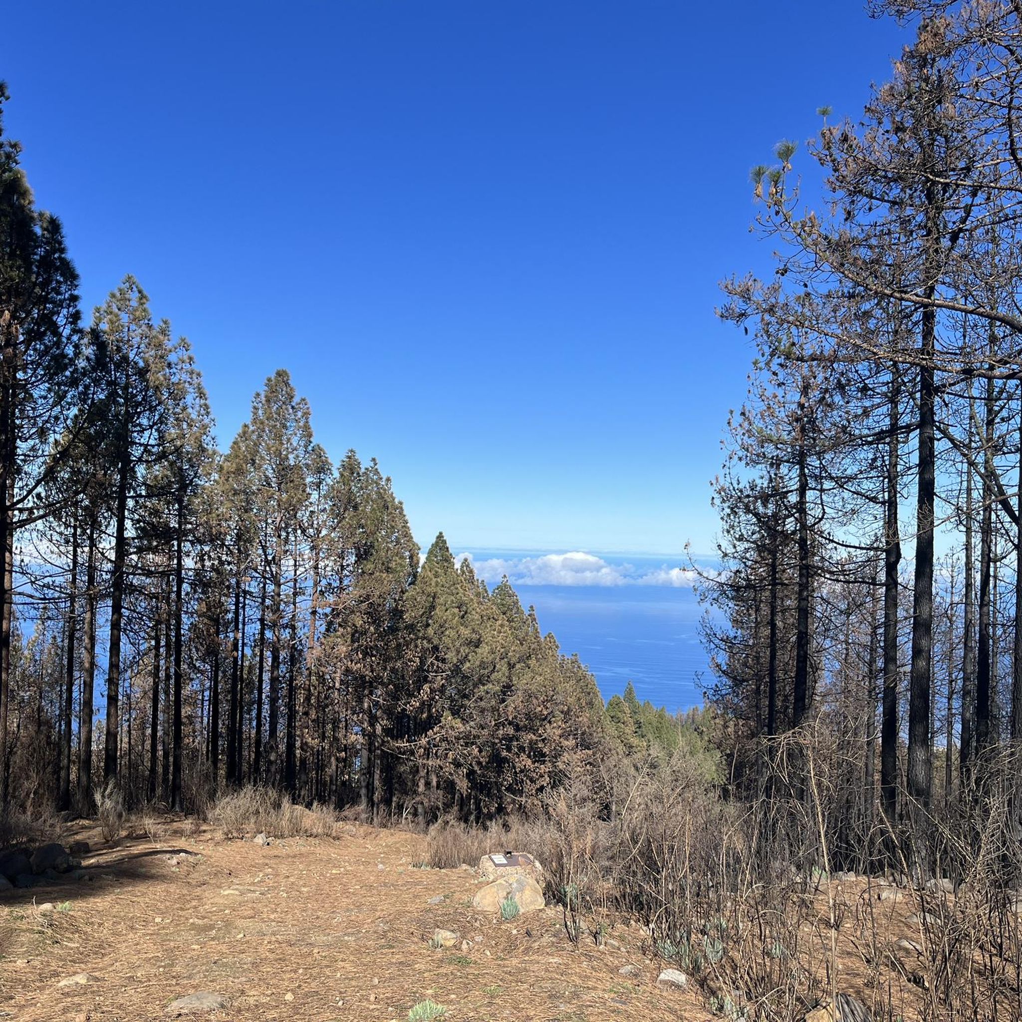
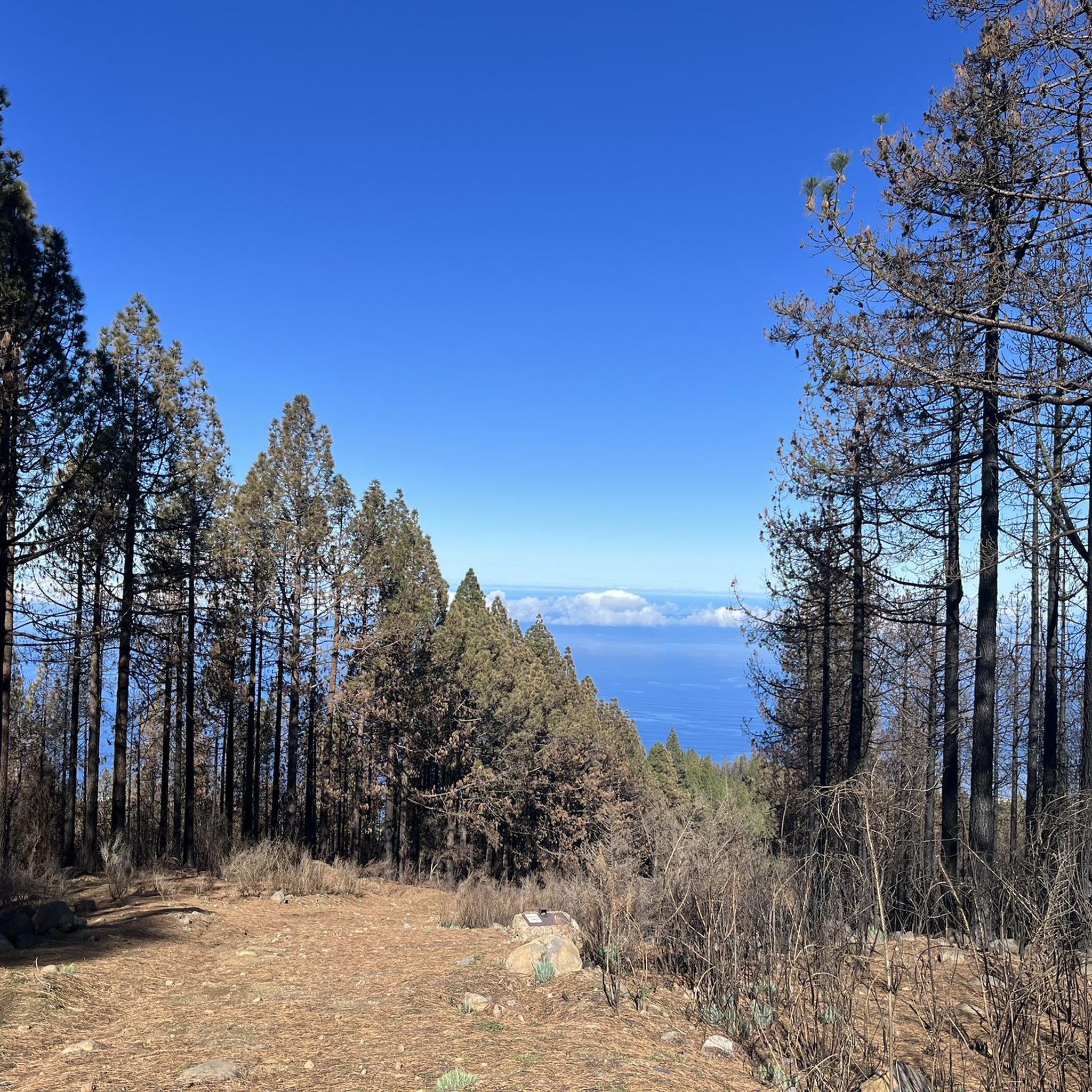
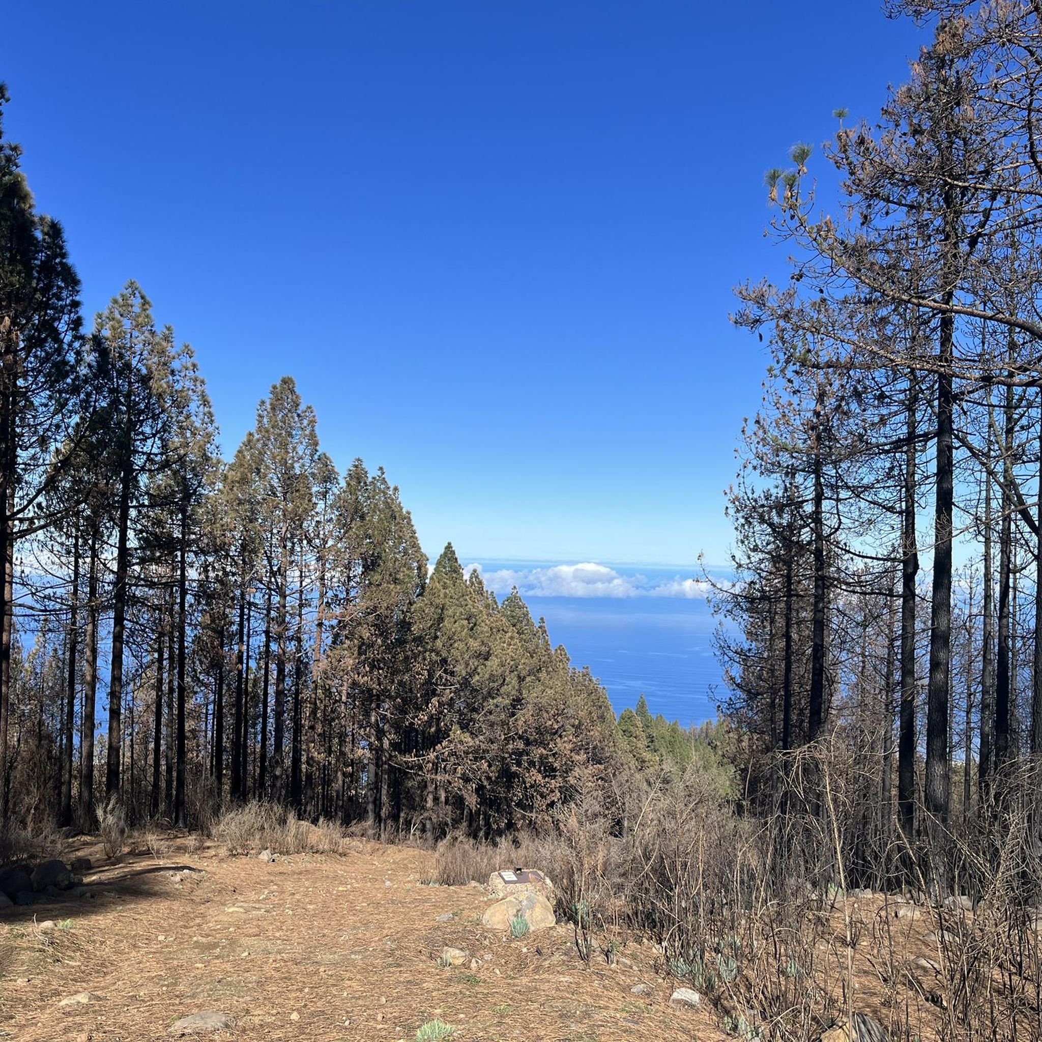
Currently (November 2024) the mystical atmosphere is unfortunately not to be found due to the forest fires. Instead there are black tree trunks and fresh green needles. The path via los Organes, Casa del Agua is completely closed due to restoration. Be sure to inform yourself before hiking
1
0

Theoretically, the hiking trail is still closed, but the gate that is supposed to block it is open and everyone walks down there. But everyone has to decide that for themselves. Otherwise great views and great coast. 🇮🇨
2
2

There's no reason why you can't walk the path. However, I would forego the trip to the beach. However, the normal way is not a problem
2
0
Frequently Asked Questions
What are some unique natural features to explore in La Victoria de Acentejo?
The region offers diverse natural features. You can visit the dramatic coastal cliffs and rock formations like Los Roques coastal rock formation, known for the interplay of waves. Inland, explore the mystical Cloud Forest of La Orotava Valley, characterized by moss-draped trees and frequent fog, indicating high air quality. The Barranco Hondo also features a trail leading to a beach with the prominent Roque de la Playa.
Are there any natural monuments with historical significance in the region?
Yes, the Barranco de Acentejo is not only naturally beautiful but also holds historical importance as the site of a decisive battle during the conquest of Tenerife. It is now a protected area, offering a chance to reflect on its past while enjoying its natural sanctuary.
Which natural monuments are suitable for families with children?
The La Caldera Recreation Area is an excellent choice for families. It features parking, a bar-restaurant, public toilets, grills, and a children's playground. It's built around a small caldera and offers a pleasant environment for a day out. Additionally, Barranco de Ruiz, a Site of Scientific Interest, also provides a recreational area with picnic tables and a children's play area.
Where can I find stunning viewpoints of the landscape?
For impressive panoramic views, visit the Mirador de la Sabina, which offers expansive vistas of the Barranco de Acentejo. The Paisaje Protegido de Las Lagunetas also provides broad views of the island's north, showcasing a blend of chestnut trees, vineyards, and pine forests.
What kind of wildlife can I expect to see in the natural monuments?
The natural monuments are rich in biodiversity. Barranco Hondo is known for its abundant endemic fauna, and its Roque de la Playa is a nesting site for Bulwer's Petrel. The Barranco de Acentejo is a sanctuary for various endemic flora and fauna. Barranco de Ruiz is particularly notable for its avifauna, hosting almost all raptor species found in Tenerife, making it a prime spot for birdwatching.
Are there opportunities for hiking near these natural monuments?
Absolutely. Many natural monuments offer hiking opportunities. For instance, Barranco Hondo has a trail leading down to the beach. The La Caldera Recreation Area serves as a starting point for various trails. You can find numerous hiking routes in the broader region, including trails through the Running Trails around La Victoria De Acentejo guide.
What other outdoor activities can I do near these natural monuments?
Beyond hiking, the area around La Victoria de Acentejo offers diverse outdoor activities. You can explore MTB Trails, with options like the Las Canales Picnic Area loop. Road cycling enthusiasts can find challenging routes such as the View of Mount Teide loop from Ravelo Alto, detailed in the Road Cycling Routes around La Victoria De Acentejo guide.
What is the Paisaje Protegido de Costa de Acentejo?
The Paisaje Protegido de Costa de Acentejo is a protected landscape extending across several municipalities, including La Victoria de Acentejo. It features exceptional cliff landscapes and rugged terrain, representing significant geomorphic features of the north coast. It's scientifically valuable for its threatened flora and fauna, and serves as an important nesting ground for marine birds. You can learn more about it on the Visit Canary Islands website.
Are there any natural beaches among the monuments?
Yes, El Bollullo Beach is a beautiful, secluded beach with a charming beach bar located in a bay on the north coast. Another option is Los Roques Beach, which offers natural surroundings and striking rock formations in the sea, though it's less suitable for swimming due to strong currents and rocky terrain.
What do visitors enjoy most about the natural monuments in La Victoria de Acentejo?
Visitors frequently appreciate the breathtaking landscapes and the opportunity to connect with Tenerife's unique natural and historical heritage. The secluded beauty of beaches like El Bollullo Beach, the dramatic coastal rock formations, and the mystical atmosphere of the Cloud Forest of La Orotava Valley are often highlighted. The presence of well-equipped recreational areas like La Caldera also makes these sites popular for family outings.
Is there a natural monument known for its unique geological formations?
The Los Roques coastal rock formation is particularly noted for its interesting rocks in the sea, where the constant play of waves creates a captivating visual experience. The entire Paisaje Protegido de Costa de Acentejo also features exceptional cliff landscapes and rugged terrain, showcasing significant geomorphic features of the north coast.
Can I find remnants of ancient forests in the protected landscapes?
Yes, the Paisaje Protegido de Las Lagunetas still retains small remnants of laurel forest interspersed with pine trees along its ravines and gullies. Additionally, Barranco de Ruiz is valued for its varied relict vegetation, including laurisilva and thermophilic forests, which are important ecological features.
Most popular routes around La Victoria De Acentejo
Most popular attractions around La Victoria De Acentejo

Get inspired with the komoot mobile app


Explore more
Extend your search for the best caves by checking out these guides of the top ones around La Victoria De Acentejo:
