Top 6 Natural Monuments around Alía
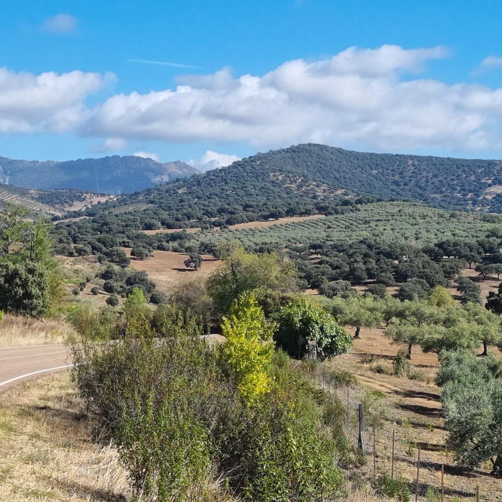
Best natural monuments around Alía are situated within the Extremadura region, specifically in the province of Cáceres. This area is largely encompassed by the UNESCO Global Geopark Villuercas-Ibores-Jara, known for its unique Appalachian-type relief. The landscape features parallel valleys and mountain ranges, offering diverse geological formations and ecological habitats. This makes the region a destination for exploring natural features and significant landscapes.
Best natural monuments around Alía
- The most popular natural monuments is Pico Villuercas Summit, a summit that…
Last updated: October 18, 2026
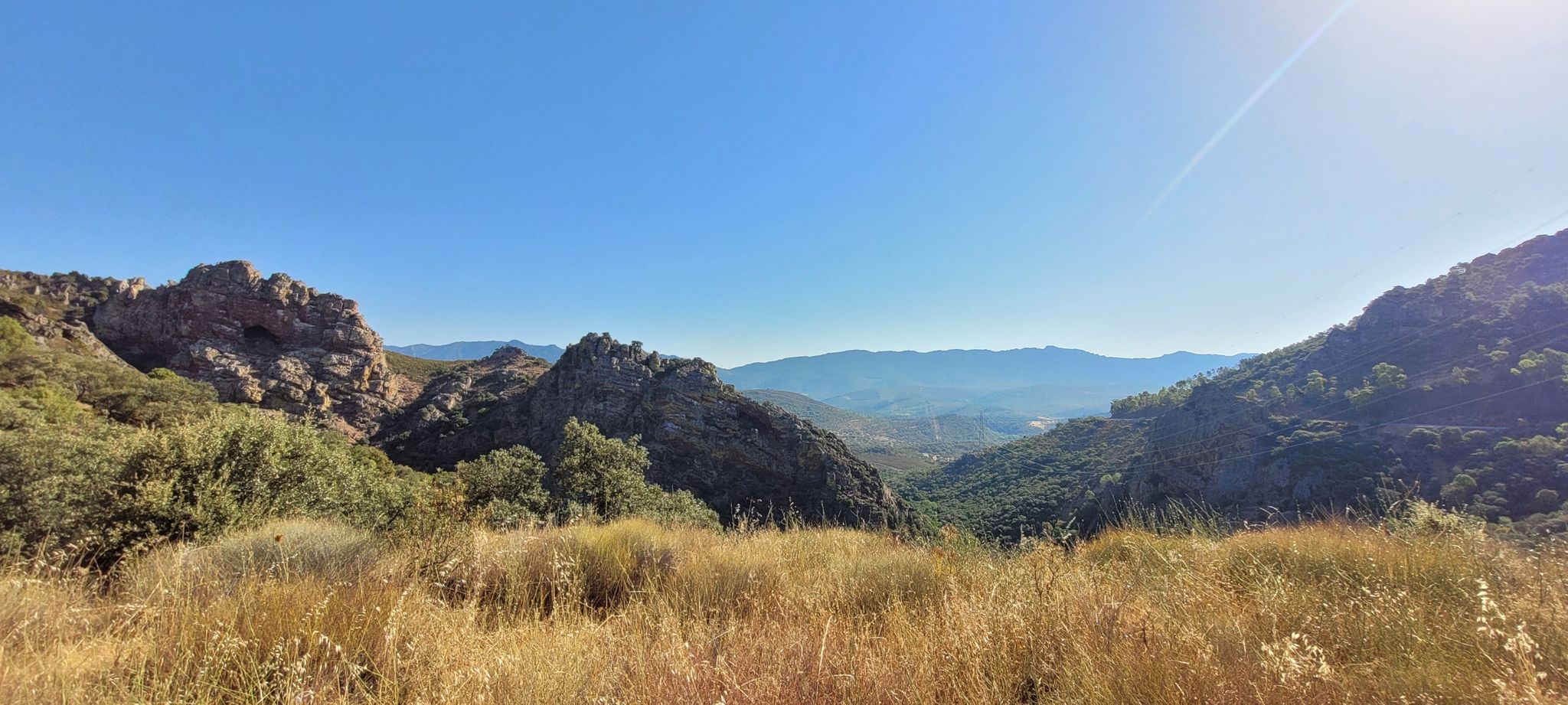
High point of the Peña Amarilla gorge
Highlight • Viewpoint
The viewpoint overlooks the Estrecho …
Translated by Google •
Tip by

La Chiquita Cave
Highlight • Cave
Translated by Google •
Tip by
Sign up now to discover places like this
Get recommendations on the best single tracks, peaks, & plenty of other exciting outdoor places.
Pico Villuercas Summit
Highlight • Summit
Translated by Google •
Tip by

Pico Agudo
Highlight • Summit
Translated by Google •
Tip by

Grandfather Chestnut of the Mirabel Hermitage
Highlight • Natural Monument
Translated by Google •
Tip by
Sign up for free to discover even more natural monuments around Alía.
Already have an account?
Start today with a free account
Your next adventure awaits.
Other adventures around Alía

Tips from the Community

Beautiful viewpoint with a small parking lot, there is a path of approx. 600 meters to the gorge. Hundreds of swallows nest in the opposite cave.
5
0

Mirador del Estrecho de la Peña Amarilla (Yellow Rock Strait Viewpoint), one of the most interesting panoramic viewpoints in the Villuercas-Ibores-Jara Geopark, in Alía (Cáceres). The viewpoint overlooks the Estrecho de la Peña Amarilla, a spectacular river gorge carved by the Jarigüela stream amidst the quartzite formations of the Armorican Quartzite, a characteristic feature of the geopark. One of the routes that passes through this point is the one that connects Alía – Mirador del Estrecho – Puerto de San Vicente, a section of the Villuercas Natural Trail, with moderate scenery and elevation changes (17.78 km, +596 m).
5
0

This majestic chestnut tree, known as the "Grandfather," is a centuries-old tree that stands imposingly on the grounds of the Mirabel Hermitage, near the historic Isabel La Católica route.
0
1
At an altitude of 1,081 meters, it is located between the towns of Guadalupe and Cañamero, and is part of the Villuercas-Ibores-Jara UNESCO Global Geopark, recognized for its unique geology and biodiversity. From its summit, you can enjoy impressive panoramic views encompassing the Guadalupe and Viejas River valleys, as well as the mountainous formations characteristic of the region's Appalachian terrain. On clear days, you can see the imposing Sierra de Gredos to the north. Pico Agudo can be accessed via hiking trails that depart from Guadalupe, such as the one that follows part of the historic Isabel la Católica Trail.
0
1
It was the first cave with paintings discovered by science in the province of Cáceres. It's a place shrouded in legend about a snake and has been used as both a refuge and a ritual meeting place for centuries.
4
0

Fantastic view of the surrounding mountains. Adventurous people can also climb the nearby rocks from here
0
1

On clear days you can see the entire Geopark. sunsets are fantastic
0
1

The original viewpoint is located a few meters above, next to the road. From here you can enjoy even more views of the spectacular geomorphological formation of the gorge of the Peña Amarilla Strait.
0
1
Frequently Asked Questions
What are some of the most popular natural monuments to visit around Alía?
Among the most popular natural monuments, the Pico Villuercas Summit stands out for its spectacular panoramic views of the Villuercas Ibores Geopark. Visitors also highly appreciate the Viewpoint at the Estrecho de Peña Amarilla, offering impressive vistas of a river gorge carved by the Jarigüela stream.
Are there any natural monuments with historical significance near Alía?
Yes, the La Chiquita Cave is a site of great historical importance. It was the first cave in Cáceres province where ancient paintings were discovered and served as both a refuge and a ritual meeting place for centuries. Additionally, the Entrance to Cerro Castrejón features the ruins of an old fortification, possibly Celtic and later used by Muslims, offering beautiful views and a glimpse into the region's past.
What kind of geological features can I expect to see in the natural monuments around Alía?
The region, largely within the UNESCO Global Geopark Villuercas-Ibores-Jara, is known for its unique Appalachian-type relief with parallel valleys and mountain ranges. You can observe quartzite formations at the Viewpoint at the Estrecho de Peña Amarilla. The Cueva de Castañar de Ibor, though with restricted access, is renowned for its spectacular aragonite and calcite speleothems, showcasing unique underground geological formations.
Are there challenging hikes or climbs to reach any of the natural monuments?
Yes, reaching the Pico Villuercas Summit involves a challenging climb. It's a long and hard ascent, approximately 11 km with a 6% average slope, reaching 1543 meters above sea level. This makes it a rewarding challenge for experienced hikers and cyclists seeking panoramic views.
What outdoor activities can I do near these natural monuments?
The area around Alía offers diverse outdoor activities. You can find numerous routes for hiking, including easy loops like the Guadalupe Monastery and Viaduct Loop. For cyclists, there are challenging touring bicycle routes such as the Castañar de Ibor loop. Mountain biking enthusiasts can explore MTB trails like the Alía loop from Alía.
Is there a natural monument that offers extensive panoramic views?
Absolutely. The Pico Villuercas Summit is the highest point of the Villuercas mountain range and provides unbeatable 360º panoramic views of the entire UNESCO Global Geopark Villuercas-Ibores-Jara, including the Guadalupe River valley and various geological formations. Similarly, Pico Agudo also offers impressive views of the Guadalupe and Viejas River valleys, and on clear days, even the Sierra de Gredos.
Are there any unique botanical sites or rare natural habitats in the area?
Yes, the Lorera de la Trucha (La Trucha Laurel Forest) is a significant ecological site. It hosts the most important formation of *Prunus lusitanica L. subsp. lusitanica* (Portuguese Laurel) in Spain, a relict species from the Tertiary period. This area along the Garganta de la Trucha is of high ecological value for those interested in unique botany and ancient flora.
What is the best time of year to visit the natural monuments around Alía?
The region is part of a Special Protection Area for Birds (ZEPA), making it particularly rewarding for birdwatchers between January and March when numerous bird species, including cranes, make their seasonal migratory stop. Generally, spring and autumn offer pleasant temperatures for hiking and exploring the natural landscapes.
Are there any natural monuments suitable for families with children?
While specific 'family-friendly' designations are not always explicit, easily accessible viewpoints like the Viewpoint at the Estrecho de Peña Amarilla offer impressive scenery without strenuous effort, making them suitable for families. The nearby Interpretation Center for the Cueva de Castañar de Ibor also provides an engaging virtual 3D tour, which can be a great educational experience for children.
Can I observe wildlife, especially birds, near the natural monuments?
Yes, the Sierra de Las Villuercas and Valle del Guadarranque area is designated as a Special Protection Area for Birds (ZEPA). It is vital for numerous bird species, including endangered birds like vultures and eagles. The Viewpoint at the Estrecho de Peña Amarilla is particularly noted for the majestic flight of vultures over the strait and mountains, making it an excellent spot for birdwatching.
Is there an option to learn more about the Cueva de Castañar de Ibor if direct access is restricted?
Yes, due to the extreme fragility of its ecosystem and high radon concentration, direct visits to the Cueva de Castañar de Ibor are very restricted. However, a nearby Interpretation Center offers a virtual 3D tour, reproductions of its unique speleothems, and explanatory panels, providing an excellent way to experience the cave's beauty and geological significance.
What should I wear when visiting the natural monuments, especially in winter?
Given the mountainous terrain and potential for challenging climbs, especially to summits like Pico Villuercas, it's advisable to wear appropriate hiking gear. In winter, temperatures can drop significantly, and winds can be strong at higher elevations. Layered clothing, waterproof and windproof outer layers, sturdy hiking boots, and warm accessories like hats and gloves are recommended for comfort and safety.
Most popular attractions around Alía

Get inspired with the komoot mobile app


Explore more
Extend your search for the best caves by checking out these guides of the top ones around Alía:
