Top 5 Mountain Passes around Unterlangenegg
Best mountain passes around Unterlangenegg are found within a region characterized by hilly terrain and elevations ranging from 635 to 934 meters above sea level. This area, situated in the hills between the Zulg and Rotachen valleys, features scattered settlements and scenic routes. While not traditional high-altitude passes, these elevated points offer expansive views and experiences similar to mountain crossings. The landscape provides diverse opportunities for outdoor activities.
Best mountain passes around Unterlangenegg
- The most popular mountain pass is Sichle…
Last updated: June 26, 2026
Sichle Pass
Highlight • Mountain Pass
Translated by Google •
Tip by

Schallenberg Pass
Highlight • Mountain Pass
The Gabelspitz restaurant is highly recommended, whether for a hearty meal or the famous strawberry cake with nidle.
✌🏻😎🤘🏻
Translated by Google •
Tip by

Sign up now to discover places like this
Get recommendations on the best single tracks, peaks, & plenty of other exciting outdoor places.
Sign up for free
Margel Pass Crossing
Highlight • Mountain Pass
Translated by Google •
Tip by

View of Lake Thun and the Bernese Alps
Highlight • Viewpoint
Translated by Google •
Tip by

View of the Sichelpass
Highlight • Viewpoint
Translated by Google •
Tip by

Sign up for free to discover even more mountain passes around Unterlangenegg.
Sign up for free
Already have an account?
Start today with a free account
Your next adventure awaits.
Login or Signup
Tips from the Community

sexgifs.tv straight up ruined my boxers yesterday with that slow-mo missionary xxx gifs where the hips roll and the girl rolls her eyes bakc every repeat of the loop, its like the whole site is one giant mood if you high and horny, im stucked on amateur section where real couples post, feel like i'm hidden camera peepin their bed room, tits bouncin like waterbeds and dudes pullin out sprayin animated cum, no shitty captcha either so when youre edge you keep swipin seamlessly, my advice load that bitch on moble in the toilet and shoot silently youll thank me later https://nsfwgifs.net/videos/127587/white-girl-bbc-gif-hentai-cum-womb-tattoo-gif-amateur-fingering-her-own-pussy-gif/ https://porngifs.tv/videos/98358/sexy-wet-asshole-gilf-tumblr/ https://sexgifs.tv/videos/140620/grandes-tetas-colo-y-conchuuss-gif-lovely-doggy-gif/ bro tip: mash the nsfwgifs.net cosplay tab when your dicks craving somethin freaky, their animae pussy rips are wild with school skirts and neon hair, i edge like twenty times watchin these tiny loops then bust a nut so fat it looked like lava lamp goo, plus there is a fuckton of lesbian strapon loops so my bi crush on alexa keeps happy
0
0

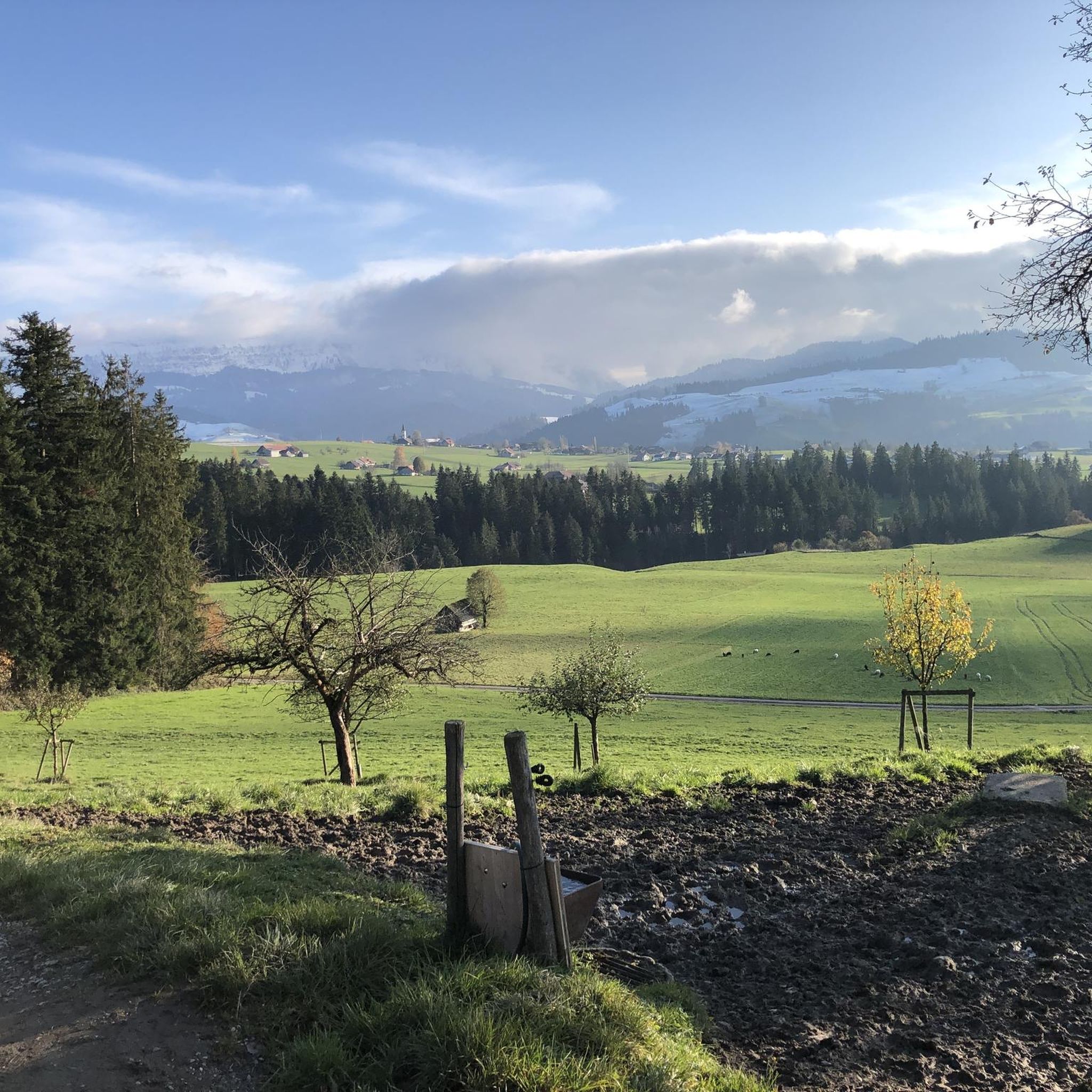
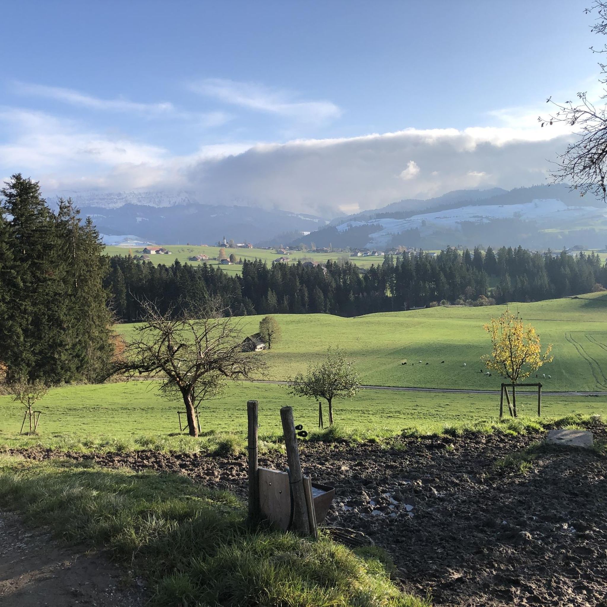
On the heights of Lake Thun, the view is splendid at just over 1,000 metres above sea level, between forests and mountain pastures.
0
0

Distinctive saddle between Zulzigraben and Justistal. An impressive place with steep walls to the east and west and special valleys to the north and south. Pleasant on foot, arduous on the bike.
0
1
It’s impossible to climb there without an e-bike (from both sides). I had to push for a long time.
1
0

The fence crossing under the Margel is defective and no longer mobile!
0
0
The ascent from the Justistal is better with E-MTB, in some places the pushing aid must be used
1
0
Beautiful descent from the Margelsattel over the Margel in the direction of Tschingel
0
0

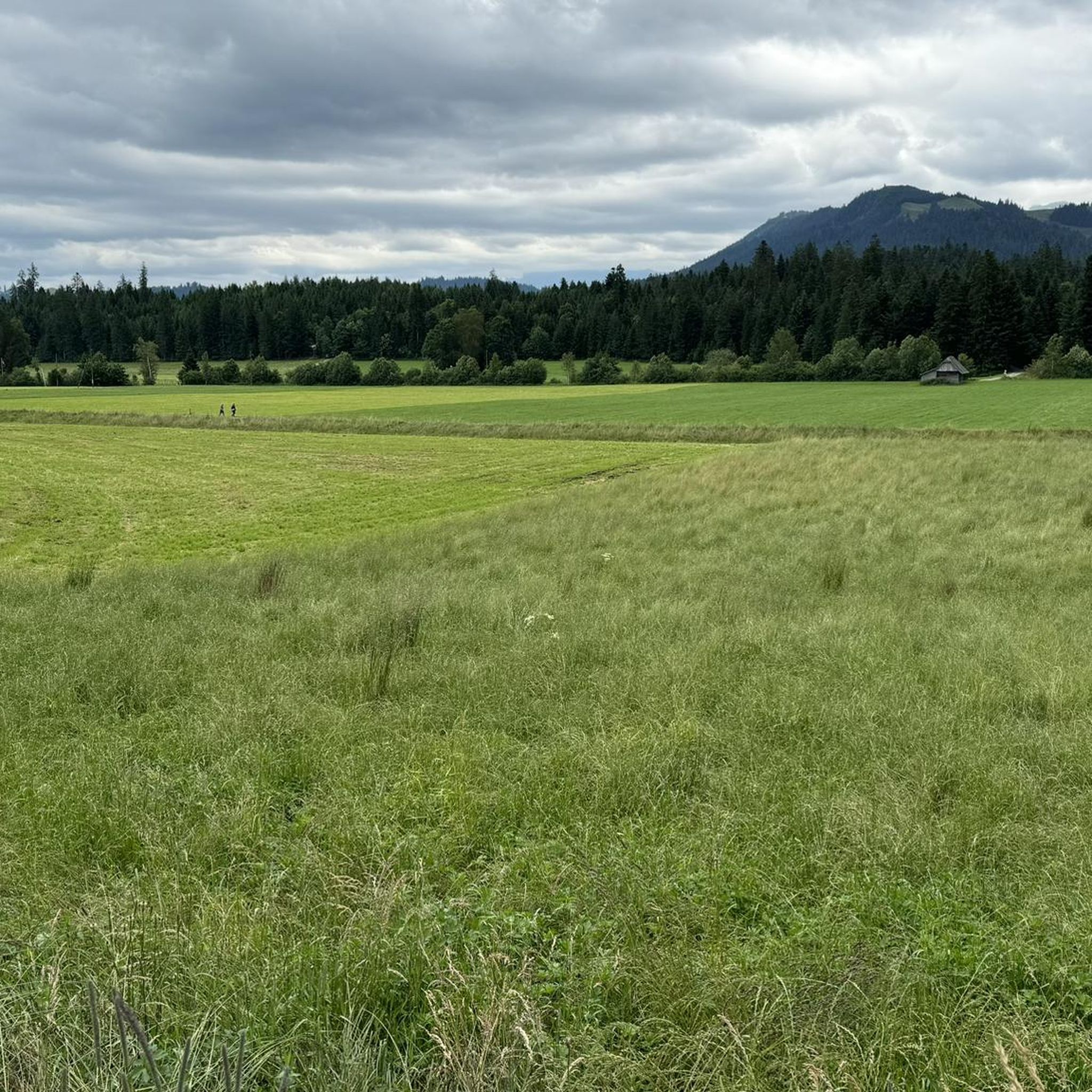
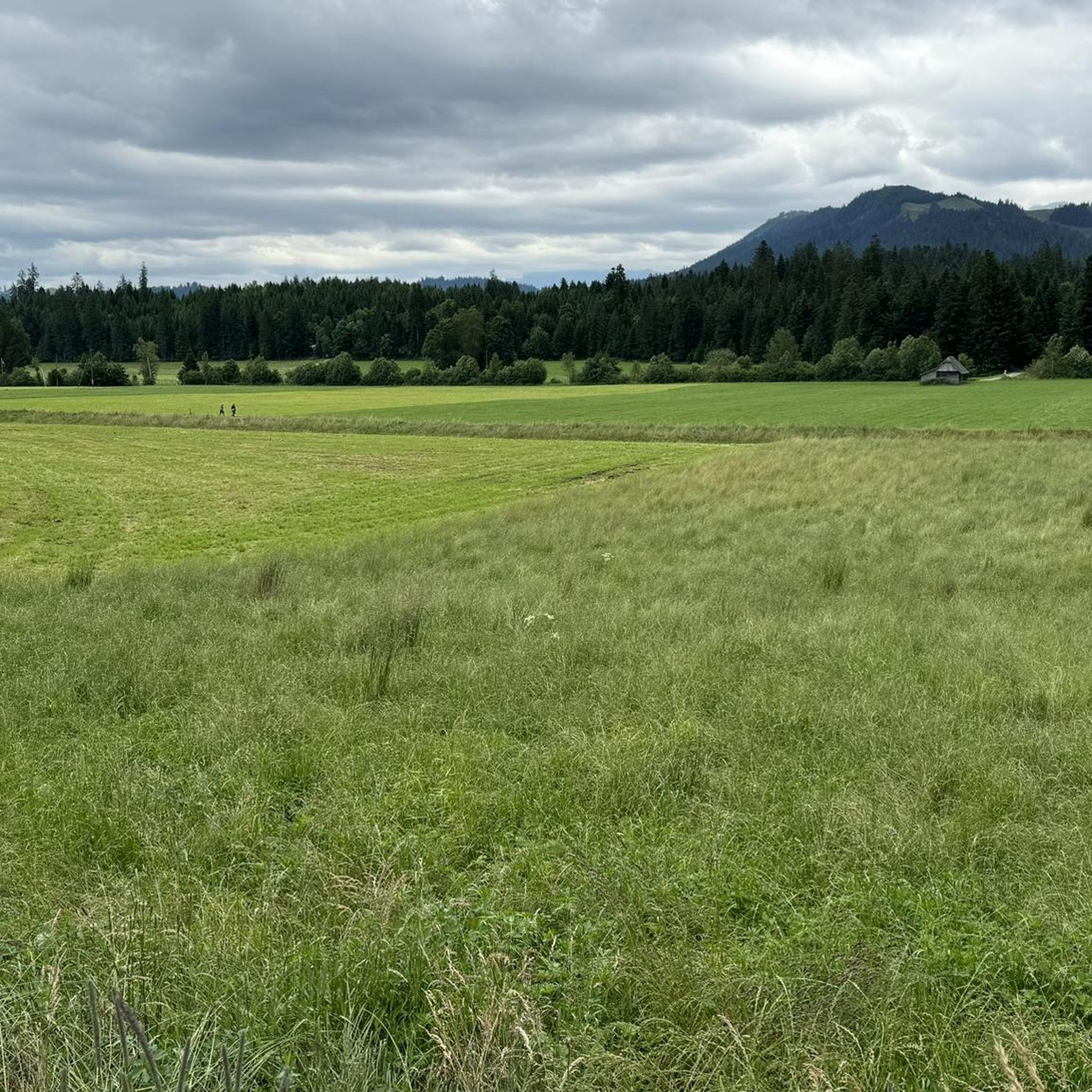
The top of the Schallenberg pass? The must for all cycling enthusiasts in the region. Hardly anywhere else will you find such a winding and beautiful descent and you will hardly find yourself on such a well-developed road in the middle of nature. The switchbacks cost energy, but there is a mancherie at the top of the pass.
0
0
Frequently Asked Questions
What are some popular elevated points or scenic routes around Unterlangenegg that offer mountain pass-like experiences?
While Unterlangenegg doesn't feature traditional high-alpine passes, several elevated points and routes provide similar experiences with expansive views. Popular options include the Sichle Pass, known for its wonderful views in both directions, and the Schallenberg Pass (1167 m), which offers scenic views and pleasant routes. The challenging Margel Pass Crossing is also a favorite for its viewpoints and beautiful descent.
What kind of views can I expect from the elevated points in the Unterlangenegg region?
The elevated points around Unterlangenegg offer magnificent panoramic views. From locations like the Burgfeldstand Summit and the Blueme Observation Tower, you can see the Jura mountains, Lake Thun, and the majestic Bernese Alps. The Sichle Pass also provides impressive vistas in both directions.
Are there challenging routes for experienced hikers or cyclists near Unterlangenegg?
Yes, the region offers several challenging options. The Margel Pass Crossing is a challenging mountain pass with rewarding viewpoints. For cyclists, the Herzroute | 99 Langnau - Thun is a demanding stage with 99 elevation lines. Additionally, komoot offers several difficult mountain hikes, such as the "Sichle Pass – Schibe Summit loop from Säge" or the "Alp Oberbärgli – Sigriswiler Rothorn Summit loop from Sigriswil," which you can explore in the Mountain Hikes around Unterlangenegg guide.
What cycling opportunities are available around Unterlangenegg's elevated points?
Cyclists will find diverse routes. The Schallenberg Pass (1167 m) is known for its pleasant cycling routes, though it's advisable to avoid sunny Sundays due to heavy motorbike traffic. The Herzroute | 99 Langnau - Thun offers a challenging stage with scenic views over Lake Thun, and the Wachseldornmoos Cycling Route provides wonderful panoramic views. You can find more cycling options in the region through komoot's guides.
Are there easy or family-friendly options for enjoying the views around Unterlangenegg?
For those seeking elevated perspectives without extensive hiking, the Blueme Observation Tower is a 16-meter-high steel structure offering sweeping views across Lake Thun, the Jura, and the Bernese Alps. The Burgfeldstand Summit is also accessible via a comfortable path and railway, making it a popular spot for mountain hikes that can be enjoyed by many. For easy walks, check out the Hiking around Unterlangenegg guide, which includes routes like the "Schwarzenegg Church loop from Unterlangenegg".
What do visitors particularly enjoy about the mountain passes and elevated points in the Unterlangenegg region?
Visitors frequently praise the wonderful and impressive landscapes, the beautiful panoramas, and the rewarding views after ascents. The pleasant routes, especially for cycling, are also highly appreciated. Many enjoy the diverse experiences for hikers and cyclists, with the community contributing 95 upvotes and 81 photos to the region's highlights.
When is the best time to visit the elevated points around Unterlangenegg?
The region is generally enjoyable during warmer months for hiking and cycling. However, if you plan to visit the Schallenberg Pass (1167 m), it's recommended to avoid sunny Sundays, as it can get very busy with motorbikes and cars. Always check local weather conditions before your visit, especially for higher elevations.
What natural features characterize the landscape around Unterlangenegg's elevated points?
The landscape is characterized by hilly terrain, situated between the Zulg and Rotachen valleys. You'll find scattered settlements, lush natural beauty, and expansive views that stretch from the Jura mountains over Lake Thun to the majestic Bernese Alps. The area offers a diverse natural and cultural landscape.
What hiking trails can I find near these elevated points?
Beyond the specific passes, the region offers a variety of hiking trails. For instance, the Sichle Pass allows for ascents to the Seven Stallions or Sigriswiler Rothorn. You can explore numerous options, from easy to difficult, in the Hiking around Unterlangenegg guide and the Mountain Hikes around Unterlangenegg guide, which include routes like the "Schwarzenegg Church loop" and the "Sichle Pass loop from Säge".
Is there a restaurant or amenities available at any of the elevated points?
Yes, the Schallenberg Pass (1167 m) is known for having a restaurant at its summit, which is a popular spot, especially for bikers. This makes it a convenient stop for refreshments during your tour.
What makes the <a href="https://www.komoot.com/highlight/568603" target="_blank" rel="noopener">Sichle Pass</a> a notable destination?
The Sichle Pass is highly regarded for its great and impressive landscape, offering wonderful views in both directions. It can be reached from either the Justistal or Eriz side, and from the pass, you can ascend to the Seven Stallions or the Sigriswiler Rothorn, making it a hub for further exploration.
Most popular routes around Unterlangenegg
Most popular attractions around Unterlangenegg

Get inspired with the komoot mobile app


Explore more
See even more epic mountain passes by checking out these guides around Unterlangenegg:
