Top 19 Natural Monuments in the Central Mexican Plateau
Best natural monuments in the Central Mexican Plateau showcase a diverse landscape characterized by expansive plains, rolling hills, and rugged mountains. This high-altitude region, flanked by the Sierra Madre Occidental and Sierra Madre Oriental, features unique geological formations and ecosystems. Visitors can explore a variety of natural areas, from impressive monoliths to vast desert systems. The region offers opportunities to experience significant natural landmarks and diverse topography.
Best natural monuments in the Central Mexican Plateau
- The most popular natural monuments…
Last updated: July 10, 2026
Santa Elena Canyon
Highlight (Segment) • Canyon
Translated by Google •
Tip by

Balanced Rock
Highlight • Natural Monument
Tip by

Sign up now to discover places like this
Get recommendations on the best single tracks, peaks, & plenty of other exciting outdoor places.
Sign up for free
Pinnacles Trail
Highlight (Segment) • Trail
Tip by

Emory Peak
Highlight • Summit
Tip by
The Window Pour-off Viewpoint
Highlight • Viewpoint
Tip by
Thousand Steps Trail
Highlight • Trail
Tip by

Mount Cristo Rey
Highlight • Summit
Tip by

Aztec Cave
Highlight • Cave
Tip by

South Franklin Mountain summit
Highlight • Summit
Tip by
Ranger Peak
Highlight • Summit
Tip by
Sign up for free to discover even more natural monuments in the Central Mexican Plateau.
Sign up for free
Already have an account?
Start today with a free account
Your next adventure awaits.
Login or Signup

Other adventures in the Central Mexican Plateau

Tips from the Community

Balanced Rock is an interesting geological formation created by millions of years of erosion, which gradually exposed rocks that appear to be balanced precariously on one another. These formations not only draw hikers but also provide insights for scientists studying earthquake activity. The final stretch of the trail leading to Balanced Rock involves navigating steep, rough bedrock and a landscape filled with boulders. Hikers should stay on the trail, follow directional arrows carefully, and exercise caution.
0
0

From the summit you can see far into Mexico, and across El Paso and southern New Mexico. The giant historic statue of Christ at the summit is both a scenic and spiritual destination.
0
0

Sierra Del Cristo Rey translates to "Mountain of Christ the King". It is a peak right on the border of Texas, New Mexico, and Mexico.
0
0
Sierra Del Cristo Rey translates to "Mountain of Christ the King". It is a peak right on the border of Texas, New Mexico, and Mexico. There is a cool statue at the top and view all along the trail. This one is smooth enough to really push the pace on the uphill and the downhill.
0
0

Pinnacles Trail is known as a steep, strenuous hike with great views of the Chisos Basin and the Chihuahuan Desert. Pinnacles is a shorter route to popular stops like South Rim or Emory Peak but hikers will often hike Pinnacles Trail and stop at Pinnacles Pass, due to the steepness of the trail and the views it offers.
0
0
Emory Peak is the highest point in Big Bend National Park at 7,796 feet. The summit provides panoramic views of the rocky peaks in Chisos Basin. The last quarter mile of the climb to this mountain top is steep and rocky. The last 25 feet to the summit requires scrambling along a rock face. There is very little shade along most of this trail and Texas's summer temps can be brutal. Make sure to pack appropriately.
0
0
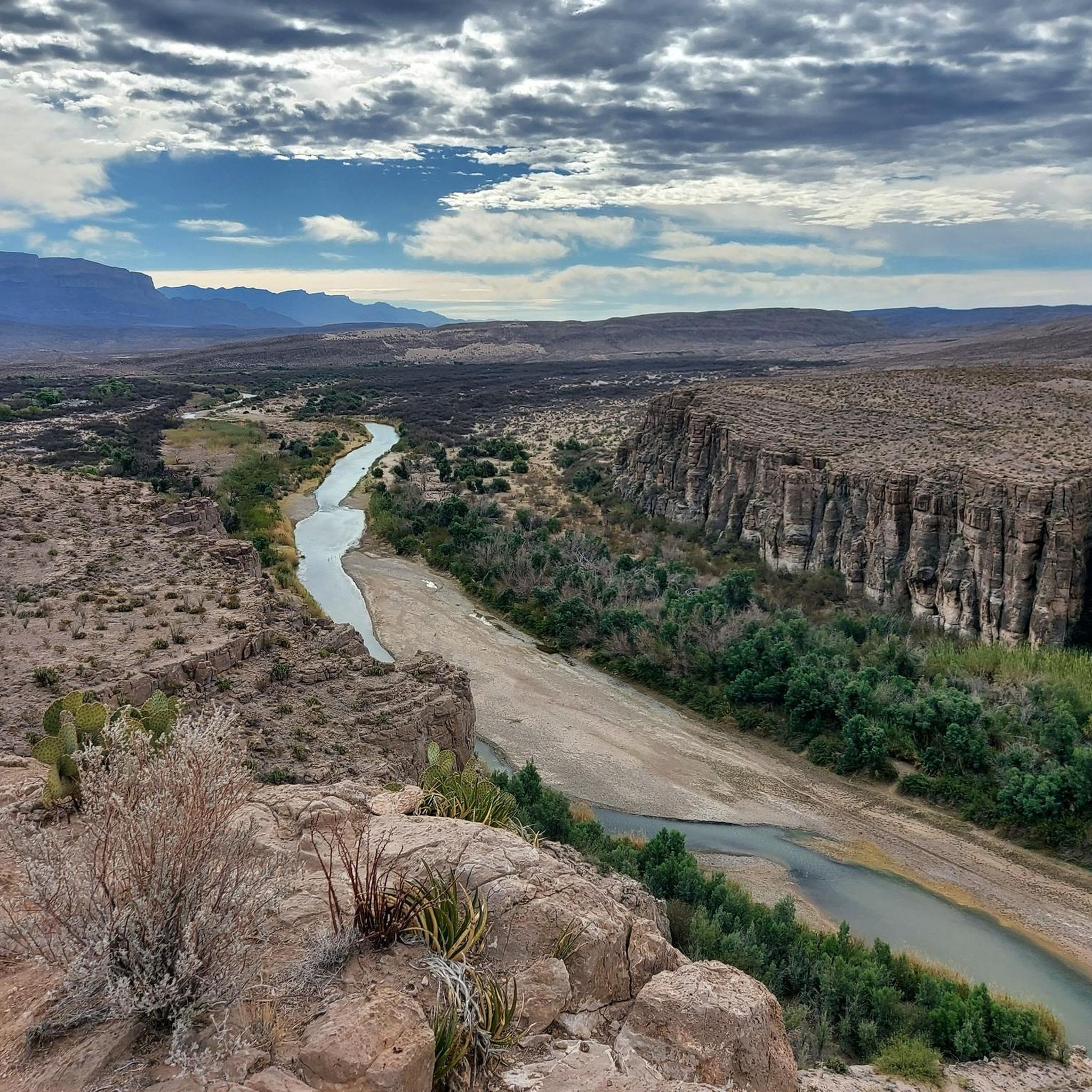
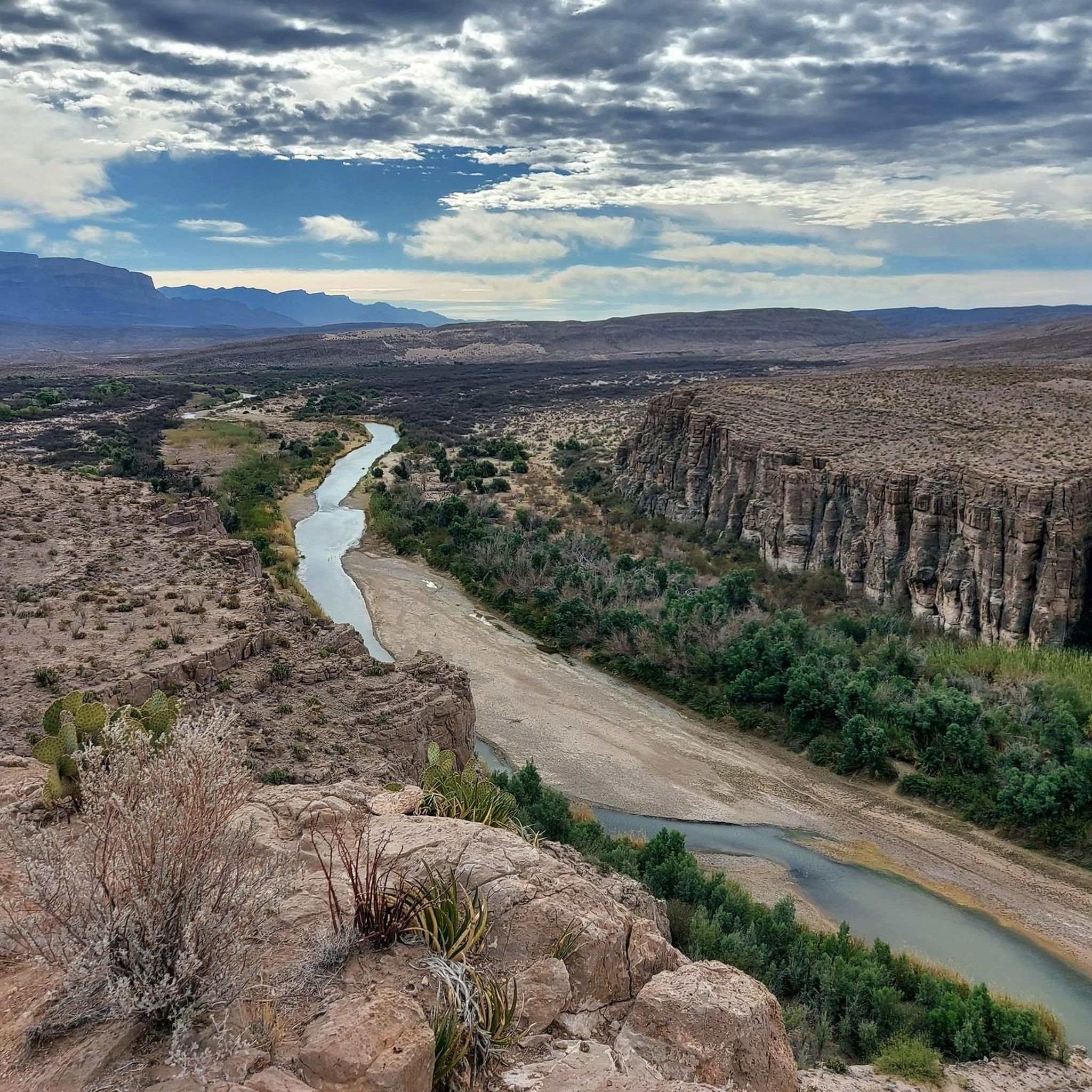
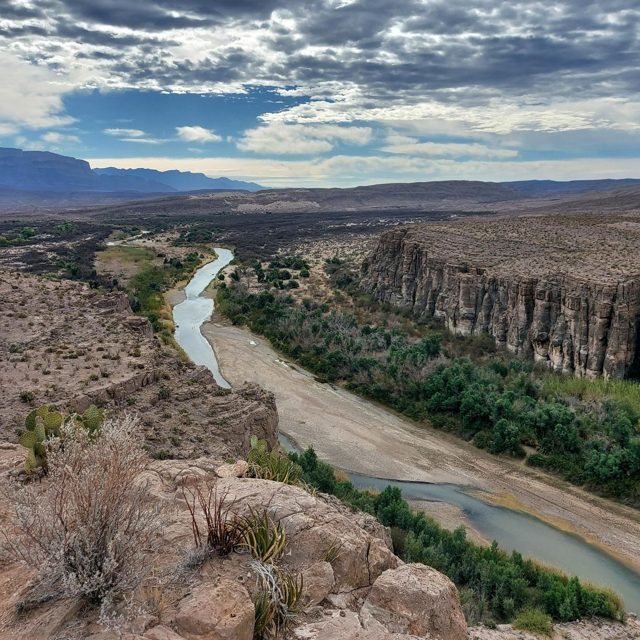
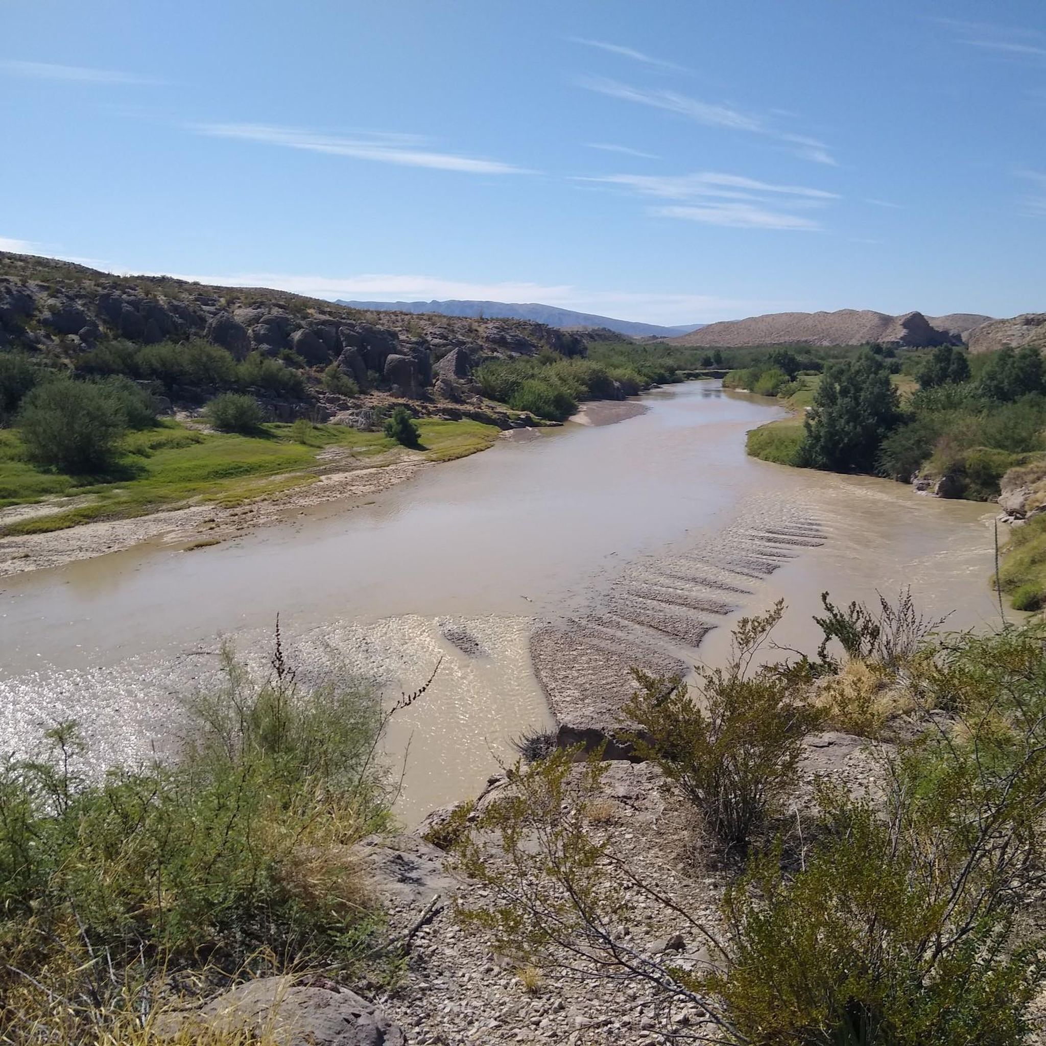
This trail leads directly into the mouth of the canyon. It follows the Rio Grande along its banks with rock stairs and a dirt path, and then along the lower parts of the rocky canyon walls. When the dirt path ends, hikers will often wade into the usually knee-high water to experience more of the canyon.
0
1
The gem of this trail is a narrow overlook through two tall sandstone walls, known as The Window Pour-off, that is on the side of the mountain. The giant rock mountain is known as The Window because of the way it frames views of the desert from afar.
0
0
Frequently Asked Questions
What are some of the most notable natural features to explore in the Central Mexican Plateau?
The Central Mexican Plateau is rich in diverse natural features. You can find impressive geological formations like The Window Pour-off Viewpoint, which offers a narrow overlook through tall sandstone walls framing desert views. Another unique formation is Balanced Rock, where erosion has created rocks that appear to be precariously balanced. The region also features dramatic canyons such as Santa Elena Canyon, known for its impressive interior views, and various summits like Emory Peak, the highest point in Big Bend National Park offering panoramic vistas.
Are there challenging hiking trails among the natural monuments in the Central Mexican Plateau?
Yes, several natural monuments in the Central Mexican Plateau offer challenging hiking experiences. For instance, the Pinnacles Trail is known as a steep and strenuous hike with great views of the Chisos Basin. Climbing Emory Peak involves a steep and rocky ascent, with the final 25 feet requiring scrambling. For those seeking a climb, the South Franklin Mountain summit also presents a challenging climb with rewarding views.
What unique geological formations can be found in the Central Mexican Plateau?
The Central Mexican Plateau boasts several unique geological formations. Beyond the balanced rocks and sandstone windows, the region is home to the spectacular Balanced Rock, a result of millions of years of erosion. Further afield, though not strictly within the Central Mexican Plateau, sites like Peña de Bernal in Querétaro stand as one of the tallest monoliths in the world, and Los Prismas Basálticos in Hidalgo showcase dramatic hexagonal basalt columns formed by cooling lava, with waterfalls cascading over them.
What kind of wildlife and flora can I expect to see in the natural areas of the Central Mexican Plateau?
The Central Mexican Plateau, with its varied topography from arid deserts to temperate regions, supports diverse wildlife and flora. While specific wildlife sightings depend on the monument, areas like the Monarch Butterfly Biosphere Reserve in Michoacán are world-renowned for hosting millions of monarch butterflies during their winter migration. Cuatro Ciénegas in Coahuila is a unique hydrological system known for its exceptional biodiversity and endemic species that have evolved in isolation, offering a glimpse into ancient ecosystems.
Are there any natural monuments in the Central Mexican Plateau that are particularly good for day trips?
Many natural monuments in the Central Mexican Plateau are suitable for day trips, offering a chance to experience significant natural landmarks. For example, The Window Pour-off Viewpoint and Balanced Rock are popular spots for day hikes. The region's diverse offerings mean you can often combine a visit to a natural monument with nearby towns or other attractions for a fulfilling day out.
What outdoor activities, such as hiking or cycling, can I do near the natural monuments in the Central Mexican Plateau?
The Central Mexican Plateau offers a variety of outdoor activities near its natural monuments. For hiking enthusiasts, you can explore routes like the Window Trail, Lost Mine Trail, or the Emory Peak Loop. You can find more details on these and other trails in the Hiking in the Central Mexican Plateau guide. If you prefer cycling, there are road cycling routes such as the Smugglers Pass & Mission Valley loop or the Mount Locke loop, detailed in the Road Cycling Routes in the Central Mexican Plateau guide. Additionally, you can discover Waterfall hikes in the Central Mexican Plateau, including routes like the Oak Spring Trail.
What is the best season to visit the natural monuments in the Central Mexican Plateau?
The best season to visit the natural monuments in the Central Mexican Plateau largely depends on the specific monument and your preferred activities. Generally, the cooler, drier months from October to April are ideal for hiking and exploring, as summer temperatures can be high, especially in arid areas. However, if you wish to witness the monarch butterfly migration at the Monarch Butterfly Biosphere Reserve, the best time is typically from November to March.
Are there any natural monuments in the Central Mexican Plateau that are particularly family-friendly?
While many natural monuments involve some level of hiking, several can be enjoyed by families. Shorter, less strenuous trails leading to viewpoints like The Window Pour-off Viewpoint can be suitable. For a truly unique family experience, the Monarch Butterfly Biosphere Reserve offers an unforgettable spectacle for all ages, though it requires some walking to reach the butterfly colonies. Always check the specific trail difficulty and conditions before visiting with children.
What are some of the most impressive canyons in the Central Mexican Plateau?
The Central Mexican Plateau is home to several impressive canyons. Santa Elena Canyon is a must-see, offering fantastic views as you explore its interior, often requiring a crossing of Terlingua Creek. While not strictly within the Central Mexican Plateau, the region's proximity to areas with dramatic geological features means visitors can experience similar awe-inspiring landscapes.
What do visitors enjoy most about the natural monuments in the Central Mexican Plateau?
Visitors frequently praise the breathtaking views and unique geological formations found throughout the Central Mexican Plateau. The dramatic sandstone walls at The Window Pour-off Viewpoint, the precarious Balanced Rock, and the impressive interior of Santa Elena Canyon are often highlighted. The opportunity for strenuous hikes with rewarding panoramic vistas, such as those from Emory Peak, also receives high acclaim from the komoot community.
Are there any caves or unique underground natural monuments in the Central Mexican Plateau?
Yes, the Central Mexican Plateau region offers unique underground natural monuments. One notable example is Aztec Cave, which provides an intermediate level of exploration. Further afield, in San Luis Potosí, lies El Sótano de las Golondrinas (Cave of Swallows), an enormous open-air pit cave famous for the spectacular flight displays of thousands of birds at dawn and dusk, offering a truly awe-inspiring natural phenomenon.
What should I pack for visiting natural monuments in the Central Mexican Plateau, especially during the rainy season?
When visiting natural monuments in the Central Mexican Plateau, especially during the rainy season (typically May to October), it's crucial to pack appropriately. Essential items include sturdy hiking shoes, plenty of water, sun protection (hat, sunscreen), and layers of clothing. During the rainy season, waterproof gear such as a rain jacket and waterproof hiking boots are highly recommended, as creek crossings (like at Santa Elena Canyon) can become more challenging, and trails may be muddy. Always check local weather conditions before your trip.
Most popular routes in the Central Mexican Plateau
Most popular attractions in the Central Mexican Plateau

Get inspired with the komoot mobile app


Explore more
Extend your search for the best caves by checking out these guides of the top ones in the Central Mexican Plateau:
