Top 11 Mountain Passes around Apricale
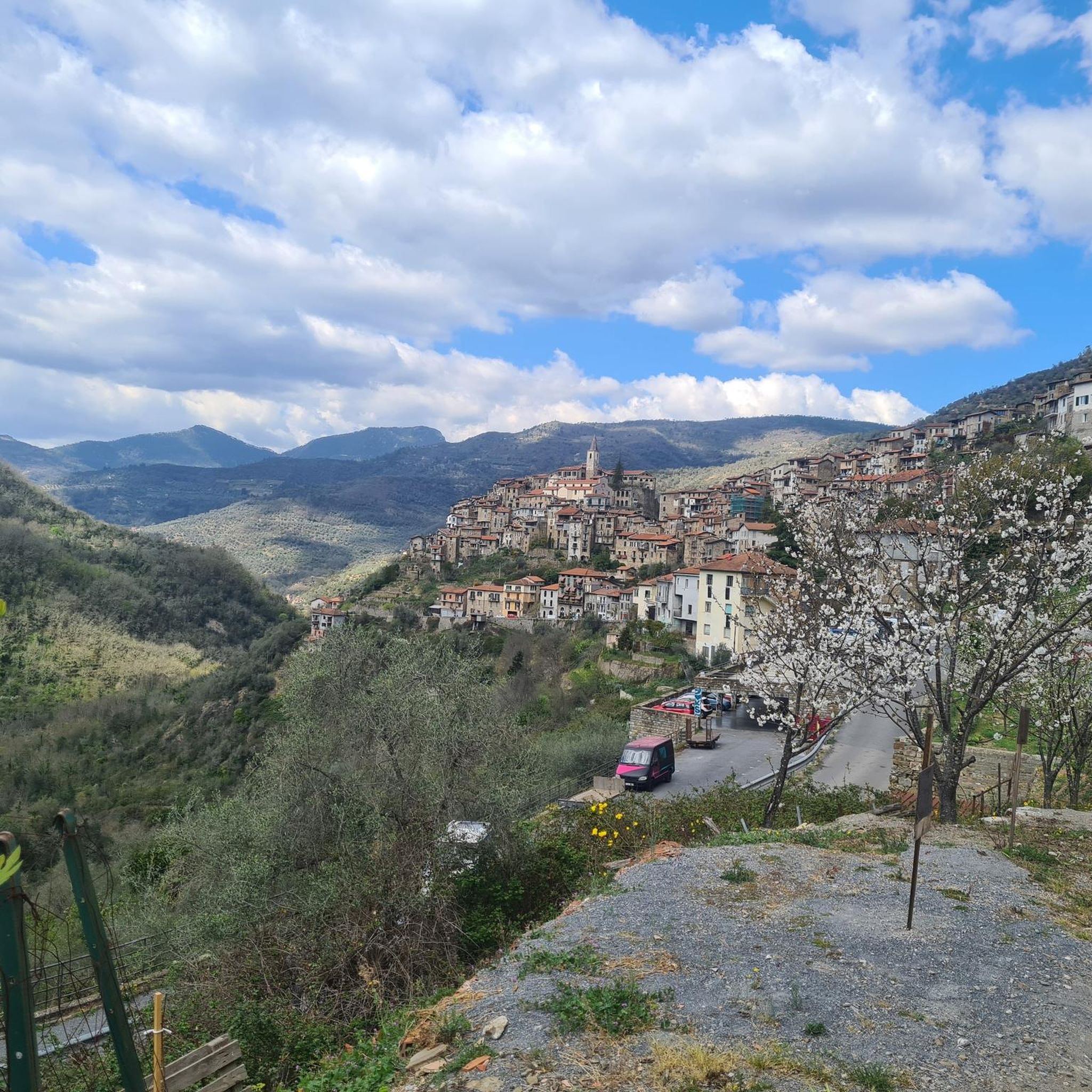
Best mountain passes around Apricale are situated in the Ligurian Alps, providing access to high-altitude areas for hikers and cyclists. This medieval village is nestled in the Nervia Valley, offering a blend of challenging ascents and panoramic views. The region features diverse landscapes, from dense forests to arid grasslands, with vistas extending to the Mediterranean Sea. Apricale serves as a base for exploring numerous trails and historical routes.
Best mountain passes around Apricale
- The most popular mountain pass is Brouis…
Last updated: October 13, 2026
Poggio di Sanremo Climb
Highlight (Segment) • Climb
Translated by Google •
Tip by

Brouis Pass (879 m)
Highlight • Mountain Pass
Showing Translation
Tip by

Sign up now to discover places like this
Get recommendations on the best single tracks, peaks, & plenty of other exciting outdoor places.
Col de Vescavo – Olivetta San Michele Border Crossing
Highlight (Segment) • Mountain Pass
Translated by Google •
Tip by
Pietravecchia - Torragio West traverse
Highlight • Trail
Tip by

Tunnel at Colle dei Termini di Bajardo
Highlight • Structure
Translated by Google •
Tip by

Sign up for free to discover even more mountain passes around Apricale.
Already have an account?
Start today with a free account
Your next adventure awaits.

Tips from the Community

The only one you can do by bike. Don't cycle the Alpine Trail.
0
0

A beautiful training route with varying gradients (5% to 11%). Those who enjoy culture as well as nature should also cycle the last 5 km to Piene Haute.
0
0

https://youtu.be/zjW_mgeyPfk The path is not blocked and, apart from the one place with a rope, is wide enough for the bike and rider. It goes steeply downhill, so you should not be afraid of heights. But technically it's not a problem.
0
0

The famous Poggio climb. The last asperity of the Milan-Sanremo.
1
0
This is the Poggio climb, famous for being the decisive point of the Milan-Sanremo. The climb does not have very challenging slopes and from its hairpin bends you can enjoy a beautiful view towards the sea
0
1

The last climb of the classic Milan - Sanremo. Easy to ride and with beautiful views of the Riviera
0
0

little fountain that goes well
2
0

Small and westernmost municipality in all of Liguria, Olivetta San Michele is located between Col de Vescavo and Airole, along the banks of the Bevera stream. Here the Ligurian Roiasco dialect is spoken, but - a unique case in Liguria - the entire municipal territory also belongs to the historical Occitan linguistic minority. Olivetta, which has a station on the Ventimiglia-Turin route in the hamlet of San Michele, is part of the Union of the municipalities of the Nervia and Roja Valleys.
1
0
Frequently Asked Questions
What are some of the most scenic mountain passes and viewpoints near Apricale?
For breathtaking 360-degree panoramas, consider visiting Monte Ceppo. While technically a summit, it offers views encompassing the Ligurian and French Alps, and the Mediterranean Sea, including coastal towns and even Corsica on clear days. Another excellent viewpoint is Col de Vescavo – Olivetta San Michele Border Crossing, which provides varying gradients and scenic vistas.
Are there challenging mountain passes for experienced cyclists near Apricale?
Yes, Passo Gouta (Sella di Gouta) is highly regarded as a challenging training climb for serious cyclists. It features a consistent 7% average gradient over approximately 14 kilometers, with nearly 1,000 meters of height gain. The paved road transitions to gravel at the top, making it delightfully traffic-free. Another option for varying gradients (5% to 11%) is the route to Col de Vescavo – Olivetta San Michele Border Crossing.
What kind of natural features can I expect to see around the mountain passes near Apricale?
The region offers diverse landscapes. At higher elevations like Monte Ceppo, you'll find arid, grassy areas, while lower down, dense forests of pine and beech are common. The area is also a site of community interest and a special protection zone, home to protected flora and fauna. The Alta Via dei Monti Liguri, which passes near Apricale, showcases ancient rural settlements, forests, and valleys, with opportunities to spot rare alpine flora and wild fauna.
Are there any long-distance hiking trails accessible from Apricale?
Yes, Apricale is an excellent base for exploring sections of the Alta Via dei Monti Liguri (AV). This extensive long-distance hiking trail traverses the entire Ligurian region, including parts near Apricale. It offers 44 day-hike sections through diverse landscapes, following historical military roads and alpine paths. Sections 3 and 4 of the AV are particularly close to Apricale, offering unparalleled opportunities for multi-day trekking or shorter excursions.
What are the best times of year to visit the mountain passes around Apricale for outdoor activities?
Monte Ceppo is popular for both hiking and mountain biking throughout the year, suggesting good conditions across seasons. Generally, spring and autumn offer pleasant temperatures for hiking and cycling. While winter conditions can vary, some areas might be suitable for winter hiking, but always check local conditions and prepare accordingly for colder weather and potential snow at higher altitudes.
What kind of activities can I do near the mountain passes around Apricale?
Besides exploring the passes themselves, the region offers a variety of outdoor activities. You can find numerous hiking trails, including moderate loops like the 'View of Apricale – View of the Mediterranean Sea loop' or 'Colle Scarassan – Rifugio Gola di Gouta loop'. For mountain biking, there are routes such as the 'Monte Bignone – View of Bajardo loop'. Road cyclists can tackle challenging routes like the 'Poggio di Sanremo Climb'. For more details on routes, you can explore the hiking guide, MTB trails guide, and road cycling guide for Apricale.
Are there any historical or cultural points of interest near the mountain passes?
Many mountain passes in the region have historical significance. For example, Brouis Pass (879 m) served as an old Franco-Italian border. The Alta Via dei Monti Liguri trail itself follows historical military roads and mule tracks, connecting numerous charming medieval villages, allowing for cultural exploration alongside outdoor activity. The Tunnel at Colle dei Termini di Bajardo is also notable for marking the boundary between the municipalities of Sanremo and Bajardo, with 'terms' stones indicating historical land divisions.
What are some of the more unique or less-known mountain passes in the area?
The Tunnel at Colle dei Termini di Bajardo offers a distinctive feature with its tunnel, dividing the municipality of Sanremo from Bajardo and being passable by bike. Another interesting spot is Vescavo Pass (477 m), a small pass on the Franco-Italian border connecting the Valleys of Bévéra and Roya, offering panoramic views.
Are there any mountain passes suitable for a starting point for tours of various difficulty levels?
Yes, Brouis Pass (879 m) is an excellent starting point for tours of various difficulty levels. It's well-known for offering several descents towards Olivetta-Sospel and Breil sur Roya, catering to different skill sets.
What should I know about the terrain and difficulty of hiking around Apricale's mountain passes?
The terrain around Apricale's mountain passes can vary significantly. While some routes are moderate, others, like the 'Pietravecchia - Torragio West traverse', are considered challenging and recommended for well-trained individuals accustomed to such trails, featuring steep downhill sections and technical passages. Elevations can range from lower passes like Vescavo Pass (477 m) to higher points like Monte Ceppo (1,627 meters), offering a mix of difficulty levels.
Are there any refuges or places to get refreshments near the mountain passes?
Yes, at the top of Passo Gouta, there is a refuge where visitors can find refreshments. Additionally, near Brouis Pass (879 m), there is a small hostel with food available, making it a convenient stop for those embarking on tours.
Most popular attractions around Apricale

Get inspired with the komoot mobile app


Explore more
See even more epic mountain passes by checking out these guides around Apricale:
