The best road cycling routes around Vråvatn
4.8
(6)
143
riders
8
rides
Road cycling around Vråvatn offers diverse and picturesque landscapes in Norway's Telemark region. The area features a mountainous topography with hills and clear lakes like Vråvatn and Nisser, providing varied terrain for cyclists. Lush forests and rugged sections characterize the environment, creating a dynamic backdrop for routes. The region's natural features include the Storstraum-Småstraum Canal, connecting Vråvatn and Lake Nisser.
Best road cycling routes around Vråvatn
- The most popular road cycling route is Russlian – Briskedekkan loop from Kalsøy,…
Last updated: July 1, 2026
5.0
(2)
37
riders
38.1km
01:50
340m
340m
Moderate road ride. Good fitness required. Some segments of this route may be unpaved and difficult to ride.
18
riders
64.9km
03:30
1,240m
1,240m
Hard road ride. Very good fitness required. Some segments of this route may be unpaved and difficult to ride.

Sign up for free
5.0
(1)
38
riders
41.7km
01:56
330m
330m
Moderate road ride. Good fitness required. Some segments of this route may be unpaved and difficult to ride.
10
riders
138km
06:17
1,360m
1,360m
Hard road ride. Very good fitness required. Some segments of this route may be unpaved and difficult to ride.
5.0
(1)
8
riders
86.9km
03:45
590m
590m
Moderate road ride. Good fitness required. Some segments of this route may be unpaved and difficult to ride.
Get access to more routes and recommendations from other explorers.
Sign up for free
Already have an account?
Our route recommendations are based on thousands of hikes, rides, and runs completed by other people on komoot.
Start today with a free account
Your next adventure awaits.
Login or Signup
Popular around Vråvatn
Tips from the Community

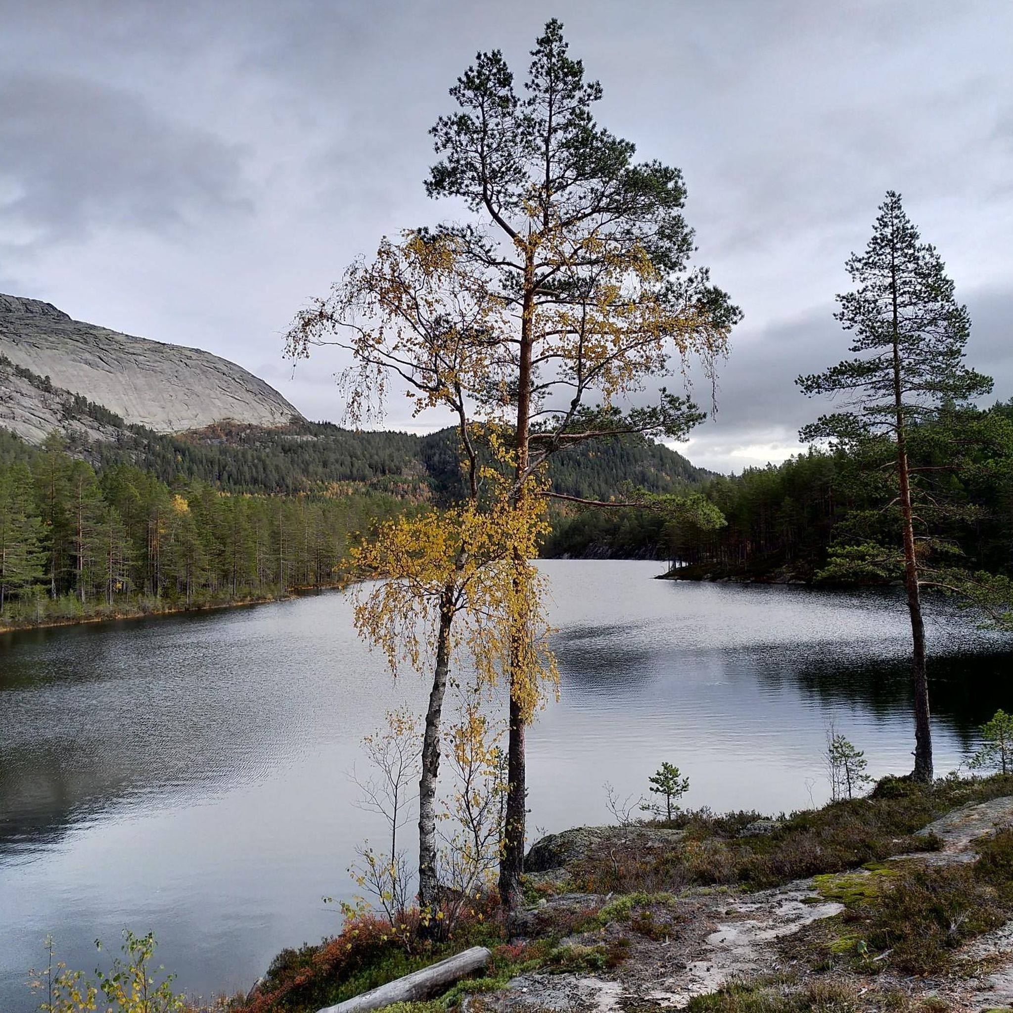
Lake Nisser is the largest lake in the Telemark region, known for its crystal-clear water and the smooth granite mountains that slope directly into its depths. The lake's diverse shoreline features numerous sandy beaches and small islands.
0
0

The Fjonevegen is a stunning road that runs alongside the Nisser. Here, a trail begins that leads up to Kronfjell.
0
0

You can stop here for a break, sit at the wooden tables, and admire the view. It's a great spot for lunch!
0
0

Kviteseid Bygdetun is an open-air museum located in Kviteseid, showcasing traditional buildings from the surrounding region. It offers a glimpse into historical ways of life and local architecture in Telemark.
0
0


Pass summit between Drangedal and Kviteseid municipality with a former bear cave. Nice descent to Steane. Otherwise a moderate increase.
0
0

At the bottom of Vradal is a beach and hotel
0
0

Small camp with a friendly owner. Super parking space on the water!
1
0
Frequently Asked Questions
What kind of terrain can I expect when road cycling around Vråvatn?
The Vråvatn region features a diverse landscape, characterized by mountainous topography, clear lakes like Vråvatn and Nisser, and lush forests. You'll encounter varied terrain, including both paved and some unpaved sections, offering a dynamic backdrop for your rides. The area is known for its 'minialpine' peaks and unique island landscape shaped by the Ice Age.
Are there road cycling routes suitable for beginners or those looking for an easier ride?
Yes, Vråvatn offers routes for various fitness levels. While some routes have significant elevation gain, there are easier options. For instance, the local 'Vråvatn rundt' route is known for having relatively few steep climbs, making it a moderately easy tour. Overall, the guide lists 1 easy route and 3 moderate routes, providing accessible choices.
What are some challenging road cycling routes in the Vråvatn area?
For experienced cyclists seeking a challenge, Vråvatn has several difficult routes. One notable option is the Steep Climb to Vrådal – Kleivhammar loop from Vrådal kyrkje, which is 40.7 miles (65.6 km) long and features significant elevation gain. Another demanding route is the Øyne Camping – Kleivhammar loop from Fossøyi, spanning 138 km with over 1300 meters of ascent. In total, there are 4 difficult routes listed in the guide.
What natural features or landmarks can I see along the road cycling routes?
The routes around Vråvatn offer stunning views of crystal-clear lakes like Vråvatn and Nisser, and pass through lush forests. A unique historical and natural attraction is the Storstraum-Småstraum Canal, which connects Vråvatn and Lake Nisser. Along the 'Vråvatn rundt' route, you can also observe the old Vråliosen hotel and guesthouse, a notable historical building.
Is Vråvatn a good destination for family-friendly road cycling?
Vråvatn can be suitable for families, especially on routes with less elevation. The 'Vråvatn rundt' route, for example, is considered moderately easy with few steep climbs, making it enjoyable for many. The village of Vrådal, a central hub, offers amenities and activities like canoe, SUP, and boat rentals at places like Straand Sommerland, which can complement a family cycling trip.
When is the best time of year to go road cycling in Vråvatn?
The region's good climate makes it enjoyable for road cycling, particularly during the warmer months. Summer offers pleasant conditions for exploring the diverse landscapes, with opportunities for swimming in the shallow beaches of Vrådal. Always check local weather forecasts before heading out.
Are there any cafes or places to stop for refreshments along the road cycling routes?
The village of Vrådal serves as a central hub in the region and provides amenities, including places for refreshments. While specific cafes directly on every route are not detailed, Vrådal is strategically located at the junction of Vråvatn and Nisser, making it a convenient stop for cyclists.
What do other road cyclists think about the routes in Vråvatn?
The road cycling routes in Vråvatn are highly regarded by the komoot community, holding an impressive average rating of 4.8 stars from a handful of reviews. Over 130 road cyclists have used komoot to explore the varied terrain, indicating a positive experience among users.
How many road cycling routes are available in the Vråvatn area?
There are 8 road cycling routes detailed in this guide for the Vråvatn area. These routes cater to different skill levels, including 1 easy, 3 moderate, and 4 difficult options, ensuring there's a ride for every preference.
Can I find loop routes for road cycling around Vråvatn?
Yes, many of the road cycling routes around Vråvatn are designed as loops, allowing you to start and end at the same point. Examples include the Russlian – Briskedekkan loop from Kalsøy and the Storstraum – Geitåsen loop from Fossøyi, providing convenient circular journeys through the scenic landscape.
Are there opportunities to explore cultural sites near the road cycling routes?
While not directly on the cycling routes, the Vråvatn area is part of the rich Telemark region, offering cultural experiences. You can visit sites like the West Telemark Museum, the Norwegian Ski Museum in Morgedal, or the impressive 13th-century Heddal Stave Church, all accessible from the Vråvatn area for a cultural detour.
What is the typical duration for road cycling routes in Vråvatn?
The duration of road cycling routes in Vråvatn varies significantly based on distance and difficulty. For example, the moderate Russlian – Briskedekkan loop from Kalsøy typically takes around 1 hour 50 minutes, while the difficult Steep Climb to Vrådal – Kleivhammar loop from Vrådal kyrkje can take over 3 hours 40 minutes due to its length and elevation.

Get inspired with the komoot mobile app


Explore more
Browse the best Road cycling routes in other regions.
