The best walks and hikes around Area A (Wynndel/Crawford Bay/Riondel)
4.2
(5)
55
hikers
5
hikes
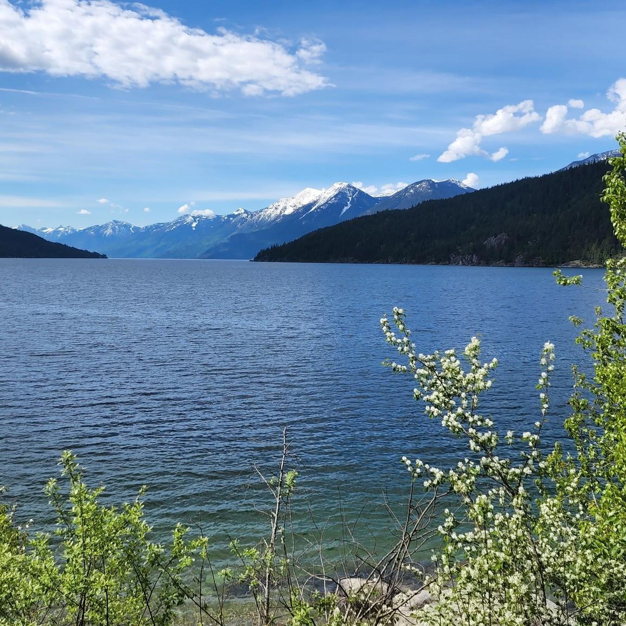
Hiking around Area A (Wynndel/Crawford Bay/Riondel) offers diverse landscapes along the eastern shore of Kootenay Lake. The region is characterized by mountains, including the Purcell Mountains, and significant old-growth forests and wetlands. Trails range from gentle lakeside paths to more challenging mountain treks, providing varied terrain for exploration.
Best hiking trails around Area A (Wynndel/Crawford Bay/Riondel)
- The most popular hiking route is Hourglass Lake Trail — Kimberley, a 3.8 miles (6.1 km) moderate trail that takes 2 hours 15 minutes to complete. This route features an elevation gain of 339 meters.
- Another top favourite among local hikers is Stone Sculptures in the Forest loop from Kaslo, an easy 2.0 miles (3.2 km) path. This trail includes an elevation gain of 79 meters and can be completed in 55 minutes.
- Local hikers also love the Kaslo City Hall – Stone Sculptures in the Forest loop from Kaslo, a 3.4 miles (5.4 km) trail leading through varied terrain, often completed in about 1 hour 32 minutes.
- Hiking around Area A (Wynndel/Crawford Bay/Riondel) is defined by Kootenay Lake views, old-growth forests, and mountain landscapes, with options for different ability levels.
- The routes in Area A (Wynndel/Crawford Bay/Riondel) are highly rated by the komoot community with an average score of 3.3 stars from 5 reviews. More than 40 hikers have used komoot to explore Area A (Wynndel/Crawford Bay/Riondel)'s varied terrain.
Last updated: August 31, 2026
3.7
(3)
27
hikers
3.39km
00:58
80m
80m
Easy hike. Great for any fitness level. Easily-accessible paths. Suitable for all skill levels.
6
hikers
10.7km
04:49
1,020m
1,020m
Hard hike. Very good fitness required. Easily-accessible paths. Suitable for all skill levels.

Sign up for free
3
hikers
6.14km
02:15
340m
340m
Moderate hike. Good fitness required. Easily-accessible paths. Suitable for all skill levels.
4.0
(1)
10
hikers
9.79km
02:45
200m
200m
Moderate hike. Good fitness required. Easily-accessible paths. Suitable for all skill levels.
5.0
(1)
9
hikers
6.18km
02:17
400m
400m
Moderate hike. Good fitness required. Easily-accessible paths. Suitable for all skill levels.
Our route recommendations are based on thousands of hikes, rides, and runs completed by other people on komoot.
Start today with a free account
Your next adventure awaits.
Login or Signup
Popular around Area A (Wynndel/Crawford Bay/Riondel)
Tips from the Community

Located in British Columbia's West Kootenay region, the Kaslo River is a stunning waterway that serves up picturesque views around every bend. The river makes its short 58-kilometre run from the mountains to Kootenay Lake at the town of Kaslo. It's here, near the mouth, where you'll find the family friendly Kaslo River Trail, which is a must do short loop that's fun for all ages.
0
0
A number of statues, known as Koots, are dotted along the Kaslo River Trail. Some of them are quite obvious while others are a bit more hidden. Keep your eyes peeled as you walk along the river and through the forest, you never know what you might see looking back at you.
0
0
This picturesque covered bridge is one of two that cross over the Kaslo River on the Kaslo River Trail. This is the closest one to town, so even if you don't have time to do the full trail, it's worth it to come out here to see the fairytale like setting.
0
0

The Loki-Baldur Trail is steep and leads through the woods, then opens up to a meadow where the trail mellows out. The trail climbs again, reaching Portman’s Notch, and Mount Loki comes into sight. Once above the treeline, the class 2-3 scramble will begin.
0
0
The summit of Mount Loki sits at 2779 meters and provides 360-degree views from this rocky peak high above the treeline. The views are fantastic, even breathtaking, but the summit push is a scramble and not recommended for kids or beginners.
0
0
The Loki-Baldur Trail involves a class 2-3 scramble just before the summit. Typically the route is easy to follow, but it can get tricky during this rocky scramble. The scramble is on a ridgeline and involves a few false summits. No technical gear is required, and the views from the false summits are beautiful, but if the weather takes a turn or if the scramble makes you uncomfortable, turn back.
0
0

The Hourglass Lake Trail is a relatively challenging path that leads to a picturesque alpine lake, popular with hikers and anglers. The trail is unmarked but easy to follow, climbing steadily through forest and open slopes to the lake, with roughly 340 metres of elevation gain, offering fantastic views of Pyramid, White Grouse, and Mount McKay in the distance. There is access to a nearby tarn via a short spur, a beautiful shoreline view at the lake and the option to scramble up a steep talus slope to a higher cirque lake. This trail ticks all the boxes—challenge, solitude, and incredible scenery.
0
0
At the west end of Hourglass Lake, there is a roaring waterfall that spills down from the upper basin. To reach Upper Hourglass Lake, it’s a strenuous climb up the steep talus slope to the right of the falls. There’s no formal trail, just a rugged scramble up shifting rock and loose boulders. Only attempt this route if you’re confident on unstable terrain and prepared for off-trail alpine travel.
0
0
Frequently Asked Questions
What kind of hiking experiences can I expect in Area A (Wynndel/Crawford Bay/Riondel)?
Area A offers a diverse range of hiking experiences, from gentle lakeside paths to more challenging mountain treks. You'll find trails along the eastern shore of Kootenay Lake, through significant old-growth forests, and with views of the Purcell Mountains and Kokanee Glacier. Options cater to various ability levels.
Are there any easy or family-friendly hiking trails in the region?
Yes, there are several options suitable for families and those seeking easier walks. The Stone Sculptures in the Forest loop from Kaslo is an easy 3.2 km path. The Crawford Creek Regional Park and Wetlands Trails also offer an accessible network with ponds, beaver dams, and a boardwalk, ideal for a gentle outing.
What are some notable natural features or viewpoints I can discover on a hike?
The region is rich in natural beauty. You can find breathtaking views of Kootenay Lake and the surrounding mountains. The Pilot Bay Lighthouse Trail leads to an historic lighthouse with expansive lake views. The Fraser Hill Viewpoint Trail offers views of Kokanee Glacier through the trees. For a more rugged experience, Gray Creek Pass provides scenic vistas along the Trans Canada Trail route. You can also explore highlights like Gray Creek Pass or the Kootenay River and Kootenay Lake Route.
Are there any historical trails or points of interest in Area A?
Yes, the Riondel Historic Waterline Trail, built in 1905, offers a pleasant walk with a historical connection and views of an "engineering marvel." The Riondel Heritage Trail also provides a walking tour through the historic mining town, showcasing old-growth cedar forests and mining areas. Additionally, the Pilot Bay Lighthouse, built in 1904, is a significant historical landmark accessible via a short trail.
What is the best time of year for hiking in Area A?
The best time for hiking in Area A is generally from spring through fall. Summer offers warm weather for lake activities and higher elevation trails. Fall brings the chance to see golden larches, particularly in areas like Haystack Mountain. Some trails might be accessible in winter, but conditions can vary, and specific preparation would be needed.
Are there any challenging or longer hikes for experienced adventurers?
For those seeking a challenge, the Hourglass Lake Trail — Kimberley is a moderate 6.1 km route with a significant elevation gain. The Lockhart Creek Trail, near Boswell, is a more strenuous option, climbing through magnificent old-growth forest for 15 km up to a ridge line at 7000 feet. Gray Creek Pass also offers a tough and rugged experience along a forest service road.
Can I bring my dog on the hiking trails in Area A?
Many trails in the Kootenay Lake area are dog-friendly, but it's always recommended to check specific trail regulations before heading out. Generally, dogs should be kept on a leash to protect wildlife and ensure a pleasant experience for all hikers.
Are there any loop trails available in the region?
Yes, loop trails are available. The Stone Sculptures in the Forest loop from Kaslo and the Kaslo City Hall – Stone Sculptures in the Forest loop from Kaslo are both popular loop options. The Hiking loop from YRB Highway Maintenance Yard also provides a moderate loop experience.
What do other hikers say about the trails in Area A?
The routes in Area A are highly rated by the komoot community, with an average score of 3.3 stars from 5 reviews. Hikers often praise the diverse terrain, the stunning Kootenay Lake views, and the opportunity to explore old-growth forests and mountain landscapes.
Where can I find parking for trailheads in Wynndel, Crawford Bay, or Riondel?
Parking is generally available at or near many trailheads throughout the region. For specific trails like those in Pilot Bay Provincial Park or Crawford Creek Regional Park, designated parking areas are provided. For trails originating in Riondel, you can typically find parking within the community or at the trailhead access points.
Are there any places to eat or stay near the hiking areas?
Yes, the communities of Wynndel, Crawford Bay, and Riondel offer various amenities. Crawford Bay is known for its artisan shops, while Wynndel has wineries. All three communities provide options for cafes, pubs, and accommodation, allowing you to relax and refuel after your hikes.
What kind of wildlife might I encounter on the trails?
The region's old-growth forests and wetlands provide rich habitats for various wildlife. You might spot migrating birds, especially in areas like Crawford Creek Regional Park. As with any outdoor activity in this region, be aware of larger wildlife and practice safe hiking habits.
Most popular routes around Area A (Wynndel/Crawford Bay/Riondel)
Most popular attractions around Area A (Wynndel/Crawford Bay/Riondel)

Get inspired with the komoot mobile app


Explore more
Browse the best Hikes in other regions.
