The best road cycling routes around Area A (Wynndel/Crawford Bay/Riondel)
5.0
(1)
85
riders
9
rides
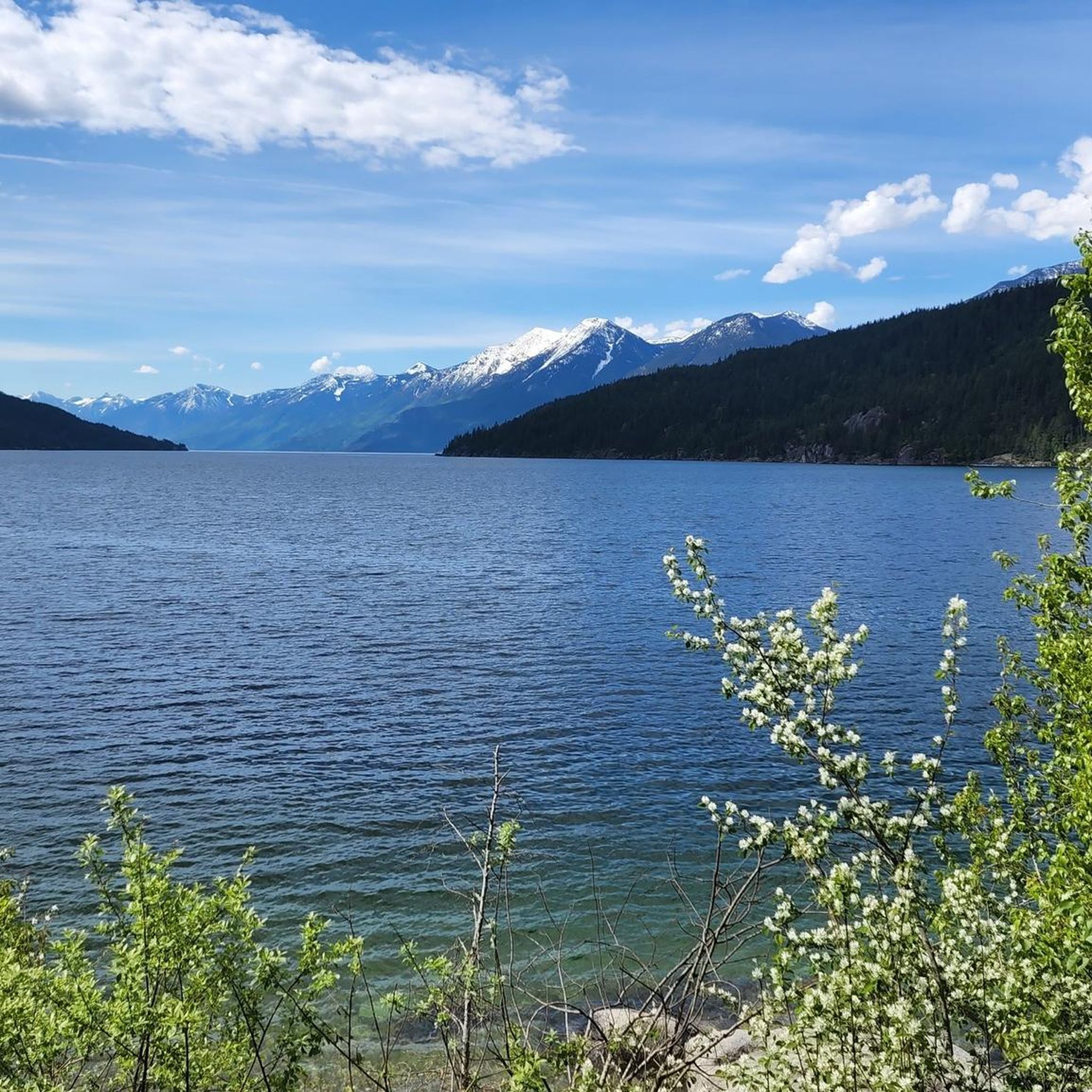
Road cycling around Area A (Wynndel/Crawford Bay/Riondel) offers diverse terrain along the East Shore of Kootenay Lake. The region is characterized by majestic mountains, lush forests, and the expansive Kootenay Lake, providing a varied backdrop for road cyclists. Cyclists can expect smoothly paved, winding roads with continuous waterfront views and relatively low traffic. The area includes both gentle climbs and more challenging sections, catering to different fitness levels.
Best road cycling routes around Area A (Wynndel/Crawford Bay/Riondel)
- The most popular…
Last updated: October 14, 2026
33
riders
66.9km
02:59
590m
590m
Moderate road ride. Good fitness required. Some segments of this route may be unpaved and difficult to ride.
13
riders
71.4km
03:37
1,210m
1,210m
Hard road ride. Very good fitness required. Mostly well-paved surfaces and easy to ride.

6
riders
37.3km
01:49
380m
380m
Moderate road ride. Good fitness required. Mostly well-paved surfaces and easy to ride.
5
riders
34.7km
01:53
440m
440m
Moderate road ride. Good fitness required. Mostly well-paved surfaces and easy to ride.
5.0
(1)
7
riders
91.0km
04:24
1,160m
1,160m
Hard road ride. Very good fitness required. Mostly well-paved surfaces and easy to ride.
Get access to more routes and recommendations from other explorers.
Already have an account?
Our route recommendations are based on thousands of hikes, rides, and runs completed by other people on komoot.
Start today with a free account
Your next adventure awaits.
Popular around Area A (Wynndel/Crawford Bay/Riondel)
Tips from the Community

Take a moment to admire the views across the West Arm of Kootenay Lake from the southern end of Lakeside Park. Framed by the Selkirk Mountains, this glacier-carved lake is one of British Columbia's largest and most scenic waterways.
0
0
Relax on the long sandy beach and enjoy views across the West Arm of Kootenay Lake towards the surrounding mountains. The beach is popular for swimming, paddling and picnics, while the adjoining park has gardens, a playground, playing fields and a broad waterfront promenade. You’ll also find a public wharf, boat launch and seasonal café nearby.
0
0

Created in 1955 this provincial park sits Kokanee Creek meets Kootenay Lake. It covers 260 hectares of forest, beaches, and deltas. You'll find a nice network of trails, a visitor centre, campgrounds, boat launch, and more.
0
0
This picturesque covered bridge is one of two that cross over the Kaslo River on the Kaslo River Trail. This is the closest one to town, so even if you don't have time to do the full trail, it's worth it to come out here to see the fairytale like setting.
0
0
Frequently Asked Questions
How many road cycling routes are available in Area A (Wynndel/Crawford Bay/Riondel)?
There are 10 road cycling routes available around Area A (Wynndel/Crawford Bay/Riondel) on komoot. These routes offer diverse terrain along the East Shore of Kootenay Lake, catering to various fitness levels.
What kind of terrain can I expect on road cycling routes around Kootenay Lake's East Shore?
You can expect smoothly paved, winding roads with continuous waterfront views of Kootenay Lake. The region features majestic mountains and lush forests, providing a varied backdrop. Routes include both gentle climbs and more challenging sections, with relatively low traffic for a pleasant experience.
Are there road cycling routes suitable for beginners or those seeking an easier ride?
While many routes in the area are moderate to difficult, the East Shore offers various routes that cater to different fitness levels. For example, the Roadbike loop from Creston RCMP is a moderate 37.2 km ride with manageable elevation, offering a good option for those seeking a less strenuous experience.
What scenic highlights or landmarks can I see while road cycling in Area A?
Road cycling routes in Area A offer continuous waterfront views of Kootenay Lake and glimpses of the surrounding Purcell and Selkirk Ranges. You might pass by the Kootenay River and Kootenay Lake Route, or the Kootenay Bay Terminal. The region is also known for its lush forests and charming communities like Crawford Bay, a hub for artisans.
Is the Kootenay Lake Ferry accessible for cyclists, and how does it enhance a ride?
Yes, the Kootenay Lake Ferry is fully accessible for cyclists. It's the longest free ferry in the world, offering a scenic 40-minute crossing from Kootenay Bay to Balfour. This allows cyclists to connect routes on both the east and west shores, creating unique loop opportunities and adding a distinctive experience to their ride.
What are the road conditions like for cycling on Highway 3A along the East Shore?
Highway 3A along the East Shore of Kootenay Lake is generally known for its smoothly paved, winding roads. Cyclists can typically enjoy relatively low traffic, making for a pleasant and immersive experience with continuous waterfront views.
Are there challenging road cycling routes for experienced cyclists in the region?
Yes, for experienced cyclists seeking a challenge, routes like the Fish Lake – Mirror Lake loop from Balfour offer significant elevation gain. This difficult 132.1 km path traverses varied terrain with nearly 2000 meters of ascent, providing a demanding ride with rewarding views of the surrounding mountains and forests.
When is the best time of year for road cycling in Area A?
The best time for road cycling in Area A is typically during the warmer months, from late spring through early autumn. This period offers pleasant temperatures, less chance of precipitation, and full access to all routes and amenities, allowing you to fully enjoy the scenic landscapes and waterfront views.
Are there options for food and drink along the road cycling routes?
Yes, communities like Crawford Bay are hubs for artisans and offer unique shops. You'll find cafes and restaurants in Crawford Bay, Wynndel, and Riondel where you can refuel and relax during or after your ride. These towns provide convenient stops along many of the region's cycling routes.
What do other road cyclists enjoy about the routes in Area A (Wynndel/Crawford Bay/Riondel)?
The road cycling routes in Area A are highly rated by the komoot community, with an average score of 5.0 stars. Cyclists often praise the winding paved roads, continuous Kootenay Lake views, and the stunning mountain backdrops, highlighting the region's diverse and picturesque terrain.
Are there any loop road cycling routes available in the area?
Yes, several loop routes are popular in the region. For instance, the Crescent Bay – Roberts Bay loop from Balfour is a moderate 65.3 km ride featuring scenic roads with continuous waterfront views. Another option is the Mirror Lake – Kaslo Bay loop from Balfour, a more challenging 72.4 km route.
Most popular routes around Area A (Wynndel/Crawford Bay/Riondel)
Most popular attractions around Area A (Wynndel/Crawford Bay/Riondel)

Get inspired with the komoot mobile app


Explore more
Browse the best Road cycling routes in other regions.
