The best running trails around Vorlandsvatnet
3.5
(2)
35
runners
5
runs
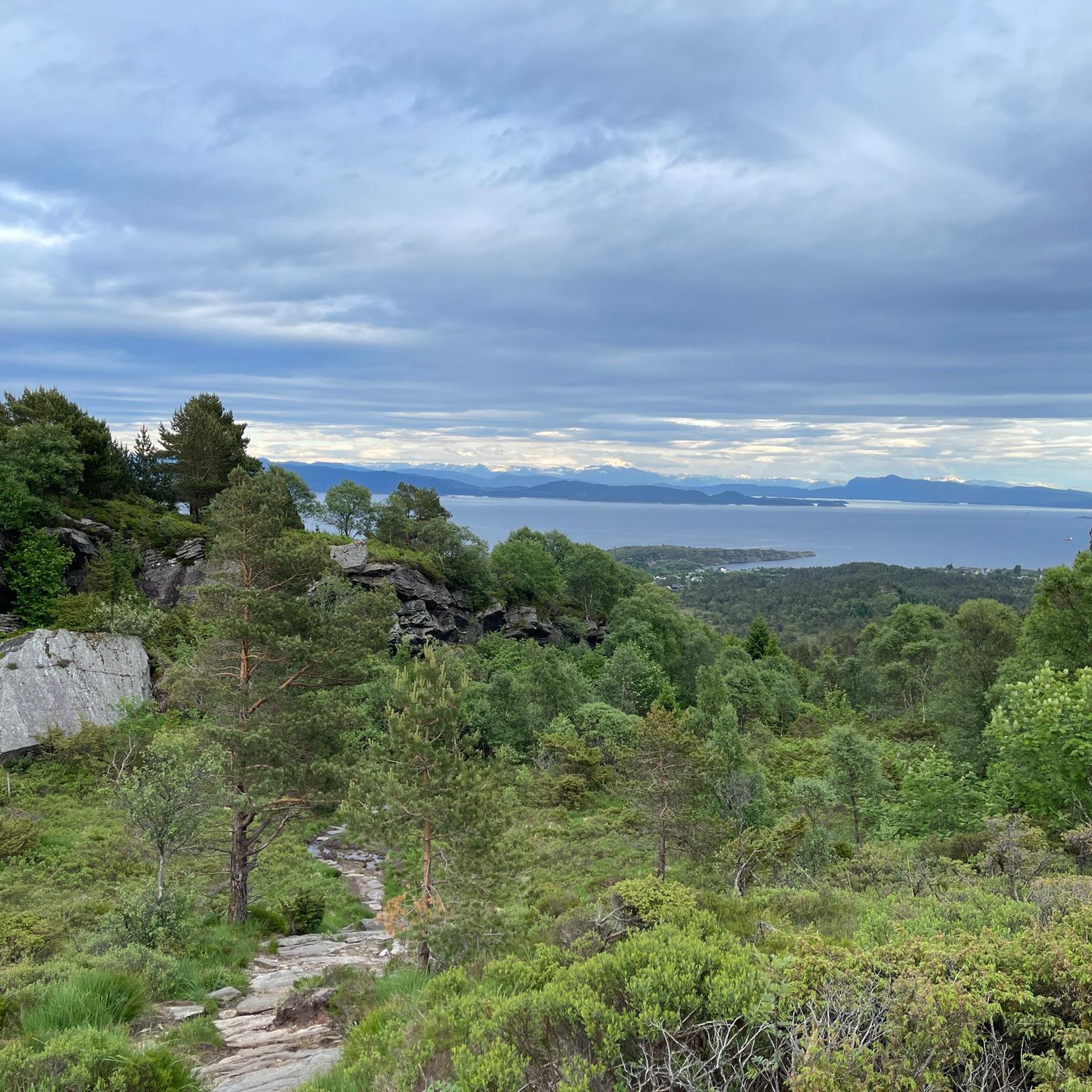
Jogging around Vorlandsvatnet offers a serene experience in a lakeside environment, approximately 35 meters above sea level. The region features accessible trails and gentle topography, with water flowing from the Veten hills. Many running routes include paved or easily accessible paths, making them suitable for various fitness levels. The landscape is characterized by tranquil lakeside paths and gentle hills, providing a natural setting for outdoor activity.
Best jogging routes around Vorlandsvatnet
- The most popular jogging route is Laksvågen loop from…
Last updated: June 26, 2026
16
runners
7.27km
00:47
90m
90m
Moderate run. Good fitness required. Mostly paved surfaces. Suitable for all skill levels.
3.5
(2)
11
runners
4.61km
00:30
60m
60m
Easy run. Great for any fitness level. Mostly paved surfaces. Suitable for all skill levels.

Sign up for free
5
runners
12.8km
01:50
370m
370m
Hard run. Very good fitness required. Sure-footedness, sturdy shoes and alpine experience required.
2
runners
9.15km
01:09
150m
150m
Moderate run. Good fitness required. Mostly accessible paths. Some sure footedness required.
1
runners
9.53km
01:16
220m
220m
Hard run. Good fitness required. Sure-footedness, sturdy shoes and alpine experience required.
Our route recommendations are based on thousands of hikes, rides, and runs completed by other people on komoot.
Start today with a free account
Your next adventure awaits.
Login or Signup
Popular around Vorlandsvatnet
Tips from the Community

Here you will climb well-maintained wooden stairs on the cliffs. Be careful: the wood can be slippery when wet!
0
0

Frequently Asked Questions
What is the general character of the running routes around Vorlandsvatnet?
The running routes around Vorlandsvatnet offer a serene experience with accessible trails and gentle topography. You'll find tranquil lakeside paths and gentle hills, making for a natural and enjoyable outdoor activity. Many paths are paved or easily accessible, suitable for various fitness levels.
What is the difficulty level of the running routes around Vorlandsvatnet?
The routes around Vorlandsvatnet cater to a range of fitness levels. You can find easy paths like the Grønevika loop, moderate runs such as the Laksvågen loop, and even more challenging trails with significant elevation gain, like the Djupatjørna – Kleppaksla loop from Toftarøyna.
Are there any notable landmarks or natural features to see while running?
While the primary draw is the serene lakeside environment and gentle hills, the broader area includes interesting geological features. For example, the Bekhilderen Rock Formations loop from Glesvær is a running trail that highlights some of the unique natural formations in the region.
What is the best time of year for running around Vorlandsvatnet?
The mild weather from spring through autumn makes these seasons ideal for running around Vorlandsvatnet, as paths are generally clear and conditions are pleasant. The tranquil lakeside environment is particularly enjoyable during these months.
Are the running trails around Vorlandsvatnet suitable for families?
Yes, many of the paths are easily accessible and feature gentle topography, making them suitable for families. Routes like the Grønevika loop from Toftarøyna are considered easy and offer a pleasant experience for all ages.
Can I bring my dog on the running routes?
The region around Vorlandsvatnet is generally welcoming to outdoor enthusiasts and their dogs. However, it's always recommended to keep dogs on a leash, especially in nature reserves or areas with livestock, and to check local regulations for specific trails.
How many running routes are available in the Vorlandsvatnet area?
There are at least 5 distinct running routes detailed for the Vorlandsvatnet area, ranging from easy to difficult, ensuring options for various preferences and fitness levels.
What do other runners enjoy the most about jogging in Vorlandsvatnet?
The running routes in Vorlandsvatnet are highly rated by the komoot community, with an average score of 3.5 stars. Runners frequently praise the serene lakeside paths, the natural environment, and the variety of terrain available, from gentle loops to more challenging trails.
Is there parking available near the running trails?
While specific parking locations are not detailed in the route information, areas like Toftarøyna and Glesvær, which serve as starting points for several routes, typically offer parking facilities for visitors accessing outdoor trails. It's advisable to check local signage upon arrival.
How can I reach the running routes around Vorlandsvatnet using public transport?
The Vorlandsvatnet area, located in the municipality of Øygarden, is generally accessible. While specific public transport links to each trailhead are not provided, local bus services often connect to key villages and starting points like Toftarøyna or Glesvær. Planning your journey in advance with local transport schedules is recommended.
What is a good moderate running route to try?
A great moderate option is the Laksvågen loop from Toftarøyna. This 4.5-mile (7.2 km) trail features moderate elevation gain along the lakeside and typically takes about 46 minutes to complete.
Are there any longer, more challenging running options?
For a more challenging run, consider the Djupatjørna – Kleppaksla loop from Toftarøyna. This 8.0-mile (12.8 km) trail leads through varied terrain with significant elevation, often completed in about 1 hour 49 minutes, offering a good workout.
Most popular routes around Vorlandsvatnet

Get inspired with the komoot mobile app


Explore more
Browse the best Running Trails & Routes in other regions.
