The best running trails around Harestuvatnet
85
runners
13
runs
Jogging routes around Harestuvatnet offer diverse terrain in the Nordmarka region of Akershus, Norway. The lake, situated at 234 meters above sea level, is approximately 4.3 kilometers long, providing a natural focal point for outdoor activities. A universally designed and illuminated trail runs along the lake's bank, connecting Harestua center to the Bøhrentangen swimming area, ideal for running. The area also features a river delta at the northern end where the Myllselva and Sveselva rivers converge.
Best jogging routes around…
Last updated: October 13, 2026
9
runners
13.6km
01:27
90m
90m
Moderate run. Good fitness required. Mostly paved surfaces. Suitable for all skill levels.
5
runners
17.5km
01:57
310m
310m
Hard run. Very good fitness required. Mostly paved surfaces. Suitable for all skill levels.

9
runners
33.8km
04:05
680m
680m
Hard run. Very good fitness required. Sure-footedness, sturdy shoes and alpine experience required.
6
runners
8.42km
00:55
140m
140m
Moderate run. Good fitness required. Mostly paved surfaces. Suitable for all skill levels.
5
runners
12.7km
01:23
190m
190m
Moderate run. Good fitness required. Mostly paved surfaces. Suitable for all skill levels.
Get access to more routes and recommendations from other explorers.
Already have an account?
Our route recommendations are based on thousands of hikes, rides, and runs completed by other people on komoot.
Start today with a free account
Your next adventure awaits.

Tips from the Community

A rennovated stable, today Tverrsjøstallen is a simple dining spot that serves food and drink at weekends during the skiing season. While it's closed at other times in the year, the bus stop here is the ideal start point for a hike to Svarttjernshøgda, Nordmarka's highest point.
0
0
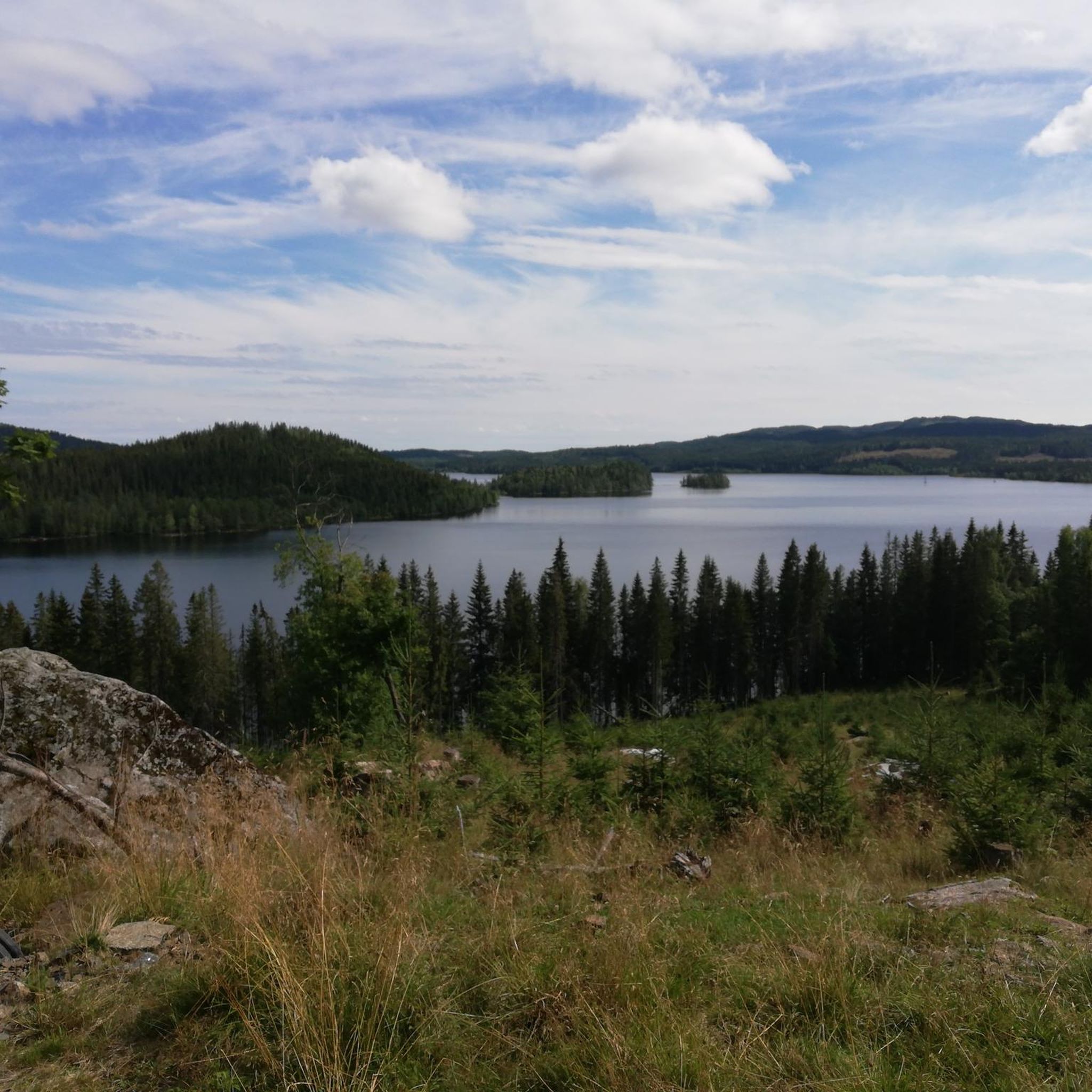
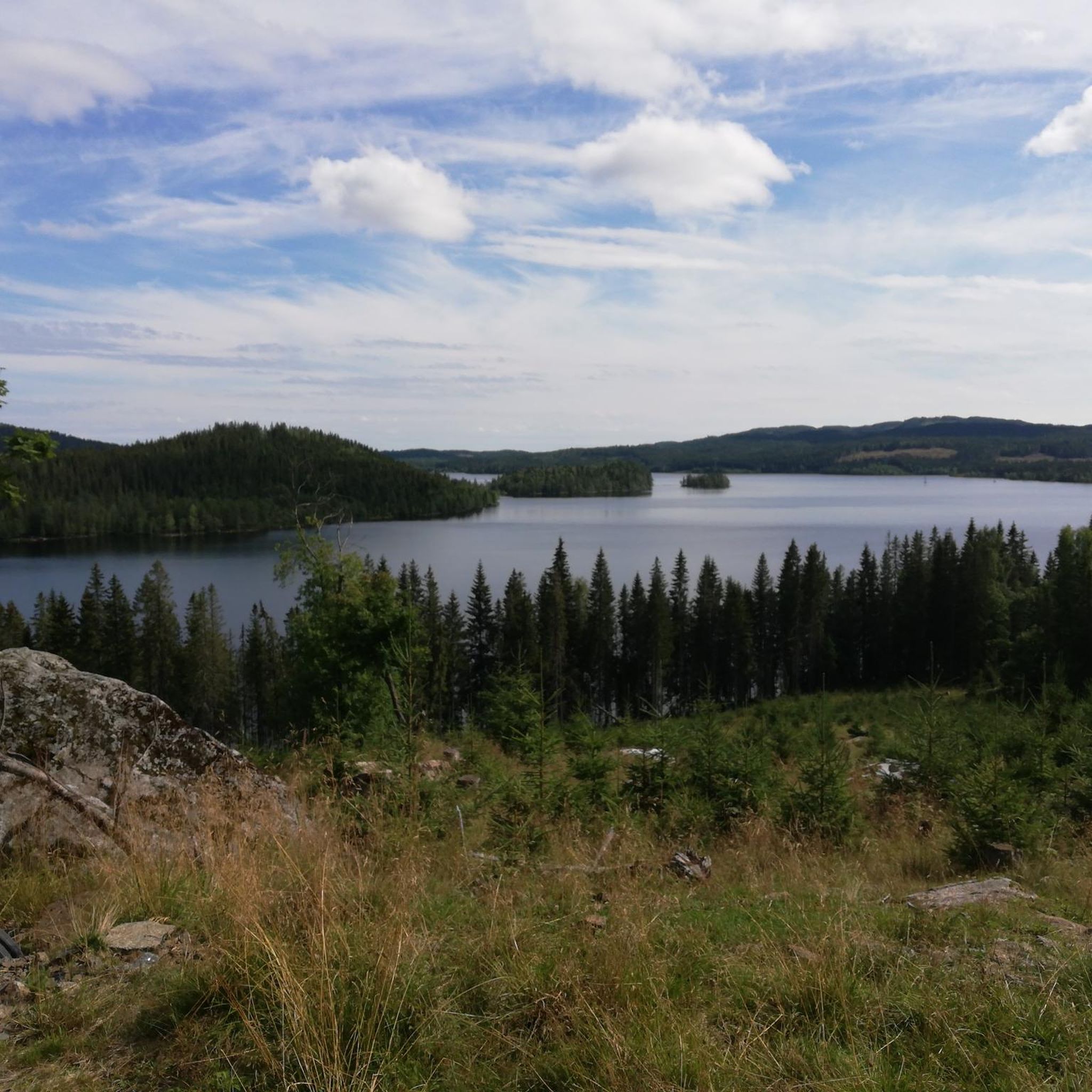
Ølja is a lovely lake at the eastern foot of Svarttjernshøgda, Nordmarka's highest peak at 717 metres (2,352 ft). One of two main trails to the top begins from the lake's western end.
0
0

Nice spot for one tent or a couple of hammocks. Easy road access, but it will be shadded in the setting summer sun.
1
0

Frequently Asked Questions
How many running routes are available around Harestuvatnet?
There are over 15 running routes around Harestuvatnet, offering a variety of distances and difficulty levels to explore the scenic Nordmarka region.
Are there any easy or beginner-friendly jogging trails near Harestuvatnet?
Yes, a universally designed and illuminated trail opened in 2024 along the bank of Harestuvatnet. This path connects Harestua center to the Bøhrentangen swimming area and is ideal for easier runs and beginners.
What kind of terrain can I expect on the jogging routes around Harestuvatnet?
The routes around Harestuvatnet feature diverse terrain, including lake-side paths, areas near river deltas, and trails through the surrounding Nordmarka forest landscape. You'll find a mix of moderate and more challenging paths.
Are there any circular running routes around Harestuvatnet?
Yes, many routes offer a circular experience. For example, the Running loop from Harestua is a popular moderate 9.3 km circular path, and the Strykenvatnet – Strekan loop from Harestua offers a scenic 13.6 km loop.
What natural attractions can I see while running around Harestuvatnet?
Runners can enjoy the beautiful Harestuvatnet lake itself, the river delta at its northern end where the Myllselva and Sveselva rivers converge, and the diverse vegetation of the Nordmarka region. The lake is also known for its good ecological condition and wildlife.
Are there facilities like parking or public transport access for these running routes?
Many routes, such as those starting from Harestua, are accessible from the town center, which typically offers parking options. For specific routes, it's best to check the individual tour details on komoot for precise starting points and accessibility information.
Can I jog around Harestuvatnet during winter?
Yes, Harestuvatnet offers unique opportunities in winter. Several kilometers of ice skating rink and walkways are plowed on the ice, providing alternative activities and potentially different running conditions depending on ice safety and snow cover.
What do other runners enjoy most about the Harestuvatnet area?
Runners frequently appreciate the varied terrain and the natural beauty of the Nordmarka forest and lake landscape. The area is well-used by the komoot community, with over 90 runners having explored its diverse trails.
Are there any longer, more challenging running routes for experienced runners?
Absolutely. For experienced runners seeking a challenge, routes like the Putten – Storfløyta loop from Haneknemoen offer a difficult 17.5 km trail. Another demanding option is the Syljuseterlia – Johannstjennsbrenna loop from Lunner, which spans over 33 km.
Are there any recreational facilities near the running trails?
Yes, near the Bøhrentangen swimming area, which is connected by the new illuminated trail, you'll find a new sand beach, a grilling area, and a ball court. Canoe rentals are also available at Harestua Kro for those interested in water activities.
Is the area suitable for family-friendly running or walks?
The newly developed universally designed and illuminated trail along Harestuvatnet is particularly suitable for families, offering a safe and accessible path for running or walking. The recreational facilities at Bøhrentangen also make it a great spot for a family outing.
What is the best time of year to go jogging around Harestuvatnet?
The area is beautiful year-round. Spring and autumn offer vibrant colors and pleasant temperatures, while summer is ideal for combining a run with a swim. Even winter provides unique opportunities with plowed ice paths, weather permitting.
Most popular routes around Harestuvatnet

Get inspired with the komoot mobile app


Explore more
Browse the best Running Trails & Routes in other regions.
