Easy hikes and walks in Bajo Guadalquivir
4.3
(926)
7,430
hikers
419
hikes
Easy hiking trails in Bajo Guadalquivir are primarily characterized by the flat landscapes surrounding the lower Guadalquivir River and its extensive marshlands. This region, part of the province of Seville, features unique ecosystems with riparian habitats, oxbow lakes, and agricultural lands. The terrain is generally low-lying, offering accessible paths suitable for easy walks and exploration of its natural and cultural landmarks.
Best easy hiking trails in Bajo Guadalquivir
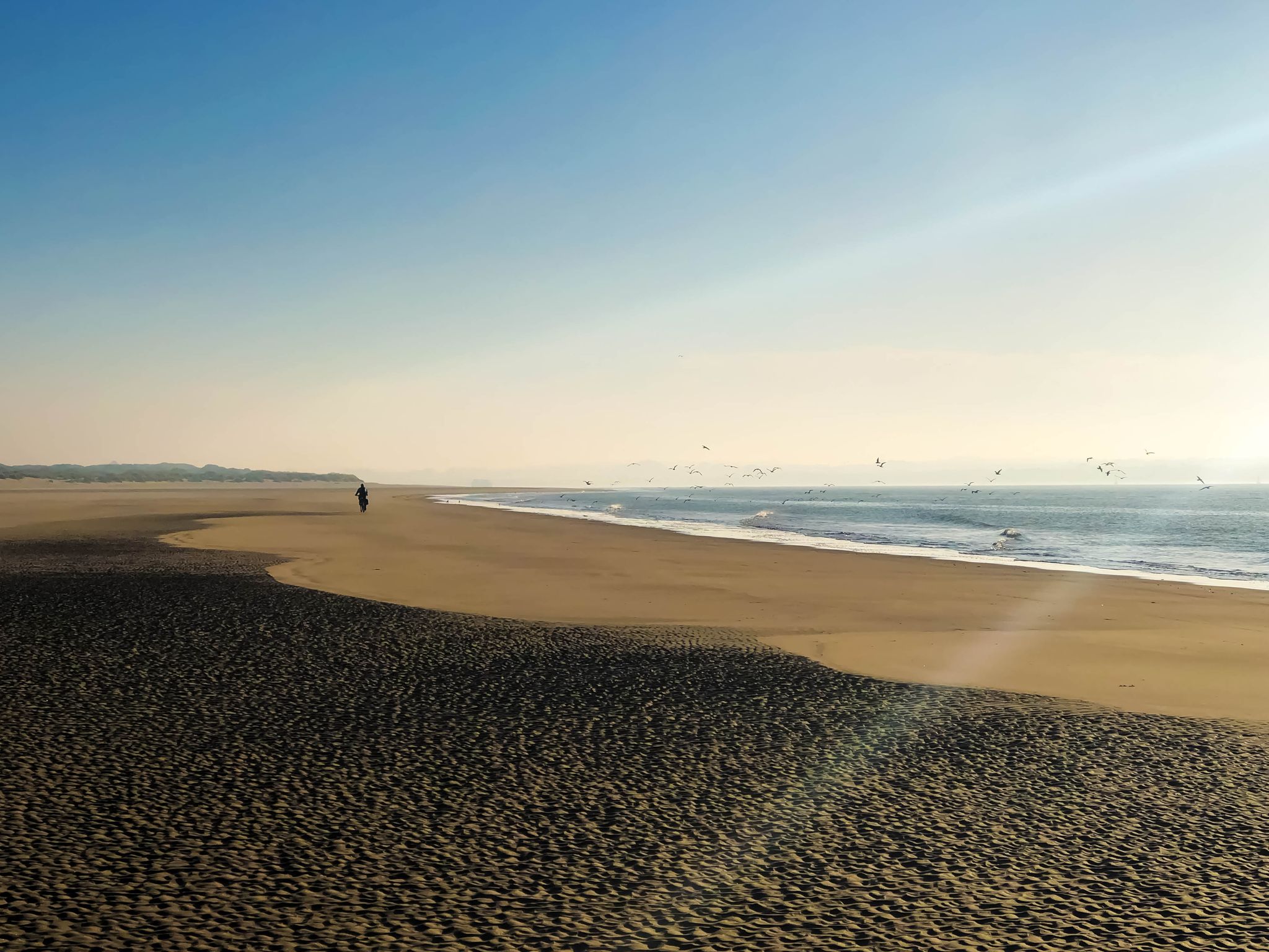
- The most popular easy hiking route is The Beach – Playa de Sanlúcar de Barrameda loop from Sanlúcar de Barrameda, a 4.3 miles (7.0 km) trail that takes 1 hour 46 minutes to complete. This route offers views of the beach and the Guadalquivir River estuary.
- Another top favourite among local hikers is Statue of Hasekura Tsunenaga loop from Coria del Río, an easy 3.1 miles (5.0 km) path. This trail follows the riverbank, passing by the notable Statue of Hasekura Tsunenaga.
- Local hikers also love the Statue of Hasekura Tsunenaga loop from La Puebla del Río, a 4.0 miles (6.5 km) trail leading through the riparian landscape along the Guadalquivir River, often completed in about 1 hour 41 minutes.
- Hiking in Bajo Guadalquivir is defined by riverine ecosystems, expansive marshlands, and agricultural fields. The network offers options primarily for easy ability levels, ideal for relaxed exploration.
- The routes in Bajo Guadalquivir are highly rated by the komoot community with an average score of 4.2 stars from over 800 reviews. More than 6,600 hikers have used komoot to explore Bajo Guadalquivir's varied terrain.
Last updated: June 30, 2026
30
hikers
Easy hike. Great for any fitness level. Easily-accessible paths. Suitable for all skill levels.
5.0
(3)
16
hikers
4.97km
01:17
30m
30m
Easy hike. Great for any fitness level. Easily-accessible paths. Suitable for all skill levels.

Sign up for free
2.6
(5)
9
hikers
Easy hike. Great for any fitness level. Easily-accessible paths. Suitable for all skill levels.
12
hikers
7.77km
01:59
30m
30m
Easy hike. Great for any fitness level. Easily-accessible paths. Suitable for all skill levels.
3
hikers
5.12km
01:19
20m
20m
Easy hike. Great for any fitness level. Easily-accessible paths. Suitable for all skill levels.
Get access to more routes and recommendations from other explorers.
Sign up for free
Already have an account?
Our route recommendations are based on thousands of hikes, rides, and runs completed by other people on komoot.
Start today with a free account
Your next adventure awaits.
Login or Signup
Popular around Bajo Guadalquivir
Other adventures in Bajo Guadalquivir

Tips from the Community

The Barqueta Bridge spans the Guadalquivir River. It is one of the main access routes to the northern part of Isla de la Cartuja and is located near the Science and Technology Park, as well as the Isla Mágica theme park. It connects La Cartuja with La Resolana and with the old town near the Monastery of San Clemente.
1
0


The Nao Victoria is a replica of the ship that made the first circumnavigation of the world between 1519 and 1522, commanded by Juan Sebastián Elcano. This replica was built in Spain in 1991, following an exhaustive process of historical research.
5
0

The Torre Sevilla, formerly known as Torre Pelli, is a modern skyscraper in Seville and, at 180.5 metres, the tallest building in Andalusia. Its distinctive design, consisting of oval floors that widen towards the top, dominates the city's skyline. In addition to offices and a hotel, the tower also houses a viewing platform with panoramic views of Seville and the surrounding region, making it a popular tourist attraction. The tower's construction was controversial due to its impact on the historic cityscape, but it is now an iconic element of modern Seville.
8
0

very nice and pretty
0
1

There are several rowing clubs on the Gudalquivir
0
0
Frequently Asked Questions
How many easy hiking trails are available in Bajo Guadalquivir?
Bajo Guadalquivir offers a wide selection of easy hiking trails, with over 260 routes specifically designed for relaxed exploration. The region's flat terrain along the Guadalquivir River and its marshlands makes it ideal for accessible walks.
What is the best time of year to go hiking in Bajo Guadalquivir?
The best time to hike in Bajo Guadalquivir is typically during the cooler months, from autumn through spring (October to May). Summers can be very hot, making early mornings or late afternoons the only comfortable times for outdoor activities. Spring is particularly beautiful with blooming vegetation and active wildlife.
Are there any family-friendly easy hikes in Bajo Guadalquivir?
Yes, many of the easy trails in Bajo Guadalquivir are suitable for families due to their generally flat and accessible nature. Routes like the El Alamillo Farmhouse – Alamillo Park loop from Estadio La Cartuja de Sevilla offer pleasant, short walks in green spaces, perfect for all ages.
Can I bring my dog on the easy hiking trails?
Many trails in Bajo Guadalquivir are dog-friendly, especially those that follow riverbanks or pass through open agricultural areas. However, always check local regulations, especially when near protected natural areas like the Doñana Marshes, where restrictions might apply to protect wildlife. Keeping your dog on a leash is generally recommended.
Are there any circular or loop trails for easy hiking?
Yes, Bajo Guadalquivir features several excellent circular routes. For example, the Statue of Hasekura Tsunenaga loop from Coria del Río is an easy 5 km loop that follows the riverbank, offering scenic views and a cultural landmark.
What interesting landmarks or natural features can I see along the easy hiking trails?
The easy trails often showcase the region's unique natural and cultural heritage. You can explore the expansive Doñana Marshes, walk along the historic Carlos De Mesa Promenade, or cross the impressive Bridge over the Guadalquivir River. The region is defined by the Guadalquivir River itself, with its rich riparian vegetation.
Where can I park my car when accessing easy hiking trails?
Parking availability varies by trailhead. For routes starting in towns like Sanlúcar de Barrameda or Coria del Río, you can often find public parking near the starting points. For more rural trails, look for designated parking areas or safe roadside spots. It's always advisable to check specific route details for parking recommendations.
Is public transport an option to reach easy hiking trails in Bajo Guadalquivir?
Public transport, primarily buses, connects many of the towns and villages in Bajo Guadalquivir. You can often reach trailheads or starting points in places like Coria del Río or La Puebla del Río via bus services. Planning your route in advance and checking local bus schedules is recommended.
Are there good spots for a picnic along the easy trails?
Yes, the scenic riverbanks and parks in Bajo Guadalquivir offer many pleasant spots for a picnic. Look for shaded areas under the abundant riparian vegetation or open spaces with views of the marshes and agricultural fields. Some urban-adjacent trails, like those near Seville, also feature parks with picnic facilities.
What kind of wildlife can I expect to see on an easy hike in Bajo Guadalquivir?
Bajo Guadalquivir is a haven for birdwatching, especially in areas like the Brazo del Este and the Doñana Marshes. You can spot a variety of aquatic and migratory birds. The riparian vegetation along the Guadalquivir River also supports diverse insect life and small mammals. Keep an eye out for herons, flamingos, and various waterfowl.
What do other hikers enjoy most about hiking in Bajo Guadalquivir?
The komoot community highly rates the easy hikes in Bajo Guadalquivir, with an average score of 4.2 stars from over 800 reviews. Hikers often praise the region's unique flat landscapes, the tranquility of the river and marshlands, and the opportunity to observe diverse birdlife. The accessibility of the trails for all fitness levels is also frequently highlighted.
Are there any easy trails that offer views of the Guadalquivir River estuary?
Absolutely. The region is defined by the Guadalquivir River. The The Beach – Playa de Sanlúcar de Barrameda loop from Sanlúcar de Barrameda is a fantastic option, offering direct views of the beach and the river's estuary as it meets the Atlantic.
What is the terrain like on easy hikes in Bajo Guadalquivir?
The terrain on easy hikes in Bajo Guadalquivir is predominantly flat, characterized by the low-lying landscapes of the Guadalquivir River and its extensive marshlands. Trails typically follow well-maintained paths, dirt tracks through agricultural fields, or promenades along the river, making them very accessible and suitable for leisurely walks.
Most popular routes in Bajo Guadalquivir
Most popular attractions in Bajo Guadalquivir

Get inspired with the komoot mobile app


Explore more
Browse the best Hikes in other regions.
