Easy hikes and walks in Deux-Sèvres
4.4
(2949)
15,408
hikers
987
hikes
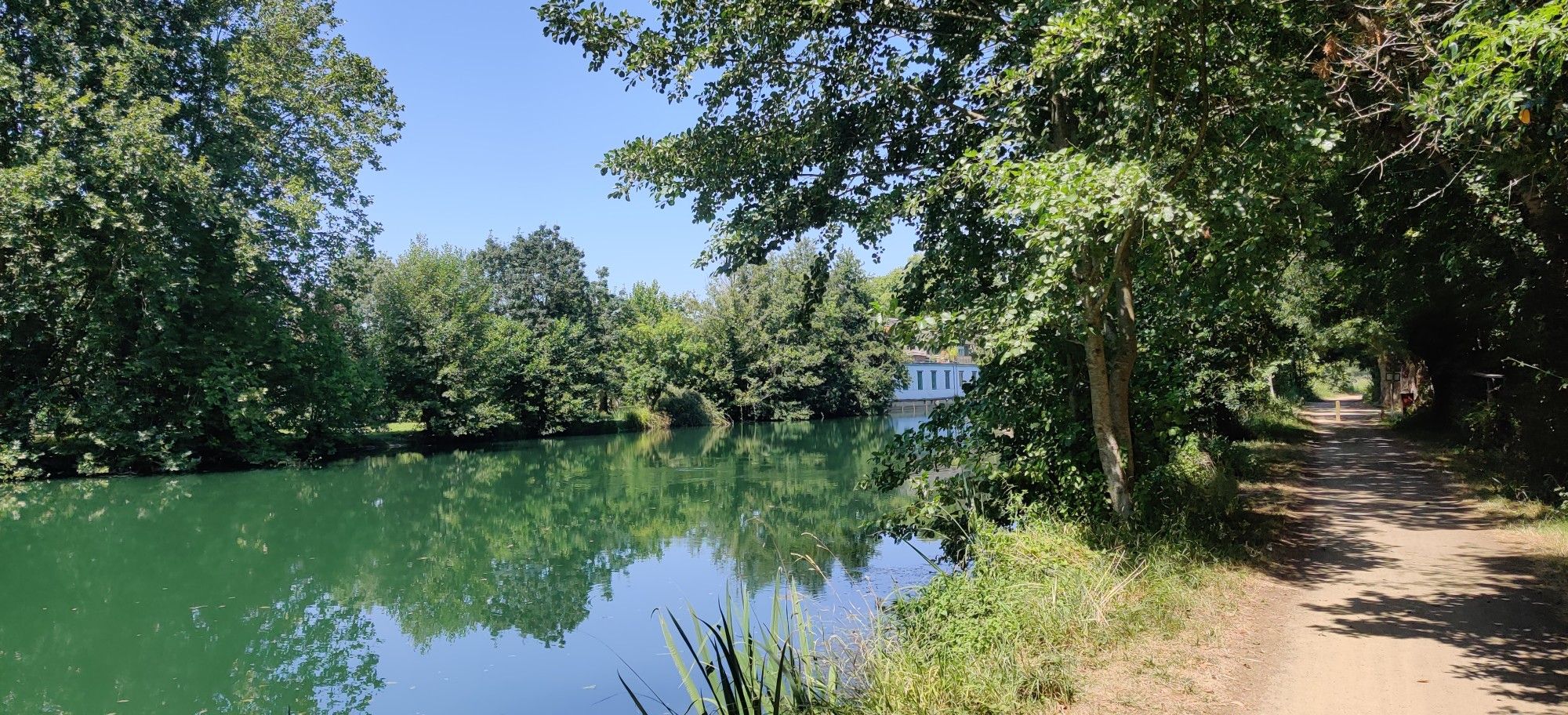
Easy hiking trails in Deux-Sèvres traverse a diverse landscape of rolling farmland, river valleys, and tranquil wetlands. The region is characterized by its bocage countryside, featuring dense hedgerows and numerous streams, alongside the extensive network of canals and meadows in the Marais Poitevin. Gentle elevation changes and well-maintained paths make Deux-Sèvres suitable for accessible outdoor exploration.
Best easy hiking trails in Deux-Sèvres
- The most popular easy hiking route is Puits d'Enfer Loop Trail, a 2.5 miles (4.1 km) trail…
Last updated: October 10, 2026
4.3
(9)
40
hikers
4.07km
01:06
50m
50m
Hike the easy 2.5-mile Puits d'Enfer Loop Trail through peaceful woodlands, past waterfalls and unique flora near Exireuil.
4.5
(11)
51
hikers
5.21km
01:23
60m
60m
Easy hike. Great for any fitness level. Easily-accessible paths. Suitable for all skill levels.

4.0
(5)
31
hikers
6.17km
01:39
70m
70m
Easy hike. Great for any fitness level. Easily-accessible paths. Suitable for all skill levels.
5.0
(1)
10
hikers
Easy hike. Great for any fitness level. Easily-accessible paths. Suitable for all skill levels.
4.8
(6)
14
hikers
5.68km
01:32
80m
80m
Easy hike. Great for any fitness level. Easily-accessible paths. Suitable for all skill levels.
5.0
(1)
5
hikers
5.96km
01:34
50m
50m
Enjoy an easy 3.7-mile loop hike around the picturesque Plan d'eau de Boismé, featuring bocage scenery and unique sunken paths.
4.0
(1)
7
hikers
5.20km
01:23
50m
50m
Hike an easy 3.2-mile loop from Trompe Souris, exploring the historic Pont Roman de la Roche and scenic Thouaret river.
8
hikers
4.06km
01:05
40m
40m
Easy hike. Great for any fitness level. Easily-accessible paths. Suitable for all skill levels.
3
hikers
4.47km
01:10
40m
40m
Hike the easy Pont de la Roche Trail, a 2.8-mile (4.5 km) route in Luzay, France, featuring the Pont Roman de la Roche and Château de La Coi
4.8
(18)
71
hikers
Easy hike. Great for any fitness level. Easily-accessible paths. Suitable for all skill levels.
Get access to more routes and recommendations from other explorers.
Already have an account?
Our route recommendations are based on thousands of hikes, rides, and runs completed by other people on komoot.
Start today with a free account
Your next adventure awaits.
Popular around Deux-Sèvres
Other adventures in Deux-Sèvres


Tips from the Community

Attention! Following a fire on July 8, 2026, the site will certainly be closed this weekend.
0
0

Built in the 19th century, this former agricultural estate includes a park and spaces to cultivate, an orangery, a greenhouse, and remarkable farm buildings. At the time, this way of thinking about the organization of farms was new and is linked to the major industrial rationalization movements observed from the mid-19th century onwards. It was about simultaneously considering aspects related to animal hygiene and comfort, as well as the aesthetics of the buildings.
0
0

A natural gem to discover! The Puits d’Enfer (Hell's Well) is an impressive site, ideal for a refreshing walk in the heart of nature. The scenery is magnificent, with limestone cliffs and lush vegetation. The trail is well-maintained and accessible, perfect for an outing with family or friends. A must-see if you're in the area!
0
0

A charming place on the banks of the Sèvre Niortaise
1
0

Sturdy shoes and rain gear are recommended. Enjoy this walk.
0
0

Take advantage of this hike to discover magical places.
0
1

Very nice walk in the forest with a path impassable for strollers or bicycles: lots of roots on the ground and rocks. A great tour in the forest!
0
0
The Thouet, a peaceful river in western France (142 km), crosses several departments before flowing into the Loire. Its name, of Gallic origin, evokes "tranquility." Why stroll along the Thouet? Bucolic walks The landscaped banks around Parthenay offer a green and peaceful path, popular for walking or cycling. The "Along the Thouet" route (approximately 5–6 km) is classified as easy, punctuated by picnic tables, pétanque courts, and recreational areas.
1
0
Frequently Asked Questions
How many easy hiking trails are available in Deux-Sèvres?
Deux-Sèvres offers a wide selection of easy hiking trails, with over 390 routes specifically classified as easy. In total, the region boasts nearly 1,000 hiking routes, catering to various preferences and abilities.
What kind of terrain can I expect on easy hikes in Deux-Sèvres?
Easy hikes in Deux-Sèvres typically feature gentle elevation changes and well-maintained paths. You'll traverse diverse landscapes including rolling farmland, peaceful river valleys, and the tranquil wetlands of the Marais Poitevin. The region's bocage countryside, characterized by dense hedgerows and numerous streams, also offers intimate natural environments.
What is the best time of year to go hiking in Deux-Sèvres?
Deux-Sèvres is enjoyable for hiking throughout much of the year. Spring and autumn offer pleasant temperatures and vibrant scenery, with the Gâtine region's bocage landscape changing beautifully with the seasons. Summer is also suitable, especially for trails along rivers or in shaded woodlands. Winter hikes can be peaceful, but always check local conditions.
Are there any waterfalls on easy hiking trails in Deux-Sèvres?
Yes, you can discover waterfalls on some easy trails. For example, the Puits d'Enfer Loop Trail leads through peaceful woodlands and past waterfalls. Another option is The Pressoir valley and the Pommiers waterfall - loop, which explores a verdant valley and features a waterfall.
Are the easy hiking trails in Deux-Sèvres suitable for families with children?
Many easy hiking trails in Deux-Sèvres are ideal for families. The region's focus on gentle routes, often following riverbanks, canal towpaths, or disused railway lines converted into 'voies vertes' (greenways), makes them perfect for car-free exploration and suitable for children. The diverse landscapes, from wetlands to woodlands, offer engaging experiences for all ages.
Can I bring my dog on easy hikes in Deux-Sèvres?
Generally, dogs are welcome on many hiking trails in Deux-Sèvres. However, it's always recommended to keep them on a leash, especially in nature reserves like the Marais Poitevin, or when passing through farmland with livestock. Always check specific trail regulations before you go.
Are there many circular easy walks in Deux-Sèvres?
Yes, Deux-Sèvres offers numerous easy circular walks, allowing you to start and finish at the same point. Examples include the Puits d'Enfer Loop Trail, The Pressoir valley and the Pommiers waterfall - loop, and The citadel of Parthenay — loop from La Caserne, which are popular choices among local hikers.
What natural features can I see on easy hikes in Deux-Sèvres?
You'll encounter a rich variety of natural features. The Marais Poitevin, often called 'Green Venice,' offers tranquil canals and wetlands. The Thouet Valley features picturesque riverbanks, while the Gâtine region showcases a preserved bocage landscape with dense hedgerows and streams. Many trails also lead through peaceful woodlands and past small lakes like La Touche Poupard Dam or Ballastière Pond.
Are there any historical landmarks or points of interest along easy trails?
Yes, many easy trails integrate historical elements. You can explore the medieval town of Parthenay, with its ancient ramparts, on routes like The citadel of Parthenay — loop from La Caserne. Other trails might pass by charming villages, Romanesque churches, or even castles such as Bressuire Castle or Coudray-Salbart Castle.
Is parking available at the trailheads for easy hikes in Deux-Sèvres?
Yes, parking is generally available at or near the trailheads for most easy hikes in Deux-Sèvres, especially in popular areas and villages. Many routes are designed to be accessible by car, with designated parking areas often indicated on local maps or route descriptions.
Can I access easy hiking trails in Deux-Sèvres by public transport?
While some larger towns like Niort and Parthenay have public transport connections, accessing specific rural trailheads by public transport can be challenging. Many trails are located in more remote areas. It's advisable to check local bus schedules or consider carpooling for greater flexibility when planning your hike.
What do other hikers enjoy most about easy hiking in Deux-Sèvres?
The komoot community highly rates hiking in Deux-Sèvres, with an average score of 4.5 stars from over 1,500 reviews. Hikers often praise the region's peaceful beauty, the diversity of its landscapes from wetlands to woodlands, and the well-maintained, accessible paths that make for a relaxing and enjoyable outdoor experience.
Most popular routes in Deux-Sèvres
Most popular attractions in Deux-Sèvres

Get inspired with the komoot mobile app


Explore more
Browse the best Hikes in other regions.
