Easy hikes and walks around Furth bei Göttweig
4.5
(416)
2,810
hikers
89
hikes
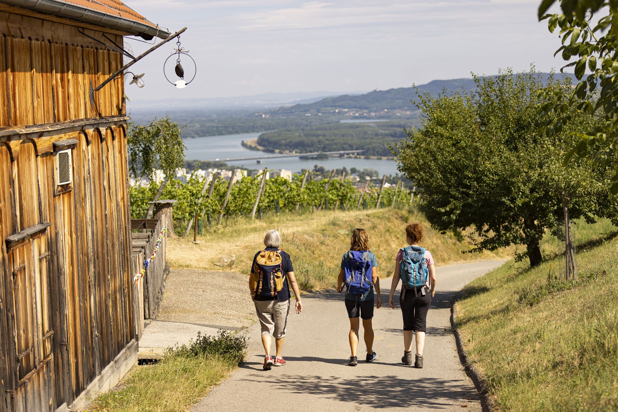
Easy hiking trails around Furth bei Göttweig traverse a landscape shaped by the Danube river valley and rolling hills, offering diverse natural features. The region is characterized by vineyards, wooded areas influenced by the Dunkelsteinerwald, and the prominent Göttweiger Berg. Hikers can explore varied terrain, from gentle paths through loess walls in Zellergraben to routes offering views of the Danube.
Best easy hiking trails around Furth bei Göttweig
- The most popular easy hiking route is View of Göttweig Abbey –…
Last updated: June 30, 2026
4.8
(5)
50
hikers
5.88km
01:47
210m
210m
Easy hike. Great for any fitness level. Easily-accessible paths. Suitable for all skill levels.
4.2
(6)
27
hikers
Easy hike. Great for any fitness level. Easily-accessible paths. Suitable for all skill levels.

Sign up for free
4.1
(7)
24
hikers
6.02km
01:36
60m
60m
Easy hike. Great for any fitness level. Easily-accessible paths. Suitable for all skill levels.
4.8
(4)
27
hikers
Easy hike. Great for any fitness level. Easily-accessible paths. Suitable for all skill levels.
3.0
(1)
21
hikers
Easy hike. Great for any fitness level. Easily-accessible paths. Suitable for all skill levels.
Get access to more routes and recommendations from other explorers.
Sign up for free
Already have an account?
Our route recommendations are based on thousands of hikes, rides, and runs completed by other people on komoot.
Start today with a free account
Your next adventure awaits.
Login or Signup
Popular around Furth bei Göttweig
Other adventures around Furth bei Göttweig

Tips from the Community

The Bildstock (created around 1629), of exceptional height, stands at the exit of Paudorf towards Kleinwien on the Zellerweg. A brick pillar rests on a prismatic base and, above a wide, richly articulated cornice, carries a tabernacle with four round-arched niches between small corner pillars. On the roadside, there is a small square niche that was added later. The tiled roof bears a richly decorated iron cross.
0
0
The Bildstock (originating around 1629), of exceptional height, stands at the exit of Paudorf in the direction of Kleinwien on the Zellerweg. A brick pillar rests on a prismatic base and, above a wide, richly structured cornice, supports a tabernacle with four round-arched niches between small corner pillars. On the roadside, there is a small square niche that was added later. The tiled roof bears a richly decorated iron cross.
0
0
On the Eichberg, southeast of Paudorf, lies the largest stand of giant sequoias in Austria. Adalbert Dungel was the forest master of the Göttweig Abbey from 1877 to 1886 and in 1880 planted several seeds of "Wellingtonia gigantea" in the ground. Today, these "Adalbert Wellingtonias" as true giant sequoias tower over the treetops of the surrounding forests.
0
0
On the Eichberg, southeast of Paudorf, you will find the largest stand of giant sequoias in Austria. Adalbert Dungel was the forest master of the Göttweig Abbey from 1877 to 1886 and planted several seeds of the "Wellingtonia gigantea" in the ground in 1880. Today, these "Adalbert Wellingtonias" tower as true giant sequoias above the treetops of the surrounding forests.
0
0

A great sunken lane with lots of information boards.
3
0
A beautiful rest area with a view of Göttweig Abbey, located on the Vinum Circa Montem cycle path.
3
0

Göttweig is nice to look at from all directions.
0
0
Here, there is an unexpectedly beautiful view of the Predigtstuhl and Göttweig Abbey.
3
1
Frequently Asked Questions
How many easy hiking trails are there in Furth bei Göttweig?
Furth bei Göttweig offers a good selection of easy hiking trails. You can find over 35 easy routes in the area, perfect for a relaxed outdoor experience.
What kind of landscapes can I expect on easy hikes around Furth bei Göttweig?
The easy hikes in Furth bei Göttweig traverse a diverse landscape. You'll find paths winding through picturesque vineyards, rolling hills, and wooded areas influenced by the Dunkelsteinerwald. Many routes also offer stunning views of the Danube river valley and the prominent Göttweiger Berg.
Are there any family-friendly easy hikes in the area?
Yes, many of the easy trails are suitable for families. The region's gentle terrain and scenic views make for enjoyable outings. For example, the View of Göttweig Abbey – View of Göttweig Abbey loop from Furth-Göttweig is a popular easy path that offers continuous views of the historic abbey, which can be engaging for all ages.
Can I bring my dog on the easy hiking trails?
Generally, dogs are welcome on most hiking trails in the Furth bei Göttweig region. It's always a good idea to keep your dog on a leash, especially near wildlife, vineyards, or cultivated areas, and to carry waste bags. Always check local signage for any specific restrictions.
Are there easy circular routes available?
Absolutely. Many of the easy trails in Furth bei Göttweig are designed as circular routes, allowing you to start and end at the same point. Popular options include the View of Göttweig Abbey – Waxenberg loop from Paudorf and the View of Göttweig Abbey – Zellergraben loop from Furth-Palt, both offering varied scenery.
What historical landmarks or attractions can I see on these easy trails?
The region is rich in history. Many easy trails offer views of or lead to the magnificent Göttweig Abbey, a UNESCO World Heritage Site. You might also encounter historical sights like the rediscovered St. Georg church or various chapels. While not directly on every easy trail, nearby attractions like Dürnstein Castle Ruins or Grafenegg Castle are also part of the broader cultural landscape.
Are there any unique natural features to explore on easy hikes?
Yes, you can discover several unique natural features. The View of Göttweig Abbey – Zellergraben loop from Furth-Palt takes you through the Zellergraben, known for its steep loess walls formed during the Ice Age. Another special sight is the Giant Sequoias of Paudorf, a botanical rarity that can be found on routes like the Giant sequoias in the Göttweig Forest – Giant Sequoias of Paudorf loop from Paudorf.
What do other hikers say about the easy trails in Furth bei Göttweig?
The easy trails in Furth bei Göttweig are highly rated by the komoot community, with an average score of 4.5 stars from over 260 reviews. Hikers often praise the well-maintained paths, the stunning views of Göttweig Abbey and the Danube, and the peaceful atmosphere of the vineyards and forests.
Are there options for short, easy walks?
Yes, there are several short and easy walks available. For instance, the View of Göttweig Abbey – Waxenberg loop from Paudorf is about 3.6 miles (5.8 km) and can be completed in under two hours, making it ideal for a quick, refreshing outing.
How accessible are the trailheads by public transport or car?
Many trailheads in Furth bei Göttweig are easily accessible by car, often with designated parking areas. While public transport options exist within the broader region, specific access to individual trailheads can vary. It's advisable to check local bus schedules if you plan to rely on public transport for your starting point.
What is the best time of year for easy hikes in Furth bei Göttweig?
The spring and autumn months are particularly beautiful for easy hikes in Furth bei Göttweig. Spring brings blooming apricot trees and fresh greenery, while autumn offers vibrant foliage in the vineyards and forests. Summer is also pleasant, especially in the cooler, wooded sections, and winter can provide serene, crisp walks, though some paths might be icy.
Are there places to stop for refreshments or a meal along the easy trails?
While specific refreshment stops directly on every easy trail vary, the region around Furth bei Göttweig has several huts and inns. For example, the Fessl Hut and Schwarzalm Krems Mountain Inn are popular spots in the wider area where you can enjoy local cuisine and take a break.
What kind of elevation changes can I expect on easy hikes?
Easy hikes in Furth bei Göttweig are characterized by generally gentle elevation changes. While some routes might have slight inclines, such as the View of Göttweig Abbey – Waxenberg loop from Paudorf with about 213 meters of ascent, they are manageable and suitable for beginners or those seeking a less strenuous experience. Many trails, like the View of Göttweig Abbey – View of Göttweig Abbey loop from Furth-Göttweig, have minimal elevation gain.
Most popular routes around Furth bei Göttweig
Most popular attractions around Furth bei Göttweig

Get inspired with the komoot mobile app


Explore more
Browse the best Hikes in other regions.
