Easy hikes and walks around Hochneukirchen-Gschaidt
4.5
(991)
4,976
hikers
288
hikes
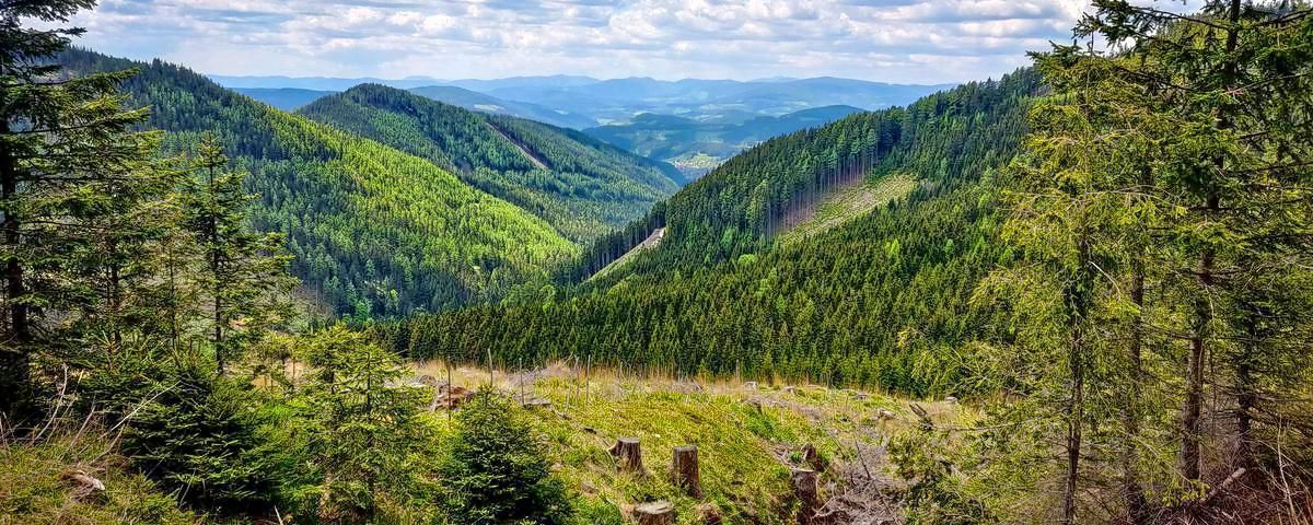
Easy hiking trails around Hochneukirchen-Gschaidt traverse the Bucklige Welt, a hilly region with elevations between 500 and 900 meters. The landscape features a mix of dense forests and open fields, offering varied scenery. From higher points, panoramic views extend across the Schneeberg mountain and other distant regions. This area provides diverse terrain suitable for various hiking experiences.
Best easy hiking trails around Hochneukirchen-Gschaidt
- The most popular easy hiking route is Viewpoint "Roof of the World" – Hutwisch lookout tower loop…
Last updated: June 30, 2026
4.0
(50)
330
hikers
4.12km
01:09
80m
80m
Easy hike. Great for any fitness level. Easily-accessible paths. Suitable for all skill levels.
4.6
(48)
145
hikers
5.40km
01:34
140m
150m
Easy hike. Great for any fitness level. Easily-accessible paths. Suitable for all skill levels.

Sign up for free
4.7
(38)
197
hikers
5.27km
01:31
130m
130m
Easy hike. Great for any fitness level. Easily-accessible paths. Suitable for all skill levels.
4.9
(12)
74
hikers
Easy hike. Great for any fitness level. Easily-accessible paths. Suitable for all skill levels.
5.0
(3)
40
hikers
Easy hike. Great for any fitness level. Easily-accessible paths. Suitable for all skill levels.
Get access to more routes and recommendations from other explorers.
Sign up for free
Already have an account?
Our route recommendations are based on thousands of hikes, rides, and runs completed by other people on komoot.
Start today with a free account
Your next adventure awaits.
Login or Signup
Popular around Hochneukirchen-Gschaidt

Other adventures around Hochneukirchen-Gschaidt


Tips from the Community

The park is lined with fragrant flower islands, shady trees, a babbling brook, and quacking ducks in the pond.
1
0

War memorial of both World Wars
0
0
Can't open it, it's broken, but still funny.
0
0
Along the roadside with beautiful paintings
0
0
Frequently Asked Questions
How many easy hiking trails are available in Hochneukirchen-Gschaidt?
Hochneukirchen-Gschaidt offers over 100 easy hiking trails. These routes traverse the diverse landscape of the Bucklige Welt, providing accessible options for various skill levels.
What kind of views can I expect on easy hikes in Hochneukirchen-Gschaidt?
The easy hikes in Hochneukirchen-Gschaidt, particularly from higher elevations like the Hutwisch, offer expansive panoramic views. On clear days, you can see the Schneeberg mountain, the Neusiedlersee, the Wechsel region, and even as far as the Steiner Alpen in Slovenia. The region is known as the 'Roof of the Bucklige Welt' for its stunning vistas.
Are there any circular easy hiking routes in the area?
Yes, many easy trails in Hochneukirchen-Gschaidt are circular. For example, the Viewpoint "Roof of the World" – Hutwisch lookout tower loop from Hochneukirchen-Gschaidt is a popular option that takes you to the Hutwisch lookout tower. Another excellent choice is the Gscheidter Rundwanderweg, which offers magnificent views over the countryside and Schneeberg.
What are some notable landmarks or attractions along the easy trails?
A prominent landmark is the Hutwisch Lookout Tower, the highest point in the Bucklige Welt, offering 360-degree views. While hiking, you might also encounter historical sites such as Jormannsdorf Castle or the Kirchschlag Castle Ruins, which are part of the region's rich heritage.
Are the easy hiking trails suitable for families with children?
Absolutely. Many easy trails are ideal for families. The Gscheidter Rundwanderweg and the Panorama Trail, for instance, are known for their gentle slopes and scenic beauty, making them perfect for family excursions. These routes often wind through forests and open fields, providing varied and engaging scenery.
What is the best time of year for easy hiking in Hochneukirchen-Gschaidt?
The region is particularly beautiful for hiking in spring and autumn. During these seasons, the natural landscape flourishes with vibrant colors, offering a refreshing and picturesque experience. The weather is generally mild, making for comfortable hiking conditions.
Are there any short easy hikes for a quick outing?
Yes, there are several short and easy options. The Hutwisch lookout tower – Viewpoint "Roof of the World" loop from Hochneukirchen is a 4.8 km trail that can be completed in about 1 hour 22 minutes. Another short route is the Kurpark Bad Schönau – Sconarium Bad Schönau loop from Bad Schönau, which is just under 4 km.
What do other hikers say about the easy trails in Hochneukirchen-Gschaidt?
The easy trails in Hochneukirchen-Gschaidt are highly rated by the komoot community, with an average score of 4.6 stars from over 400 reviews. Hikers often praise the well-maintained paths, the diverse scenery of forests and fields, and the stunning panoramic views from various points.
Are the easy hiking trails in Hochneukirchen-Gschaidt dog-friendly?
Generally, the natural trails through forests and fields in Hochneukirchen-Gschaidt are suitable for dogs. It's always recommended to keep dogs on a leash, especially in areas with wildlife or near livestock, and to carry water for your pet.
Can I find easy trails that are part of longer hiking networks?
Yes, Hochneukirchen-Gschaidt is integrated into well-known long-distance hiking networks. Stages 6 and 7 of the Wiener Alpenbogen (WAB) pass through or originate near the area, and the extensive Eastern Austrian Borderland Trail (07) also runs through the region, offering connections to broader routes.
Are there easy trails with good viewpoints?
Many easy trails are designed to maximize scenic overlooks. The View of the Hills – Sattlerplatz Bench loop from Bad Schönau is an easy path specifically known for its scenic vistas across the hilly landscape. The Panorama Trail also lives up to its name, providing wonderful views over the entire valley.
Most popular routes around Hochneukirchen-Gschaidt
Most popular attractions around Hochneukirchen-Gschaidt

Get inspired with the komoot mobile app


Explore more
Browse the best Hikes in other regions.
