Easy hikes and walks around Häselgehr
4.6
(8500)
40,899
hikers
338
hikes
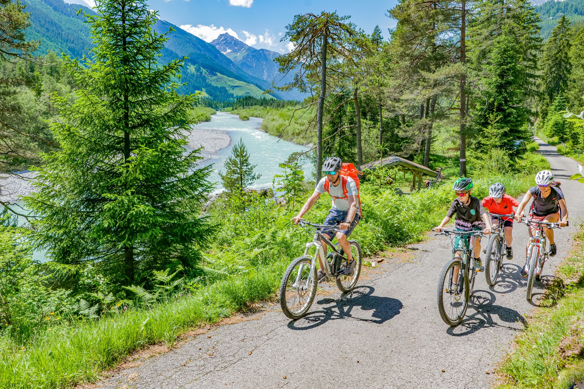
Hiking around Häselgehr offers a diverse landscape within the Lech Valley Alps, characterized by the wild Lech River and its surrounding natural park. The terrain features wide riverbeds, gravel bars, and mountain forests, providing varied environments for exploration. Trails often run alongside the Lech River, offering views of the valley, and some lead through impressive formations like the Grießbach Gorge. The region's elevation, around 1,006 meters, contributes to its alpine character, with numerous easy hiking trails suitable for different abilities.
Best easy hiking trails around Häselgehr
- The most popular easy hiking route is Start of Adlerweg – Gibler Alm loop from Elbigenalp, a 3.1 miles (5.0 km) trail that takes about 1 hour 33 minutes to complete. This route features gentle ascents through alpine meadows.
- Another top favourite among local hikers is Rest Area by the Lech River – View of the Lech River loop from Elmen, an easy 3.0 miles (4.9 km) path. This trail offers scenic views along the Lech River, ideal for a leisurely walk.
- Local hikers also love the Nikolaus Bridge – Bernhardsbach Bridge loop from Elbigenalp, a 3.2 miles (5.2 km) trail leading through riverside paths and local hamlets, often completed in about 1 hour 26 minutes.
- Hiking around Häselgehr is defined by the Lech River, mountain forests, and the surrounding Lech Valley Alps. The network offers options for different ability levels, including family-friendly and accessible routes.
- The routes in Häselgehr are highly rated by the komoot community with an average score of 4.6 stars from over 2,700 reviews. More than 13,000 hikers have used komoot to explore Häselgehr's varied terrain.
Last updated: June 30, 2026
4.7
(31)
115
hikers
5.03km
01:34
190m
190m
Easy hike. Great for any fitness level. Easily-accessible paths. Suitable for all skill levels.
4.6
(25)
98
hikers
Easy hike. Great for any fitness level. Easily-accessible paths. Suitable for all skill levels.

Sign up for free
4.5
(15)
61
hikers
5.34km
01:28
90m
90m
Easy hike. Great for any fitness level. Easily-accessible paths. Suitable for all skill levels.
4.6
(7)
85
hikers
2.46km
00:51
130m
130m
Easy hike. Great for any fitness level. Easily-accessible paths. Suitable for all skill levels.
4.5
(10)
39
hikers
Easy hike. Great for any fitness level. Easily-accessible paths. Suitable for all skill levels.
Get access to more routes and recommendations from other explorers.
Sign up for free
Already have an account?
Our route recommendations are based on thousands of hikes, rides, and runs completed by other people on komoot.
Start today with a free account
Your next adventure awaits.
Login or Signup



Tips from the Community

A special place directly above the Lech river: The Naturparkhaus Klimmbrücke is located on a bridge and offers exciting insights into the habitat of the wild river. In the exhibition “Adventure Wild River” you can learn more about the nature and dynamics of the Lech river. Outside, a nature playground with various elements invites you to discover and try things out. Open from May to September, on weekdays depending on staffing or by request: https://www.naturpark-tiroler-lech.at/naturparkhaeuser
0
0
In the small hut near the path, with a little patience, you can discover various bird species. Information boards will help you identify typical inhabitants – from the Ringed Plover to the White Wagtail.
0
0

At the Gibler Alm you can recharge your batteries and enjoy the view.
1
0

Great hiking trails. We'll be back.
0
0
Great hiking trails. We'll be back.
0
0
Great hiking area. We'll be back.
0
0
Great bridge. It's a bit of a work of art.
0
0
Frequently Asked Questions
How many easy hiking trails are available around Häselgehr?
Häselgehr offers a wide selection of easy hiking trails, with over 100 routes specifically categorized as easy. In total, the region boasts more than 340 hiking tours, catering to various preferences and fitness levels.
What do other hikers enjoy most about the easy trails in Häselgehr?
The easy trails in Häselgehr are highly rated by the komoot community, with an average score of 4.6 stars from over 2,700 reviews. Hikers often praise the scenic views along the Lech River, the well-maintained paths through alpine meadows, and the overall accessibility for a relaxing outdoor experience.
Are there any easy circular walks in Häselgehr?
Yes, Häselgehr features several easy circular walks. For example, the Start of Adlerweg – Gibler Alm loop from Elbigenalp is a popular 5 km (3.1 miles) route that takes you through alpine meadows. Another option is the Nikolaus Bridge – Bernhardsbach Bridge loop from Elbigenalp, which follows riverside paths and passes through local hamlets.
Can I find easy hikes with waterfalls in Häselgehr?
Absolutely. The Doser Waterfall near Luxnach is a mystical and central attraction in the region, famous for its unique phenomenon of drying up and reappearing annually. Several easy hiking trails lead to or past this natural spectacle, such as the Waterfall by the Trail – Small Waterfall in Lechtal loop from Häselgehr.
Are the easy trails in Häselgehr suitable for families?
Many easy trails in Häselgehr are ideal for families, including those with buggies. The paths often follow the gentle course of the Lech River, offering leisurely walks and opportunities to enjoy the natural surroundings. Shorter loops around the Doser Waterfall are also very family-friendly.
Are dogs allowed on easy hiking trails in Häselgehr?
The Lech Valley region, including Häselgehr, is generally very dog-friendly. Most easy hiking trails are suitable for dogs, allowing them to enjoy the natural environment alongside their owners. Always ensure your dog is on a leash where required and be mindful of local wildlife.
What natural features can I expect to see on easy hikes around Häselgehr?
Easy hikes in Häselgehr offer diverse natural features. You'll encounter the pristine Lech River, often referred to as the 'last wild river of Europe,' with its wide riverbeds and gravel bars. Trails also lead through mountain forests, offering views of the surrounding Lech Valley Alps and impressive formations like the Grießbach Gorge.
Are there any short, easy walks for a quick outing?
Yes, for a quick outing, you can find several short and easy walks. The Gibler Alm – View of Bernhardsbach Gorge loop from Elbigenalp is a shorter option at about 2.5 km (1.5 miles), offering rewarding views without a long commitment. Many trails along the Lech River also provide opportunities for shorter, leisurely strolls.
What interesting places can I explore near the easy hiking trails?
Beyond the trails, you can explore several interesting highlights. The region features various caves, such as the Tunnels and cave views on the way to Sulzlalm. You might also encounter cultural sites like traditional villages or the historic Pest Chapel, offering insights into the local heritage.
Is public transport available to reach easy hiking trails in Häselgehr?
Yes, Häselgehr is well-connected by public transport, making it convenient to access various trailheads. The village's commitment to public transport, along with offerings like the Lechtal Aktiv Card, helps visitors explore the region's diverse recreational opportunities without needing a car.
What is the best time of year for easy hikes in Häselgehr?
The best time for easy hikes in Häselgehr is generally from spring to autumn. During these seasons, the weather is mild, and the trails are clear. Spring offers the unique spectacle of the Doser Waterfall reappearing, while autumn provides vibrant foliage. Some trails may also be accessible for easy winter walks, depending on snow conditions.
Are there any beginner-friendly trails for those new to hiking?
Häselgehr is an excellent place for beginners. Many of the easy trails are characterized by minimal elevation gain and well-maintained paths, making them perfect for those new to hiking. Routes along the Lech River, like the Rest Area by the Lech River – View of the Lech River loop from Elmen, are particularly suitable for a gentle introduction to hiking.
Most popular routes around Häselgehr
Most popular attractions around Häselgehr

Get inspired with the komoot mobile app


Explore more
Browse the best Hikes in other regions.
