Easy hikes and walks in Tal Der Roten Weißeritz
4.6
(18800)
70,160
hikers
81
hikes
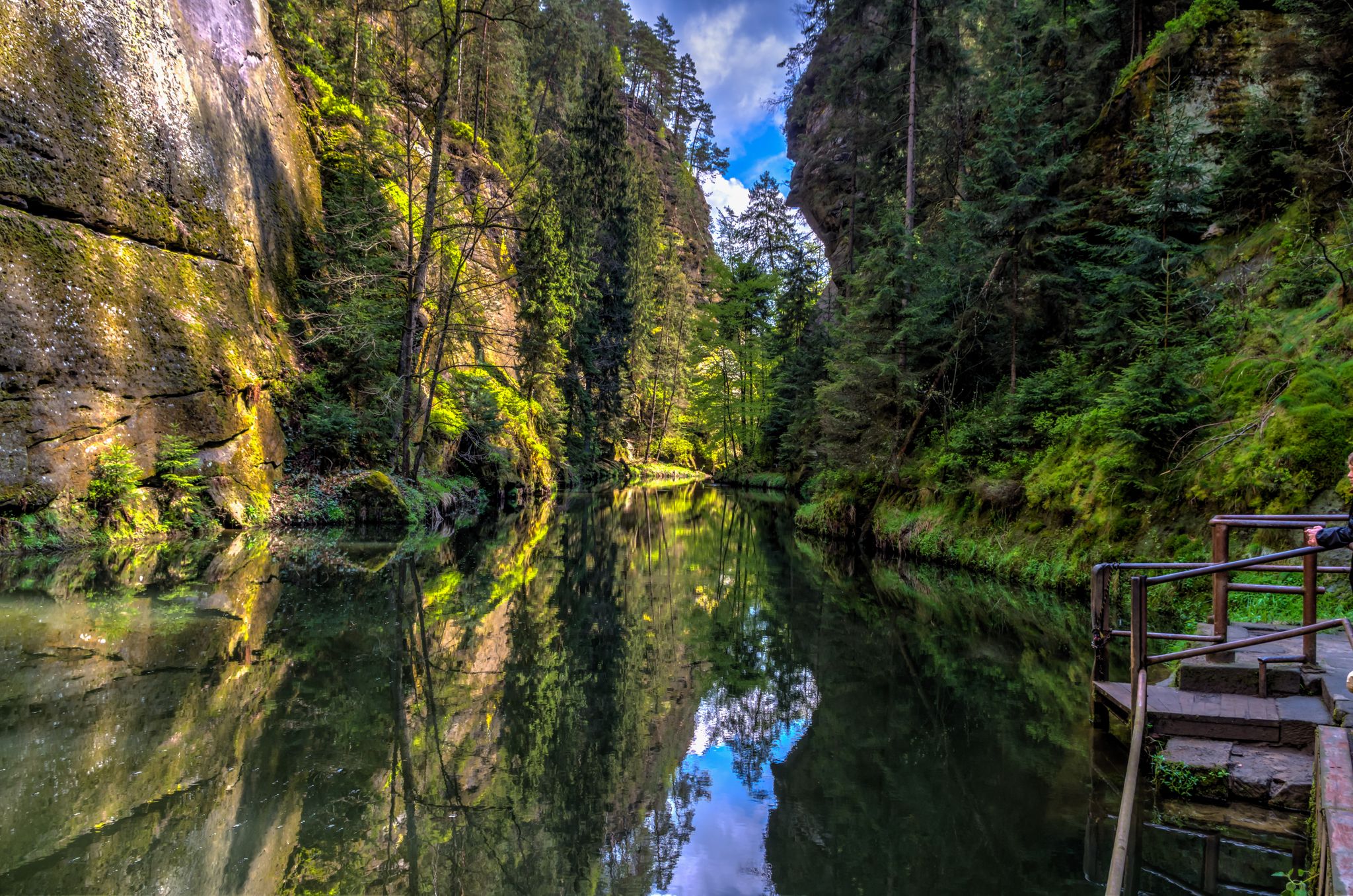
Easy hiking trails in Tal Der Roten Weißeritz are primarily found within the deeply incised V-shaped valley of the Red Weißeritz river, known as the Rabenauer Grund. This region features steep-walled carved valleys, diverse deciduous forests, and notable rock formations. The terrain includes broad paths along the river and narrower trails, with elevation changes typically under 150 meters. The area is designated as a nature reserve, supporting a variety of plant and animal species.
Best easy hiking trails in Tal…
Last updated: June 30, 2026
4.6
(28)
239
hikers
Easy hike. Great for any fitness level. Easily-accessible paths. Suitable for all skill levels.
4.4
(14)
56
hikers
2.93km
00:49
60m
60m
Easy hike. Great for any fitness level. Easily-accessible paths. Suitable for all skill levels.

Sign up for free
4.9
(25)
119
hikers
Easy hike. Great for any fitness level. Easily-accessible paths. Suitable for all skill levels.
4.9
(19)
65
hikers
5.16km
01:30
120m
120m
Easy hike. Great for any fitness level. Easily-accessible paths. Suitable for all skill levels.
4.9
(7)
32
hikers
Easy hike. Great for any fitness level. Easily-accessible paths. Suitable for all skill levels.
Get access to more routes and recommendations from other explorers.
Sign up for free
Already have an account?
Our route recommendations are based on thousands of hikes, rides, and runs completed by other people on komoot.
Start today with a free account
Your next adventure awaits.
Login or Signup

Other adventures in Tal Der Roten Weißeritz


Tips from the Community

Georgenkirche Somsdorf. A hall church from 1712, with a three-sided closure, reusing remnants of the Romanesque predecessor building. The Georgenkirche in Somsdorf is said to have been consecrated as early as 1238. Somsdorf itself is first mentioned in documents around 1350.
1
0

It's simply breathtakingly beautiful here 😊.
0
1
It's simply breathtakingly beautiful here 😊.
0
1
It's simply breathtakingly beautiful here 😊.
0
0

beautifully maintained gravesite in a small clearing
0
1
Rocky and steep but very beautiful
0
1
It's just incredibly beautiful here 😊.
0
0
It's just incredibly beautiful here 😊.
0
1
Frequently Asked Questions
How many easy hiking trails are available in Tal Der Roten Weißeritz?
There are over 25 easy hiking trails in Tal Der Roten Weißeritz, primarily located within the scenic Rabenauer Grund. In total, the region offers more than 80 hiking routes for various skill levels.
Are there any easy circular walks in Tal Der Roten Weißeritz?
Yes, many easy routes in Tal Der Roten Weißeritz are circular. For example, the Rabenauer Grund Nature Reserve – Weißeritztalbahn Steam Railway loop from Rabenau is a popular 4.9 km (3.1 miles) loop that takes about 1 hour 20 minutes. Another option is the Rabenauer Mill – Swiss Bridge loop from Rabenau, a shorter 2.9 km (1.8 miles) loop.
What natural attractions can I see along the easy hiking trails?
The easy hiking trails in Tal Der Roten Weißeritz, especially within the Rabenauer Grund Nature Reserve, offer a wealth of natural beauty. You can encounter bizarre rock formations like the Predigtstuhl (Pulpit) and Nadelöhr (Needle's Eye). The deeply incised Rabenauer Grund – Valley of the Red Weißeritz itself is a highlight, along with picturesque side valleys such as the Somsdorf Gorge.
Are the easy hiking trails in Tal Der Roten Weißeritz suitable for families?
Yes, Tal Der Roten Weißeritz is very family-friendly. Many easy trails feature broad, accessible paths along the river. The region also offers adventure paths like the 'Sagenhafter Mühlberg' (Legendary Mill Hill) with interactive stations, making it engaging for children. The Rabenauer Grund Nature Reserve – Weißeritztalbahn Steam Railway loop from Rabenau is a great option for families, offering views of the historic railway.
Can I bring my dog on the easy hiking trails?
Yes, the easy hiking trails in Tal Der Roten Weißeritz are generally dog-friendly. The diverse landscapes, from broad river paths to forest trails, provide varied terrain for you and your dog to explore. Always ensure your dog is on a leash, especially in nature reserve areas, and be mindful of other hikers and wildlife.
What are the typical lengths and durations of easy hikes in this region?
Easy hikes in Tal Der Roten Weißeritz typically range from 2.5 to 7 kilometers (1.5 to 4.5 miles) in length. Most can be completed within 1 to 2 hours. For instance, the Weißeritztalbahn Steam Railway – Swiss Bridge loop from Seifersdorf is 7.2 km (4.5 miles) and takes about 1 hour 53 minutes, while the Rabenauer Mill – Swiss Bridge loop from Rabenau is 2.9 km (1.8 miles) and takes around 48 minutes.
Are there any viewpoints on the easy trails in Tal Der Roten Weißeritz?
While the valley itself offers continuous scenic views, some trails provide specific vantage points. The 'Sagenweg' (Legends Path) high above the valley features viewpoints. You can also find scenic spots along routes like the Backofenfelsen Viewpoint – Rote Weißeritz loop from Freital-Coßmannsdorf, which offers views of the Rote Weißeritz river.
What is the best time of year for easy hikes in Tal Der Roten Weißeritz?
The Tal Der Roten Weißeritz is beautiful year-round. Spring brings lush greenery and blooming wildflowers, while autumn offers vibrant fall foliage. Summer is ideal for longer days and warmer weather. Even in winter, the snow-covered landscape can be enchanting, though some paths might be slippery, requiring appropriate footwear.
What do other hikers enjoy most about hiking in Tal Der Roten Weißeritz?
The area is highly rated by the komoot community, with an average score of 4.8 stars from over 1,700 reviews. Hikers often praise the wild romanticism of the Rabenauer Grund, the diverse forest communities, and the well-maintained paths suitable for all ages. The historic Weißeritztalbahn steam railway, which runs through the valley, is also a frequently mentioned highlight.
Are there places to eat or rest along the easy hiking trails?
Yes, you'll find options for refreshments. The historic Rabenauer Mühle serves as an inn and is a popular resting point for hikers. The Rabenauer Mill – Swiss Bridge loop from Rabenau passes directly by this welcoming spot.
What kind of wildlife can I expect to see on an easy hike?
As a nature reserve, Tal Der Roten Weißeritz is home to diverse wildlife. Along the Red Weißeritz river, you might spot brown trout, sculpins, or even noble crayfish. Birdwatchers can look out for species like the White-throated Dipper, Common Kingfisher, Grey Wagtail, and Blackcap, especially in early spring when the White-throated Dipper's courtship display is easily observable.
Is there public transport access to the easy hiking trails?
Yes, the historic Weißeritztalbahn narrow-gauge railway runs through the Rabenauer Grund, offering an alternative way to access the scenery and combine hiking with a train ride. This provides convenient public transport options to various points along the valley where trails begin or pass through.
Most popular routes in Tal Der Roten Weißeritz
Most popular attractions in Tal Der Roten Weißeritz

Get inspired with the komoot mobile app


Explore more
Browse the best Hikes in other regions.
