Easy hikes and walks around Alberni-Clayoquot
4.6
(1743)
13,521
hikers
110
hikes
Easy hiking trails around Alberni-Clayoquot offer access to a diverse landscape in the heart of Vancouver Island. The region features rugged mountains, freshwater lakes, and lush forests, alongside significant coastal areas with ocean views. This varied topography provides a range of experiences for hikers, from gentle lakeside paths to trails along the Pacific coastline. The area is characterized by its mix of natural features, including waterfalls and ancient forests.
Best easy hiking trails around Alberni-Clayoquot
- The most popular easy hiking…
Last updated: October 16, 2026
4.8
(349)
2,677
hikers
2.80km
00:45
30m
30m
Easy hike. Great for any fitness level. Easily-accessible paths. Suitable for all skill levels.
5.0
(3)
33
hikers
2.69km
00:44
50m
50m
Hike the easy 1.7-mile China Creek Falls Trail near Port Alberni to discover a powerful waterfall and impossibly turquoise waters.

5.0
(3)
14
hikers
3.95km
01:09
100m
100m
Easy hike. Great for any fitness level. Easily-accessible paths. Suitable for all skill levels.
5.0
(3)
14
hikers
4.56km
01:16
80m
80m
Easy hike. Great for any fitness level. Easily-accessible paths. Suitable for all skill levels.
5.0
(1)
10
hikers
2.84km
00:50
80m
80m
Easy hike. Great for any fitness level. Easily-accessible paths. Suitable for all skill levels.
Get access to more routes and recommendations from other explorers.
Already have an account?
Our route recommendations are based on thousands of hikes, rides, and runs completed by other people on komoot.
Start today with a free account
Your next adventure awaits.
Popular around Alberni-Clayoquot
Other adventures around Alberni-Clayoquot

Tips from the Community

The bridge only exists in remnants. But: great route with steep sections through the valley.
1
0

It's an interesting experience walking the old railroad between Loon Lake and Summit Lake. The stretch across the western end of Summit Lake is particularly scenic. The original railway ties can be uneven, rotten or have gaps and some timbers have weathered considerably after decades without maintenance. It's best not to walk out onto the trestles unless you're comfortable assessing the conditions yourself. Generally not suitable for dogs.
0
0
Nestled within a spurce forest, Loon Lake is easily accessible from Port Alberni and attracts families and anglers. A walk along the old railway line to nearby Summit Lake is an interesting experience, while it's possible to do a fine loop of both lakes too.
0
0
The old railroad at Summit Lake provides views towards Arrowsmith Mountain on a clear day. The mountain is the highest on Vancouver Island east of Port Alberni and its jagged profile is a fine sight.
0
0

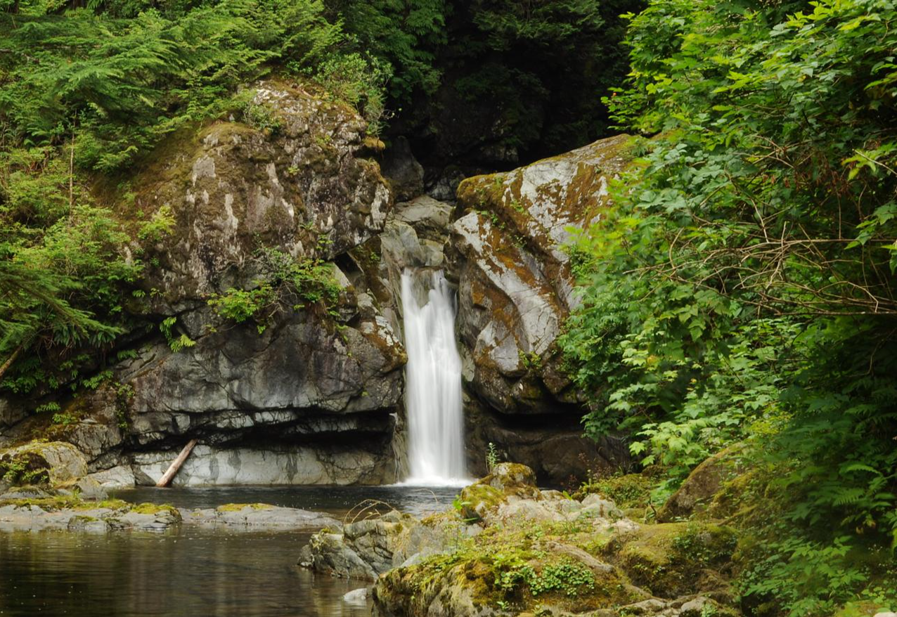
Hole-in-the-Wall is a small but unique natural waterfall. The waterfall gets its name from a literal hole in the wall, creating a “keyhole” effect that’s especially exciting after rain or during spring runoff. Mossy rock walls, ferns, and dense coastal forest surround this waterfall.
1
0
This wooden suspension bridge spans Rogers Creek. It is wide enough for one person and has simple ropes as guardrails.
1
0
Rock hop across Rogers Creek, there is no bridge, but a little balance and trekking poles can help you a lot. If there has been recent rain, consider bringing water shoes; you will cross the river twice here.
1
0

Sproat Lake, formerly known by the Nootka name Kleecoot, is a large, clear lake on Vancouver Island. It’s a popular spot for hiking, swimming, kayaking, boating, and fishing.
0
0
Frequently Asked Questions
How many easy hiking trails are available in Alberni-Clayoquot?
Alberni-Clayoquot offers a wide selection of easy hiking trails, with over 70 routes specifically categorized as easy. The region boasts a total of over 100 hiking trails for various skill levels.
What kind of terrain can I expect on easy hikes in Alberni-Clayoquot?
Easy hikes in Alberni-Clayoquot feature a diverse landscape, from gentle paths through lush forests to trails along the Pacific coastline. You can expect varied topography, including routes near freshwater lakes and those offering ocean views. The region's moderate climate allows for year-round outdoor adventures.
Are there any easy trails that lead to waterfalls?
Yes, the Alberni Valley is home to several waterfalls accessible via easy trails. For example, the China Creek Falls Trail is an easy 2.7 km path that leads to a powerful waterfall and turquoise waters. Stamp River Falls also offers easy access.
Are there any family-friendly or dog-friendly easy hikes?
Many easy trails in Alberni-Clayoquot are suitable for families and are often dog-friendly, though it's always best to check specific trail regulations for leash requirements. Trails like the Wild Pacific Trail: Lighthouse Loop are generally well-maintained and accessible for various ages and pets.
What interesting natural features or landmarks can I see on easy hikes?
Easy hikes in Alberni-Clayoquot can lead you to stunning natural features. You can explore ancient forests with giant Western Red Cedar and Western Hemlock trees, such as those found near the Rainforest Trail. The region also features coastal beauty with expansive sandy beaches and rocky islands. For a unique cultural experience, visit the ancient Petroglyphs at Sproat Lake. You might also encounter viewpoints like Mount Ozzard Radio Tower or Lone Cone Trail Viewpoint, though access to these specific viewpoints might involve slightly more challenging sections or require checking the full route details.
Are there any easy circular routes or loop trails?
Yes, there are several easy loop trails. The Hole-in-the-Wall loop via Rogers Creek Trailhead near Port Alberni is a great option. Another popular loop is the Beaver Pond to Log Train Trail loop, also in Port Alberni.
What is the average length and duration of easy hikes in the region?
Easy hikes in Alberni-Clayoquot vary in length, but many are relatively short, making them ideal for a relaxed outing. For example, the Wild Pacific Trail: Lighthouse Loop is about 2.8 km (1.7 miles) and takes approximately 45 minutes. The Sproat Lake via Fossli Trail is around 2.8 km (1.8 miles) and can be completed in about 50 minutes.
What do other hikers enjoy most about easy trails in Alberni-Clayoquot?
The easy trails in Alberni-Clayoquot are highly rated by the komoot community, with an average score of 4.6 stars from over 1,200 reviews. Hikers often praise the stunning ocean views, the tranquility of the lush forests, and the accessibility of trails leading to beautiful natural features like waterfalls and lakes. The varied terrain and well-maintained paths are frequently highlighted.
Are there any easy trails near Sproat Lake?
Yes, Sproat Lake is a popular area with scenic hiking opportunities. The Sproat Lake via Fossli Trail, located in Fossli Provincial Park, is an easy 2.8 km loop that offers views of the lake. Sproat Lake Provincial Park itself is a great place to explore.
What is the best time of year to go on easy hikes in Alberni-Clayoquot?
Thanks to its moderate climate, Alberni-Clayoquot offers opportunities for year-round outdoor adventures. While summer provides warm, sunny conditions perfect for coastal walks, spring and fall offer cooler temperatures and vibrant foliage. Even winter can be suitable for easy hikes, especially on lower elevation trails, though it's always wise to check local weather conditions.
Are there any easy trails that offer views of the Alberni Inlet?
While specific easy trails directly alongside the entire Alberni Inlet are not detailed, the inlet provides deep-sea access and beautiful views. Some trails in the broader Alberni Valley area, such as the Hole-in-the-Wall loop, are located near Port Alberni, which sits at the head of the inlet. These routes may offer glimpses or access to areas with inlet views.
Most popular attractions around Alberni-Clayoquot

Get inspired with the komoot mobile app


Explore more
Browse the best Hikes in other regions.
