The best gravel rides around Lamanère
4.6
(6)
138
riders
3
rides
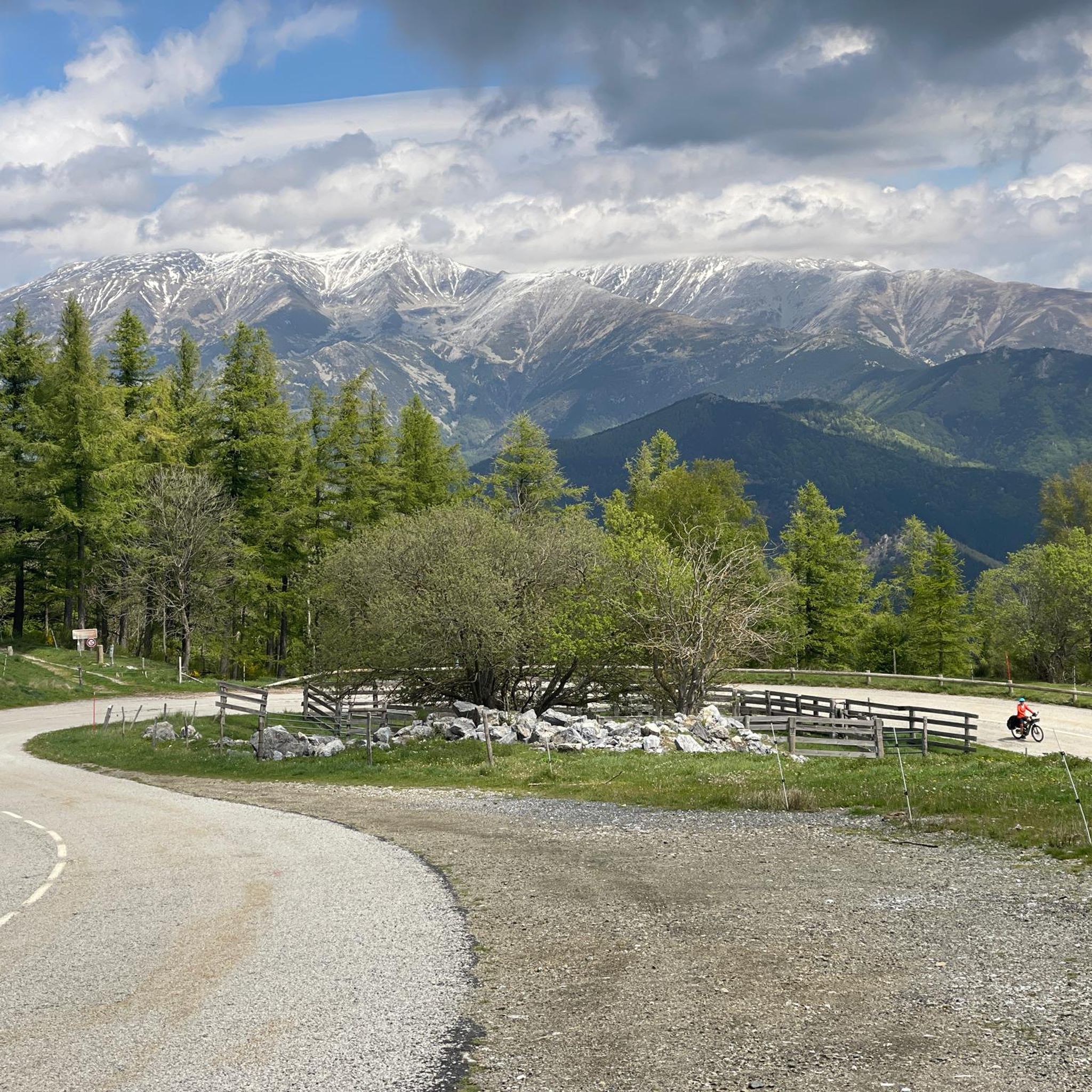
Gravel biking around Lamanère offers routes through the Haut Vallespir, a rural area nestled in the Pyrénées-Orientales region of France. The terrain features expansive forests of chestnut and beech trees, with trails that slowly ascend through varied landscapes. The region is characterized by its position in the foothills of the Canigó massif, providing a mix of forest tracks and gravel roads. Elevations range up to 1,554 meters at Puig de Coma Negra, the highest point in the commune.
Best gravel…
Last updated: July 5, 2026
4.5
(2)
64
riders
51.5km
03:44
1,300m
1,300m
Hard gravel ride. Very good fitness required. Mostly paved surfaces. Suitable for all skill levels.
5.0
(1)
43
riders
98.3km
07:32
2,730m
2,730m
Hard gravel ride. Very good fitness required. Mostly paved surfaces. Suitable for all skill levels.

Sign up for free
6
riders
61.8km
04:52
1,870m
1,870m
Hard gravel ride. Very good fitness required. Mostly paved surfaces. Suitable for all skill levels.
4.0
(1)
4
riders
Hard gravel ride. Very good fitness required. Mostly paved surfaces. Suitable for all skill levels.
9
riders
33.2km
02:40
980m
980m
Hard gravel ride. Very good fitness required. Mostly paved surfaces. Suitable for all skill levels.
Our route recommendations are based on thousands of hikes, rides, and runs completed by other people on komoot.
Start today with a free account
Your next adventure awaits.
Login or Signup
Tips from the Community

Espai natural exuberant i muntanyós, amb impressionants cingleres i gorges i interessants vestigis de l’art romànic. Per a més informació: https://costabrava.org/on-anar/comarques/ripolles/camprodon/
0
0

This village had great historical significance: in the Middle Ages, its castle was key in the Remensa Wars and in the control of the region, passing through the hands of various noble families. The manor remained until the mid-19th century, when it disappeared with the state expropriation of 1854.
0
0

All of Camprodon is worth visiting!!!
0
0

Small village of Rocabruna which can be reached by the GIV5223 road between Oix and Molló road. It is recognized for the Sanctuary of Rocabruna and for its scenic beauty.
0
0
Small town of Beget, architectural heritage of Catalonia, well known for its cobbled streets and houses and for the landscape that surrounds it, the Alta Garrotxa.
0
0
Segment of the road that goes from Beget to the Camprodon road, with a climb with good slopes between Beget and Rocabruna.
0
0
Small town of L'Alta Garrotxa, architectural heritage of Catalonia, recognized for its high landscape value, natural diversity and its cobbled streets and houses, built on the Beget stream and the Torrent dels Trulls, which are saved with rock bridges . There are local craft shops and it's a perfect place to disconnect from everything.
0
0

Very beautiful church. The first name Laurenz is common in my family.
3
0
Frequently Asked Questions
How many gravel bike trails are available around Lamanère?
There are several gravel bike trails around Lamanère, with a curated selection of routes catering to various skill levels. The komoot community has documented 4 routes in the area, ranging from moderate to difficult.
What kind of terrain can I expect on gravel bike trails near Lamanère?
The terrain around Lamanère features a mix of paved surfaces, forest tracks, and scenic gravel roads, including 'white tracks' characteristic of the area. You'll ride through expansive forests of chestnut and beech trees, with trails that slowly ascend through varied landscapes in the foothills of the Canigó massif.
Are there challenging gravel bike trails for experienced riders?
Yes, Lamanère offers several challenging gravel bike trails. For instance, the Collado Fonda – View of Pont Nou in Camprodon loop from Camprodon is a difficult 51.5 km route with over 1299 meters of elevation gain, offering extensive views across the Pyrenean landscape. Another demanding option is the La Forge del Mitg (school) – Sagué Pass loop from Saint-Laurent-de-Cerdans, a 31.6 km path navigating through forested areas with significant elevation.
Are there any moderate gravel bike trails suitable for less experienced riders?
Yes, there are moderate options available. The Coustouges – Hostal de la Muga (Ruins) loop from Coustouges is a moderate 17.4 km trail leading through rural landscapes, often completed in about 1 hour 44 minutes, making it a good choice for those seeking a less strenuous ride.
What is the best time of year for gravel biking in Lamanère?
Lamanère benefits from an almost year-round sunny climate, making it suitable for gravel biking for much of the year. Spring and autumn offer pleasant temperatures and vibrant scenery, while summer can be warm but still enjoyable, especially on shaded forest tracks. Winter riding is also possible, though conditions may vary.
What scenic views or points of interest can I discover on gravel bike routes in Lamanère?
Gravel biking in Lamanère offers access to stunning natural landscapes and historical sites. You can find routes leading to the Puig de Coma Negra, the southernmost point of continental France, offering exceptional panoramic views. Other notable points include the Coll d'Arès mountain pass, the majestic Hermitage of Notre Dame du Coral, and the Beget Village with its medieval bridge. The Church of Sant Feliu de Rocabruna is also accessible via scenic trails.
Are there any loop gravel bike trails in Lamanère?
Yes, many of the gravel bike trails around Lamanère are designed as loops, allowing you to start and finish at the same point. Examples include the Collado Fonda – View of Pont Nou in Camprodon loop and the Coustouges – Hostal de la Muga (Ruins) loop, providing convenient circular routes for exploration.
What do other gravel bikers enjoy the most about gravel biking in Lamanère?
The area is highly rated by the komoot community, with an average score of 4.5 stars. Reviewers often praise the diverse terrain, dense woodlands, and ascending forest tracks that define the gravel biking experience. The region's rugged beauty and varied landscapes are frequently highlighted as key attractions.
Are there opportunities for cross-border gravel biking from Lamanère?
Absolutely. As a border village with Spain (Catalonia), Lamanère provides excellent access to cross-border gravel adventures. The Pirinexus is a notable 340 km cross-border loop that incorporates car-free gravel roads, old railway paths, and quiet rural roads, showcasing diverse landscapes across both France and Spain.
Is there parking available for gravel bikers in Lamanère?
While specific parking areas for gravel biking are not detailed, Lamanère is a rural village, and parking is generally available within or near the village center. Many routes start from nearby towns like Camprodon or Coustouges, where public parking facilities are typically present.
Are there any family-friendly gravel bike routes in Lamanère?
While many routes in Lamanère involve significant elevation and are rated moderate to difficult, families with older children or those comfortable with some climbing might enjoy shorter, less technical sections of the moderate trails. Always check the route details for distance and elevation to ensure it matches your family's ability.
Can I find cafes or places to eat along the gravel bike routes?
Lamanère and the surrounding villages are rural, so amenities like cafes and pubs might be sparse directly on the trails. It's advisable to plan your route to pass through villages like Lamanère, Coustouges, or Camprodon for refreshment stops. Always carry sufficient water and snacks, especially on longer rides.
What is the highest point I can reach on a gravel bike trail in Lamanère?
The highest point within the commune of Lamanère is Puig de Coma Negra, at 1,554 meters. While not all gravel routes directly summit it, many trails in the area offer significant ascents, providing rewarding views of the Pyrenean mountain range.
Most popular attractions around Lamanère

Get inspired with the komoot mobile app


Explore more
Browse the best Gravel rides in other regions.
