The best mountain hikes around Ontex
4.8
(7)
39
hikers
4
hikes
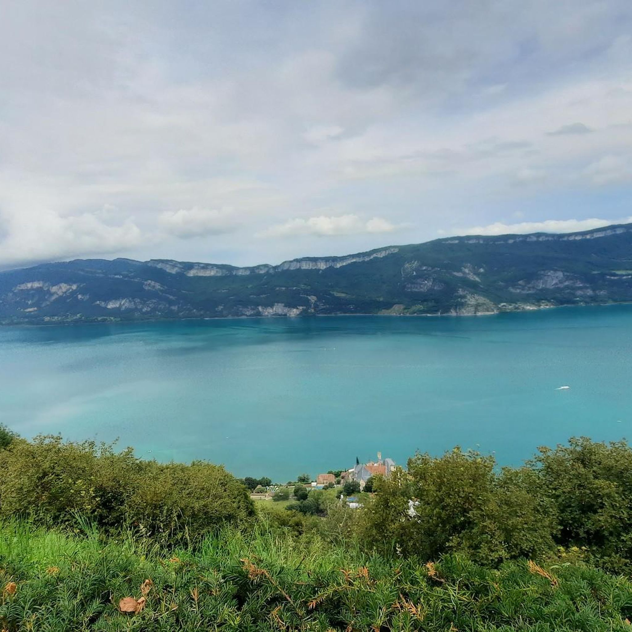
Mountaineering routes around Ontex are situated within the Aix-les-Bains Riviera des Alpes region of France, characterized by mountainous terrain and scenic viewpoints. The area features prominent natural landmarks such as the Belvédère d'Ontex, offering panoramic views of Lac du Bourget and the Abbaye d'Hautecombe. The landscape includes varied elevations, providing diverse conditions for mountaineering activities.
Best mountaineering routes around Ontex
- The most popular mountaineering route is Col du Chat (Chat Pass) – Cat's Tooth loop from Bourdeau, a 4.6…
Last updated: October 3, 2026
4.5
(4)
23
hikers
7.43km
04:00
660m
660m
Hard mountaineering route. Good fitness required. Sure-footedness, sturdy shoes and alpine experience required.
5.0
(1)
9
hikers
4.51km
01:31
180m
180m
Moderate mountaineering route. Great for any fitness level. Mostly accessible paths. Sure-footedness required.

5.0
(2)
5
hikers
8.30km
03:10
550m
550m
Hard mountaineering route. Good fitness required. Sure-footedness, sturdy shoes and alpine experience required.
Our route recommendations are based on thousands of hikes, rides, and runs completed by other people on komoot.
Start today with a free account
Your next adventure awaits.

Tips from the Community

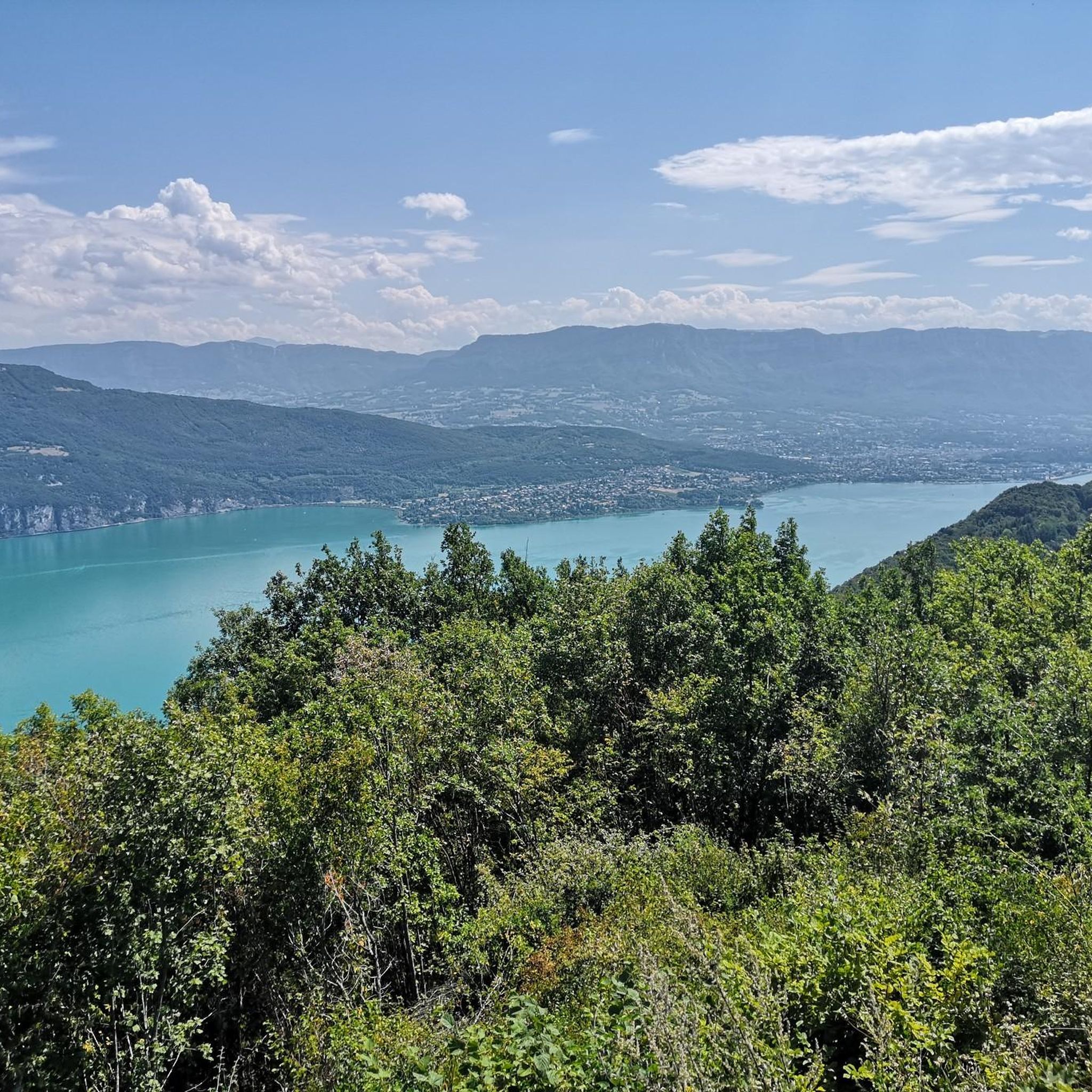
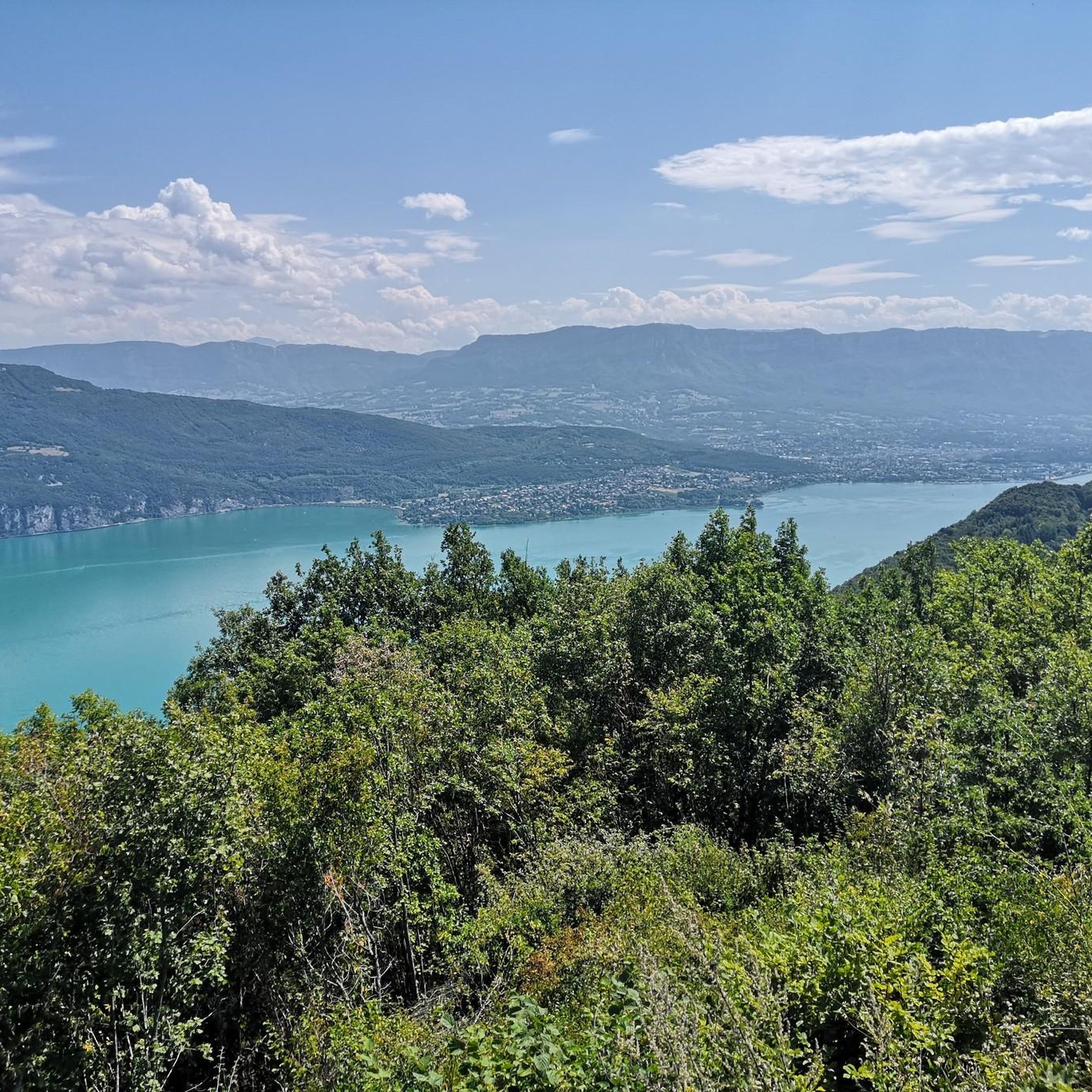
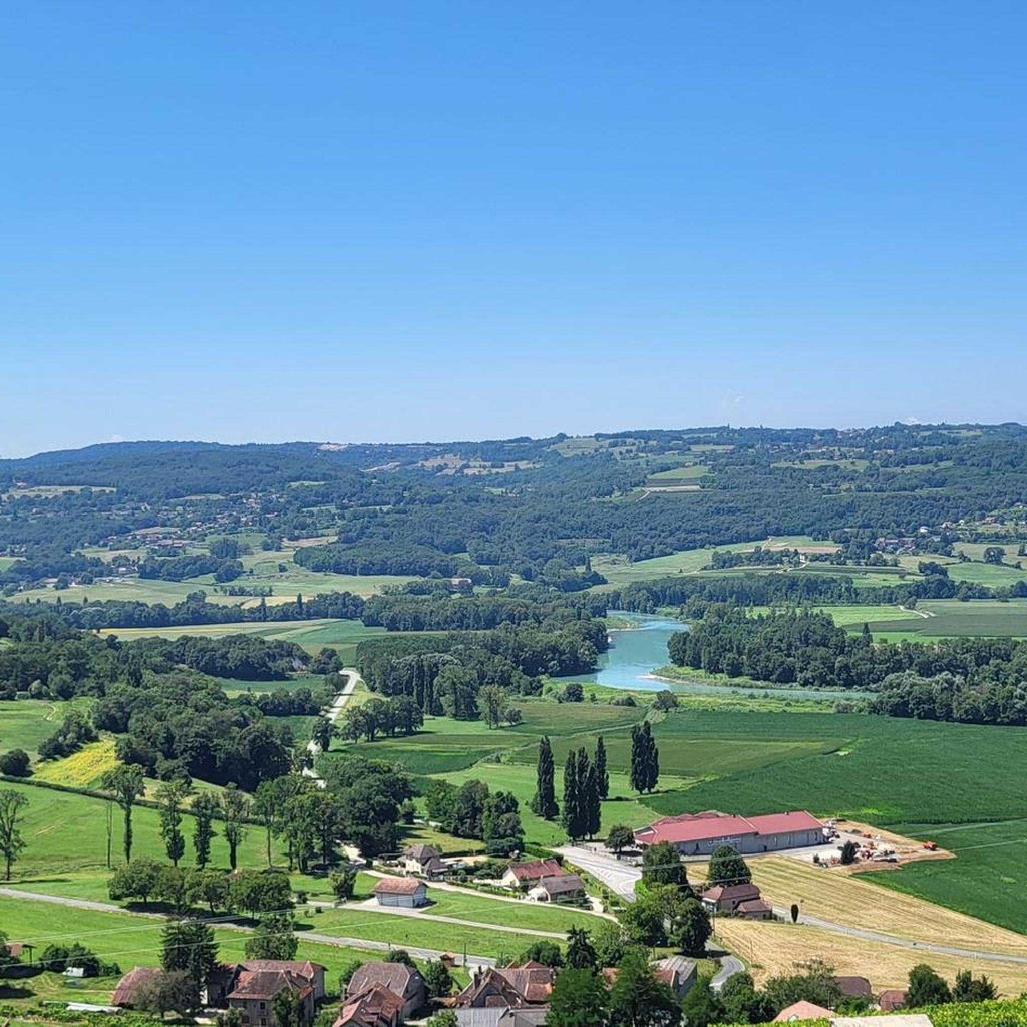
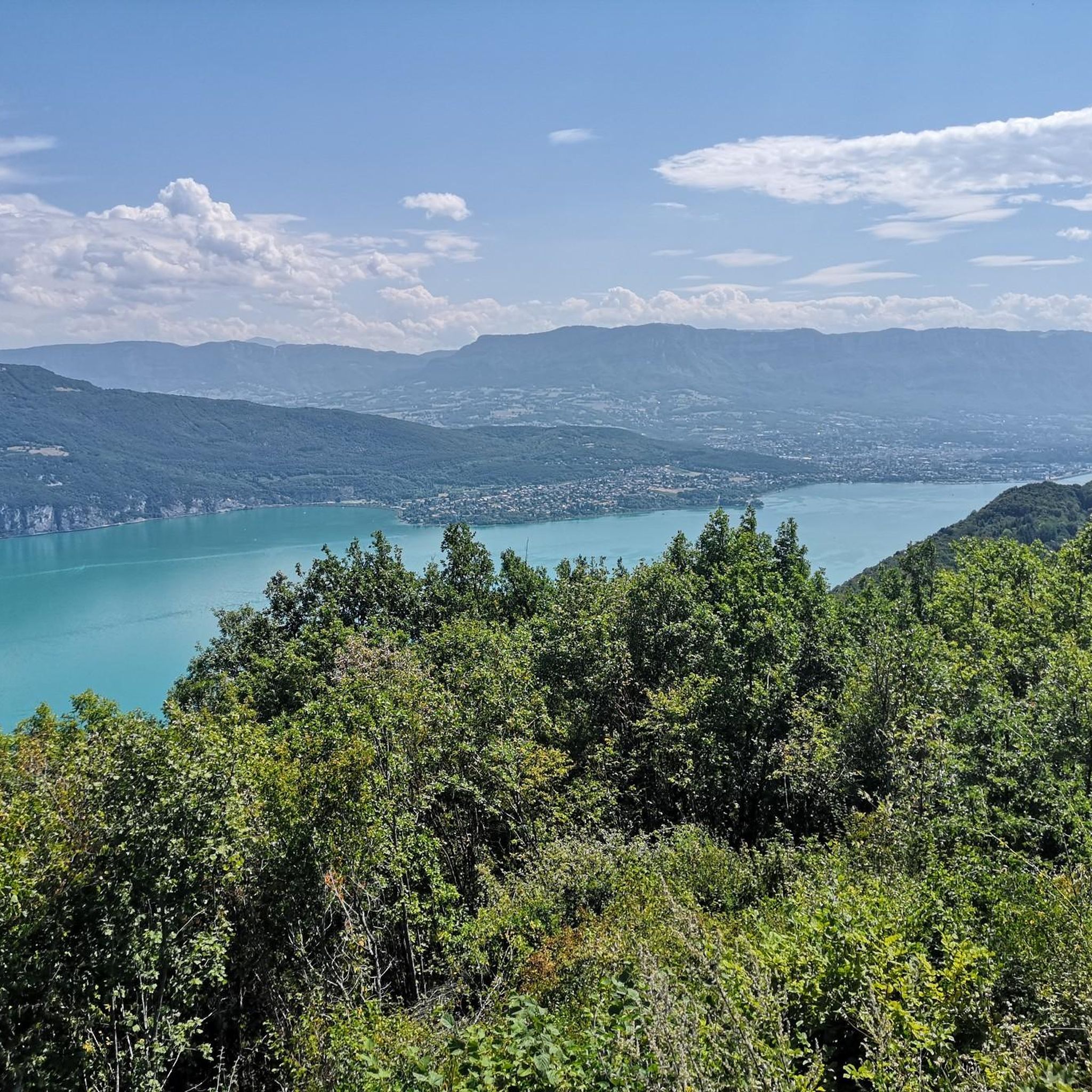
Panoramic view, over the Savoyard pre-Alps, the lake, the Dent du Chat, le Revard, Croix du Nivollet and in clear weather even as far as Mont Blanc! The route does not require any particular physical condition but requires vigilance to place your feet well in order to avoid rocks and roots on the path.
0
0


Beautiful view of the lake.
0
0
Beautiful view of the lake.
0
0

It's a must-see place with a magnificent view of Lake Bourget.
1
0

Aerial passage via ladders with gas, not recommended for beginners. Avoid summer weekends, as crowded conditions can cause traffic jams.
0
0

Very difficult summit, 10% average for 12km from Le Bourget du lac, no respite. The view at the top is worth it and in high season there is a restaurant bar for refueling.
3
0
Frequently Asked Questions
What kind of mountaineering routes can I find around Ontex?
The Ontex area, situated within the Aix-les-Bains Riviera des Alpes region, offers a diverse range of mountaineering routes. You'll find options varying in difficulty from moderate to difficult, all set amidst mountainous terrain with panoramic views of Lac du Bourget and various scenic viewpoints.
How many mountaineering routes are available in the Ontex area?
This guide details 5 mountaineering routes around Ontex, providing a selection of trails for different skill levels.
Are there any challenging mountaineering routes near Ontex?
Yes, several routes offer a significant challenge. For instance, the Col du Chat (638 m) – Roc du Cornillon viewpoint loop from Bourdeau is a difficult 14.8 km route with over 1000 meters of elevation gain. Another demanding option is the Col du Chat (Chat Pass) – Cat's Tooth loop from Bourdeau, known for its challenging climbs.
Are there any moderate mountaineering options around Ontex?
Absolutely. If you're looking for a moderate challenge, consider the Le Molard Noir – Molard Noir Viewpoint loop from Mont du Chat, a 4.5 km path offering scenic vistas. Another moderate option is the Lamartine Cave – View of Lake Bourget loop from Bourdeau, which is about 9 km long.
What do other mountaineers enjoy the most about mountaineering in Ontex?
The routes in Ontex are highly rated by the komoot community, with an average score of 4.8 stars. Mountaineers often praise the panoramic views of Lac du Bourget and the varied mountainous terrain that makes each tour unique.
Are there any circular mountaineering walks in the Ontex region?
Yes, all the mountaineering routes listed in this guide are circular walks, allowing you to start and finish at the same point. Examples include the Col du Chat (Chat Pass) – Cat's Tooth loop from Bourdeau and the Molard Noir Viewpoint – Le Molard Noir loop from Mont du Chat.
What natural features or landmarks can I see along the mountaineering routes?
The routes offer stunning natural features. You can expect panoramic views of Lac du Bourget and the Abbaye d'Hautecombe from viewpoints like the Belvédère d'Ontex. Specific highlights include the Col du Chat (638 m) and the Chambotte Pass.
Are there any interesting places to explore near the mountaineering trails?
Beyond the trails, the region offers charming spots. You could visit Chanaz – Savoy's Little Venice, known for its picturesque canals, or explore the Savière Canal. These are great for a post-hike exploration.
What is the best time of year for mountaineering in Ontex?
While specific seasonal data isn't provided, the Aix-les-Bains Riviera des Alpes region, where Ontex is located, is generally known for its outdoor activities during spring, summer, and early autumn when the weather is most favorable for mountain excursions and views are clear.
Are there any viewpoints accessible on the mountaineering routes?
Yes, several routes lead to notable viewpoints. The Le Molard Noir – Molard Noir Viewpoint loop from Mont du Chat specifically provides access to the Molard Noir Viewpoint, offering expansive vistas. The region itself is famous for viewpoints like Belvédère d'Ontex and Belvédère de la Chambotte.
What is the longest mountaineering route in this guide for Ontex?
The longest route featured in this guide is the Col du Chat (638 m) – Roc du Cornillon viewpoint loop from Bourdeau, which spans approximately 14.8 kilometers and typically takes over 6 hours to complete.
Most popular attractions around Ontex

Get inspired with the komoot mobile app


Explore more
Browse the best Mountain Hikes & Routes in other regions.
