The best walks and hikes in Terence Bay Wilderness Area
4.9
(20)
282
hikers
20
hikes
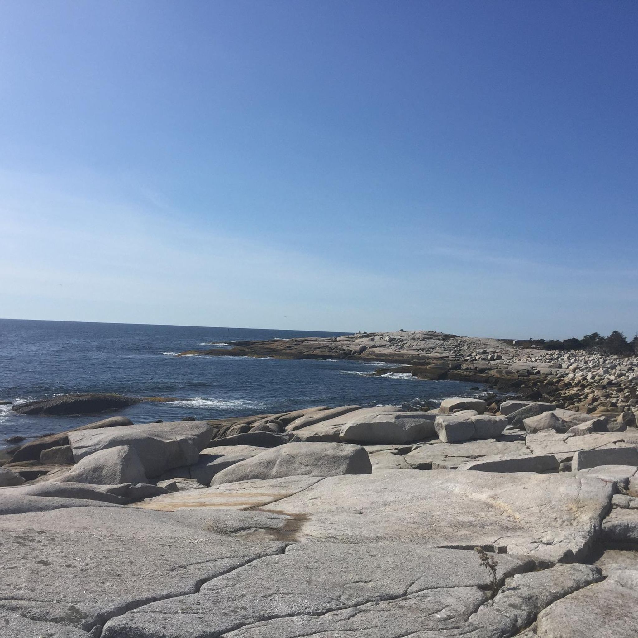
Hiking in Terence Bay Wilderness Area offers diverse and rugged landscapes within Nova Scotia's Pennant Coastal Barrens Natural Landscape. The region features dramatic granite headlands, coastal barrens, and patches of coastal conifer forests, with inland areas consistently forested. Numerous lakes and streams are common throughout this 4,551-hectare wilderness area, which connects to Long Lake Provincial Park. The terrain includes wave-cut platforms, sea cliffs, and evidence of glacial processes.
Best hiking trails in Terence Bay Wilderness Area
- The most popular hiking route is A – Mackerel Cove loop from Sambro Creek, a 6.5 miles (10.4 km) trail that takes about 2 hours 45 minutes to complete, traversing rugged coastal terrain.
- Another top favourite among local hikers is A – Crystal Crescent Beach loop from Sambro Creek, an easy 2.5 miles (4.0 km) path. This route offers views of the Atlantic Ocean and coastal features.
- Local hikers also love the Witherod Lake Trail, a 2.2 miles (3.6 km) trail leading through forest paths to quiet viewpoints, often completed in about 55 minutes.
- Hiking in Terence Bay Wilderness Area is defined by rugged coastal barrens, granite headlands, and coastal conifer forests, alongside numerous lakes. The network offers options for different ability levels, from easy loops to moderate backcountry exploration.
- The routes in Terence Bay Wilderness Area are highly rated by the komoot community with an average score of 4.9 stars from more than 15 reviews. More than 200 hikers have used komoot to explore Terence Bay Wilderness Area's varied terrain.
Last updated: July 10, 2026
1.94km
00:31
20m
20m
Easy hike. Great for any fitness level. Easily-accessible paths. Suitable for all skill levels.
4.3
(10)
48
hikers
10.4km
02:44
80m
80m
Moderate hike. Good fitness required. Easily-accessible paths. Suitable for all skill levels.

Sign up for free
23
hikers
4.00km
01:04
40m
40m
Easy hike. Great for any fitness level. Easily-accessible paths. Suitable for all skill levels.
14
hikers
3.50km
00:57
50m
50m
Easy hike. Great for any fitness level. Easily-accessible paths. Suitable for all skill levels.
5.0
(2)
33
hikers
3.57km
00:55
10m
10m
Easy hike. Great for any fitness level. Easily-accessible paths. Suitable for all skill levels.
Get access to more routes and recommendations from other explorers.
Sign up for free
Already have an account?
Our route recommendations are based on thousands of hikes, rides, and runs completed by other people on komoot.
Start today with a free account
Your next adventure awaits.
Login or Signup
Tips from the Community

The Pennant River Brook Trail ends here where the Pennant River meets Grand Lake. There is a small clearing here with a fire pit that is usually a good stopping point to turn around.
0
0
The parking area for the Pennant River Brook Trail (also known as "The Brook") is a small gravel area on the side of West Pennant Road. There is space for about 4-5 cars here with direct access to the trail along the river.
0
0
Here there is an access point to the Pennant River with a small, deep pool that is popular for swimming. There is a rope in the water that can serve as an anchor, but make sure you take a look at the current and water level before getting in.
0
0

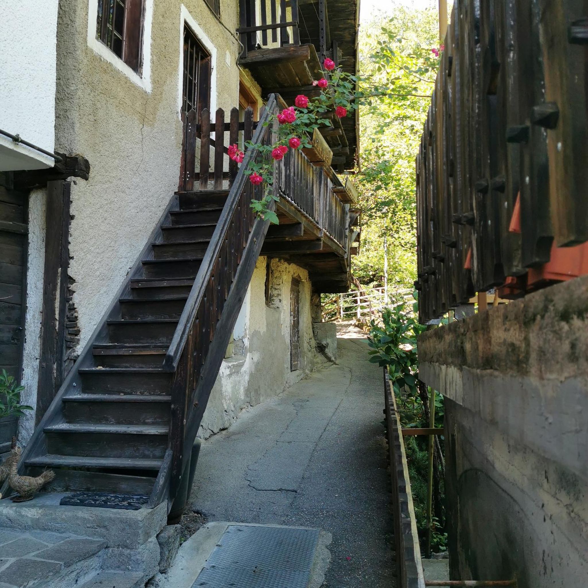
Witherod Lake Trail is a forest path connecting the main Long Lake trail system to the shoreline of Witherod Lake. The route is mostly level with a packed-earth surface, light roots, and sections of exposed granite typical of the park. It provides quick access to quiet viewpoints over the lake and works well as a small detour from the larger loop near Dunbrack Street. Suitable for hiking and running, and easy to combine with nearby paths around Long Lake.
0
0
A sizeable urban wilderness area in Halifax with forest trails, lakeshore paths, and open granite terrain. The park offers mostly level to moderately varied hiking routes, including loops around Long Lake and nearby smaller lakes. Trails range from narrow forest singletrack to wider packed-earth paths, with many informal viewpoints down to the water. Access is easiest from Dunbrack Street, where several signed trail openings lead directly into the park.
0
0
A mostly level forest path on the east side of Long Lake in Halifax’s Long Lake Provincial Park. The trail runs close to the shoreline, with short side paths leading to open granite slabs and clear lake views. The surface varies between packed earth, roots, and occasional rocky sections. Suitable for hiking and running, with multiple access points from Dunbrack Street. Works well as a short loop or as part of a longer circuit through the park.
0
0
Frequently Asked Questions
What kind of terrain can I expect when hiking in Terence Bay Wilderness Area?
The Terence Bay Wilderness Area is characterized by Nova Scotia's Pennant Coastal Barrens, featuring dramatic granite headlands, rugged barrens, and coastal conifer forests. You'll encounter varied trail types, from narrow forest single-tracks and wider packed-earth paths to routes with exposed granite sections. Some areas also utilize ATV trails, which can be muddy. The landscape also includes numerous lakes, streams, wave-cut platforms, and sea cliffs.
Are there any easy hiking trails suitable for beginners or families?
Yes, there are several easy trails perfect for beginners or families. For example, the A – Crystal Crescent Beach loop from Sambro Creek is an easy 4.0 km path offering views of the Atlantic Ocean. Another great option is the Witherod Lake Trail, a 3.6 km mostly level forest path leading to quiet viewpoints.
What are some notable natural features or landmarks to look out for?
The area boasts several striking natural features. A significant attraction is Shelbird Lake, overlooked by a large granite cliff, which is the site of an old granite quarry and popular with rock climbers. The rugged coastline features wave-cut platforms, sea cliffs, and small pocket beaches. You'll also see evidence of glacial processes, such as glacial striations and erratics, from approximately 12,000 years ago.
Are there any loop hikes available in Terence Bay Wilderness Area?
Yes, loop hikes are a great way to experience the diverse landscape. The A – Mackerel Cove loop from Sambro Creek is a moderate 10.4 km trail traversing rugged coastal terrain. For an easier option, consider the A – Crystal Crescent Beach loop from Sambro Creek, which is 4.0 km.
What do other hikers enjoy most about Terence Bay Wilderness Area?
The area is highly rated by the komoot community, with an average score of 4.9 stars from 18 reviews. Hikers often praise the dramatic coastal views, the rugged wilderness feel, and the variety of terrain that allows for both challenging and easy excursions away from urban life.
Is Terence Bay Wilderness Area suitable for dog walking?
While the wilderness area is generally welcoming to outdoor enthusiasts, specific regulations regarding dogs on trails can vary. It's always best to keep dogs on a leash to protect wildlife and ensure a pleasant experience for all visitors. Please check local signage for any specific restrictions.
What is the best time of year to go hiking in Terence Bay Wilderness Area?
The Terence Bay Wilderness Area offers hiking opportunities throughout much of the year. Spring and fall provide pleasant temperatures and beautiful scenery, with fall foliage being particularly striking in the forested areas. Summer is ideal for coastal walks, though insects can be present. Winter hiking is possible for those prepared for colder conditions and potentially icy or snowy trails.
How many hiking trails are there in Terence Bay Wilderness Area?
There are over 18 hiking routes recorded in Terence Bay Wilderness Area on komoot, offering a wide range of experiences from easy strolls to more moderate backcountry explorations.
Are there any challenging trails for experienced hikers?
Yes, for those seeking a more rugged experience, trails like "Sorrow's End" (mentioned in regional research) offer moderate to difficult terrain, including wet and rugged coastal barrens. These trails can reveal impressive views of lakes and the granite cliff at Shelbird Lake, providing a true wilderness adventure.
Is there parking available for trail access?
While specific parking areas are not detailed for every trail, access points to the wilderness area typically have designated parking. Given the area's popularity, especially near well-known trails and coastal access points, it's advisable to arrive early during peak times. Always ensure you park in designated areas to avoid obstructions or fines.
Can I reach Terence Bay Wilderness Area using public transport?
Terence Bay Wilderness Area is located within the suburban fringe of Halifax Regional Municipality. While some public transport options might serve nearby communities, direct access to trailheads within the wilderness area via public transport can be limited. It is recommended to check local transit schedules and routes for the most up-to-date information on reaching the area.
What should I wear when hiking in Terence Bay Wilderness Area?
Given the varied terrain and coastal exposure, it's advisable to wear sturdy, waterproof hiking boots, especially as some trails can be wet or muddy. Layered clothing is recommended to adapt to changing weather conditions, as coastal areas can be windy and temperatures can fluctuate. Bringing rain gear is also a good idea, regardless of the forecast.
Most popular routes in Terence Bay Wilderness Area

Get inspired with the komoot mobile app


Explore more
Browse the best Hikes in other regions.
