The best walks and hikes in Rocky Point Pine Barrens State Forest
5.0
(5)
37
hikers
21
hikes
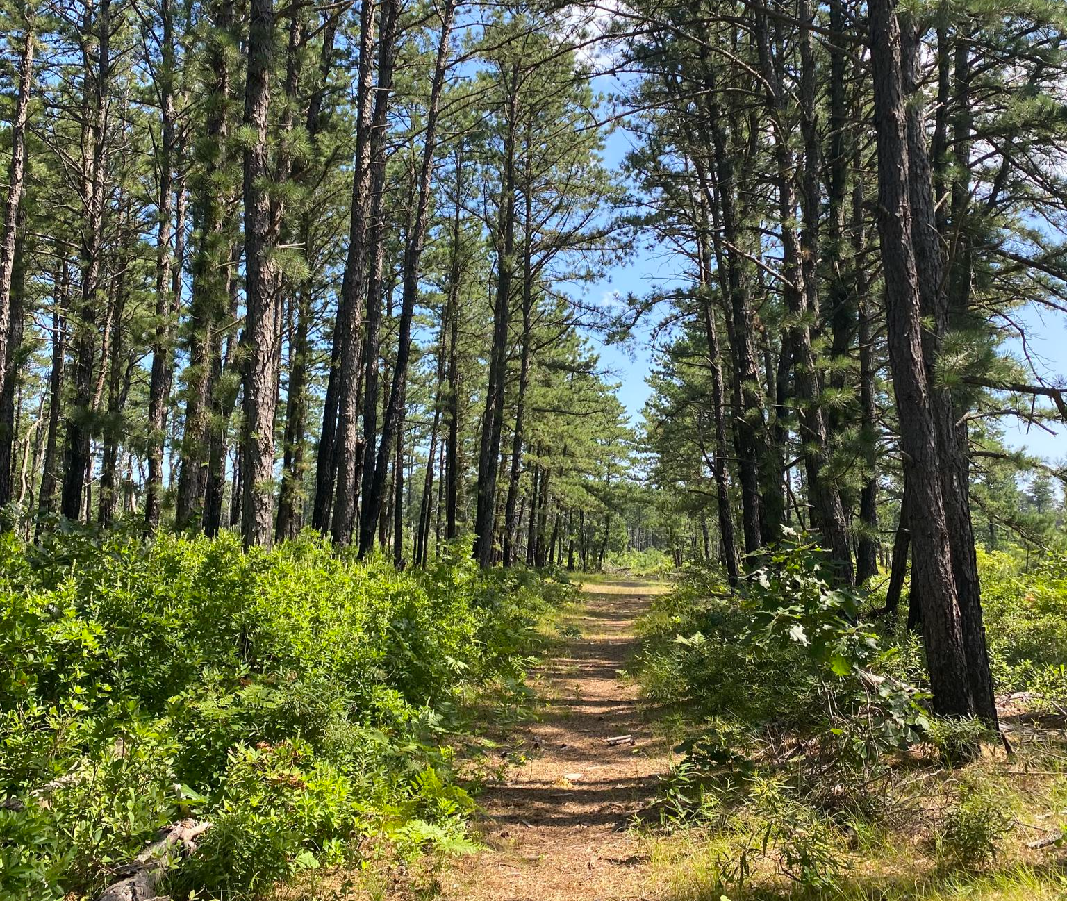
Hiking in Rocky Point Pine Barrens State Forest offers routes through a large, protected woodland area in Suffolk County. The landscape is defined by its pine barrens ecosystem, with sandy, relatively flat trails winding through the forest. This area was formerly the site of a large RCA radio transmitting center, and remnants of its history can be found along some of the paths.
Best hiking trails in Rocky Point Pine Barrens State Forest
- The most popular hiking route is Paumanok Path loop — Rocky Point Pine Barrens State Forest, a 9.9 mile (15.9 km) trail that takes about 4 hours to complete. This moderate hike follows a section of the long-distance Paumanok Path.
- Another top favourite among local hiking enthusiasts is Panamoka Pine Barrens State Forest to Otis Pike Preserve West via Paumanok Path, a moderate 6.5 mile (10.4 km) path. The route connects two distinct forest preserves on well-marked trails.
- Local hiking enthusiasts also love the Tarkill Pond Complex loop from Brookhaven State Park, a 5.1 mile (8.1 km) trail leading through mixed woodland, often completed in about 2 hours.
- Hiking in Rocky Point Pine Barrens State Forest is defined by sandy tracks, extensive pine woodlands, and flat terrain. The network of trails offers options for different ability levels, though most routes are considered moderate due to their length.
- The routes in Rocky Point Pine Barrens State Forest are highly rated by the komoot community with an average score of 5.0 stars from a number of reviews. More than 20 hikers have used komoot to explore Rocky Point Pine Barrens State Forest's varied terrain.
Last updated: July 7, 2026
3.22km
00:49
10m
20m
The Raymond P. Corwin Trail offers a tranquil escape into Long Island's Central Pine Barrens, guiding you through serene pitch pine forests and past potential black gum swamps. This easy 2.0-mile (3.2 km) hike is mostly flat, following doubletrack paths that are perfect for a peaceful nature walk. You might even spot some of the over 30 species of warblers that nest here, adding a delightful element for birdwatchers.
For planning your visit, the Raymond P. Corwin Pine Barrens Trails Center is a convenient access point, providing a gateway to this unique natural area. This short route, taking approximately 49 minutes to complete with only 31 feet (10 metres) of elevation gain, is ideal for a quick outing. It's a great option for families or anyone looking for a gentle, accessible trail.
Named in honor of environmentalist Ray Corwin, this trail is a vital part of Long Island's remaining wilderness and connects to other extensive pathways like the Paumanok Trail. It offers a glimpse into the region's unique ecology, including a notable glacial rock feature further along the full trail, making it a significant natural landmark.
29.3km
07:28
90m
110m
The Paumanok Path: Rocky Point to Manorville offers a deep dive into Long Island's wilder side, guiding you through the unique pine barrens of the Rocky Point State Forest. This difficult 18.2-mile (29.3 km) hike, with 305 feet (93 metres) of elevation gain, winds through forests of gnarled trees, past glacial kettles and erratics, and over a charming wooden footbridge. It's a long, immersive journey that feels far removed from the usual Long Island bustle, perfect for those seeking solitude and a true test of endurance.
Expect to spend around 7 hours and 28 minutes on this demanding route, so plan for an early start and carry all necessary supplies, including ample water. The trail includes remote sections without easy road access. Be aware of deer ticks, especially outside of late fall and winter, and consider visiting during cooler months to minimize this concern. Parking information for the Rocky Point trailhead should be researched in advance.
This section is part of the larger 125-mile Paumanok Path, Long Island's only long-distance trail, stretching from Rocky Point to Montauk Point. It traverses some of the region's most ecologically significant open spaces, vital for groundwater recharge and home to beautiful coastal plain ponds. The path is marked with white blazes and honors Stephen Talkhouse, a 19th-century Montaukett Native American known for his long walks, adding a layer of historical depth to your challenging hike.

Sign up for free
5.0
(1)
4
hikers
15.9km
04:02
40m
40m
The Paumanok Path and Red Trail Loop offers a captivating moderate hike through Long Island's unique pine barrens, where you'll discover rolling hills and geological features like glacial kettles left by the last Ice Age. This 9.9-mile (15.9 km) route, with its 134 feet (41 metres) of elevation gain, guides you through dense patches of scrub oak and pine forests, providing a rich tapestry of flora and a sense of peaceful immersion in nature. Expect about 4 hours and 1 minutes to complete this journey, making it a perfect half-day adventure for those seeking a blend of natural beauty and a good workout.
Before you head out, remember that some parts of the Paumanok Path can be quite remote, so plan to carry enough water and snacks. Parking is available at various trailheads, but it's always a good idea to arrive early, especially on weekends, to secure a spot. Be sure to check yourself for deer ticks after your hike, as they are common in this natural environment. This trail is best enjoyed during the cooler, drier months to avoid excessive heat and humidity.
This specific Red Trail Loop within the Rocky Point Pine Barrens State Forest is a segment of the much larger, 125-mile Paumanok Path, which is celebrated for its ecological diversity and geological interest. The path showcases globally rare natural communities and crucial groundwater recharge areas, highlighting Long Island's significant natural heritage. It also holds historical significance, inspired by the extensive walks of Stephen Talkhouse, a 19th-century Montaukett Native American, connecting you to the island's deep past.
3
hikers
8.11km
02:04
30m
20m
If you're looking for a pleasant and manageable hike, the Green Trail delivers a moderate 5.0-mile (8.1 km) journey with minimal elevation gain, only 84 feet (26 metres). You'll traverse gentle dirt and grass paths, winding through open woods and possibly some mountain laurel thickets, offering a serene experience. The terrain is largely flat with only small, stretched-out inclines, making it a great option for those new to hiking or families with children.
Planning your outing on the Green Trail is generally simple. While specific trailhead and parking details aren't provided, it's always a good idea to arrive early to secure a spot, especially on weekends. The trail's accessible nature means it's enjoyable in most seasons, but checking local conditions for any closures or specific advisories is recommended. You can expect to complete this route in approximately 2 hours and 4 minutes at a steady pace.
This Green Trail is a fantastic example of an easy route, often signifying a trail suitable for a wide range of hikers. It's a great way to experience the natural beauty of the Ridge area without committing to a strenuous climb. Keep an eye out for local flora and fauna as you enjoy the peaceful surroundings, making it a hidden gem for a relaxed day outdoors.
2
hikers
2.36km
00:37
20m
10m
Step into a rare natural wonder on the Prosser Pines Loop Trail, an easy 1.5-mile (2.4 km) hiking route that winds through Long Island's only white pine forest. The path is soft underfoot, cushioned by pine needles, as you pass towering trees that create a serene, quiet atmosphere. You'll feel a world away from the hustle, surrounded by the unique beauty of this historic plantation, with some trees reaching 100 feet into the sky.
This easy trail, with a minimal 62 feet (19 metres) of elevation gain, can be completed in about 36 minutes, making it perfect for a quick outing. It's accessible year-round and welcomes leashed dogs, offering a peaceful escape for all skill levels. Look for the fun teepee structures made from fallen limbs, which are a highlight for families, and enjoy the unique contrast of the neighboring sod farm, especially calming in winter.
What makes Prosser Pines truly special is its historical significance as one of the oldest surviving white pine plantations in the eastern United States, dating back to 1812. This unique ecosystem provides a distinct natural feature for Suffolk County, offering a tranquil setting for photography or a simple, refreshing walk. It's an ideal spot for beginners or anyone seeking a high-payoff nature experience without a strenuous climb.
Get access to more routes and recommendations from other explorers.
Sign up for free
Already have an account?
Our route recommendations are based on thousands of hikes, rides, and runs completed by other people on komoot.
Start today with a free account
Your next adventure awaits.
Login or Signup
Popular around Rocky Point Pine Barrens State Forest



Other adventures in Rocky Point Pine Barrens State Forest

Tips from the Community

Along the Paumanok Path, hikers encounter a charming wooden footbridge that helps in crossing the creek. Despite its modest size, the bridge exudes a rustic charm that complements the natural surroundings.
0
0
This trail junction offers two distinct experiences at Rocky Point Pine Barrens State Park. Take the southeast turn that leads to the sandpits, where daring bikers perform thrilling tricks amid the sandy terrain, providing an adrenaline-fueled spectacle. Or continue on the Paumanok Path and immerse yourself in nature's tranquility.
0
0
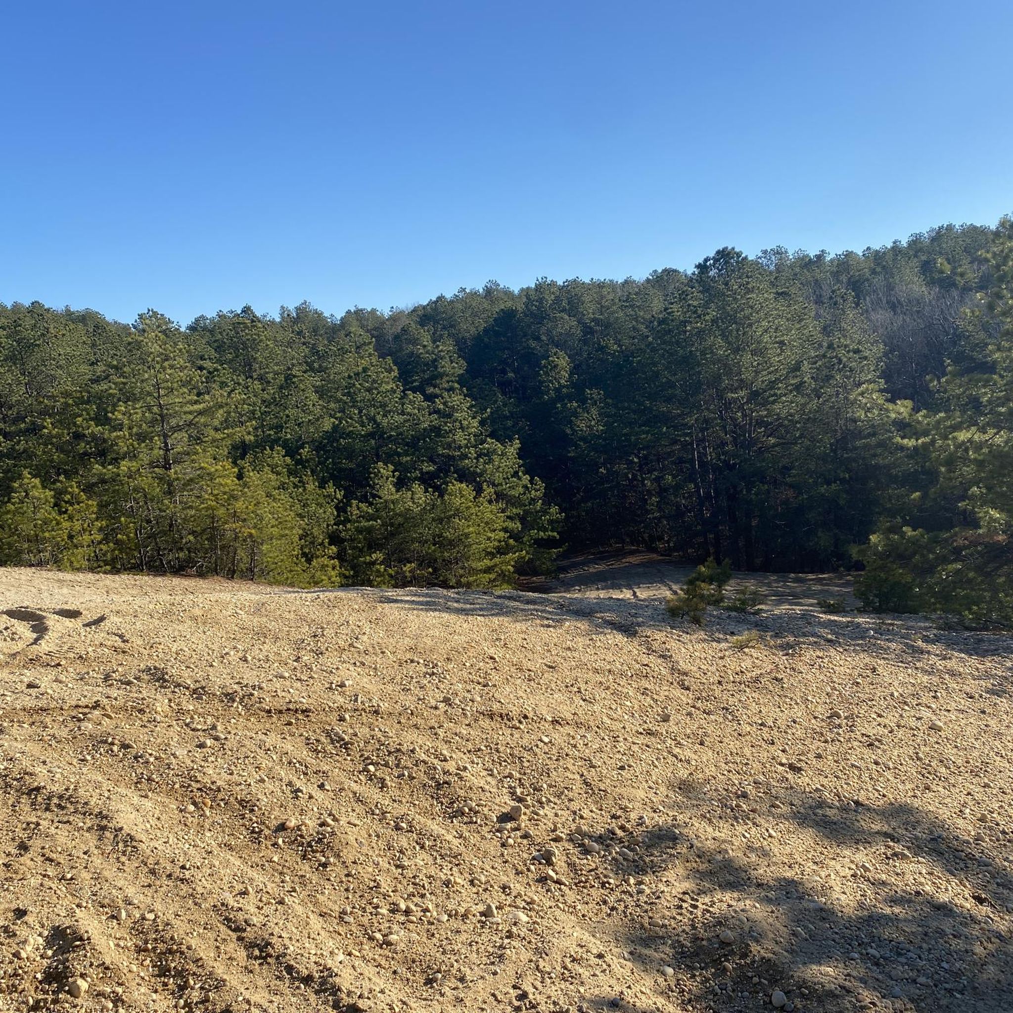
Rocky Point Pine Barrens State Forest offers a unique glimpse into Long Island's history as the former site of RCA's massive radio transmitting center. While most structures have been dismantled, remnants such as concrete tower foundations, old utility poles, and piles of cables serve as reminders of the area's past. The forest itself is crisscrossed with a network of flat trails, some recently created and others dating back to when the site was actively serviced. These well-maintained paths make the area ideal for hiking, biking, and even cross-country skiing during snowy winters.
0
0

Great singletrack, but watch out for hairpin trees, and spiderwebs.
0
0

Leads to the Manorville Main Loop that is a blast to ride! Lots of climbs but never very long, a good workout.
0
0
Frequently Asked Questions
Are dogs allowed in Rocky Point Pine Barrens State Forest?
Yes, dogs are permitted in the state forest, but they must be kept on a leash at all times. The sandy, wide trails are great for walking with your canine companion, but please be mindful of other users like mountain bikers and horseback riders.
Is Rocky Point Pine Barrens State Forest suitable for beginner hikers?
The terrain is mostly flat and the trails are generally wide, which makes it accessible for beginners. However, many of the marked loops are quite long. If you're new to hiking, it's a good idea to start with a shorter out-and-back walk and use a navigation app to track your distance, as the trail network can be confusing.
What are the trail conditions like?
The trails are predominantly sandy and can be loose in some sections, which is characteristic of the pine barrens ecosystem. The terrain is relatively flat with very little elevation change. After heavy rain, some areas can become muddy or have standing water, but the sandy soil allows for quick drainage.
How long are the hiking trails?
Trail lengths vary significantly. You can find shorter walks of just a few miles or combine trails for much longer hikes. For example, the Cathedral Pines County Park loop is a moderate route of about 5.1 miles (8.3 km). Many hikers create their own routes using the extensive network of numbered trails.
Are the trails better for hiking or mountain biking?
The trails are popular for both hiking and mountain biking. The relatively flat, sandy terrain offers a fast ride for bikers, while the extensive network provides hikers with miles of peaceful woodland to explore. Both groups share the trails, so it's important to be aware of your surroundings.
What is the history of the Rocky Point Pine Barrens?
The area has a unique history as the former site of the RCA Radio Central transmitting station, which was once the largest in the world. While hiking, you can still see some historical remnants, such as the large concrete foundations where the radio towers once stood.
What kind of wildlife might I see?
The pine barrens ecosystem supports a variety of wildlife. You may encounter white-tailed deer, various bird species including pine warblers and eastern towhees, and reptiles like the eastern box turtle. The area is a designated Bird Conservation Area, making it a great spot for birdwatching.
What are the numbered signs along the trails for?
The numbered signs are emergency trail rescue markers. In case of an emergency, you can give the number of the nearest sign to 911 dispatchers, which helps them pinpoint your exact location within the vast trail network.
How does hiking here compare to Brookhaven State Park?
Both parks are part of the Long Island Pine Barrens and share a similar landscape of pine and oak forests with sandy trails. Rocky Point is significantly larger and has a more extensive and complex trail network, making it popular for longer hikes and mountain biking. Brookhaven offers a more compact trail system but connects directly to other preserves.
What should I bring for a hike in the Pine Barrens?
It's essential to bring plenty of water, especially in the summer, as the trails are often exposed to the sun. Good footwear is recommended for the sandy paths. Since the trail network is extensive, a reliable GPS device or a map and compass are crucial for navigation. Insect repellent is also advisable during warmer months.
Are there any other activities besides hiking and biking?
Yes, the preserve is a multi-use area. Besides hiking and mountain biking, horseback riding is popular on the designated trails. Seasonal hunting and trapping are also permitted in certain areas, so it's a good idea to wear bright colors during hunting season for safety.
What do other hikers think of the trails here?
The area is highly rated by the komoot community. Reviewers often praise the peacefulness of the vast woodlands and the well-maintained, wide trails that are perfect for both leisurely walks and more strenuous, long-distance hikes.
Most popular routes in Rocky Point Pine Barrens State Forest

Get inspired with the komoot mobile app


Explore more
Browse the best Hikes in other regions.
