The best gravel rides around Askerton
5.0
(3)
32
riders
3
rides
Gravel biking around Askerton offers routes through a landscape characterized by rolling hills, historical sites, and proximity to significant water bodies like Kielder Water. The area features a mix of quiet country lanes, forest tracks, and paths alongside ancient Roman fortifications. This terrain provides varied surfaces suitable for gravel bikes, from compacted gravel to more rugged sections. The region's rural setting ensures a sense of exploration away from busier roads.
Best gravel bike trails around Askerton
- The most popular gravel bike trail is Kielder Dam – Kielder Dam and Reservoir loop from Activity Car Park, a 35.0 miles (56.3 km) trail that takes 3 hours 55 minutes to complete, offering extensive views around the reservoir.
- Another top favourite among local gravel bikers is Hadrian's Wall – Birdoswald Roman Fort loop from Gilsland, a difficult 33.8 miles (54.4 km) path that explores the historic Hadrian's Wall corridor and Roman fort.
- Local gravel bikers also love the Bewcastle Church and Cross – View of Bewcastle Castle loop from Bewcastle School, a 35.2 miles (56.7 km) trail leading through rural landscapes and past historical landmarks, often completed in about 3 hours 53 minutes.
- Gravel biking around Askerton is defined by historical Roman sites, expansive reservoir views, and quiet country roads. The network offers options for different ability levels, including challenging long-distance routes.
- The routes in Askerton are highly rated by the komoot community with an average score of 5.0 stars from over 2 reviews. More than 33 gravel bikers have used komoot to explore Askerton's varied terrain.
Last updated: July 2, 2026
5.0
(1)
7
riders
56.3km
03:55
680m
680m
Hard gravel ride. Very good fitness required. Mostly paved surfaces. Suitable for all skill levels.
5.0
(1)
12
riders
54.4km
03:32
630m
630m
Hard gravel ride. Very good fitness required. Mostly paved surfaces. Suitable for all skill levels.

Sign up for free
5.0
(1)
7
riders
Hard gravel ride. Very good fitness required. Mostly paved surfaces. Suitable for all skill levels.
3
riders
Moderate gravel ride. Good fitness required. Mostly paved surfaces. Suitable for all skill levels.
3
riders
23.8km
01:45
410m
410m
Moderate gravel ride. Good fitness required. Mostly paved surfaces. Suitable for all skill levels.
Our route recommendations are based on thousands of hikes, rides, and runs completed by other people on komoot.
Start today with a free account
Your next adventure awaits.
Login or Signup
Tips from the Community

At this small sacred monument, there are several reasons why cyclists should not pass by carelessly, but should linger for a moment: Firstly, the church, together with the surrounding cemetery and the 'Bewcastle Cross' standing on the grounds, form a very harmonious unit. Secondly, when contemplating this cross, one looks far back into history, as its creation is dated to the 7th or 8th century. Thirdly, however – and mainly (!) – the artistic design of the obelisk, which rises to about the lower eaves of the church roof, tapering slightly upwards, is extremely noteworthy ('Amy' and 'Joe' have already described this in their contributions). My personal conclusion: Although the actual cross, which once crowned the obelisk, has long been missing, it is still a noteworthy small sacred monument!
0
0

Well, we got here nearly at the end of our Hadrian's Wall hike for the day and had a bit of bad luck. Fancy turning up at one of the best Roman forts on Hadrian's Wall to be told it was closed because the wind was too strong and it might blow us off the wall. A place to come back to.
0
0

St Cuthbert Bewcastle Church stands on the foundations of a Roman fort and has roots dating back to the 13th century. Although the current building largely dates from the 18th and 19th centuries, parts of the east chancel are still medieval. The church exudes simplicity and tranquility, with a rectangular plan and a wooden gallery on the west side. Within the church, traces of the Border Reivers' turbulent history can be found, including gravestones bearing names like Armstrong and Routledge.
8
0
Bewcastle Fort (Latin: Fanum Cocidi) was a Roman fort in the English town of Bewcastle. The fort lay north of Hadrian's Wall and was connected by a road (Maiden Way) to the Banna (Birdoswald) fort on the wall. The fort's Latin name (The Shrine of Cocidius) indicates that it enclosed an existing local shrine. The Romans equated the deity Cocidius with Mars, and the fort was possibly built there to control tribal gatherings. In the second century, the Cohors I Dacorum mil. eq. (a mixed cohort with infantry and cavalry in dual garrisons, with auxiliaries from Dacia) was stationed there. A dual garrison cohort was also likely stationed there in the third century. By 400, before Hadrian's Wall was abandoned, Bewcastle Fort had already been abandoned. Around 1092, Bewcastle Castle was built in a corner of the former fortress, using Roman stone. The church of St. Cuthbert is also located within the old fortress walls.
7
0
You don't see much here, but the trail is nice and the scenery is picturesque.
11
0
Here you can once again take picturesque shots. The trail meanders along the beautiful beach.
12
0
On a strategic rise above the River Irthing lies Birdoswald Roman Fort (Banna), one of the best-preserved forts along Hadrian's Wall. Built around 122 AD, it housed troops from countries including Dacia (modern-day Romania) and played a key role in defending the northwestern border of the Roman Empire. The fort lies on the longest continuous stretch of Hadrian's Wall still visible. Within the ruins, you'll find the remains of barracks, granaries, gates, and even a unique Roman drill hall. The visitor center offers interactive exhibits and original artifacts, including altars and inscriptions. Birdoswald is an ideal rest stop for cyclists following the Hadrian's Cycleway. The tearoom and the view make it a pleasant stop with historical depth.
12
0
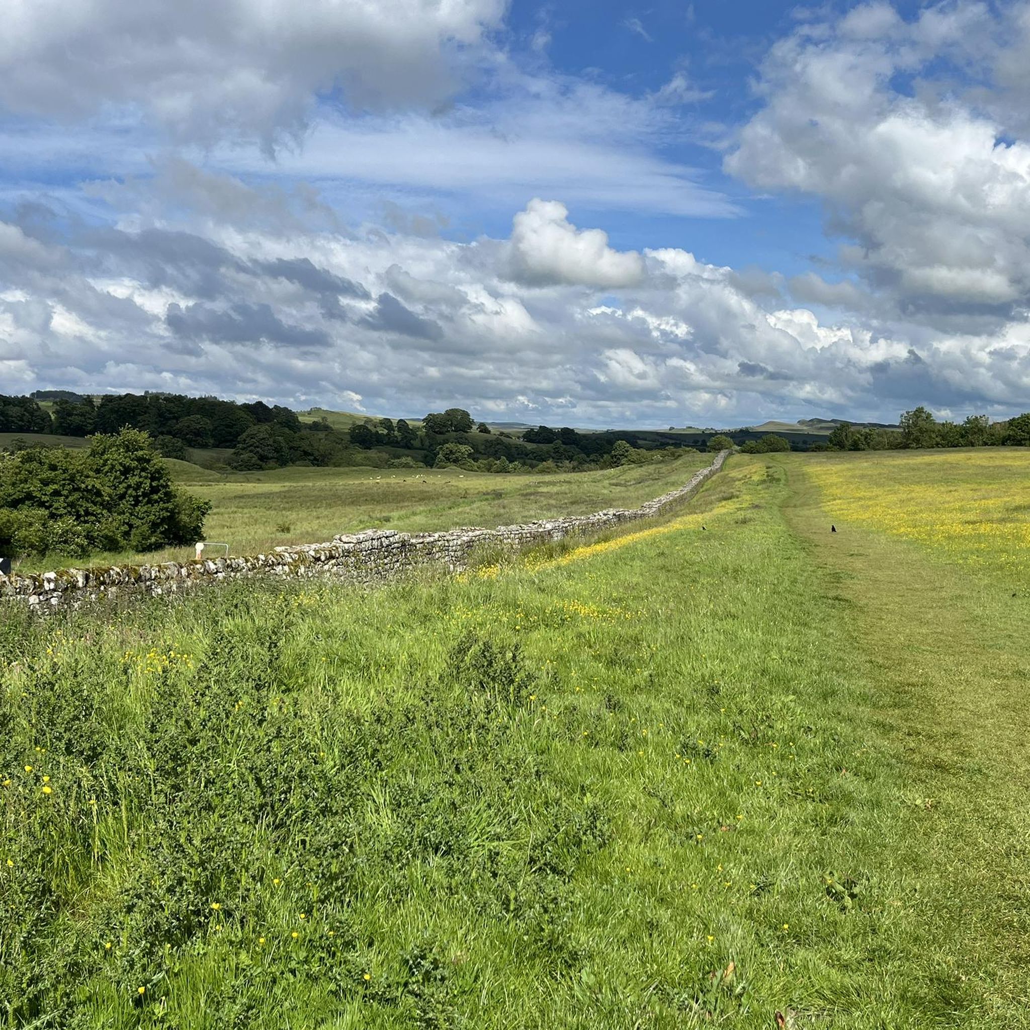
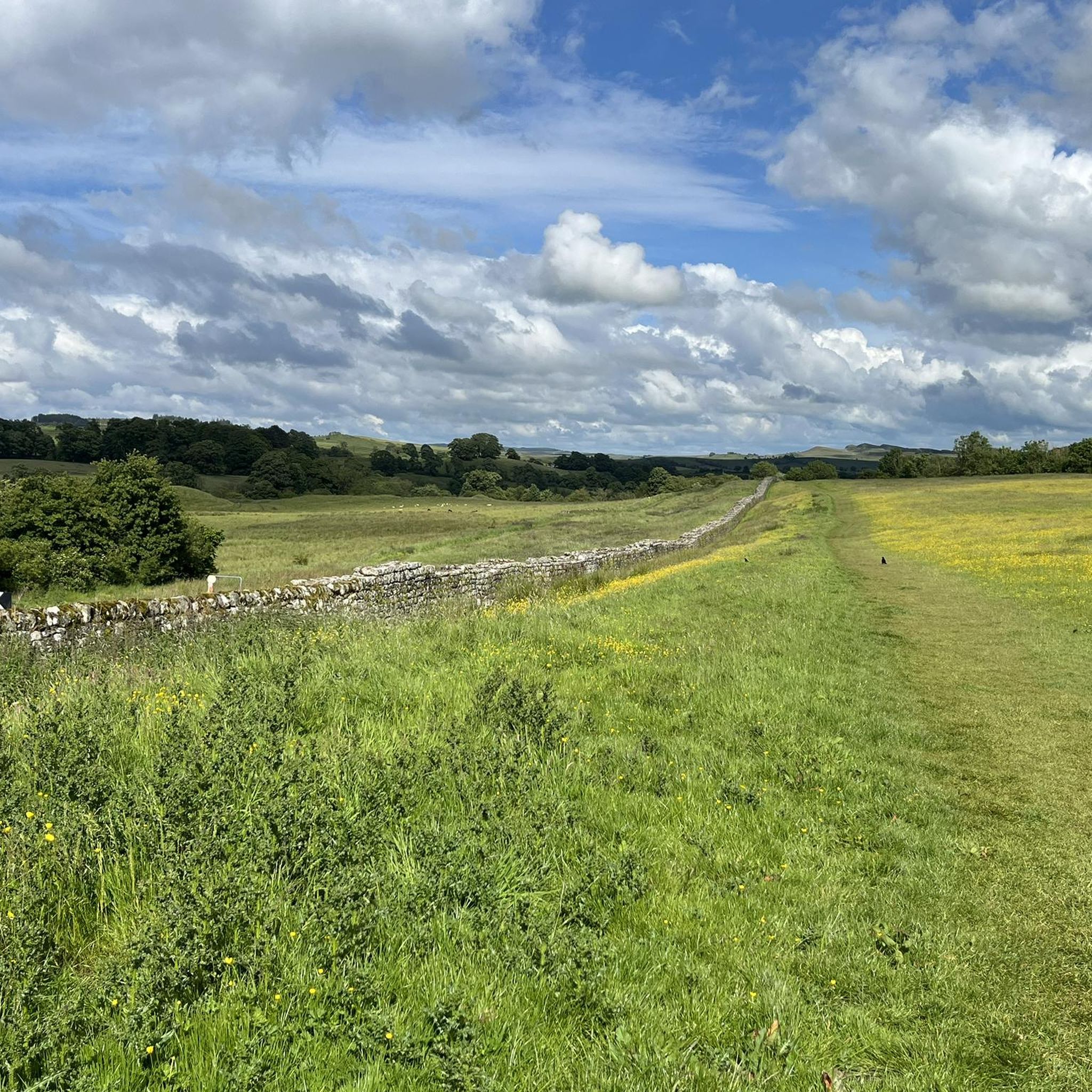
Hadrian's Wall was a 117 km long defensive wall built from 122 AD under Emperor Hadrian as the northwestern border of the Roman Empire. The wall ran from the Tyne to the Solway Firth, its central section following the natural ridge of the Whin Sill, a hard dolerite geological formation. This location offered Roman troops a tactical advantage: high ground with wide visibility and natural defenses. The wall served to control movement, delay incursions, and demonstrate Roman power. Here, next to Birdoswald Fort, you'll find the longest remaining section of the historic wall.
11
0
Frequently Asked Questions
How many gravel bike trails are available around Askerton?
There are five gravel bike trails detailed for the Askerton area, offering a range of experiences from moderate to difficult. These routes explore the region's unique blend of historical sites, expansive reservoir views, and quiet country roads.
What is the general difficulty level of gravel biking trails near Askerton?
The gravel biking trails around Askerton primarily feature moderate to difficult ratings. For instance, routes like Kielder Dam – Kielder Dam and Reservoir loop from Activity Car Park and Hadrian's Wall – Birdoswald Roman Fort loop from Gilsland are considered difficult, while the Kielder Water Lakeside Trail – Bull Crag Peninsula loop from Activity Car Park offers a moderate challenge.
Are there any circular gravel bike routes in the Askerton area?
Yes, all the featured gravel bike routes around Askerton are circular. Examples include the Bewcastle Church and Cross – View of Bewcastle Castle loop from Bewcastle School, which takes you through rural landscapes and past historical landmarks, and the Kielder Dam – Kielder Dam and Reservoir loop from Activity Car Park, offering extensive reservoir views.
What historical sites or landmarks can I see along the gravel bike trails?
The Askerton area is rich in history. Many routes pass by significant landmarks such as Hadrian's Wall, Thirlwall Castle Ruins, and Lanercost Priory. The Hadrian's Wall – Birdoswald Roman Fort loop from Gilsland specifically explores the historic Roman corridor.
Are there any viewpoints or scenic spots along the gravel bike routes?
Absolutely. The routes often provide expansive views, particularly around Kielder Water. The Kielder Dam – Kielder Dam and Reservoir loop from Activity Car Park offers extensive views around the reservoir. You can also find scenic spots like Freya's Cabin (Kielder Water), which provides excellent vistas.
What do other gravel bikers enjoy most about the Askerton trails?
The komoot community highly rates the Askerton trails, with an average score of 5.0 stars. Riders frequently praise the varied terrain, the sense of exploration away from busier roads, and the combination of historical sites with natural beauty, especially around Kielder Water and Hadrian's Wall.
Are there any family-friendly gravel biking options near Askerton?
While many routes are rated moderate to difficult, the Kielder Water Lakeside Trail – Bull Crag Peninsula loop from Activity Car Park is a moderate option that might be suitable for families with some gravel biking experience, offering a shorter distance and scenic lakeside views.
What kind of terrain can I expect on gravel bike trails in Askerton?
The terrain around Askerton is diverse, featuring a mix of quiet country lanes, forest tracks, and paths alongside ancient Roman fortifications. You'll encounter varied surfaces, from compacted gravel to more rugged sections, all set within a landscape of rolling hills and proximity to Kielder Water.
Are there any lakes or water bodies to explore near the gravel routes?
Yes, the region is close to significant water bodies. Kielder Water is a prominent feature, with routes like the Kielder Dam – Kielder Dam and Reservoir loop from Activity Car Park offering extensive views of the reservoir. You can also find Talkin Tarn Lake nearby, which is another beautiful natural monument.
What is the best time of year for gravel biking around Askerton?
Gravel biking around Askerton can be enjoyed through much of the year. Spring and autumn offer pleasant temperatures and vibrant scenery. While winter riding is possible, be prepared for potentially wetter and colder conditions on the trails, especially on more exposed sections or forest tracks.
Are there any cafes or places to stop for refreshments near the gravel trails?
While specific cafes directly on every trail are not listed, routes often start or pass near villages like Gilsland or Bewcastle, where you may find local amenities. For routes around Kielder Water, there are facilities and cafes available at the Kielder Water & Forest Park visitor centers.
Is there parking available for gravel biking routes in Askerton?
Yes, routes typically start from locations with parking. For example, the Kielder Dam – Kielder Dam and Reservoir loop starts from Activity Car Park, and the Bewcastle Church and Cross – View of Bewcastle Castle loop begins near Bewcastle School, implying accessible starting points for vehicles.
Can I access any gravel bike routes near Askerton using public transport?
While Askerton itself is a rural area, some starting points for routes, such as Gilsland for the Hadrian's Wall – Birdoswald Roman Fort loop, may be accessible via local bus services. It's advisable to check local public transport schedules and routes in advance for specific connections to trailheads.
Most popular attractions around Askerton

Get inspired with the komoot mobile app


Explore more
Browse the best Gravel rides in other regions.
