The best gravel rides in Eleonorenwald
4.4
(33)
90
riders
6
rides
Gravel biking in Eleonorenwald offers an extensive network of forestry roads within the largest contiguous forest in Northwest Lower Saxony. The region features a generally flat and undulating geest landscape with diverse forest compositions, including conifer mixed forests and old oak grazing forests. The Marka river meanders through its lowland, creating varied terrain with soft ground. This landscape provides accessible riding conditions, with many routes incorporating significant gravel sections alongside paved and unpaved surfaces.
Best gravel bike trails in Eleonorenwald
…Last updated: July 3, 2026
4.3
(12)
19
riders
Easy gravel ride. Great for any fitness level. Mostly paved surfaces. Suitable for all skill levels.
4.0
(7)
27
riders
Moderate gravel ride. Good fitness required. Mostly paved surfaces. Suitable for all skill levels.

Sign up for free
4.2
(6)
19
riders
Easy gravel ride. Great for any fitness level. Mostly paved surfaces. Suitable for all skill levels.
5.0
(3)
16
riders
9.85km
00:41
20m
20m
Easy gravel ride. Great for any fitness level. Mostly paved surfaces. Suitable for all skill levels.
4.4
(5)
9
riders
Easy gravel ride. Great for any fitness level. Mostly paved surfaces. Suitable for all skill levels.
Our route recommendations are based on thousands of hikes, rides, and runs completed by other people on komoot.
Start today with a free account
Your next adventure awaits.
Login or Signup
Tips from the Community

You don't need to go far to enjoy the wonderful sight of the purple flowers. In the summer, the heather also blooms colorfully in the Thülsfelder Talsperre recreational area.
1
0
On the west side of the dam stretches one of Lower Saxony's large heathlands, covering an area of over 68 hectares. The area and its surroundings have been a nature reserve since 1938 and also an FFH (Flora-Fauna-Habitat) area since 2000. By the way: The heath bloom at the reservoir is thanks to around 220 sheep and 70 goats that graze daily in the heath all year round, thus preventing the heath from becoming overgrown with bushes. Source: https://www.thuelsfelder-talsperre.de/ausflugsziele/heidefl%C3%A4chen-an-der-th%C3%BClsfelder-talsperre/119951
1
0
Beautiful long wooden bridge, which leads across the Great Lagoon on the west side of the lake.
1
0

The Große Tredde is a scenic, wooded dune belt and part of the protected heathland directly on the reservoir. It is located on the northwestern shore near the village of Dwergte (Molbergen). Here you will find the striking Orkanstein, which commemorates the great storm catastrophe of 1972. The area can be explored excellently via the "Waldlehr- und Erlebnispfad Dwergter Sand" (Forest Education and Experience Trail Dwergter Sand).
0
0
In the south of the municipal area (Petersfeld) lies the Thülsfelder Talsperre recreation area, with the reservoir covering 150 hectares of water surface, inviting hotels, a youth hostel, a golf course, and large campsites with a total of 1200 individual pitches. Awareness of the local animal and plant world is opened up by an educational trail around the reservoir. Source: https://www.garrel.de/portal/seiten/thuelsfelder-talsperre-908000027-24300.html
1
0

The heathlands and moors at the Thülsfelder Talsperre reservoir are crisscrossed by varied paths through open heath landscapes, quiet moorland areas, and shady forest sections. And every now and then you'll see one of the old, thatched sheepfolds – a beautiful photo opportunity.
1
0
The Thülsfelder Talsperre is particularly worthwhile because of the well-developed circular path directly on the water. If you want more distance, you can combine the route with paths through the surrounding forest and moorland landscape. Particularly pleasant: it is often quieter on the paths in the early morning or during the week.
1
0

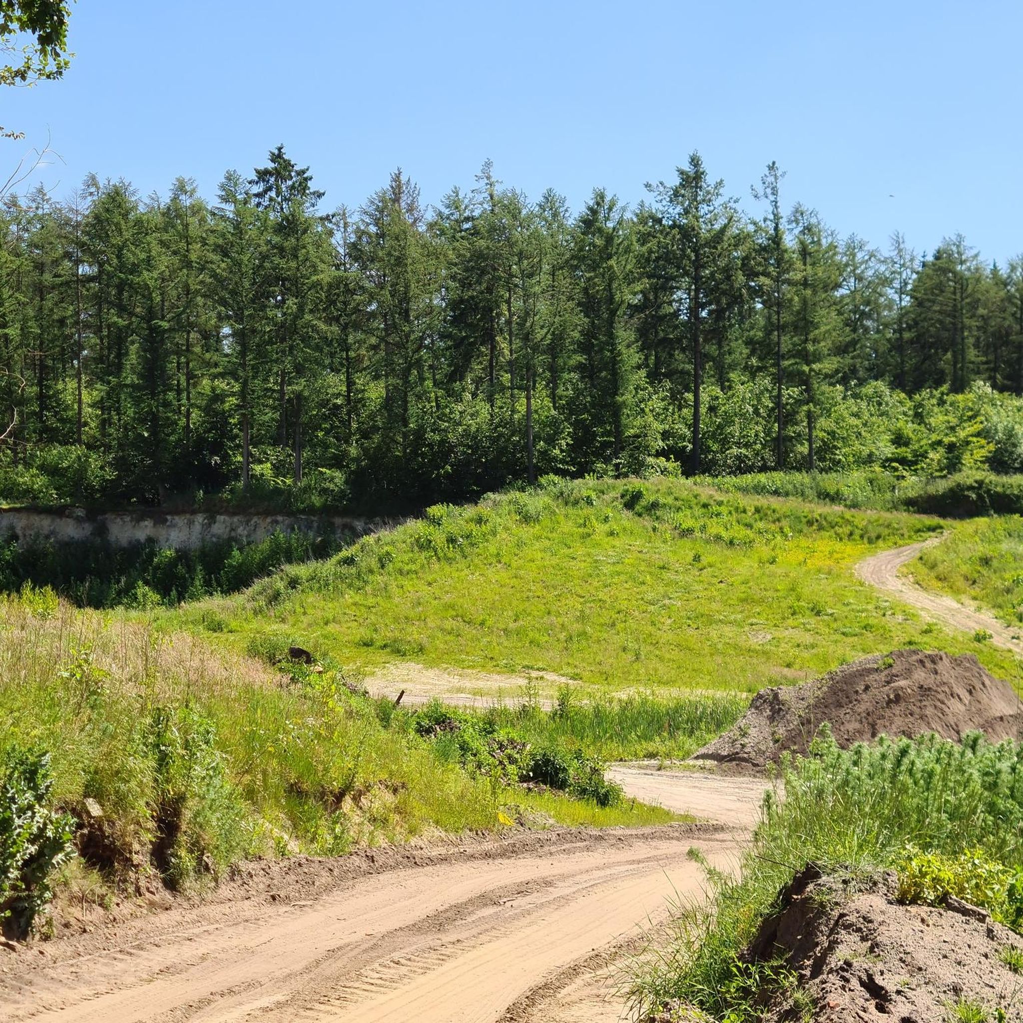
A very well-developed cycle path through the middle of the forest.
1
0
Frequently Asked Questions
How many gravel bike trails are available in Eleonorenwald?
Eleonorenwald offers a network of over 150 kilometers of forestry roads, with komoot featuring 9 distinct gravel bike routes. These range from easy to difficult, ensuring options for various skill levels.
Are there any easy gravel bike routes suitable for beginners or families?
Yes, Eleonorenwald has several easy routes. For a pleasant, shorter ride, consider the Große Tredde Forest Path – Beach at the Thülsfelder Reservoir loop from Dwergte, which is 16.9 km long and takes about 53 minutes. Another easy option is the Beach at the Thülsfelder Reservoir loop from Cloppenburg district, covering 9.8 km.
What kind of terrain can I expect on the gravel bike trails in Eleonorenwald?
The trails primarily consist of extensive forestry roads, with many routes incorporating significant gravel sections. The landscape is generally flat and undulating geest, making for accessible riding. While some sections may be uneven, the overall experience is described as pleasant and quiet. You'll encounter diverse forest compositions, including conifer mixed forests and rare old oak grazing forests, as well as soft ground along the Marka river in the Markatal Nature Reserve.
Are there any challenging gravel bike routes for experienced riders?
For experienced riders seeking a challenge, the Soeste Riverside Trail in Cloppenburg – Soeste Riverside Path loop from Wanderparkplatz Große Tredde is a difficult 44.4 km route that follows the Soeste river, offering varied riverside terrain. Another option is the Soeste Riverside Path – Petersfelder Weg Forest Path loop from Parkplatz Kletterwald Nord, a 36.8 km trail through forest and along the river.
What are some interesting natural features or landmarks to look out for along the trails?
Eleonorenwald is rich in natural beauty and historical sites. You can explore the Markatal Nature Reserve, where the Marka river meanders untouched. Keep an eye out for the Eleonorenhöhe Carved Stone, an elevated point with intriguing markings. In the northwestern part of the forest, Langenberg hosts a former baroque hunting star, a historical site where eight forest paths converge.
Are there places to rest or take a break along the gravel routes?
Yes, Eleonorenwald is well-equipped with amenities for cyclists. You'll find several shelters and resting huts strategically placed throughout the forest, such as the Waldesruh Shelter and the Eleonorenwald Rest Area, offering convenient spots for breaks in all weather conditions. Some rest stops are even equipped with basic bike repair tools and pumps.
What do other gravel bikers say about Eleonorenwald?
The gravel biking routes in Eleonorenwald are highly rated by the komoot community, with an average score of 4.5 stars from over 30 reviews. Many visitors praise the extensive network of forestry roads, the quiet natural environment, and the diverse landscapes that make for an enjoyable riding experience.
Are there any circular gravel bike routes in Eleonorenwald?
Yes, many of the gravel bike routes in Eleonorenwald are designed as loops. For example, the popular Große Tredde Forest Path – Beach at the Thülsfelder Reservoir loop from Dwergte is a circular route that explores the forest's interior. Another option is the Sheep pen in the heath – Beach at the Thülsfelder Reservoir loop from Wanderparkplatz Talsperre-Nord, which is a 10.5 km loop.
What is the best time of year to go gravel biking in Eleonorenwald?
Eleonorenwald offers accessible riding conditions throughout much of the year due to its generally flat and undulating landscape. Spring and autumn are particularly pleasant for gravel biking, with mild temperatures and beautiful foliage. However, the extensive forestry roads are suitable for riding in most seasons, though some sections might be uneven after heavy rain.
Where can I find parking for gravel biking in Eleonorenwald?
Many routes start from designated parking areas. For instance, the challenging Soeste Riverside Trail in Cloppenburg – Soeste Riverside Path loop begins from Wanderparkplatz Große Tredde. Another route, the Soeste Riverside Path – Petersfelder Weg Forest Path loop, starts from Parkplatz Kletterwald Nord. These starting points typically offer convenient parking for cyclists.
Most popular routes in Eleonorenwald
Most popular attractions in Eleonorenwald

Get inspired with the komoot mobile app


Explore more
Browse the best Gravel rides in other regions.
