The best gravel rides around Brownsville
4.7
(20)
85
riders
6
rides
Gravel biking around Brownsville, Texas, offers diverse terrain, from former river channels known as resacas to a mix of paved, rough road, gravel, and dirt sections. The region's unique natural features include lush, semi-tropical environments with dense woodlands. Routes wind alongside natural features and through areas with unique ecosystems, providing varied landscapes for cyclists.
Best gravel bike trails around Brownsville
- The most popular gravel bike trail is Shepherdstown – Antietam Aqueduct loop from Dargan, a 50.1 miles (80.6 km)…
Last updated: July 11, 2026
4.8
(9)
18
riders
26.3km
01:49
40m
40m
Easy gravel ride. Great for any fitness level. Mostly paved surfaces. Suitable for all skill levels.
19
riders
85.6km
04:46
890m
900m
Hard gravel ride. Very good fitness required. Mostly paved surfaces. Suitable for all skill levels.

Sign up for free
4.7
(7)
10
riders
27.9km
02:21
100m
100m
Moderate gravel ride. Good fitness required. Mostly paved surfaces. Suitable for all skill levels.
5.0
(2)
29
riders
111km
08:02
390m
390m
Hard gravel ride. Very good fitness required. Mostly paved surfaces. Suitable for all skill levels.
Get access to more routes and recommendations from other explorers.
Sign up for free
Already have an account?
Our route recommendations are based on thousands of hikes, rides, and runs completed by other people on komoot.
Start today with a free account
Your next adventure awaits.
Login or Signup



Tips from the Community

One of my favorite rides! The trail is well maintained and smooth. So many spots to rest and take breathtaking pics
1
0

28 Sept 2025: staircase closed as they rebuild it
0
0

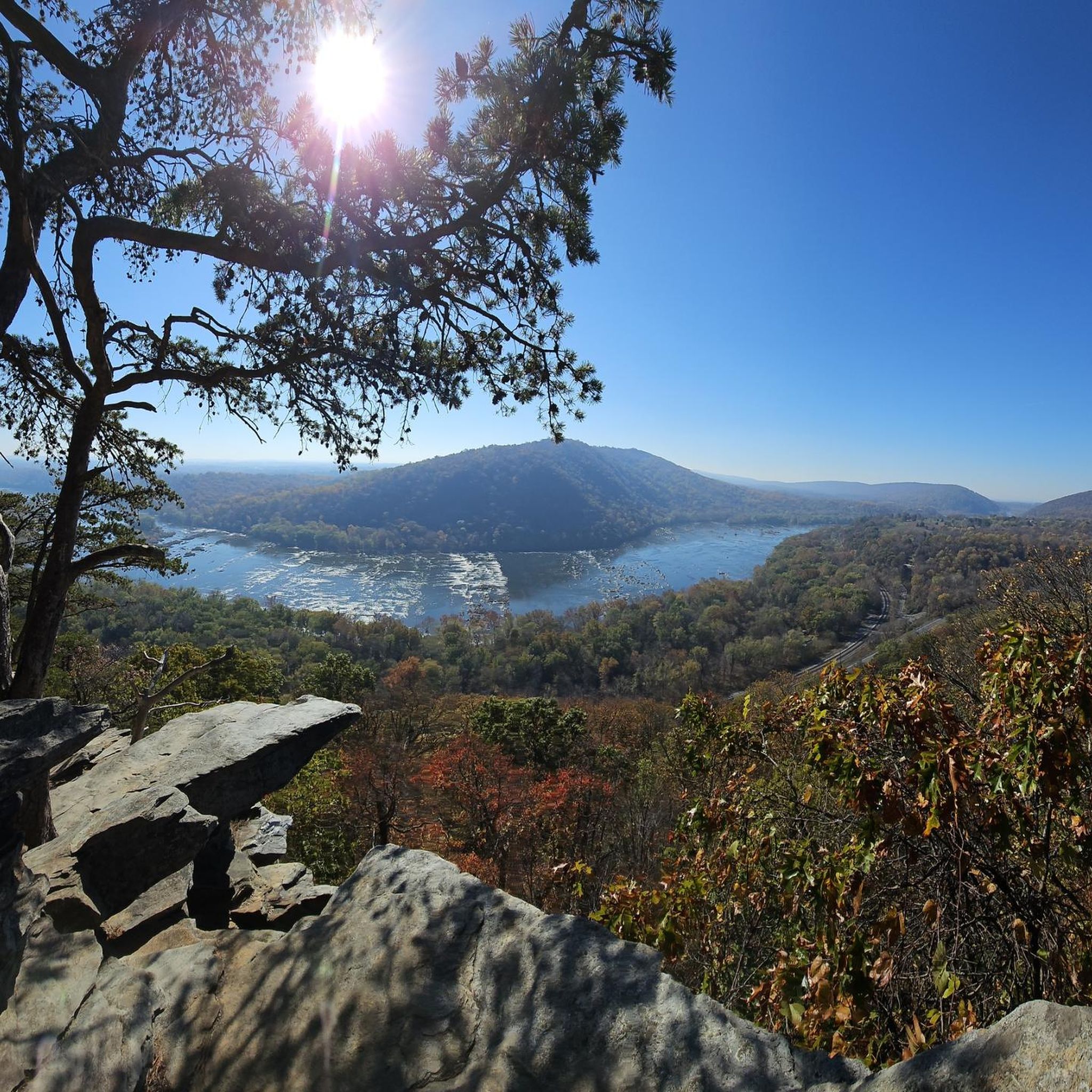
A paved elevated boardwalk stretches out along the water, giving you a fantastic view of the Potomac River. This spot can get pretty popular on summer weekends.
0
0

Purcellville, at the end of the rail line, has great places to stop. Monk's BBQ is fantastic and easy, and if you want to simply spend more time you can take the distillery tour at the Catoctin Creek Distilling Company (makers of great rye and other spirits). They town has also kept the old downtown shopping area straight out of the 1940s, which is great to see.
1
0

Unique coffee shop, café and bakery. Excellent food and drinks. check online for their hours.
0
0
to get from trail to Harper's Ferry, you have to go up these stairs. There are bike racks at the base, or you carry your bike up with you
0
0

The Potomac River has a mix of flatwater and whitewater, visible as you pedal along the C&O Canal bike trail; this is a great spot to stop and watch some of those rapids.
0
0

From this spot near McMahon’s Mill, you get great views of Big Slackwater. McMahon’s Mill used a steel wheel in the early 20th century to generate electricity. The mill closed in 1922 after a flood but was later restored by the National Park Service. Downstream from McMahon’s Mill, Big Slackwater marks where canal boats entered the Potomac River, avoiding the rocky cliffs by using pools behind Dam 4 and Dam 5. In 1996, flooding damaged the towpath, making this section impassable for over 15 years. Reconstruction began in 2010, and by 2012, the missing towpath section was restored, allowing visitors to travel the entire 184.5 miles of the C&O Canal once again.
0
0
Frequently Asked Questions
What kind of terrain can I expect on gravel bike trails in Brownsville?
Brownsville's gravel bike trails offer a diverse mix of surfaces, including former river channels known as resacas, along with paved, rough road, gravel, and dirt sections. You'll encounter varied landscapes, from unique ecosystems to areas winding alongside natural features.
Are there any challenging gravel routes for experienced riders?
Yes, Brownsville offers several challenging routes. For instance, the Shepherdstown – Antietam Aqueduct loop from Dargan is a difficult 50.1-mile (80.6 km) trail with an elevation gain of 1,097 feet (334 meters). Another difficult option is the Morven Park – Morven Park loop from Brunswick, spanning 53.1 miles (85.4 km).
What are some moderate gravel biking options in the Brownsville area?
For a moderate ride, consider the Ferry Hill – Antietam Aqueduct loop from Harpers Ferry, which is 26.8 miles (43.1 km) long with an elevation gain of 545 feet (166 meters). Another moderate option is the Huckleberry Hill Campsite – Beach access loop from Brunswick, a 26.7-mile (43 km) route.
What natural features can I see while gravel biking in Brownsville?
Brownsville is characterized by its 'resacas,' which are former Rio Grande channels now forming oxbow lakes and wetlands, offering picturesque routes and wildlife viewing. You can also explore areas like the Sabal Palm Sanctuary, preserving native Sabal palm forests, and Resaca de la Palma State Park, known for its diverse bird species and lush landscapes.
Are there any specific trails that highlight Brownsville's history or culture?
Yes, the Brownsville Historic Battlefield Trail is a 9-mile route that connects the Palo Alto Battlefield through the city to the Mitte Cultural District. This trail offers a scenic way to experience South Texas's natural environment while passing through historically significant areas.
What is the best time of year to go gravel biking in Brownsville?
Brownsville's subtropical climate allows for year-round gravel biking. However, the cooler, drier months from late fall to early spring (roughly November to April) are generally preferred for more comfortable riding conditions, avoiding the peak summer heat and humidity.
What do other gravel bikers say about the trails in Brownsville?
The gravel biking routes in Brownsville are highly rated by the komoot community, with an average score of 4.5 stars from over 17 reviews. Riders often praise the diverse terrain and the opportunity to explore the unique natural environment of South Texas.
Are there any parks with dedicated biking trails in Brownsville?
Yes, Monte Bella Park features approximately 6.2 miles of mountain biking trails, primarily dirt and single-track, suitable for an immersive experience with local flora and fauna. Pedro Benavides County Park also offers trails, including 'Trail Dos,' which is a family-friendly gravel path.
Where can I find more information about Brownsville's general trail system?
For broader information on Brownsville's extensive trail network, including paved hike and bike trails like the Paseo de la Resaca System, you can visit the city's official trails page: brownsvilletx.gov/1711/Brownsville-Trails.
What is the longest gravel bike route available in the guide for Brownsville?
The longest route featured in this guide is the Morven Park – Morven Park loop from Brunswick, which covers 53.1 miles (85.4 km) and typically takes around 4 hours 52 minutes to complete.
Are there any gravel routes that offer significant elevation changes?
Yes, some routes provide notable elevation. The Morven Park – Morven Park loop from Brunswick has an elevation gain of 933 feet (284 meters), and the Shepherdstown – Antietam Aqueduct loop from Dargan features an elevation gain of 1,097 feet (334 meters).
Can I find any gravel routes that are loops?
Many of the gravel routes in the Brownsville area are designed as loops. Examples include the Shepherdstown – Antietam Aqueduct loop from Dargan, the Ferry Hill – Antietam Aqueduct loop from Harpers Ferry, and the Big Slackwater – Big Slackwater View loop from Dargan.
Most popular routes around Brownsville
Most popular attractions around Brownsville

Get inspired with the komoot mobile app


Explore more
Browse the best Gravel rides in other regions.
