The best gravel rides around San Gabriel
5.0
(1)
62
riders
10
rides
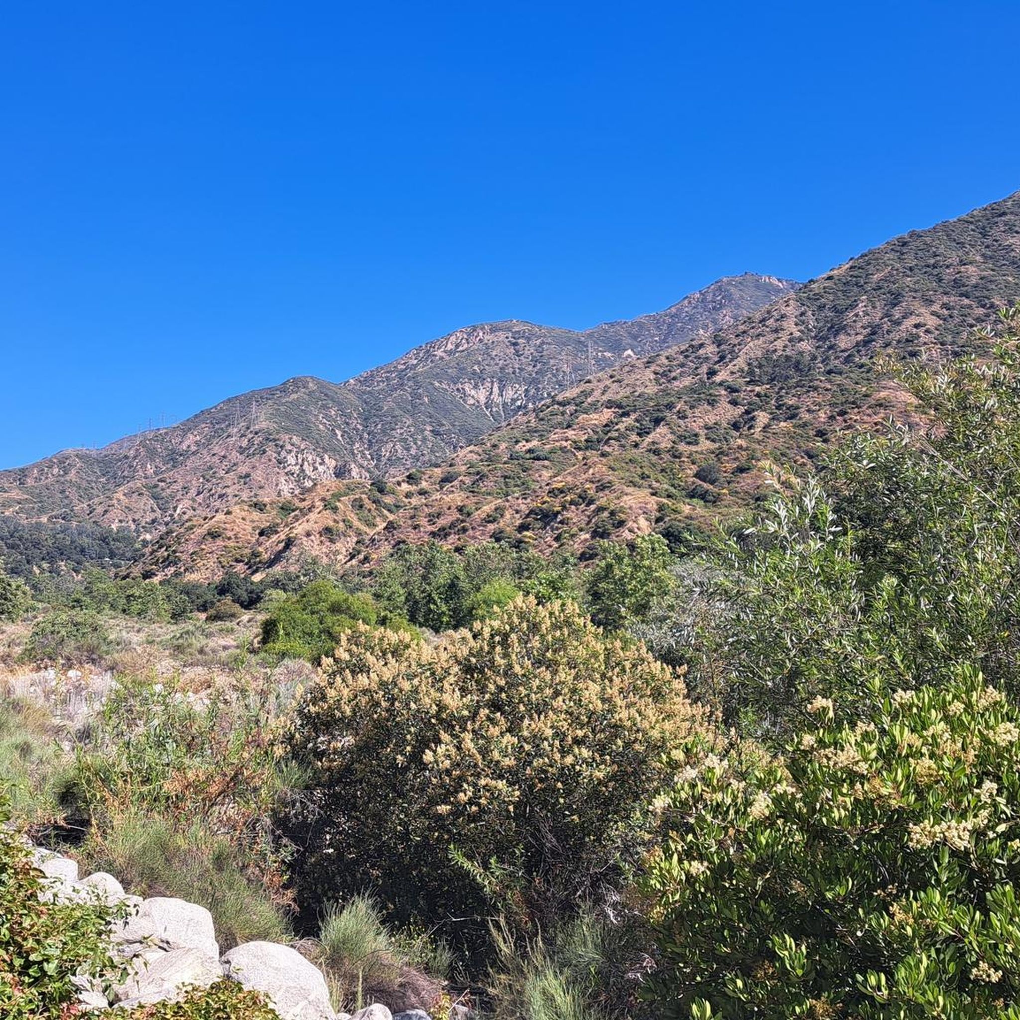
Gravel biking around San Gabriel offers diverse landscapes across the San Gabriel Mountains National Monument, characterized by extensive fire roads and mountain trails. The region features varied terrain, from high alpine environments to canyons, providing a wide array of options for cyclists. Significant elevation gains are common, with routes traversing natural features like the San Andreas Fault and offering panoramic views.
Best gravel bike trails around San Gabriel
- The most popular gravel bike trail is Verdugo Peak – Brookside Park loop from South Pasadena, a 38.0 miles (61.2 km) trail that takes 5 hours 23 minutes to complete. This difficult route features significant elevation gain and challenging gravel sections.
- Another top favourite among local gravel bikers is Turnbull Canyon – Turnbull Debris Basin loop from Rose Hills, a difficult 21.0 miles (33.7 km) path. This route offers a challenging experience for experienced gravel riders through varied canyon terrain.
- Local gravel bikers also love the Pasadena Historic City Hall – View from Mount Lukens loop from Memorial Park, a 32.2 miles (51.8 km) trail leading through mountainous terrain with substantial climbing, often completed in about 5 hours 26 minutes.
- Gravel biking around San Gabriel is defined by extensive fire roads, challenging mountain trails, and diverse canyon landscapes. The network offers options for various ability levels, though many routes feature significant climbs.
- The routes in San Gabriel are highly rated by the komoot community with an average score of 5.0 stars from a few reviews. More than 40 gravel bikers have used komoot to explore San Gabriel's varied terrain.
Last updated: June 29, 2026
5.0
(1)
17
riders
46.7km
04:38
1,710m
1,710m
Hard gravel ride. Very good fitness required. Mostly paved surfaces. Suitable for all skill levels.
11
riders
53.0km
03:51
1,060m
1,060m
Hard gravel ride. Very good fitness required. Mostly paved surfaces. Suitable for all skill levels.

Sign up for free
4
riders
32.8km
03:06
890m
890m
Hard gravel ride. Very good fitness required. Mostly paved surfaces. Suitable for all skill levels.
5
riders
53.6km
04:51
1,460m
1,460m
Hard gravel ride. Very good fitness required. Mostly paved surfaces. Suitable for all skill levels.
1
riders
66.0km
05:38
1,680m
1,680m
Hard gravel ride. Very good fitness required. Mostly paved surfaces. Suitable for all skill levels.
Get access to more routes and recommendations from other explorers.
Sign up for free
Already have an account?
Our route recommendations are based on thousands of hikes, rides, and runs completed by other people on komoot.
Start today with a free account
Your next adventure awaits.
Login or Signup


Tips from the Community

Short tunnel on the eastern slope below San Gabriel Peak, part of the old Mt Lowe Motorway, that was never paved. The tunnel is very short, so you don't have to worry about bringing light. The road continues to the trailhead half a mile uphill.
0
0


Just below the Mt Wilson Trailhead on Red Box Road, this overlook and memorial is a perfect place to pause. Sit and take in sweeping views of the San Gabriel Valley, and read the memorial plaque honoring early conservation efforts.
0
0
Henninger Flats sits along the road with views of Altadena. You’ll pass by it while climbing the Mt. Wilson Toll Road and can take a moment to catch your breath while enjoying the views. The route features a steady climb with minimal shade, so it’s best to start early, especially in summer. At the top, enjoy panoramic views of the San Gabriel Valley and explore the area, which includes a visitor center, picnic spots, and a tree nursery.
0
0

There are lots of vintage shops and cafes in the historic downtown. Library Park is a great place to rest in the shade with a bite to eat before continuing your ride.
0
0
This tunnel was blasted into existence in 1942 to form the old Mount Lowe Motorway.
0
0

Old Town Monrovia is a 10‑block historic district centered on Myrtle Avenue, that has brick‑lined sidewalks, vintage lampposts, and boutique shops.
0
0
Monrovia Recreation Park is 22 acres and has playgrounds, picnic shelters, and restrooms. It is a good spot for a break in the shade and some water.
0
0
Frequently Asked Questions
How many gravel bike trails are there in San Gabriel?
There are currently 9 gravel bike trails around San Gabriel listed in this guide. These routes primarily feature challenging terrain with significant elevation gains, catering to experienced riders.
What is the best time of year for gravel biking in San Gabriel?
San Gabriel offers excellent gravel biking opportunities year-round due to its consistent Southern California weather and sunny skies. However, be aware that higher elevations in the San Gabriel Mountains can experience snow during winter months.
Are there any family-friendly or easy gravel bike routes in San Gabriel?
The gravel routes listed in this guide for San Gabriel are generally considered difficult, featuring substantial elevation gains and challenging sections. For easier options, you might explore parts of the San Gabriel River Bike Trail, which offers more relaxed, sometimes paved, sections suitable for a family outing, though these are not specifically gravel-focused in this guide.
What kind of terrain can I expect on San Gabriel gravel bike trails?
Gravel biking in San Gabriel primarily involves extensive fire roads and mountain trails within the San Gabriel Mountains National Monument. You can expect diverse landscapes, from high alpine environments to canyons, with significant elevation changes and panoramic views. Routes often blend road and mountain biking on unpaved surfaces.
Are there any circular gravel bike routes in San Gabriel?
Yes, many of the gravel routes in San Gabriel are designed as loops. For example, the Verdugo Peak – Brookside Park loop from South Pasadena and the Turnbull Canyon – Turnbull Debris Basin loop from Rose Hills are popular circular options, offering challenging rides through varied terrain.
What are some notable landmarks or viewpoints I can see along the gravel trails?
The San Gabriel Mountains offer breathtaking scenery. Routes like the Pasadena Historic City Hall – View from Mount Lukens loop from Memorial Park provide substantial climbing to viewpoints like Mount Lukens, known for epic views of the surrounding San Gabriels. You can also find natural features like the San Andreas Fault within the monument.
Are there any waterfalls or lakes near the gravel biking routes?
Yes, the region features several natural attractions. The Eaton Canyon Waterfall is a notable 40-foot waterfall in the San Gabriel Mountains. Additionally, you can find lakes such as Debs Lake, Turtle Pond, and Legg Lake in the vicinity, offering scenic spots to explore.
What do other gravel bikers enjoy most about gravel biking in San Gabriel?
The gravel biking routes in San Gabriel are highly rated by the komoot community, with an average score of 5.0 stars. Riders often praise the challenging nature of the trails, the extensive network of fire roads, and the immersive experience in nature away from urban areas, especially the panoramic views from higher elevations.
What are some of the more challenging gravel routes for advanced riders?
For advanced riders seeking a significant challenge, routes like the Duarte Bike Trail – Monrovia Historic Downtown loop from Monrovia stand out. This route covers over 67 km with more than 1600 meters of elevation gain, offering a demanding experience. The Pasadena Historic City Hall – View from Mount Lukens loop from Memorial Park is another difficult option with substantial climbing.
Are there any specific areas within the San Gabriel Mountains known for good gravel biking?
Yes, areas like Josephine Peak are well-regarded, featuring an 8-mile gravel out-and-back climb with significant elevation and panoramic views from Josephine Saddle. Gold Creek also offers surprising gravel routes with challenging climbs and rewarding descents. The Angeles National Forest, encompassing much of the San Gabriels, provides thousands of miles of fire roads suitable for gravel cycling.
Can I find places to explore or points of interest along the gravel routes?
Beyond the trails themselves, the region offers several points of interest. You can visit the Historic Colorado Street Bridge, or explore natural areas like Bosque del Rio Hondo. Ernest E Debs Regional Park also provides access to the Arroyo Seco Trail, enhancing the outdoor experience.
What is the typical duration for a gravel bike ride in San Gabriel?
The duration of gravel bike rides in San Gabriel varies significantly based on the route's length and elevation. For instance, the Verdugo Peak – Brookside Park loop from South Pasadena typically takes around 5 hours and 23 minutes, while the shorter Brookside Park – View of Eagle Rock loop from South Pasadena can be completed in about 3 hours and 10 minutes.
Most popular attractions around San Gabriel

Get inspired with the komoot mobile app


Explore more
Browse the best Gravel rides in other regions.
