The best gravel rides around Ampoigné
4.7
(28)
308
riders
34
rides
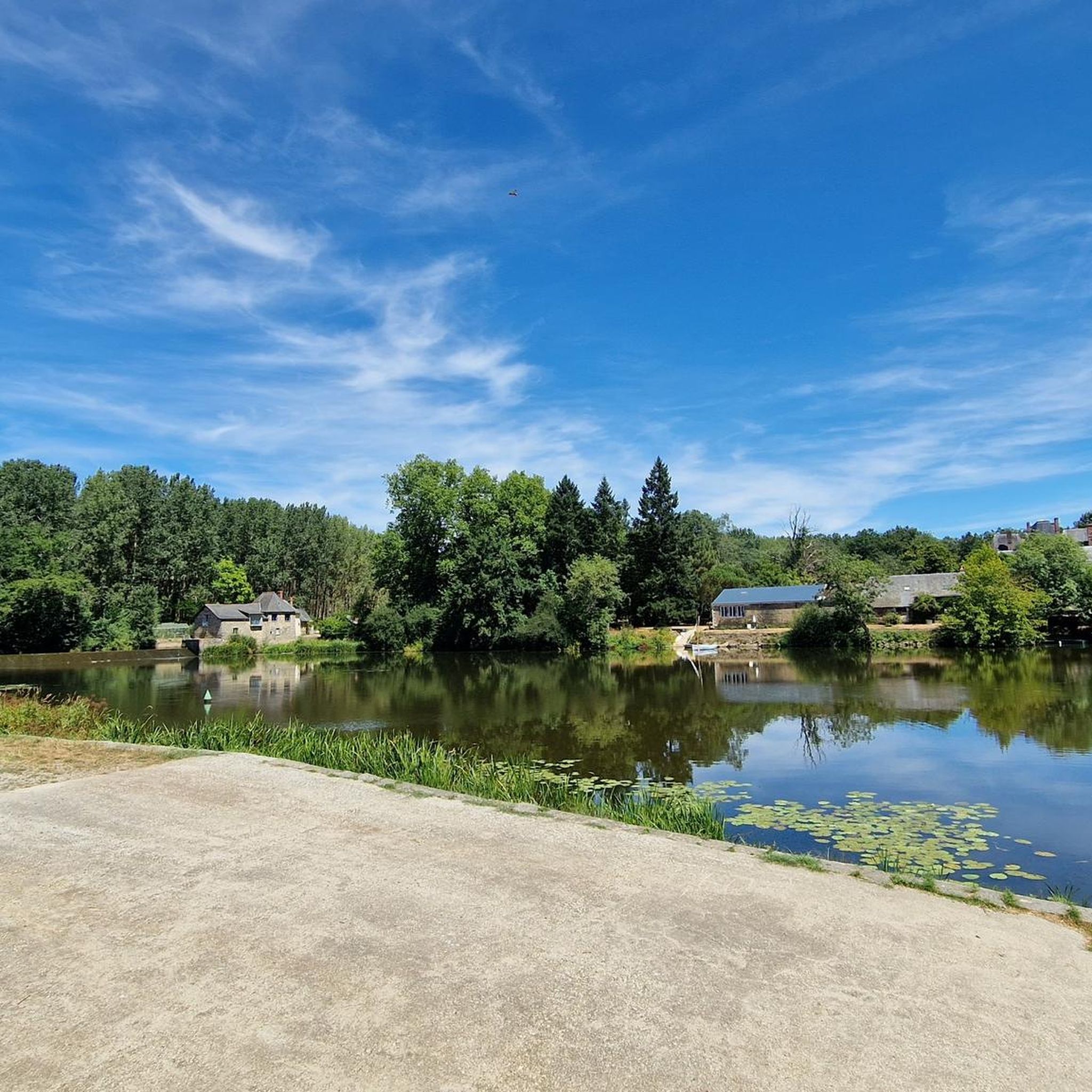
Gravel biking around Ampoigné takes place within the rural landscape of the Mayenne department in Pays de la Loire, France. The area is characterized by river valleys, extensive country lanes, and a mix of forests and meadows. Elevations in the immediate vicinity of Ampoigné range from 47 to 92 meters, offering mostly gentle terrain suitable for cycling. The region's network of paths, including river towpaths, provides a tranquil setting for exploring its natural and cultural heritage.
Best gravel bike trails around Ampoigné
- The most popular gravel bike trail is Roussière Lock – La Roussière Lock loop from Château-Gontier, a 63.1 miles (101.5 km) trail that takes about 7 hours 43 minutes to complete. This challenging route features over 1,700 feet (520 m) of elevation gain through varied terrain.
- Another top favourite among local gravel bikers is Mirwault Lock – Mayenne Viaduct loop from Bazouges, a difficult 85.1 miles (136.9 km) path. This long-distance route offers extensive views across the Mayenne countryside and river valleys.
- Local gravel bikers also love the Briacé lock – Port-Rhingeard Lock loop from La Roche-Neuville, a 31.3 miles (50.3 km) trail leading through riverine landscapes and rural lanes, often completed in about 3 hours 9 minutes.
- Gravel biking around Ampoigné is defined by quiet country roads, river towpaths, and a blend of forests and meadows. The network offers options for different ability levels, from moderate to difficult.
- The routes in Ampoigné are highly rated by the komoot community with an average score of 4.7 stars from more than 20 reviews. More than 200 gravel bikers have used komoot to explore Ampoigné's varied terrain.
Last updated: July 3, 2026
4.5
(2)
72
riders
102km
06:21
530m
530m
Hard gravel ride. Very good fitness required. Mostly paved surfaces. Suitable for all skill levels.
4.6
(7)
56
riders
176km
10:19
1,000m
1,000m
Hard gravel ride. Very good fitness required. Mostly paved surfaces. Suitable for all skill levels.

Sign up for free
5.0
(3)
24
riders
136km
08:40
790m
790m
Hard gravel ride. Very good fitness required. Mostly paved surfaces. Suitable for all skill levels.
4.5
(6)
31
riders
Moderate gravel ride. Good fitness required. Mostly paved surfaces. Suitable for all skill levels.
4.0
(1)
31
riders
119km
06:55
570m
570m
Hard gravel ride. Very good fitness required. Mostly paved surfaces. Suitable for all skill levels.
Get access to more routes and recommendations from other explorers.
Sign up for free
Already have an account?
Our route recommendations are based on thousands of hikes, rides, and runs completed by other people on komoot.
Start today with a free account
Your next adventure awaits.
Login or Signup



Tips from the Community

Sandy surface, a little rutted, not ideal for road cycling
0
0

Beautiful views, perfect for cycling or walking
0
0

A fairly smooth old railway line with low gradients and lined with trees. Very pleasant on Gravel.
0
0

Picturesque lock on the banks of the Mayenne on the Vélo Francette route. It is an ideal place to take a break and enjoy the idyllic setting. You can stock up at the Écluse bistro, or visit the small village.
1
0

Beautiful castle, beautiful view passing by the greenway
0
0
I didn't know it and I was amazed by this greenway along the Mayenne
1
0
Great spot for a short stop
0
0

This path is magnificent.
0
0
Frequently Asked Questions
How many gravel bike routes are available around Ampoigné?
There are over 30 gravel bike routes around Ampoigné, offering a variety of distances and difficulty levels. Most of these routes are rated as moderate, with a few challenging options for experienced riders.
What kind of terrain can I expect on the gravel bike trails in Ampoigné?
The terrain around Ampoigné is characterized by quiet country roads, river towpaths, and a blend of forests, meadows, and river valleys. You'll find mostly gentle inclines, with elevations ranging from 47 to 92 meters, making it suitable for varied cycling experiences.
Are there any family-friendly or easy gravel bike routes in Ampoigné?
Yes, while many routes are moderate, there are options suitable for families or beginners. The region's network of paths, particularly the river towpaths, offers peaceful and scenic experiences away from main roads. For example, the Green route – Blue Bridge over the Oudon in Segré loop from Château-Gontier-sur-Mayenne is a moderate route that offers a pleasant ride through rural landscapes.
What interesting sights or landmarks can I see along the gravel bike trails?
As you explore the gravel trails, you might encounter charming villages and historical sites. Notable attractions in the wider area include the impressive Mayenne Viaduct, the historic Château-Gontier Castle, and various locks along the river such as Mirwault Lock. The Green route itself is a highlight for many cyclists.
Are there circular gravel bike routes available in Ampoigné?
Yes, many of the gravel routes around Ampoigné are designed as loops, allowing you to start and end at the same point. Examples include the challenging Roussière Lock – La Roussière Lock loop from Château-Gontier and the moderate Briacé lock – Port-Rhingeard Lock loop from La Roche-Neuville.
What is the best time of year to go gravel biking in Ampoigné?
The Mayenne department, including Ampoigné, is ideal for gravel biking during spring, summer, and early autumn. These seasons offer pleasant weather for exploring the region's natural landscapes and river valleys. While winter cycling is possible, conditions may vary, so checking local forecasts is advisable.
What do other gravel bikers say about the routes in Ampoigné?
The gravel biking routes around Ampoigné are highly rated by the komoot community, with an average score of 4.7 stars from over 20 reviews. Cyclists often praise the tranquil setting, the variety of terrain, and the opportunity to explore the natural and cultural heritage of the area on quiet country roads and river towpaths.
Are there any long-distance gravel routes for experienced riders?
Yes, for experienced riders seeking a challenge, there are several long-distance routes. The Mirwault Lock – Mayenne Viaduct loop from Bazouges is a difficult 85.1-mile (136.9 km) path offering extensive views across the Mayenne countryside and river valleys. Another challenging option is the Roussière Lock – La Roussière Lock loop from Château-Gontier, which covers 63.1 miles (101.5 km) with over 1,700 feet (520 m) of elevation gain.
Where can I find parking for gravel biking trails near Ampoigné?
Given the rural nature of Ampoigné and the surrounding Mayenne department, parking is generally available in or near the starting points of many routes, particularly in larger towns like Château-Gontier-sur-Mayenne or Bazouges. Look for designated parking areas in villages or near popular trailheads.
Are there cafes or pubs near the gravel trails in Ampoigné?
While Ampoigné itself is a small commune, the broader Mayenne region features charming villages and towns where you can find cafes and pubs. For example, the Ménil riverside café is a notable spot along the Mayenne river that cyclists often enjoy. Exploring nearby towns like Château-Gontier-sur-Mayenne will offer more options for refreshments.
Can I bring my dog on the gravel biking routes?
Many of the rural paths and country lanes in the Mayenne department are suitable for cycling with dogs, provided they are well-behaved and kept under control, especially when encountering livestock or other trail users. Always check local regulations and ensure your dog is comfortable with the distance and terrain.
Is public transport available to access the gravel biking areas around Ampoigné?
Public transport options directly to Ampoigné may be limited due to its rural location. However, regional bus services or train connections might be available to larger towns in the Mayenne department, such as Château-Gontier-sur-Mayenne, from which you could then cycle to various trailheads. Planning your journey in advance is recommended.
Do I need any special permits for gravel biking in Ampoigné?
Generally, no special permits are required for gravel biking on public roads, country lanes, or designated cycling paths in the Mayenne department. However, always respect private property and adhere to any posted signs or local regulations, especially when passing through agricultural areas or nature reserves.
Most popular attractions around Ampoigné

Get inspired with the komoot mobile app


Explore more
Browse the best Gravel rides in other regions.
