The best gravel rides around Fontainemore
4.8
(17)
111
riders
11
rides
Gravel biking around Fontainemore, located in Italy's Aosta Valley, is characterized by mountainous terrain with significant elevation changes. The region features a network of trails that traverse river valleys and ascend into higher elevations, offering diverse environments for exploration. These routes often follow unpaved roads and forest tracks, providing varied riding surfaces. The area includes dramatic mountain scenery, larch and fir forests, and the Lys stream, making it well-suited for gravel adventures.
Best gravel bike trails around Fontainemore
- The most…
Last updated: July 4, 2026
4.8
(9)
53
riders
39.7km
03:04
1,130m
1,130m
Hard gravel ride. Very good fitness required. Mostly paved surfaces. Suitable for all skill levels.
11
riders
Moderate gravel ride. Good fitness required. Mostly paved surfaces. Suitable for all skill levels.

Sign up for free
5.0
(1)
14
riders
31.0km
02:35
950m
950m
Hard gravel ride. Very good fitness required. Mostly paved surfaces. Suitable for all skill levels.
18
riders
34.5km
02:35
960m
960m
Hard gravel ride. Very good fitness required. Mostly paved surfaces. Suitable for all skill levels.
4.9
(7)
9
riders
69.0km
05:49
2,320m
2,320m
Hard gravel ride. Very good fitness required. Mostly paved surfaces. Suitable for all skill levels.
Get access to more routes and recommendations from other explorers.
Sign up for free
Already have an account?
Our route recommendations are based on thousands of hikes, rides, and runs completed by other people on komoot.
Start today with a free account
Your next adventure awaits.
Login or Signup
Popular around Fontainemore

Alta Via n. 1 of the Aosta Valley — a walk among Italian giants

GTA Central Piedmont – Dense forests, lakes and impressive waterfalls
Three days on the Cammino Balteo – The historic Aosta Valley

Cammino Balteo – castles, vineyards and trails of the Aosta Valley

Paths, castles and views of Italy’s Aosta Valley – Cammino Balteo
Running with the giants – Alta Via 1 in the Aosta Valley
Running between the giants of the Alps – Tor des Géants

A walk among Italian giants — Aosta Valley High Route 1
Hiking around Fontainemore
Road Cycling Routes around Fontainemore


Tips from the Community

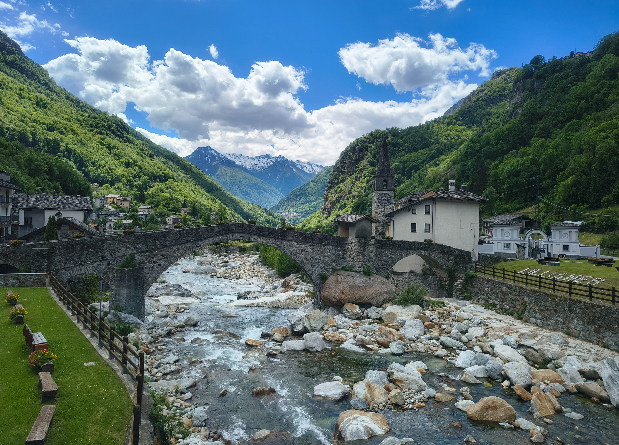
The stone bridge of Lillianes, completed in 1733, represents a hydraulic work of exceptional value for the Lys Valley, being the only historic bridge in the region structured on four round arches. The choice of this configuration, supported by robust piers equipped with cut-water spurs, was dictated by the need to span a section of the Lys stream particularly subject to violent floods. The roadway, made with a characteristic donkey-back shape in local stone, hosts a votive shrine dedicated to Saint Roch in the center, historically placed to protect travelers against pestilences. A relevant anecdote concerns the complex financing of the work: the local community, in order not to depend exclusively on central subsidies, chose to heavily tax themselves through the "taglioni" system, a form of mandatory contribution based on land ownership. It is said that the families of the village contributed not only with money but also by providing labor and materials, as the bridge was considered vital for the economy linked to the chestnut trade and transhumance. Another curious detail concerns its incredible resistance: during past floods, while other wooden or lighter structures were swept away, the bridge of Lillianes remained intact, consolidating its fame as an indestructible monument and a symbol of unity for the entire valley population.
0
0

The Ponte dei Tre Archi in the La Vecchia locality in Biella (Piedmont, Italy) is a historic stone structure located along the ancient route of the Tranvia Biella‑Oropa — the former tramway line that connected Biella to the Sanctuary of Oropa between 1911 and 1958.
11
0
The Santuario di Oropa is one of the most important Marian places of worship in Piedmont, Italy, located at about 1,159 m above sea level on the mountainside of the Valle d’Oropa, just above Biella. It is famous for its religious history, imposing architecture, and the surrounding natural landscape.
10
0

Cemetery just outside Oropa on the Tracciolino road towards Andrate
1
0
Fountain outside Billa towards Oropa
0
1
To reach Trappa, take a detour on the Tracciolino road between Andrate and Oropa
0
0

An ancient cemetery dating back to the Napoleonic era, abandoned in the 1940s. https://fondoambiente.it/luoghi/cimitero-del-fiorentino?ldc
0
0

A short, easy ride on a mix of asphalt and dirt roads that takes about half an hour to complete.
1
0
Frequently Asked Questions
Are there any easy or beginner-friendly gravel bike trails around Fontainemore?
The gravel biking terrain around Fontainemore is predominantly challenging, characterized by mountainous ascents and significant elevation changes. Most routes are rated as difficult, with only a few moderate options available. There are no easy trails listed in the immediate vicinity for beginners.
What is the typical duration for gravel bike rides in Fontainemore?
Ride durations vary significantly depending on the route's length and elevation. For example, the Oropa Sanctuary – Sanctuary of Oropa loop from Pollone, a difficult 21.4-mile (34.5 km) path, typically takes around 3 hours 10 minutes. Longer routes, like the Lake Viverone – Lake Viverone loop from Pont-Saint-Martin (55.8 miles / 89.9 km), can take up to 6 hours 40 minutes.
Where can I find parking for gravel biking trails in Fontainemore?
While specific parking areas aren't detailed for each trail, you can generally find parking in the main villages like Fontainemore, Donnas, or Pont-Saint-Martin, which serve as common starting points for many routes. Look for public parking lots or designated areas near trailheads.
Are there any family-friendly gravel biking options in Fontainemore?
Given the mountainous terrain and the prevalence of difficult routes, Fontainemore's gravel biking trails are generally not considered family-friendly for young children or inexperienced riders. The routes often feature substantial climbing and unpaved, challenging surfaces. It's best suited for experienced riders.
What is the best time of year for gravel biking around Fontainemore?
The best time for gravel biking in Fontainemore is typically from late spring to early autumn (May to October). During these months, the weather is generally milder, and trails are free of snow and ice, offering the most pleasant riding conditions. Summer can be warm, especially in the valleys, so early morning rides are recommended.
What are the winter conditions like for gravel biking in Fontainemore?
Winter conditions in Fontainemore, being in the Aosta Valley, can be challenging for gravel biking. Higher elevation trails will likely be covered in snow and ice, making them impassable or dangerous. Lower valley routes might be rideable, but expect colder temperatures, potential icy patches, and shorter daylight hours. Always check local weather and trail conditions before heading out.
Are there any circular gravel bike routes in Fontainemore?
Yes, many of the gravel bike routes around Fontainemore are designed as loops. For instance, the View of Donnas – Pont-Saint-Martin loop from Donnas is a popular circular route covering 41.5 miles (66.8 km) through varied terrain.
What kind of views or landmarks can I expect along the gravel bike trails?
The trails offer diverse scenery, from river valleys to higher elevations with alpine landscapes. You can expect views of the Dora Baltea valley and potentially pass by historical sites. Notable nearby attractions include Fort Bard and Castello Vallaise. Some routes also lead towards significant landmarks like the Oropa Sanctuary.
What do other gravel bikers enjoy most about riding in Fontainemore?
The komoot community highly rates the gravel biking experience in Fontainemore, with an average score of 4.6 stars from over 16 reviews. Riders often praise the challenging mountainous terrain, the diverse riding surfaces including unpaved roads and forest tracks, and the scenic views of the Aosta Valley.
Are there any cafes or refreshment stops along the gravel bike routes?
While specific cafes aren't listed directly on the trails, many routes pass through or near villages and towns such as Donnas, Pont-Saint-Martin, or Pollone. These locations typically offer opportunities for refreshments, food, and water refills. It's always advisable to carry sufficient supplies, especially on longer or more remote sections.
What should I wear for gravel biking in Fontainemore?
Given the mountainous and varied terrain, it's recommended to wear appropriate cycling gear that can handle changing conditions. Layers are key, as temperatures can vary between valleys and higher elevations. A waterproof and windproof jacket is advisable, along with sturdy cycling shoes, gloves, and a helmet. Always check the weather forecast before your ride.
Are there any permits required for gravel biking on the trails?
Generally, no specific permits are required for gravel biking on the public trails and unpaved roads around Fontainemore. However, always respect private property signs and adhere to any local regulations or protected area rules that might be in place. It's good practice to check for any specific restrictions if you plan to venture into very remote or sensitive areas.
Are there any other challenging gravel bike routes besides the most popular ones?
Yes, beyond the most popular routes, Fontainemore offers other demanding options. For instance, the Staffal – View of Donnas loop from Donnas is another difficult route, spanning 55 miles (88.5 km) with over 2000 meters of elevation gain, offering extensive riding through the region.
Most popular routes around Fontainemore
Most popular attractions around Fontainemore

Get inspired with the komoot mobile app


Explore more
Browse the best Gravel rides in other regions.
