The best gravel rides around The Wiehen Hills
4.5
(62)
148
riders
16
rides
Gravel biking around The Wiehen Hills offers diverse landscapes across this low mountain range in North Rhine-Westphalia and Lower Saxony. The region is characterized by lush forests, rolling hills, and varied terrain, forming the northernmost extension of the German Central Uplands. The highest point, Heidbrink, reaches 320 meters, providing a mix of ascents and descents. The eastern end is marked by the Porta Westfalica gorge and the Wittekindsberg hill, with many routes leading through dense woodlands within the terra.vita Nature…
Last updated: July 16, 2026
3
riders
54.6km
03:32
450m
450m
Hard gravel ride. Good fitness required. You may need to push your bike for some segments of this route.
4.4
(5)
49
riders
Hard gravel ride. Very good fitness required. You may need to push your bike for some segments of this route.

Sign up for free
2
riders
57.3km
03:58
730m
730m
Hard gravel ride. Very good fitness required. You may need to push your bike for some segments of this route.
5.0
(26)
3
riders
Easy gravel ride. Great for any fitness level. Mostly paved surfaces. Suitable for all skill levels.
3.5
(2)
5
riders
23.6km
01:28
240m
240m
Moderate gravel ride. Good fitness required. Mostly paved surfaces. Suitable for all skill levels.
Get access to more routes and recommendations from other explorers.
Sign up for free
Already have an account?
Our route recommendations are based on thousands of hikes, rides, and runs completed by other people on komoot.
Start today with a free account
Your next adventure awaits.
Login or Signup
Tips from the Community

There are many benches along the Mittellandkanal as resting places.
0
0

Coming from the Lechtingen windmill, you can soon get a first glimpse of the Rulle monastery.
0
0

Push up from Oldenburger Landstr. to the Karlsteinen! Above are the big and small Karlsteinen. The forest path to "Im Hone" is easily passable.
0
0

The Mittelland Canal (MLK) is a federal waterway[2] and, at 325.3 kilometers, the longest artificial waterway in Germany. Including side and connecting canals, the length is 392 km. It connects the Dortmund-Ems Canal with the Weser, the Elbe, and the Elbe-Havel Canal. In a broader sense, it is part of a connection between the Rhine and the Oder. In the west, the connection to the Rhine is established via the Dortmund-Ems Canal and the Rhine-Herne Canal or the Wesel-Datteln Canal. In the east, the Elbe-Havel Canal, the Untere Havel-Wasserstraße, and the Havel-Oder-Wasserstraße connect the Mittelland Canal with the Oder. In a European dimension, it enables a connection between the Netherlands, Belgium, Luxembourg, France, and Switzerland on the one hand, and Poland and the Czech Republic on the other. The canal is also known by the names Ems-Weser-Kanal, Weser-Ems-Kanal, Weser-Elbe-Kanal, Rhein-Elbe-Kanal, Elbe-Weser-Ems-Kanal, or Ems-Weser-Elbe-Kanal. These are old or regional designations that are now rarely used.
0
0


Frequently Asked Questions
How many gravel bike trails are available in The Wiehen Hills?
The Wiehen Hills offer a wide selection of gravel biking routes, with over 25 trails available. These range from moderate paths to more challenging routes, ensuring options for various skill levels.
What kind of terrain can I expect on gravel bike trails in The Wiehen Hills?
The terrain in The Wiehen Hills is diverse, featuring lush forests, rolling hills, and river valleys. You'll encounter a mix of surfaces, from gravel tracks and forest paths to some root-covered sections, all within the scenic backdrop of the terra.vita Nature Park. The region is known for its varied landscape, offering both ascents and descents.
Are there gravel bike trails suitable for beginners or families in The Wiehen Hills?
Yes, The Wiehen Hills offer several moderate gravel bike trails that are suitable for beginners or families. These routes typically feature less harsh climbing and provide beautiful scenery. For example, the View of the River Hase – Nette Valley at Bramheide loop from Rulle is a moderate 19.7 miles (31.6 km) trail leading through river valleys and natural landscapes.
Are there challenging gravel bike routes for experienced riders in The Wiehen Hills?
Absolutely. For experienced riders seeking a challenge, The Wiehen Hills provide routes with significant elevation changes and extensive forest sections. A notable difficult route is the Venne Observation Tower – Venner Berg Observation Tower loop from Rundfunksender Schleptruper Egge, which spans nearly 50 miles (80.1 km) and features substantial climbs.
What interesting landmarks or natural features can I see along the gravel bike trails?
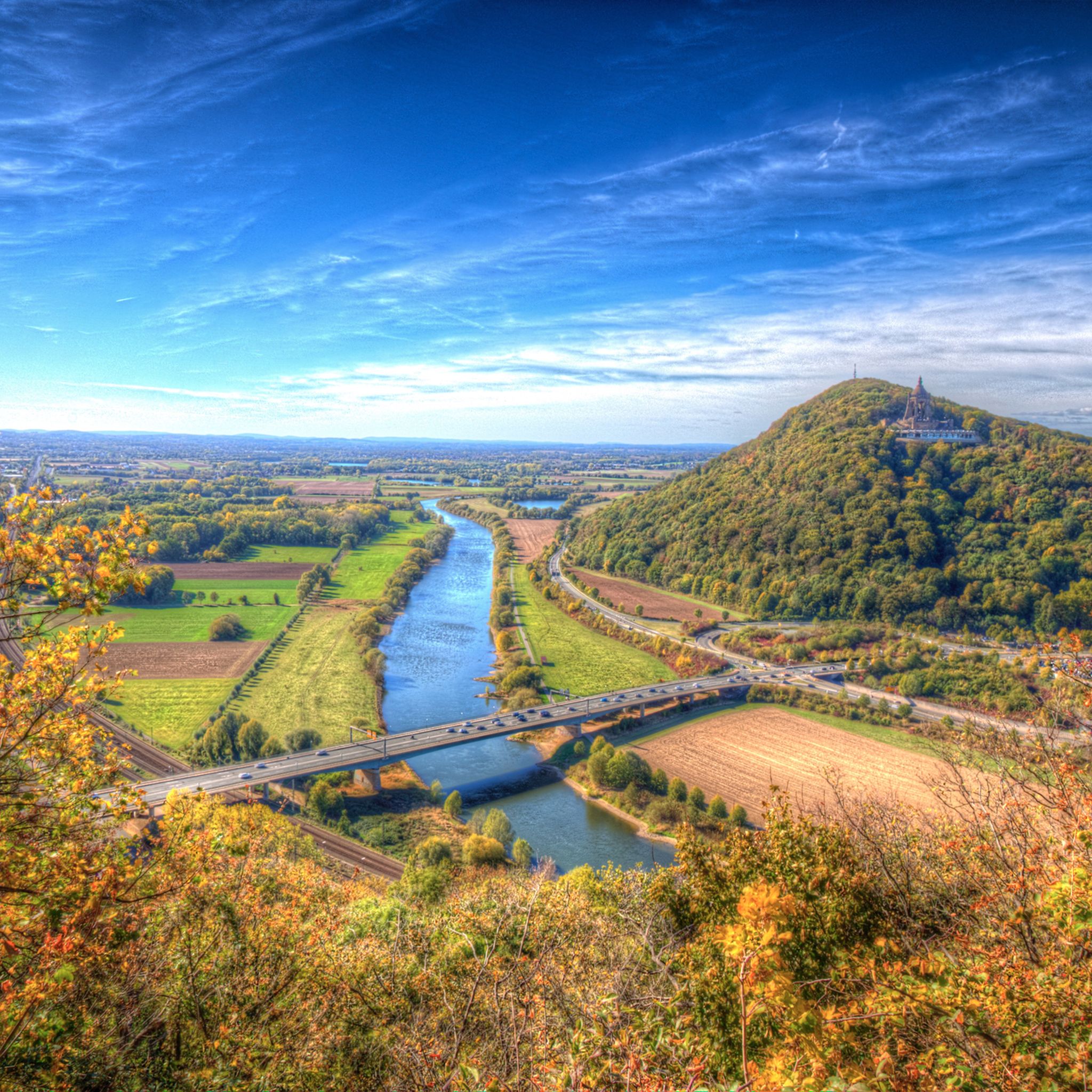
The Wiehen Hills are rich in natural beauty and historical sites. Along your rides, you might encounter significant geological features, dense forests, and panoramic viewpoints. Notable attractions include the Museum und Park Kalkriese, which relates to the Battle of the Teutoburg Forest, and the Schmittenhöhe Summit Cross (Kalkriese Hill). The region also features the impressive Kaiser Wilhelm Monument at Porta Westfalica and various archaeological sites.
What is the best time of year for gravel biking in The Wiehen Hills?
The Wiehen Hills are enjoyable for gravel biking throughout much of the year. Spring and autumn offer pleasant temperatures and vibrant scenery with changing foliage. Summer provides longer daylight hours, while winter can offer a unique experience, though conditions may vary and require appropriate gear.
Are there any circular gravel bike routes in The Wiehen Hills?
Yes, many of the gravel bike trails in The Wiehen Hills are designed as loops, allowing you to start and end at the same point. An example is the popular Venner Berg Observation Tower – Venne Observation Tower loop from Natur- und Geopark TERRA.vita, a moderate 22.7 miles (36.5 km) trail that offers varied terrain within the natural park.
Can I bring my dog on the gravel bike trails in The Wiehen Hills?
Many trails in natural areas like The Wiehen Hills are dog-friendly, especially if your dog is accustomed to longer rides and you keep them on a leash where required. It's always advisable to check specific trail regulations or local signage for any restrictions before heading out with your canine companion.
Are there places to stop for refreshments or food along the routes?
While specific cafes or pubs directly on every route might vary, the towns and villages surrounding The Wiehen Hills, such as Bad Oeynhausen or Lübbecke, offer various amenities. It's a good idea to plan your route to pass through these areas or pack sufficient snacks and water for longer rides.
What do other gravel bikers enjoy most about the trails in The Wiehen Hills?
The gravel biking experience in The Wiehen Hills is highly rated by the komoot community, with an average score of 4.5 stars from over 60 reviews. Riders frequently praise the diverse landscapes, the mix of challenging and moderate terrain, and the opportunity to explore lush forests and rolling hills. The region's balance of 'not too harsh climbing and beautiful scenery' is often highlighted.
What is the highest point I might encounter on a gravel bike ride in The Wiehen Hills?
The highest point in The Wiehen Hills is Heidbrink, which rises to 320 meters (1,050 ft) near Lübbecke. While not every route will take you directly to the summit, many trails will involve ascents and descents across the rolling hills, offering varied elevation profiles.
How long are the typical gravel bike trails in The Wiehen Hills?
The gravel bike trails in The Wiehen Hills vary significantly in length. You can find shorter, moderate routes around 20 miles (30-35 km), such as the View of the River Hase – Nette Valley at Bramheide loop from Rulle, which is about 19.7 miles (31.6 km). Longer, more challenging routes can extend up to 50 miles (80 km), like the Venne Observation Tower – Venner Berg Observation Tower loop from Rundfunksender Schleptruper Egge.
Most popular routes around The Wiehen Hills
Most popular attractions around The Wiehen Hills

Get inspired with the komoot mobile app


Explore more
Browse the best Gravel rides in other regions.
