The best gravel rides around Lago di Doberdò / Doberdobsko jezero
4.2
(38)
370
riders
47
rides
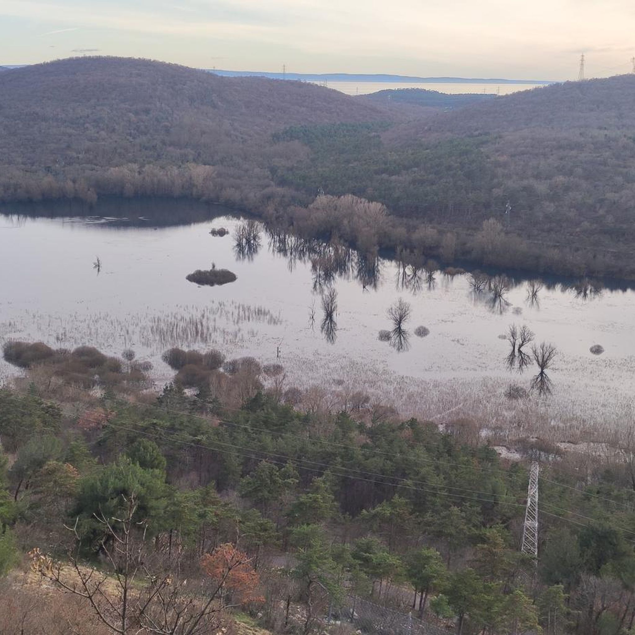
Gravel biking around Lago di Doberdò / Doberdobsko jezero explores a landscape characterized by the Karst plateau, featuring limestone formations, dense woodlands, and the presence of the Isonzo River. The region offers a mix of terrain, from flat sections along waterways to undulating paths through forested areas. Elevations are generally moderate, providing varied riding experiences without extensive mountain climbs. The unique karstic intermittent lake, Lago di Doberdò, is a central feature within this diverse environment.
Best gravel bike trails around…
Last updated: July 5, 2026
4.5
(2)
72
riders
Hard gravel ride. Very good fitness required. You may need to push your bike for some segments of this route.
5.0
(1)
19
riders
129km
08:09
1,210m
1,210m
Hard gravel ride. Very good fitness required. You may need to push your bike for some segments of this route.

Sign up for free
13
riders
24.1km
01:23
180m
180m
Moderate gravel ride. Good fitness required. Mostly paved surfaces. Suitable for all skill levels.
5.0
(1)
10
riders
Moderate gravel ride. Good fitness required. Mostly paved surfaces. Suitable for all skill levels.
4.8
(4)
37
riders
83.7km
04:54
290m
290m
Moderate gravel ride. Good fitness required. Mostly paved surfaces. Suitable for all skill levels.
Get access to more routes and recommendations from other explorers.
Sign up for free
Already have an account?
Our route recommendations are based on thousands of hikes, rides, and runs completed by other people on komoot.
Start today with a free account
Your next adventure awaits.
Login or Signup
Popular around Lago di Doberdò / Doberdobsko jezero
Tips from the Community

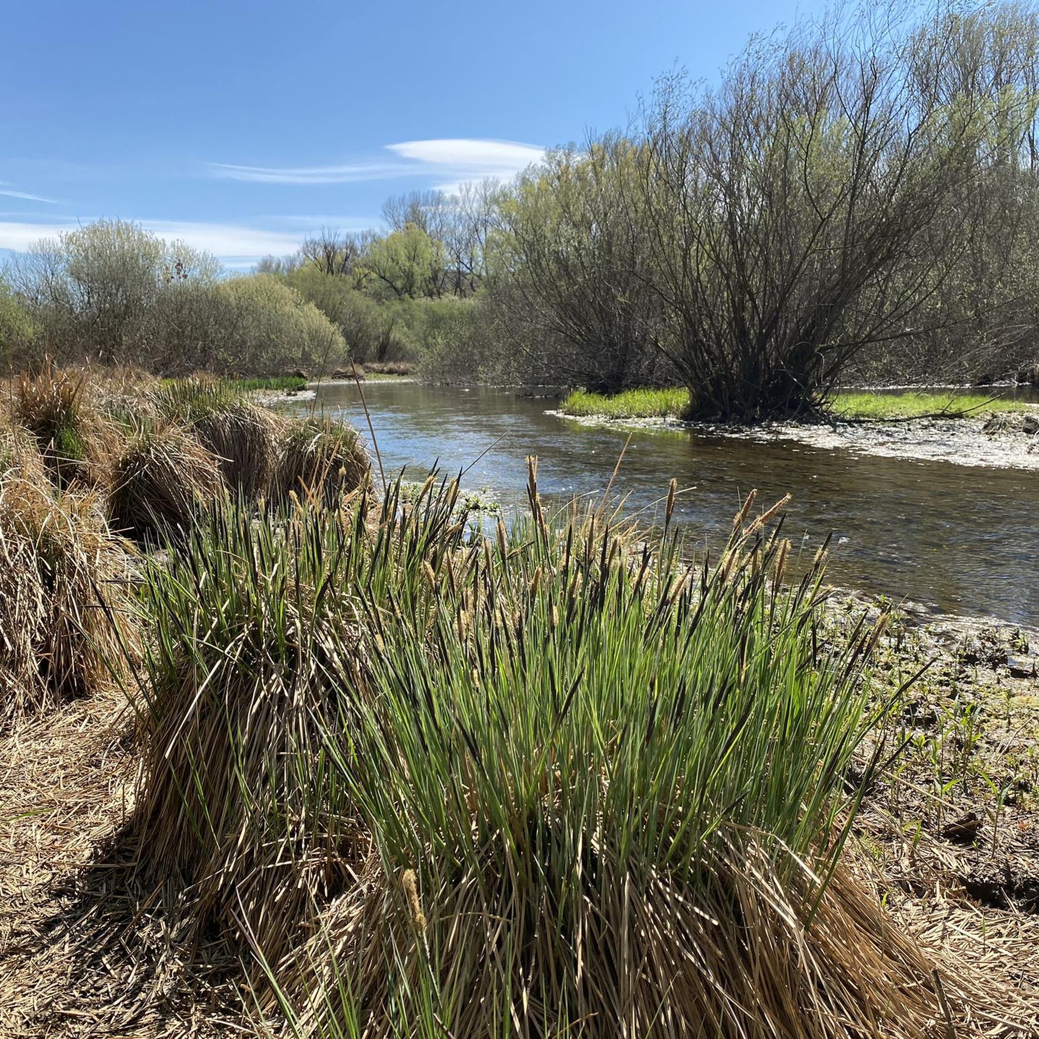
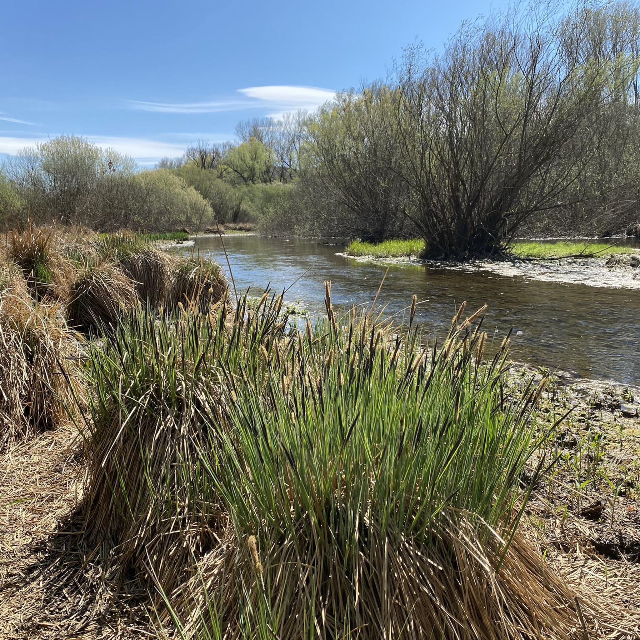
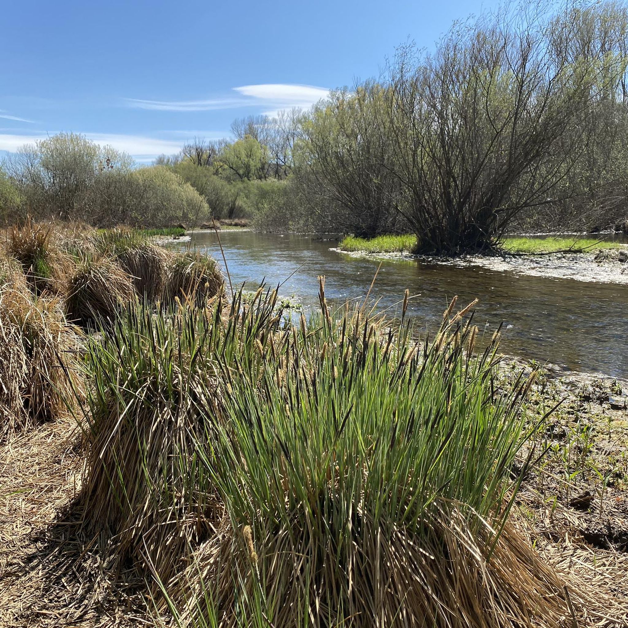
Wonderful play of colors in the river
3
0
Memorial to the fallen of both world wars
3
0

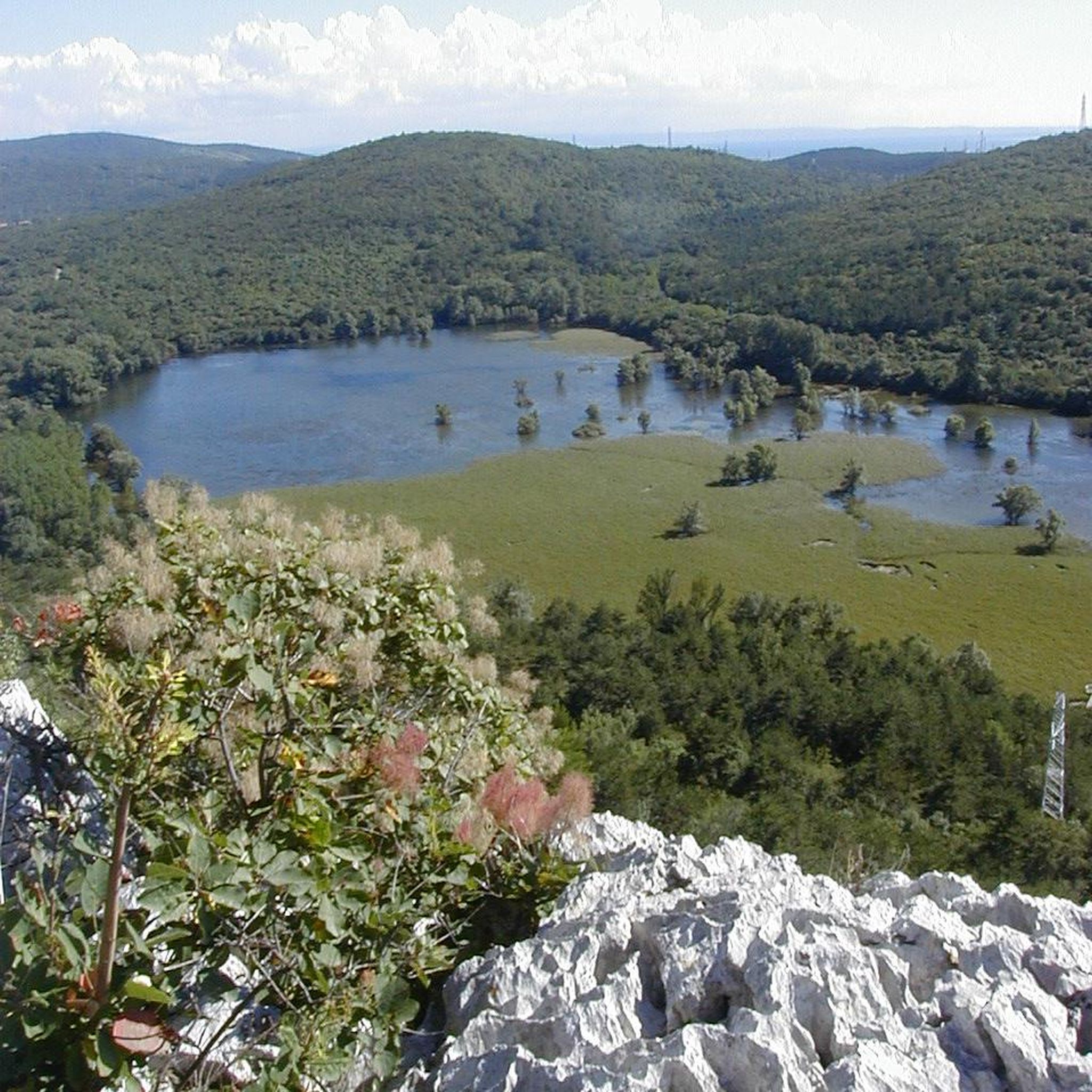
Located just a few kilometers from Duino Castle, in the western sector of the Gorizia Karst, Lake Pietrarossa is one of the pearls of the Regional Natural Reserve shared with the nearby Lake Doberdò. Together with the latter, it represents one of the very rare examples in Europe of a karst lake: a temporary basin that occupies a natural depression called a polje. The charm of this place lies in its changing nature; it is not fed by surface rivers, but by the oscillations of the underground water table. During rainy periods, water emerges from the depths, flooding the plain, while in dry seasons the lake can almost disappear, leaving space for a verdant carpet of reeds and wet meadows. This alternation creates a unique ecosystem where the arid and rocky karst landscape meets a humid area rich in biodiversity, making it a paradise for birdwatching and silent excursions.
0
0

La Vipova offers wonderful views.
0
0
Picturesque bridge well integrated into the context.
0
0
The trenches of Cima Pietrarossa, on the Isonzo Karst, are a dramatic testament to the Great War. Located in a strategic position near Monte San Michele, these fortifications dug directly into the limestone rock were the scene of fierce clashes between the Italian and Austro-Hungarian armies. Today the site is part of an open-air museum where you can walk along the paths, explore the underground shelters, and observe the machine gun posts. The visit offers a deep immersion into the harsh reality of the front, combining historical memory with an extraordinary panorama stretching from the Julian Alps to the sea, in a place where the silence of nature has now taken the place of the roar of battles.
0
0

The ancient church of San Quirino, with very old origins, although the dating of the first sacred building is uncertain. Its historical importance is evidenced by the fact that in this place, on January 27, 1202, peace was signed between the representatives of the Patriarch of Aquileia Pellegrino II (1195-1204) and the Counts of Gorizia Mainardo II (1186-1202) and Enghelberto III (1186-1216), in the presence of numerous nobles, both local and German. source: https://www.archeocartafvg.it/portfolio-articoli/cormons-go-loc-san-quirino-ruderi-della-chiesa-san-quirino/
0
0

Quota 121 of Cima di Pietrarossa was originally an Austro-Hungarian benchmark conquered by the Royal Italian Army during the Battles of the Isonzo.
0
0
Frequently Asked Questions
How many gravel bike trails are available around Lago di Doberdò / Doberdobsko jezero?
There are over 60 gravel bike routes in the Lago di Doberdò / Doberdobsko jezero region. These routes cater to various skill levels, from moderate to difficult, offering diverse experiences across the Karst landscape.
What kind of terrain can I expect on gravel bike trails in this region?
The terrain around Lago di Doberdò / Doberdobsko jezero is characterized by the Karst plateau, featuring limestone formations, dense woodlands, and paths along the Isonzo River. You'll find a mix of flat sections, undulating paths through forests, and moderate elevations, providing varied riding without extensive mountain climbs.
Are there any beginner-friendly gravel bike routes?
While many routes are moderate to difficult, there are options suitable for less experienced riders. The region's network offers a range of paths, and you can filter for easier routes on komoot to find those with less elevation and shorter distances.
Which routes offer a more challenging gravel biking experience?
For a challenging ride, consider the Bridge Over the Isonzo River – Lagoon Cycle Path loop from Jamiano / Jamlje, which is 45.5 miles (73.3 km) long with significant elevation. Another difficult option is the Vipava River Cycle Path – Summit 3 of Monte San Michele loop from Ronchi dei Legionari Nord, covering 88.5 km with over 900 meters of ascent.
Are there any family-friendly gravel bike routes near Lago di Doberdò / Doberdobsko jezero?
The region offers some routes with gentler gradients and less technical terrain that can be suitable for families. Look for routes described as 'easy' or 'moderate' on komoot, which often follow flatter sections along the Isonzo River or through less challenging woodland paths.
What is the best time of year for gravel biking around Lago di Doberdò / Doberdobsko jezero?
Spring and autumn generally offer the most pleasant conditions for gravel biking in this region, with milder temperatures and beautiful scenery. Summer can be warm, especially in open areas, while winter riding is possible but may require checking for trail conditions and potential ice or mud.
Are there any gravel bike routes that are loop trails?
Yes, many of the gravel bike routes in the area are designed as loops. Examples include the Isonzo River – Bridge Over the Isonzo River loop from Doberdò del Lago / Doberdob and the Trincea delle Frasche – Summit 3 of Monte San Michele loop from Monfalcone, allowing you to start and finish at the same point.
What do other gravel bikers enjoy most about the trails in Lago di Doberdò / Doberdobsko jezero?
The area is highly rated by the komoot community, with an average score of 4.2 stars from over 70 reviews. Riders often praise the diverse landscape, the mix of Karst woodlands and river paths along the Isonzo, and the historical sites encountered on routes like the Slivia Inner Valley – Slivia Village and Fountain loop from Ronchi dei Legionari Nord.
Are there scenic viewpoints along the gravel bike routes?
Many routes offer scenic views, particularly those that traverse higher ground or follow the Isonzo River. The Karst landscape itself provides unique vistas, and routes leading towards Monte San Michele, for instance, offer panoramic perspectives of the surrounding area.
Where can I find parking for gravel biking trailheads?
Parking is generally available near the starting points of many routes in towns and villages such as Jamiano / Jamlje, Doberdò del Lago / Doberdob, Monfalcone, and Ronchi dei Legionari Nord. Specific parking information can often be found in the route descriptions on komoot.
Do any routes pass by historical sites?
Yes, the region is rich in history. The Trincea delle Frasche – Summit 3 of Monte San Michele loop from Monfalcone is a notable example, leading through historical sites related to World War I and towards Monte San Michele, which holds significant historical importance.
Most popular routes around Lago di Doberdò / Doberdobsko jezero

Get inspired with the komoot mobile app


Explore more
Browse the best Gravel rides in other regions.
