The best gravel rides around Lake Cava Increa
4.2
(282)
2,120
riders
61
rides
Gravel biking around Lake Cava Increa offers a network of routes traversing diverse terrain, characterized by waterways, canals, and riverside paths. The region provides mostly flat sections suitable for gravel bikes, with some routes featuring gentle elevation changes and others presenting more challenging climbs. Terrain includes urban green spaces, former quarry areas, and open fields. These paths connect towns like Brugherio and Cernusco sul Naviglio, offering varied landscapes for gravel cyclists.
Best gravel bike trails around Lake Cava Increa
- The…
Last updated: July 3, 2026
4.7
(3)
12
riders
Moderate gravel ride. Good fitness required. Mostly paved surfaces. Suitable for all skill levels.
4.7
(7)
30
riders
51.5km
02:59
110m
110m
Moderate gravel ride. Good fitness required. Mostly paved surfaces. Suitable for all skill levels.

Sign up for free
4.4
(8)
41
riders
60.4km
03:40
490m
490m
Hard gravel ride. Very good fitness required. Mostly paved surfaces. Suitable for all skill levels.
47
riders
76.4km
04:55
790m
790m
Hard gravel ride. Very good fitness required. You may need to push your bike for some segments of this route.
4.5
(4)
19
riders
Hard gravel ride. Very good fitness required. You may need to push your bike for some segments of this route.
Get access to more routes and recommendations from other explorers.
Sign up for free
Already have an account?
Our route recommendations are based on thousands of hikes, rides, and runs completed by other people on komoot.
Start today with a free account
Your next adventure awaits.
Login or Signup

Tips from the Community

The Canale della Muzza is an important hydraulic work from the 12th-13th century that branches off the Adda river in Cassano d'Adda and extends for about 39 km to Castiglione d'Adda. It is one of the oldest and largest irrigation canals in Europe, fundamental for Lodi's agriculture, now also flanked by cycle paths.
0
0
The Muzza Canal is an important hydraulic work from the 12th-13th century that branches off the Adda river at Cassano d'Adda and extends for about 39 km to Castiglione d'Adda. It is one of the oldest and largest irrigation canals in Europe, fundamental for Lodi's agriculture, now also flanked by cycle paths.
0
0

The parish church of San Giovanni Battista Martire in Montevecchia, built in the 1920s. The structure is located at the intersection of via Belvedere and via Donzelli, halfway up the hill. The main sanctuary, the Santuario della Beata Vergine del Carmelo, is located higher up and is reachable via a staircase of 180 steps. The area is famous for its cycling and walking routes in the Montevecchia and Valle del Curone Natural Park.
0
0
A cycle-pedestrian route of about 37 kilometers connecting Monza to Erba, crossing the Brianza region along the Lambro river. It is a path immersed in the greenery of the Lambro Valley Regional Park, characterized by a mixed surface (dirt, cobblestone, and asphalt) ideal for mountain bikes, gravel bikes, or robust city bikes. Main Features of the Route Start: Monza Park (entrance near Biassono/Lesmo). Finish: Center and train station of Erba (CO). Total length: Approximately 37 km (can be divided into shorter stages). Surface type: Mixed, with a prevalence of dirt and forest paths. Difficulty: Medium-easy, with the presence of some steep ups and downs.
0
0
The bridge over the Muzza Canal, located in Lavagna (a hamlet of the municipality of Comazzo in the province of Lodi), is a historical landmark for crossing this ancient artificial waterway. The Muzza is a branch of the Adda river, known for being one of the oldest canals in Europe. Lavagna Lodigiana is a small rural village immersed in the countryside that develops right next to the canal. The bridge area is frequented by cyclists and hikers who travel along the Muzza cycle path or the Muzza-Ponte di Lavagna route, enjoying the river landscape.
0
0

climb almost finished, last short stretch remaining
1
0
The Muzza canal (61 km long in total) is a branch of the Adda River and has recently celebrated its 800th anniversary, making it one of the oldest in Europe. Its name, with slight variations over the centuries, still recalls the Roman family Mutia who moved here in 90 BC, starting the first land reclamation works. Smaller watercourses branch off from the wide canal, winding through the countryside for a total length of about 1000 kilometers, mainly intended for agricultural irrigation. The surrounding landscape of countryside and farmhouses is evocative, with a succession of tree-lined rows and open fields. It is also very interesting from a naturalistic point of view as it attracts many aquatic birds that can be observed along the route.
1
0
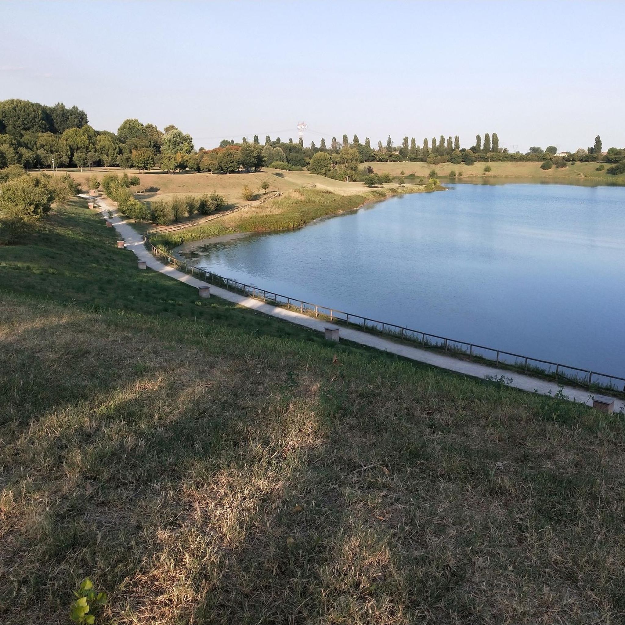
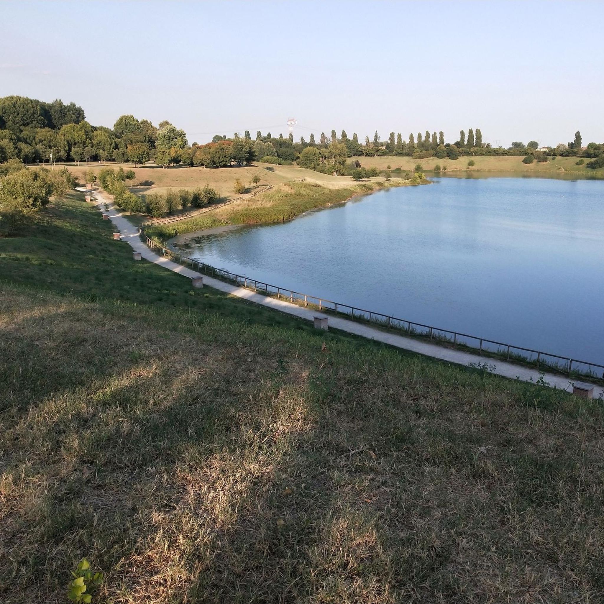
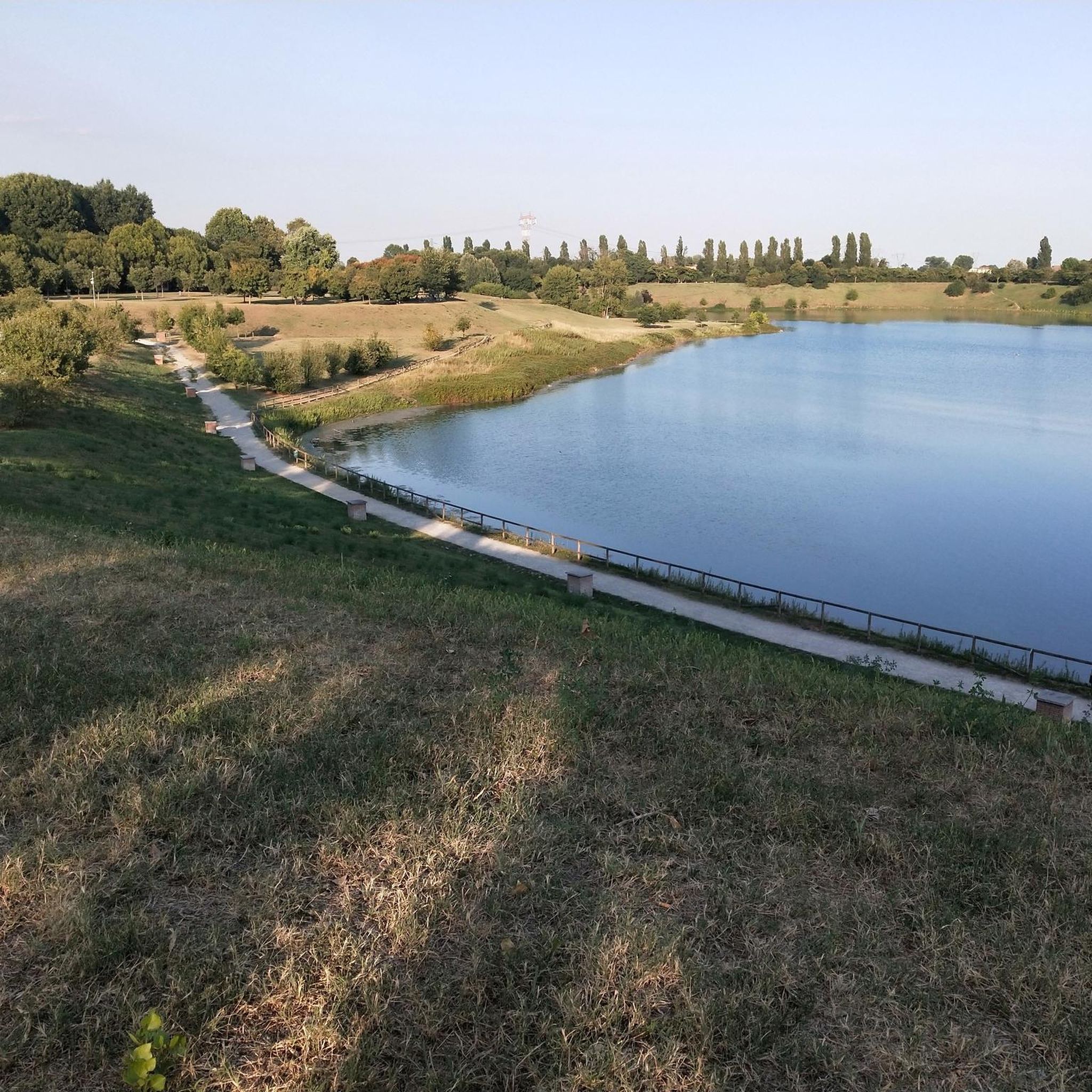
Down on the shore of Lake Increa
0
0
Frequently Asked Questions
How many gravel bike trails are available around Lake Cava Increa?
There are over 80 gravel bike trails around Lake Cava Increa, offering a wide range of options for different skill levels. This includes 12 easy routes, 35 moderate routes, and 37 difficult routes.
What kind of terrain can I expect on gravel bike trails in the Lake Cava Increa region?
The region features diverse terrain, primarily characterized by waterways, canals, and riverside paths, which provide mostly flat sections. You'll also find routes with gentle elevation changes, leading through open fields and wooded areas, with some challenging climbs on more difficult trails.
Are there any easy gravel bike trails suitable for beginners or families?
Yes, there are 12 easy gravel bike routes around Lake Cava Increa. These often follow established cycle paths along canals, providing a smooth and enjoyable experience. For example, the Val di Chiana Cycle Path – Villoresi Canal Cycle Path loop from Cologno Nord is a moderate route that follows cycle paths along canals, suitable for those looking for a less strenuous ride.
Are there any challenging gravel bike routes for experienced riders?
Absolutely. The Lake Cava Increa area offers 37 difficult gravel bike routes. These routes often feature significant elevation gain and cover longer distances. An example is the Martesana Canal – Groppello Water Wheel loop from Cassina de' Pecchi, which is a challenging 70.6-mile path with extensive canal-side riding and considerable climbing.
Are there any circular gravel bike routes around Lake Cava Increa?
Many of the gravel bike routes in the region are designed as loops, allowing you to start and finish at the same point. The Groppello Water Wheel – Martesana Canal loop from Cassina de' Pecchi is a popular 61.4-mile circular trail that takes you through canal systems and rural areas.
What do other gravel bikers enjoy most about the trails in Lake Cava Increa?
The area is highly rated by the komoot community, with an average score of 4.3 stars from over 180 reviews. Reviewers often praise the well-maintained canal paths, the variety of landscapes from open fields to wooded areas, and the accessibility of the trail network.
Are there any scenic viewpoints or notable landmarks along the gravel bike trails?
While specific viewpoints are not detailed, the routes often traverse picturesque canal systems and rural landscapes. The Cascina Melli – Montevecchia Chapel loop from Monza Sobborghi offers a route that includes the Montevecchia Chapel, providing a potential point of interest and scenic views.
What is the best season for gravel biking around Lake Cava Increa?
The region is generally pleasant for gravel biking during spring and autumn, when temperatures are milder. Summer can be warm, but canal-side routes often offer some shade. Winter riding is possible, but check local weather conditions for rain or colder temperatures.
Are there routes that follow rivers or canals?
Yes, many routes in the Lake Cava Increa area utilize the extensive network of canals and rivers. For instance, the Lambro Riverside Trail – Lambro Cycle Path loop from Monza Sobborghi is a great option for exploring riverside paths and cycleways.
Where can I access the gravel bike trails around Lake Cava Increa?
The area provides accessible gravel bike trail access points throughout the region. Many routes start from towns like Cologno Nord or Cassina de' Pecchi, which are well-connected and offer convenient starting points for your ride.
What should I bring for a gravel bike ride in this region?
Given the varied terrain and potential for longer rides, it's advisable to bring sufficient water, snacks, a repair kit, and appropriate clothing layers. For longer routes, consider navigation tools or a fully charged phone with the komoot app to follow your chosen trail.
Most popular routes around Lake Cava Increa

Get inspired with the komoot mobile app


Explore more
Browse the best Gravel rides in other regions.
