The best walks and hikes in Saratoga Gap Open Space Preserve
4.7
(336)
4,435
hikers
164
hikes
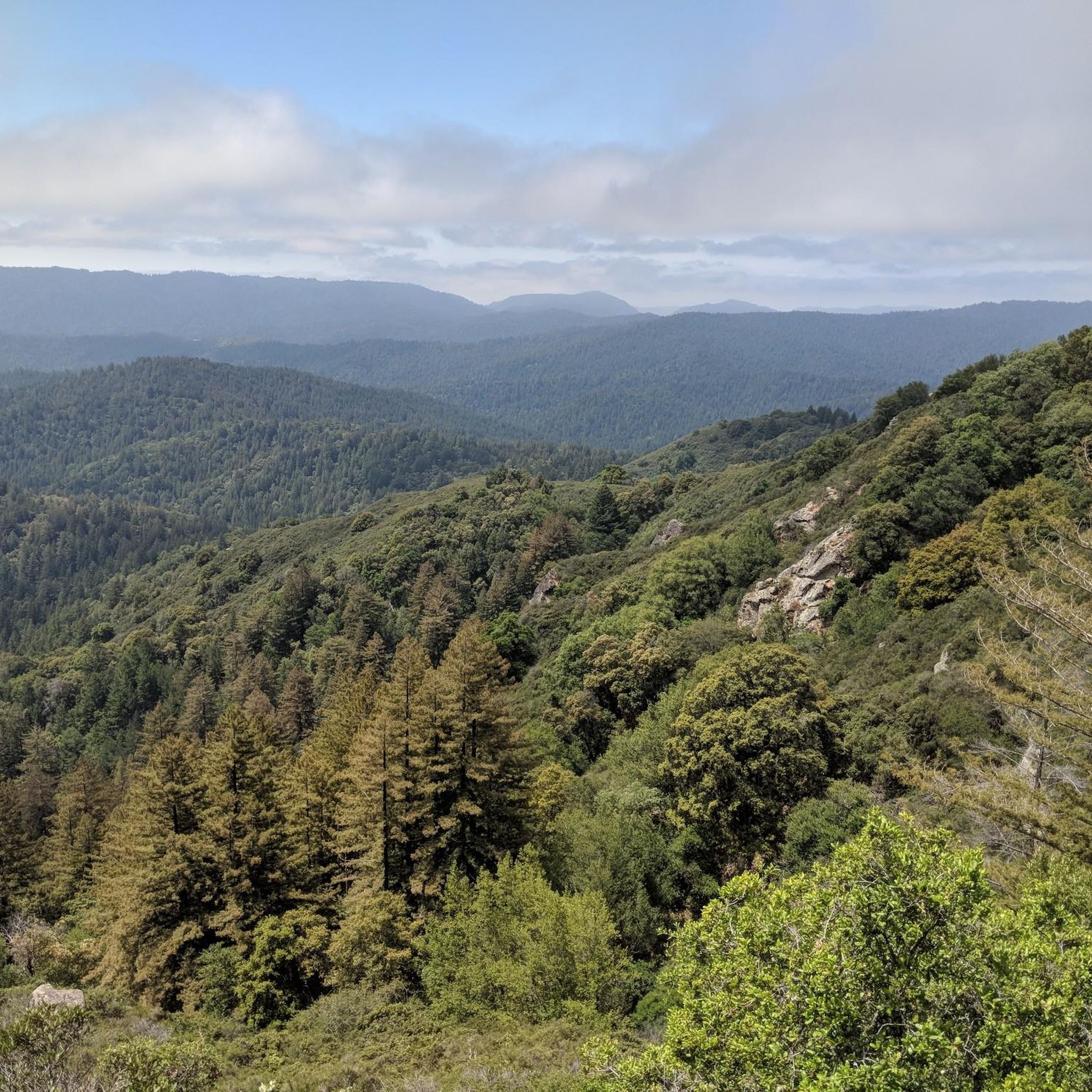
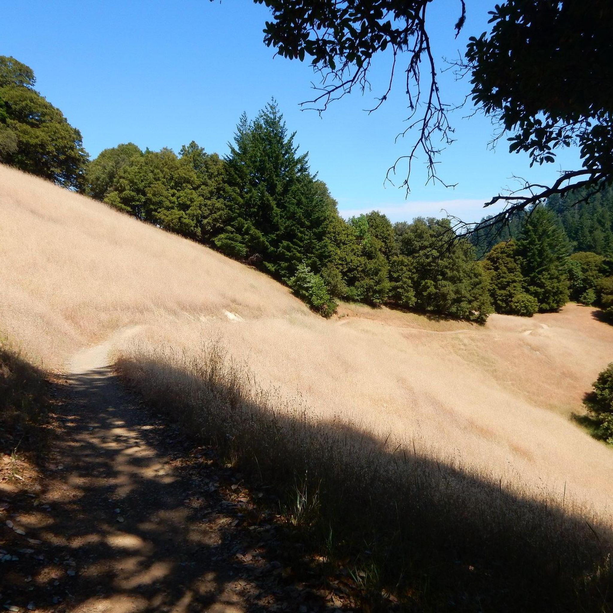
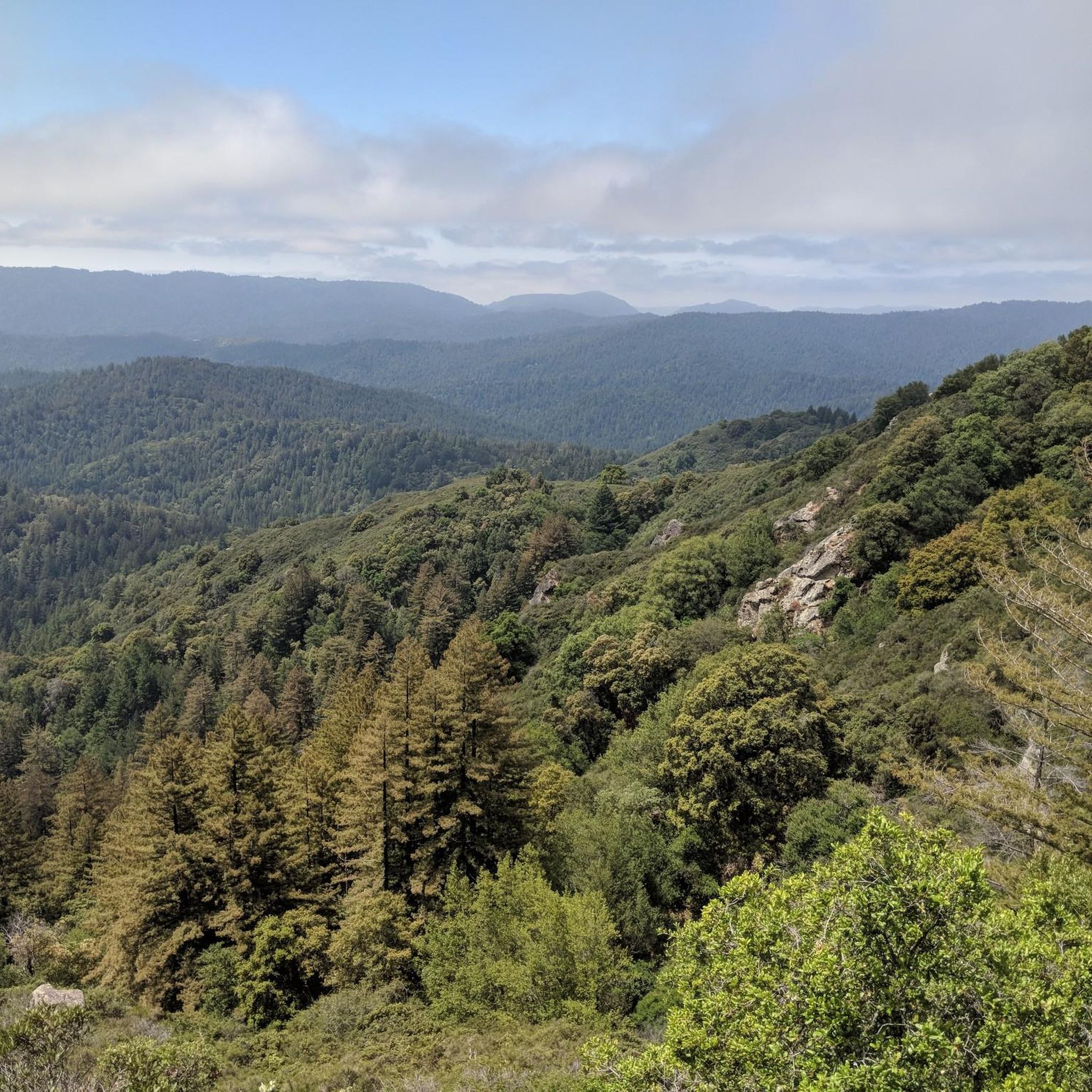
Hiking in Saratoga Gap Open Space Preserve offers a diverse array of landscapes within the Santa Cruz Mountains, spanning approximately 1,600 acres. The preserve features moist evergreen forests, oak-madrone woodlands, and high grasslands, with elevations reaching up to 2600 feet. Notable natural features include tufa formations, intricately sculpted sandstone, and water features such as Castle Rock Falls. An extensive trail network connects to larger regional parks, providing varied hiking opportunities.
Best hiking trails in Saratoga Gap Open Space Preserve
- The most popular hiking route is Skyline Trail, Travertine Springs Trail & Saratoga Toll Road loop — Castle Rock State Park, a 9.2 miles (14.8 km) trail that takes 4 hours 30 minutes to complete. This route incorporates a historic logging road and offers scenic viewpoints.
- Another top favourite among local hikers is Castle Rock Falls – Inner Connector Trail loop from Saratoga, a difficult 9.5 miles (15.3 km) path. This trail leads past Castle Rock Falls and through varied forest environments.
- Local hikers also love the Saratoga Gap – Saratoga Gap Trailhead loop from Saratoga Gap Open Space Preserve, a 4.7 miles (7.5 km) trail leading through woodlands and open areas, often completed in about 2 hours 12 minutes.
- Hiking in Saratoga Gap Open Space Preserve is defined by diverse forests, panoramic views of the Santa Cruz Mountains, and unique geological formations. The network offers options for easy, moderate, and difficult trails, catering to various ability levels.
- The routes in Saratoga Gap Open Space Preserve are highly rated by the komoot community with an average score of 4.7 stars from over 300 reviews. More than 4000 hikers have used komoot to explore Saratoga Gap Open Space Preserve's varied terrain.
Last updated: July 8, 2026
5.0
(1)
9
hikers
15.5km
04:42
380m
550m
Moderate hike. Good fitness required. Mostly accessible paths. Sure-footedness required.
1
hikers
14.3km
04:01
240m
380m
Moderate hike. Good fitness required. Easily-accessible paths. Suitable for all skill levels.

Sign up for free
4.0
(1)
9
hikers
14.8km
04:30
470m
470m
Moderate hike. Good fitness required. Mostly accessible paths. Sure-footedness required.
21
hikers
Moderate hike. Good fitness required. Mostly accessible paths. Sure-footedness required.
8
hikers
12.7km
03:42
350m
350m
Moderate hike. Good fitness required. Easily-accessible paths. Suitable for all skill levels.
Get access to more routes and recommendations from other explorers.
Sign up for free
Already have an account?
Our route recommendations are based on thousands of hikes, rides, and runs completed by other people on komoot.
Start today with a free account
Your next adventure awaits.
Login or Signup


Tips from the Community

This trail connects Skyline Trail and Travertine Springs Trail, forming a loop around the mountains in Castle Rock State Park. It has a steady incline and a nicely shaded path, making the way up easier.
0
0
This section of the Skyline Trail offers shade and occasional viewpoints overlooking the forest and valley. It's a beautiful, well-marked trail that's also shared with mountain bikers.
0
0

Turtle Rock is the highest and most prominent mountain in the area. From this viewpoint, you can enjoy a panoramic view of the surrounding mountains, especially stunning at sunset. Be cautious, as the trail is popular and often busy with hikers.
1
0

Long Ridge Open Space Preserve is a 2,035-acre preserve that follows Long Ridge in the Santa Cruz Mountains. There are a variety of trails that can be used for hiking, biking, or horse riding. This is a dirt trail area, so it is more suited for gravel bikes or a stout touring bike; a hardtail would be ideal. In addition, this is a preserve and not a park, so there are no facilities that you would normally expect in a park, such as bathrooms, drinking water fountains, picnic tables, snack bars, or stores.
1
0
Saratoga Gap is a well-known convergence area for two well-known trails, namely the Saratoga Gap Trail and the Skyline Trail. Both of these trails are mainly single-track and orientated towards gravel or mountain bikes. However, it is also the intersection for the Skyline Boulevard and the Big Basin Way, both very scenic and great cycling roads. There is a car park here, but no facilities.
1
0

Turtle Rock gets its name because it looks like a little turtle with its head sticking up. This is a stunning spot to take a break and enjoy the overlook of the rolling hills and clouds roaming through the valleys.
0
0

This beautiful small lake is a picturesque, quiet, tranquil spot with blue-eyed grass surrounding the shoreline in early spring. It is a great spot to bring a picnic basket, sit and enjoy the peaceful setting while listening to the birds in the trees.
0
0

On your way South from CA-9 riding Skyline Boulevard, there are a few spots where you can get a great view of the mountains that separate you from the Pacific ocean. Depending on the time of day and the time of year, you could see a blue range of mountains, or the mountains covered with a thick blanket of fog.
0
0
Frequently Asked Questions
How many hiking trails are there in Saratoga Gap Open Space Preserve?
Saratoga Gap Open Space Preserve offers a wide variety of hiking experiences, with over 140 recorded routes. These include a mix of easy, moderate, and difficult trails, catering to different fitness levels and preferences.
Are there any easy hiking trails suitable for beginners or families?
Yes, the preserve has numerous options for easier hikes. With over 60 easy routes available, you can find paths that are less strenuous and suitable for families or those new to hiking. Many of these trails wind through diverse forests and offer gentle gradients.
Can I bring my dog on the trails in Saratoga Gap Open Space Preserve?
Generally, dogs are permitted on leash on most trails within Saratoga Gap Open Space Preserve. However, it's always best to check specific trail regulations before your visit, as rules can vary, especially when trails connect to adjacent state parks.
Are there any trails with waterfalls in the preserve?
Yes, Saratoga Gap Open Space Preserve is home to notable water features. You can find a waterfall viewable from a platform, and the impressive Castle Rock Falls, which reaches 75 feet, is a significant attraction in the area. The Castle Rock Falls – Inner Connector Trail loop from Saratoga is one route that leads past this feature.
What kind of views can I expect while hiking in Saratoga Gap Open Space Preserve?
Hikers can enjoy spectacular panoramic views over the Santa Cruz Mountains. Highlights include vistas of the San Lorenzo River Basin, Ben Lomond Mountain, and on clear days, even Monterey Bay. Goat Rock Overlook is particularly known for its sweeping views of the San Lorenzo Valley and the Pacific Ocean.
Are there any circular hiking routes available?
Yes, the preserve offers many loop options. For example, the Saratoga Gap – Saratoga Gap Trailhead loop from Saratoga Gap Open Space Preserve is a popular 4.7-mile circular trail. The region research also mentions a 4.5-mile Saratoga Gap and Ridge Trail Loop and a 3-mile "Interconnector Trail" loop, providing varied experiences.
What are the notable natural features or landmarks to look out for?
Beyond the stunning views, you'll encounter unique geological formations like tufa formations and intricately sculpted sandstone at Goat Rock. The trails also wind through diverse forests, including tanoak, cool Douglas fir, and small groves of redwoods. Don't miss the moss-covered trees and lichen-covered boulders that add to the preserve's character.
Is there public transport available to Saratoga Gap Open Space Preserve?
Public transport options directly to Saratoga Gap Open Space Preserve are limited. It is generally recommended to travel by car. However, some regional bus services might have stops in nearby towns, requiring further travel to reach the preserve's trailheads.
Where can I park when visiting Saratoga Gap Open Space Preserve?
Parking is available at various trailheads within and around Saratoga Gap Open Space Preserve. Specific parking areas can be found near popular access points, often with signage indicating regulations and fees, if any. It's advisable to arrive early, especially on weekends, as parking can fill up quickly.
What is the best time of year to hike in Saratoga Gap Open Space Preserve?
The preserve offers enjoyable hiking year-round. Spring brings lush greenery and wildflowers, while fall provides pleasant temperatures and changing foliage. Summer can be warm, but many trails are shaded. Winter offers cooler weather, and the waterfalls are often at their fullest after rain. Always check local weather conditions before heading out.
What wildlife might I encounter on the trails?
The diverse habitats of Saratoga Gap Open Space Preserve support various wildlife. Hikers might spot hawks circling overhead, and there's a chance to see peregrine falcons, especially along the Ridge Trail. Keep an eye out for deer, smaller mammals, and a variety of bird species throughout the preserve.
Are there options for longer, more challenging hikes or multi-day trips?
Yes, for those seeking a greater challenge, the preserve connects to an extensive regional trail system. You can find difficult routes like the Castle Rock Falls – Castle Rock loop from Saratoga, which is nearly 20 km long. The preserve also provides access to backpacking campgrounds like Castle Rock and Waterman Gap, allowing for multi-day excursions, including segments of the 33-mile Skyline-to-the-Sea Trail.
What do other hikers say about the trails in Saratoga Gap Open Space Preserve?
The trails in Saratoga Gap Open Space Preserve are highly rated by the komoot community, with an average score of 4.7 stars from over 300 reviews. Hikers often praise the diverse landscapes, from moist evergreen forests to high grasslands, and the spectacular views of the Santa Cruz Mountains and beyond.
Are there any historic trails in the preserve?
Yes, the Saratoga Toll Road, a historic logging road and stagecoach line from 1871, now serves as a well-shaded and graded hiking path. This trail offers scenic viewpoints and a glimpse into the region's past. The Skyline Trail, Travertine Springs Trail & Saratoga Toll Road loop — Castle Rock State Park incorporates this historic route.
Most popular routes in Saratoga Gap Open Space Preserve
Most popular attractions in Saratoga Gap Open Space Preserve

Get inspired with the komoot mobile app


Explore more
Browse the best Hikes in other regions.
