The best cycling routes in La Honda Creek Open Space Preserve
5.0
(3)
216
riders
15
rides
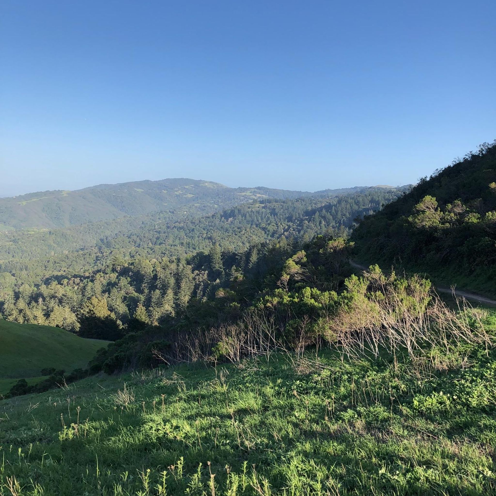
Touring cycling in La Honda Creek Open Space Preserve features a diverse landscape spanning over 6,100 acres, characterized by a mix of dense redwood and Douglas fir forests, expansive rolling grasslands, and oak woodlands. The preserve offers panoramic views of the coast, ridgelines, and the Santa Cruz Mountains. Its trail network, totaling over 17 miles, includes both paved and unpaved segments, with some routes requiring good fitness due to challenging terrain.
Best touring cycling routes in La Honda Creek Open Space Preserve
- The most popular touring cycling route is View of Skyline Ridge – Mountain Ridge View loop from La Honda, a 23.9 miles (38.5 km) trail that takes 2 hours 46 minutes to complete. This difficult route offers expansive views of the surrounding ridgelines.
- Another top favourite among local touring cyclists is Gazos Creek Beach – San Gregorio State Beach loop from San Gregorio, a difficult 33.4 miles (53.8 km) path. This route explores coastal areas and takes approximately 3 hours 20 minutes.
- Local touring cyclists also love the Stage Road – San Gregorio State Beach loop from San Gregorio, a 14.8 miles (23.8 km) trail leading through varied terrain, often completed in about 1 hour 33 minutes.
- Touring cycling in La Honda Creek Open Space Preserve is defined by dense forests, expansive grasslands, and coastal views. The network offers options for different ability levels, including moderate and difficult routes.
- The routes in La Honda Creek Open Space Preserve are highly rated by the komoot community with an average score of 5.0 stars from a few reviews. More than 250 touring cyclists have used komoot to explore La Honda Creek Open Space Preserve's varied terrain.
Last updated: July 9, 2026
9
riders
36.4km
02:34
760m
760m
The View of Skyline Ridge – Mountain Ridge View loop from La Honda is a difficult touring cycling route that delivers a serious workout alongside stunning scenery. You'll climb 2483 feet (757 metres) over 22.6 miles (36.4 km), a journey that typically takes 2 hours and 34 minutes. Expect a varied landscape, from dense redwood forests to open ridge tops offering expansive views of the Santa Cruz Mountains and the San Francisco Bay Area.
This challenging road bike loop begins in La Honda, providing access to iconic segments like Old La Honda Road. While the route is mostly paved, some sections in the wider Skyline Ridge area can be unpaved and demanding, potentially requiring you to push your bike. Always check for seasonal closures, especially if you plan to visit the David C. Daniels Nature Center at Alpine Pond.
This route is a prime example of the challenging road cycling routes available in San Mateo County. It connects diverse ecosystems, from historic ranchlands to coastal grasslands, and offers a colossal view of the 200-square-mile redwood ecosystem. The ridgeline trails are also known for spectacular spring wildflower displays, adding another layer of beauty to this demanding ride.
5.0
(1)
14
riders
Moderate bike ride. Good fitness required. Mostly paved surfaces. Suitable for all skill levels.

Sign up for free
4
riders
18.8km
01:20
350m
350m
The Alpine Road loop from Portola Valley offers a diverse touring cycling experience, guiding you through winding roads and redwood forests. You'll navigate a mix of paved and unpaved sections, with elevated points providing sweeping views of the Crystal Springs Reservoir and the San Francisco Bay. This moderate 11.7-mile (18.8 km) route, with 1158 feet (353 metres) of elevation gain, promises a varied ride that can be completed in about 1 hour and 19 minutes, making it a solid choice for an engaging outing.
To plan your visit, begin your ride from Portola Valley, a charming town known for its scenic beauty. Be prepared for varied terrain, as some unpaved sections, particularly on the Upper Alpine Road Trail, can be demanding. While specific parking information isn't detailed, the area is well-accustomed to cyclists. Always carry sufficient water and check local conditions, as parts of Alpine Road have historically seen closures due to degradation, though they now serve as popular trails.
This loop is a benchmark for many Bay Area cyclists, known for its challenging climbs and its role as a significant regional trail connection. The route's historical importance as a pre-Columbian transportation corridor adds a layer of interest to the ride. It's an excellent way to test your fitness while enjoying the unique blend of natural preserves and the affluent character of Portola Valley.
61
riders
28.6km
02:02
550m
550m
Hard bike ride. Very good fitness required. Mostly paved surfaces. Suitable for all skill levels.
24
riders
Hard bike ride. Very good fitness required. Mostly paved surfaces. Suitable for all skill levels.
Get access to more routes and recommendations from other explorers.
Sign up for free
Already have an account?
Our route recommendations are based on thousands of hikes, rides, and runs completed by other people on komoot.
Start today with a free account
Your next adventure awaits.
Login or Signup
Popular around La Honda Creek Open Space Preserve


Tips from the Community

Alise’s Restaurant is a popular spot for both cyclists and motorcyclists. The food is good, the staff is known for being friendly, and the place has a laid-back, welcoming vibe—perfect for a post-ride meal or coffee break.
1
0
This is where La Ronda Road meets Skyline Boulevard. After the climb, it’s the perfect place to recharge and grab something to eat at one of the nearby restaurants or grocery stores. Alise's Restaurant is a popular one.
0
0

The Northern part of Alpine Road is a paved and curvy descent through wooded areas and runs parallel to Coal Mine Ridge Preserve, eventually connecting with the trailhead there.
0
0


Russian Ridge is an incredible 3,137-acre preserve that boasts a rich diversity of plants and wildlife, steep forested canyons, and grasslands, with abundant wildflowers in the spring. The open ridge tops provide breathtaking panoramic views of the Santa Cruz Mountains, the Bay Area, and the Pacific Ocean, making it one of the most scenic preserves in the area to enjoy a picturesque ride.
0
0

Great place for a break in a beautiful, peaceful spot among the redwoods. The restaurant is popular with locals, motorcyclists, hikers, and cyclists, and is the perfect place for a cold drink after finishing the climb up.
1
0

It's all downhill from here! It's a pretty awesome section all the way to San Gregorio Beach.
0
0

3 miles of great winding mountain road. It ascends from the Palo Alto side up to the Skyline road. Quite narrow in places and fairly steep, but only light car use means this is a fun road climb.
2
0
Frequently Asked Questions
How many touring cycling routes are available in La Honda Creek Open Space Preserve?
La Honda Creek Open Space Preserve offers a selection of touring cycling routes. There are currently over 10 routes available on komoot, ranging in difficulty from moderate to difficult, providing options for various skill levels.
What is the general difficulty level for touring cycling in La Honda Creek Open Space Preserve?
Touring cycling in La Honda Creek Open Space Preserve is generally considered challenging. Many routes are rated as moderate or difficult, with some described as 'hard bike rides' requiring 'very good fitness.' You can expect varied terrain, including unpaved segments and significant elevation changes. For example, the View of Skyline Ridge – Mountain Ridge View loop from La Honda is a difficult route with substantial elevation gain.
What kind of terrain can I expect on the touring cycling routes?
The preserve features a diverse landscape. You'll encounter a mix of dense redwood and Douglas fir forests, expansive rolling grasslands, and oak woodlands. While some routes may include paved sections, many trails are unpaved and can be challenging, potentially requiring cyclists to push their bikes on steeper or rougher segments. The trail network totals over 17 miles, connecting various ecosystems.
Are there any easier touring cycling routes for beginners?
While many routes are challenging, there are some moderate options available. For instance, the Stage Road – San Gregorio State Beach loop from San Gregorio is a moderate route that offers a varied terrain experience without the extreme difficulty of some other trails. It's advisable to check the route details on komoot for specific elevation profiles and surface conditions before heading out.
What natural features or viewpoints can I see while cycling?
La Honda Creek Open Space Preserve is renowned for its spectacular panoramic views. You can expect breathtaking vistas of the coast, ridgelines, the Santa Cruz Mountains, and the Pacific Ocean from open ridge tops. The Coho Trail Vista Point is particularly noted for its sweeping views. The preserve also boasts diverse ecosystems, including dense redwood forests where you might spot the rare 'Big Tree' old-growth redwood, and expansive grasslands that come alive with colorful wildflowers in the spring.
Are permits required for touring cycling in the preserve?
Yes, a no-fee permit is required for access to Upper La Honda Creek. It's important to check the Midpeninsula Regional Open Space District's official website for the most current information regarding permits and access requirements before your visit.
Can I bring my dog on the touring cycling routes?
While some trails in the preserve are generally dog-friendly, there are important restrictions. For example, the Grasshopper Loop Trail has seasonal closures for dogs during calving season. It's crucial to check specific trail regulations and seasonal restrictions with the Midpeninsula Regional Open Space District before planning your ride with a dog.
What is the best time of year to go touring cycling in La Honda Creek Open Space Preserve?
Spring is an excellent time to visit, as the grasslands are vibrant with colorful wildflower displays, including California poppies and blue-eyed grass. The weather is generally mild, making for pleasant cycling conditions. However, it's always wise to check local weather forecasts, as conditions can vary, and some trails may have seasonal closures or restrictions.
Are there any circular touring cycling routes in the preserve?
Yes, several touring cycling routes in the preserve are designed as loops, offering a continuous journey without retracing your steps. Examples include the View of Skyline Ridge – Mountain Ridge View loop from La Honda and the Gazos Creek Beach – San Gregorio State Beach loop from San Gregorio. These loops allow you to experience more of the diverse landscapes and views the preserve has to offer.
What do other touring cyclists enjoy most about touring cycling in La Honda Creek Open Space Preserve?
The komoot community highly rates the touring cycling experience in La Honda Creek Open Space Preserve, with an average score of 5.0 stars. Cyclists frequently praise the preserve's diverse terrain, from dense forests to expansive grasslands, and the spectacular panoramic coastal views. The challenging nature of many routes also appeals to those seeking a rewarding and physically demanding ride.
Are there any historical elements to explore along the routes?
Yes, the preserve has a rich history. You might encounter remains of old sawmills from the logging era that began in 1865, and a historic red barn from a former ranch. These elements offer a glimpse into the area's past amidst the natural beauty.
Is there parking available for cyclists at La Honda Creek Open Space Preserve?
Parking is available, but it's important to note that public access is provided in two unconnected parts of the preserve. For equestrian parking at the Event Center, a no-fee permit is required. Cyclists should check the specific access points and parking regulations for their chosen starting location.
Most popular routes in La Honda Creek Open Space Preserve

Get inspired with the komoot mobile app


Explore more
Browse the best Cycling routes in other regions.
