The best running trails in Valles Caldera National Preserve
86
runners
40
runs
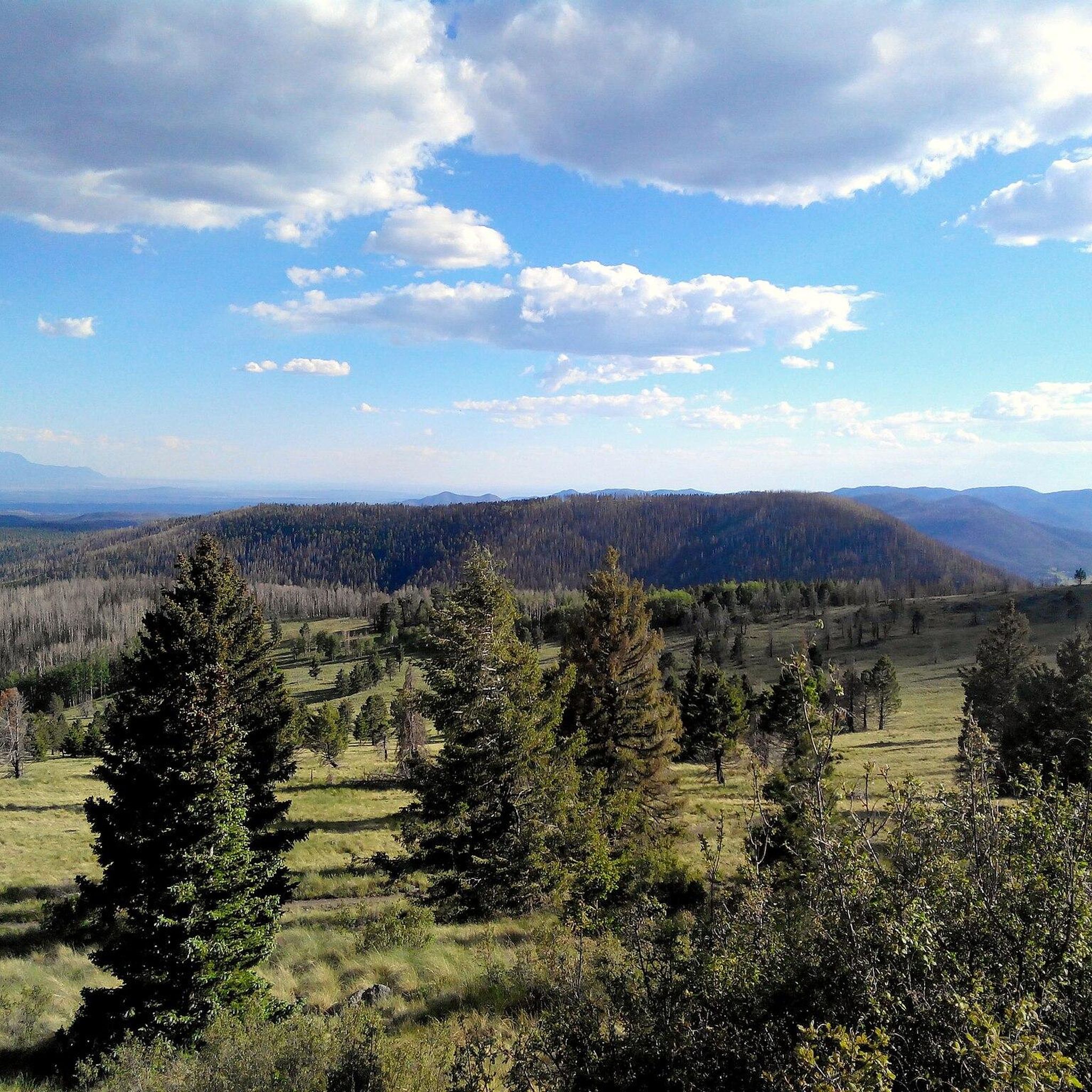
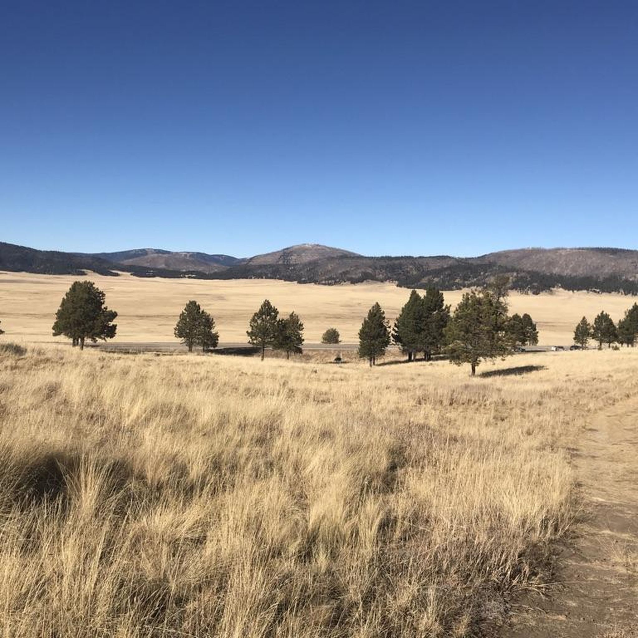
Jogging in Valles Caldera National Preserve offers a unique experience within an 89,000-acre collapsed supervolcano, characterized by expansive grassland meadows known as "valles" and surrounding forested volcanic domes. The terrain varies from relatively flat, open areas suitable for easy runs to more challenging uphill climbs on the "cerros." Meandering valley streams and Ponderosa pine groves further diversify the landscape, providing varied backdrops for running.
Best jogging routes in Valles Caldera National Preserve
- The most popular jogging route is Cerro La Jara Loop, a 2.46 miles (3.96 km) trail that takes 27 minutes to complete. This easy route circles a central caldera, offering a relatively flat path.
- Another top favourite among local runners is Coyote Call Trail, a moderate 2.88 miles (4.63 km) path. This route features varied terrain with some elevation gain, leading through diverse natural settings.
- Local runners also love the Cerro Seco Loop, a 11.04 miles (17.76 km) trail leading through forested volcanic domes, often completed in about 2 hours 13 minutes.
- Jogging in Valles Caldera National Preserve is defined by vast grassland meadows, forested volcanic domes, and meandering streams. The network offers options for different ability levels, from easy loops to more challenging trails with significant elevation changes.
- The guide includes highly-rated routes that showcase the best of the region's landscape. More than 85 runners have used komoot to explore Valles Caldera National Preserve's varied terrain.
Last updated: July 7, 2026
1
runners
11.4km
01:30
280m
280m
Embark on the Cerro Abrigo Loop for a moderate jogging experience through the Valles Caldera National Preserve. This route spans 7.1 miles (11.4 km) and involves an elevation gain of 934 feet (285 metres), typically taking about 1 hour and 30 minutes to complete. As you jog, you'll enjoy expansive, panoramic views across the caldera's beautiful valleys. The trail itself encircles a prominent lava dome, offering unique perspectives on volcanic landscapes and ever-changing scenery.
Before you set out, be aware that visiting the Valles Caldera National Preserve requires registration at the Visitor Center. You will also need a backcountry vehicle pass to access the area. Since the number of vehicles permitted daily is limited, it is wise to arrive early to secure your pass or reserve one in advance. This preparation will help ensure a smooth start to your jogging adventure.
Beyond the physical challenge, the Cerro Abrigo Loop provides a distinctive opportunity to connect with nature. Keep your eyes peeled for local wildlife, such as elk and black bears, as you make your way around the loop. You might also hear the unique cry of the pika, adding to the immersive experience. This trail truly stands out for its blend of scenic beauty and natural encounters.
1
runners
17.8km
02:13
460m
460m
If you are seeking a truly challenging jogging experience, the Cerro Seco Loop offers a difficult 11.0-mile (17.8 km) route with significant rewards. You will gain 1523 feet (464 metres) in elevation over an estimated 2 hours and 13 minutes, pushing your limits on this strenuous trail. The path ascends a narrow drainage and circles the Cerro Seco lava dome, providing dynamic terrain and expansive views of Valle Seco and the northern rim of the caldera.
Accessing this route requires careful planning, as you will need both a park entrance fee and a backcountry vehicle pass. These passes must be reserved in advance through Recreation.gov, and vehicular access is limited to 40 public vehicles per day. Be aware that the backcountry is closed to vehicles annually from November 15 to May 14, so plan your visit accordingly.
Located within the Valles Caldera National Preserve, the Cerro Seco Loop offers a unique natural environment. As you jog, keep an eye out for pikas, small mountain mammals native to the area, adding a touch of wildlife to your adventure. The trail also provides some of the best vistas of Redondo Peak, particularly as you near the later stages of your run.

Sign up for free
19.0km
02:15
380m
380m
Embark on the South Mountain Peak trail run, a difficult jogging route spanning 11.8 miles (19.0 km) with a significant 1262 feet (385 metres) of elevation gain. You can expect to complete this challenging journey in about 2 hours and 15 minutes. The terrain shifts from old logging roads to marked singletrack paths, leading you through shady mixed conifer forests. As you ascend, the forest opens into montane meadows at the summit, offering panoramic vistas of the caldera's south rim, the vast Valle Grande, and Tschicoma Mountain. This route provides a demanding yet rewarding experience for experienced trail runners.
When planning your visit, be aware that much of the Valles Caldera sits above 8,000 feet in elevation; if you are not acclimated, you might experience altitude sickness. The trail can be wet in spots due to snowmelt and may also be windy, with some deadfall across sections. Navigation can be tricky because signage is still developing and old logging roads can be confusing, so carrying a map, compass, or GPS is highly recommended for your safety. Always check local conditions before heading out.
This trail offers a unique opportunity to explore the Valles Caldera National Preserve, a vast grassland surrounded by forested mountain peaks. The area is known for its abundant wildlife; keep an eye out for elk tracks or even the animals themselves, especially during autumn. The preserve's distinct geology, formed by a collapsed volcano, creates a stunning natural environment that sets this trail apart from others in the region.
20.2km
02:09
320m
320m
Embark on a difficult jogging adventure along the VC03 Trail, a demanding route spanning 12.5 miles (20.2 km) within the expansive Valles Caldera National Preserve. This challenging journey involves an elevation gain of 1055 feet (321 metres), requiring about 2 hours and 9 minutes to complete. As you traverse the varied terrain, you will experience the unique atmosphere of the caldera, with its wide-open spaces and rolling hills. The path itself, known as Valles Caldera Trail 03, offers a true test of endurance for any jogger seeking a rigorous workout amidst natural beauty.
Before you head out, remember to confirm parking and trailhead access information directly with Valles Caldera National Preserve. While no specific warnings about snow conditions, road closures, or permits are provided, it is always wise to check local conditions before your visit. Planning ahead ensures a smoother experience on this challenging route.
The VC03 Trail is situated within the Valles Caldera National Preserve, a place renowned for its unique geological formation—a collapsed volcano. This distinct environment provides a backdrop unlike many other jogging trails, offering a chance to connect with a landscape shaped by ancient volcanic activity. The preserve's ecosystem supports diverse wildlife, making your run an immersive natural experience.
4.63km
00:38
140m
140m
Embark on the Coyote Call Trail for a moderate jogging experience that winds along the rim of an ancient volcano. This route covers 2.9 miles (4.6 km) and climbs 468 feet (143 metres), offering impressive views into the vast Valle Grande. You will pass through peaceful stands of ponderosa pine and aspen, with the entire loop taking about 37 minutes to complete.
When planning your visit, be aware that this trail is at a higher altitude, starting around 8,735 feet and reaching 9,170 feet, so prepare accordingly. The trail is generally not heavily used, allowing for a peaceful run. Parking is usually available at the trailhead, making access straightforward for your outing.
This trail provides a unique opportunity to jog within the Valles Caldera National Preserve, a landscape shaped by volcanic activity. Keep an eye out for wildlife; you might spot soaring hawks or signs of elk as you enjoy the natural features of the area. The route offers a good balance of physical activity and scenic beauty within this remarkable caldera.
Get access to more routes and recommendations from other explorers.
Sign up for free
Already have an account?
Our route recommendations are based on thousands of hikes, rides, and runs completed by other people on komoot.
Start today with a free account
Your next adventure awaits.
Login or Signup

Tips from the Community


This junction gives you a great view of Redondo Peak and the valley in between. This area does have private houses, so it's important to stay on the trail while taking in the views.
0
0
Valles Caldera Trail 03 is a 6.1-mile-long trail that snakes through the Valles Caldera National Preserve forests and grassland and eventually ends at a junction with Valles Caldera Trail 02. This trail is less popular with bikers and runners, so it's quieter and gives visitors the opportunity to hear and see more animals.
0
0
The Cerro Seco Trail, in Valles Caldera National Preserve, is a lasso-shaped trail circling the Cerro Seco lava dome. Cerro Seco translates into "dry hill." Runners can enjoy the views and spot wild animals like pikas, which are small mountain mammals native to the area that make a high-pitched squeak.
0
0
Cerros del Abrigo Loop is a 7.2-mile loop around an extinct lava dome. There are great views, especially on the east side of the loop. The National Park Service recommends running counterclockwise, but either way is fine. From the viewpoints, take a moment to look down on the grassland below and scan the area for animals like elk, which can be seen pretty much year-round.
0
0
South Mountain peak has nice views of the Valles Caldera National Preserve area, and the trail to the summit brings hikers through wooded forests and meadows. From South Moutain Peak, runners can get a view of Los Griegos, Cerro Pelado, and Las Conchas Peaks.
0
0
This junction gives runners a great view of Redondo Peak and the valley in between. This area does have private houses, so it's important to stay on the trail while taking in the views.
0
0
The Coyote Call Trail is a loop trail, and Scooter Peak can be optionally added on via a Scooter Peak Trail on the east side of the loop. Runners will find some wooden benches along the way to take breaks. This trail provides views of Valle Grande and an opportunity to view elk and other wildlife while still being close to New Mexico Highway 4.
0
0
Frequently Asked Questions
How many running trails are available in Valles Caldera National Preserve?
Valles Caldera National Preserve offers a wide selection of routes for runners, with over 35 trails to explore. These range from easy loops to more challenging, longer runs through varied terrain.
What kind of terrain can I expect when jogging in Valles Caldera?
The preserve features a diverse landscape, from expansive grassland meadows known as "valles" to forested volcanic domes, or "cerros." You'll find relatively flat, open areas perfect for easy runs, as well as more challenging uphill climbs with significant elevation changes. Meandering valley streams and Ponderosa pine groves add to the varied scenery.
Are there any easy or beginner-friendly jogging routes?
Yes, there are several options suitable for beginners or those looking for an easier run. A great choice is the Cerro La Jara Loop, an easy 2.46-mile (3.96 km) trail that circles a central caldera and is generally flat.
Can I spot wildlife while running in the preserve?
Absolutely! Valles Caldera is renowned for its abundant wildlife. Joggers frequently encounter a large population of elk, coyotes, prairie dogs, and various bird species like golden eagles and wild turkeys. Keep an eye out, especially in the early mornings or late afternoons.
Are there any circular running routes in Valles Caldera National Preserve?
Yes, many of the trails are designed as loops, offering a continuous running experience without retracing your steps. For example, the Cerro Seco Loop is a challenging 11.04-mile (17.76 km) trail that takes you through forested volcanic domes.
What are some notable landmarks or viewpoints along the running trails?
The preserve offers spectacular panoramic views. You can enjoy sights like the vast Valle Grande, the largest of the caldera's grasslands, and impressive views of Redondo Peak, the highest volcanic dome. The Prairie Dog Colony on Cerro La Jara Trail is also a popular spot to observe local wildlife.
Are there challenging running routes for experienced trail runners?
For experienced runners seeking a challenge, Valles Caldera has plenty to offer. Trails like the South Mountain Peak trail run, spanning over 11 miles with significant elevation gain, provide a demanding workout amidst stunning scenery.
What is the best time of year to go jogging in Valles Caldera?
The high-elevation environment means conditions can vary. Spring and fall generally offer pleasant temperatures for running. Summer can be warm, but the elevation often provides cooler air than lower regions. Winter running is possible, but be prepared for snow and colder temperatures, especially on higher trails.
Are there any moderate-difficulty running trails?
Yes, there are many moderate trails that offer a good balance of challenge and accessibility. The Coyote Call Trail is a popular moderate 2.88-mile (4.63 km) path featuring varied terrain and some elevation gain, leading through diverse natural settings.
What makes Valles Caldera National Preserve a unique place for running?
Jogging here is a unique experience due to its setting within an 89,000-acre collapsed supervolcano. The dramatic volcanic landscapes, expansive grassland meadows, forested domes, and high-altitude environment (8,000 to over 11,000 feet) create a distinctive and invigorating backdrop for any run. You'll also find signs of volcanic activity, including obsidian, along some trails.
Is there parking available at the trailheads?
Yes, parking is generally available at designated trailheads and visitor access points within Valles Caldera National Preserve. It's advisable to check the official preserve website or visitor information for specific parking locations and any potential fees or restrictions before your visit.
Most popular routes in Valles Caldera National Preserve
Most popular attractions in Valles Caldera National Preserve

Get inspired with the komoot mobile app


Explore more
Browse the best Running Trails & Routes in other regions.
