The best cycling routes in Valles Caldera National Preserve
5.0
(2)
38
riders
13
rides
Touring cycling in Valles Caldera National Preserve offers routes through a unique volcanic landscape in the Jemez Mountains. The preserve features an 89,000-acre caldera, characterized by expansive grassland meadows known as "valles." These open areas are surrounded by forested volcanic domes and old-growth Ponderosa pine groves, providing diverse terrain for cyclists. Meandering streams intersect the meadows, contributing to the varied natural environment.
Best touring cycling routes in Valles Caldera National Preserve
- The most popular touring cycling route is Cerro Piñon – View of Redondo Peak loop from Cerro la Jara, a 34.3 miles (55.2 km) trail that takes about 5 hours 21 minutes to complete. This difficult route encircles the Valle Grande, offering panoramic views of the caldera.
- Another top favourite among local touring cyclists is Bike loop from La Cueva, a difficult 22.8 miles (36.7 km) path. This route winds through varied terrain including forested sections and open meadows.
- Local touring cyclists also love the American Springs Loop, a 11.4 miles (18.4 km) trail leading through forested areas and offering views of the surrounding volcanic landscape, often completed in about 1 hour 29 minutes.
- Touring cycling in Valles Caldera National Preserve is defined by its volcanic caldera, expansive mountain meadows, and forested volcanic domes. The network offers options for easy, moderate, and difficult routes, catering to different ability levels.
- The guide includes highly-rated routes that showcase the best of the region's landscape. More than 20 touring cyclists have used komoot to explore Valles Caldera National Preserve's varied terrain.
Last updated: July 8, 2026
5.0
(1)
6
riders
The Cerro Piñon – View of Redondo Peak loop offers an immersive touring cycling experience through the unique volcanic landscape of the Valles Caldera National Preserve. You'll traverse expansive grassland meadows, known as "valles," surrounded by forested volcanic domes and old-growth Ponderosa pine groves. Redondo Peak, the highest point in the preserve, serves as a prominent landmark throughout the journey, providing breathtaking views as you navigate a mix of rolling gravel roads, two-track, and potentially rougher segments.
This is a difficult 34.3 miles (55.2 km) route with 1757 feet (536 metres) of elevation gain, requiring very good fitness and an estimated 5 hours and 21 minutes to complete. Starting from the Valles Caldera Visitor Center, it's crucial to be prepared for high-altitude cycling, typically above 8,500 feet. Always check current regulations for the Valles Caldera National Preserve, as permits or reservations might be required for certain activities or areas, even though bicycle access is generally year-round.
What makes this route truly special is the opportunity to explore a largely traffic-free environment and encounter abundant wildlife, including New Mexico's second-largest herd of elk. The Valles Caldera cycling landmarks viewpoints natural features are truly unique, showcasing a vast 89,000-acre volcanic depression. This loop provides a distinct challenge and a deep dive into the natural beauty of the Jemez Mountains, making it a memorable ride for those seeking adventure.
4
riders
36.7km
03:27
590m
590m
Hard bike ride. Very good fitness required. Mostly paved surfaces. Suitable for all skill levels.

Sign up for free
1
riders
18.4km
01:29
340m
340m
The American Springs Loop offers a rugged touring cycling experience through the high desert forests of New Mexico, a moderate 11.4-mile (18.4 km) route that packs 1110 feet (338 metres) of elevation gain into about 1 hour and 28 minutes. You'll traverse a two-track dirt road, winding through oak and aspen groves, then into denser stands of ponderosa pines and firs near the historic American Springs. Expect intermittently rocky and ungrated surfaces, especially past a certain gate, making it a challenging but rewarding ride for touring cyclists seeking adventure and scenic views of the Los Alamos Valley.
Planning your visit means preparing for a sunny ride with limited shade, so bring ample water and consider cooler times of day or year. The route is accessible and shared with vehicles and foot traffic due to activities like wood gathering and camping. While no specific permits are typically required for cycling, always check local regulations if you plan to extend your stay or engage in other activities.
This loop is nestled within the Santa Fe National Forest, showcasing an ecosystem shaped by past burns, which influences the current vegetation. The American Springs themselves historically served as a vital watering stop for cattle and sheep drives, adding a layer of historical context to your ride. It's a route that combines natural beauty with a touch of local history, perfect for those who appreciate a less manicured cycling path.
4
riders
47.7km
03:07
670m
670m
The Juniper Campground loop offers a challenging yet incredibly scenic touring cycling experience, winding through varied terrain on Mount Diablo's western slopes. You'll navigate unpaved surfaces and fire roads, tackling significant inclines and declines. The reward for your effort is expansive views of the San Francisco Bay and surrounding valleys, with west-facing spots providing particularly stunning sunsets. This difficult 29.7-mile (47.7 km) route, with its 2213 feet (675 metres) of elevation gain, typically takes around 3 hours and 6 minutes to complete.
Starting from the Juniper Campground, this route is a popular choice for cyclists. The campground itself provides facilities like flush toilets and showers, though it's wise to check their current availability due to potential maintenance or drought conditions. Spring brings beautiful wildflowers to the area, while winter can occasionally surprise with snow, creating a unique riding environment. Plan your visit accordingly to enjoy the best conditions and avoid the valley heat.
Beyond the physical challenge and panoramic vistas, the Mount Diablo area is a
1
riders
23.0km
01:32
380m
380m
The South Mesa loop near Los Alamos, New Mexico, offers a distinctive touring cycling experience across sweeping mesa landscapes. You'll find yourself on mostly flat terrain, meandering through open meadows and along mesa edges, with good soil conditions that are particularly enjoyable for winter riding. While generally not technical, be prepared for sandy washes, tight turns, and minor ledges that add a fun challenge to this route.
This moderate 14.3-mile (23.0 km) route, with 1236 feet (377 metres) of elevation gain, typically takes around 1 hour and 32 minutes to complete. It's best suited for touring cyclists with gravel or mountain bikes, or those confident in handling varied surfaces, as it's less ideal for bikes with slick road tires. Always check local conditions and regulations before you go, and consider visiting in winter for optimal trail conditions.
This trail stands out as a great option for practicing off-road cycling skills in a scenic, high-desert environment. Its blue difficulty rating reflects the mix of terrain, making it a popular choice for those seeking a moderately challenging ride away from overly technical singletrack. The South Mesa loop provides a unique opportunity to explore the natural beauty of the region on two wheels.
Get access to more routes and recommendations from other explorers.
Sign up for free
Already have an account?
Our route recommendations are based on thousands of hikes, rides, and runs completed by other people on komoot.
Start today with a free account
Your next adventure awaits.
Login or Signup

Tips from the Community


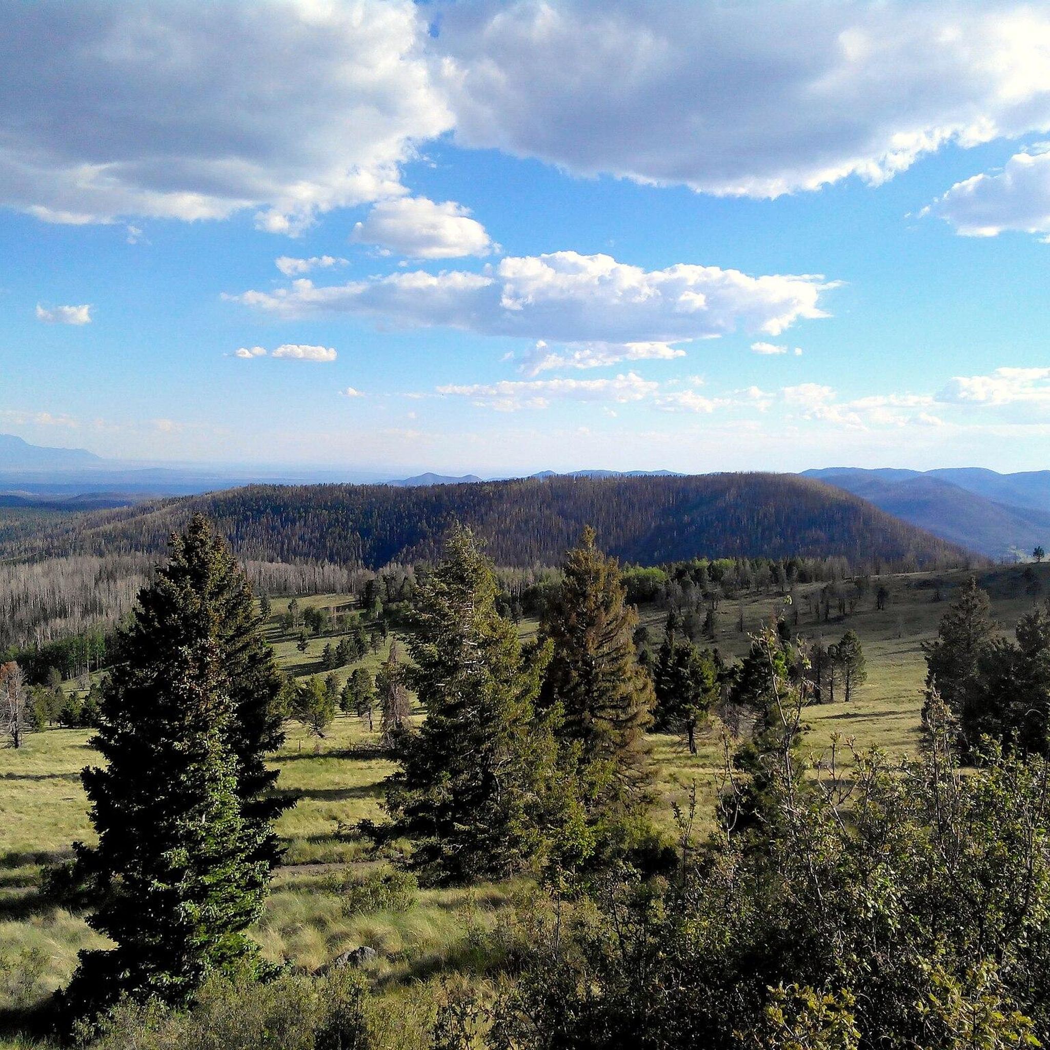
This junction gives you a great view of Redondo Peak and the valley in between. This area does have private houses, so it's important to stay on the trail while taking in the views.
0
0

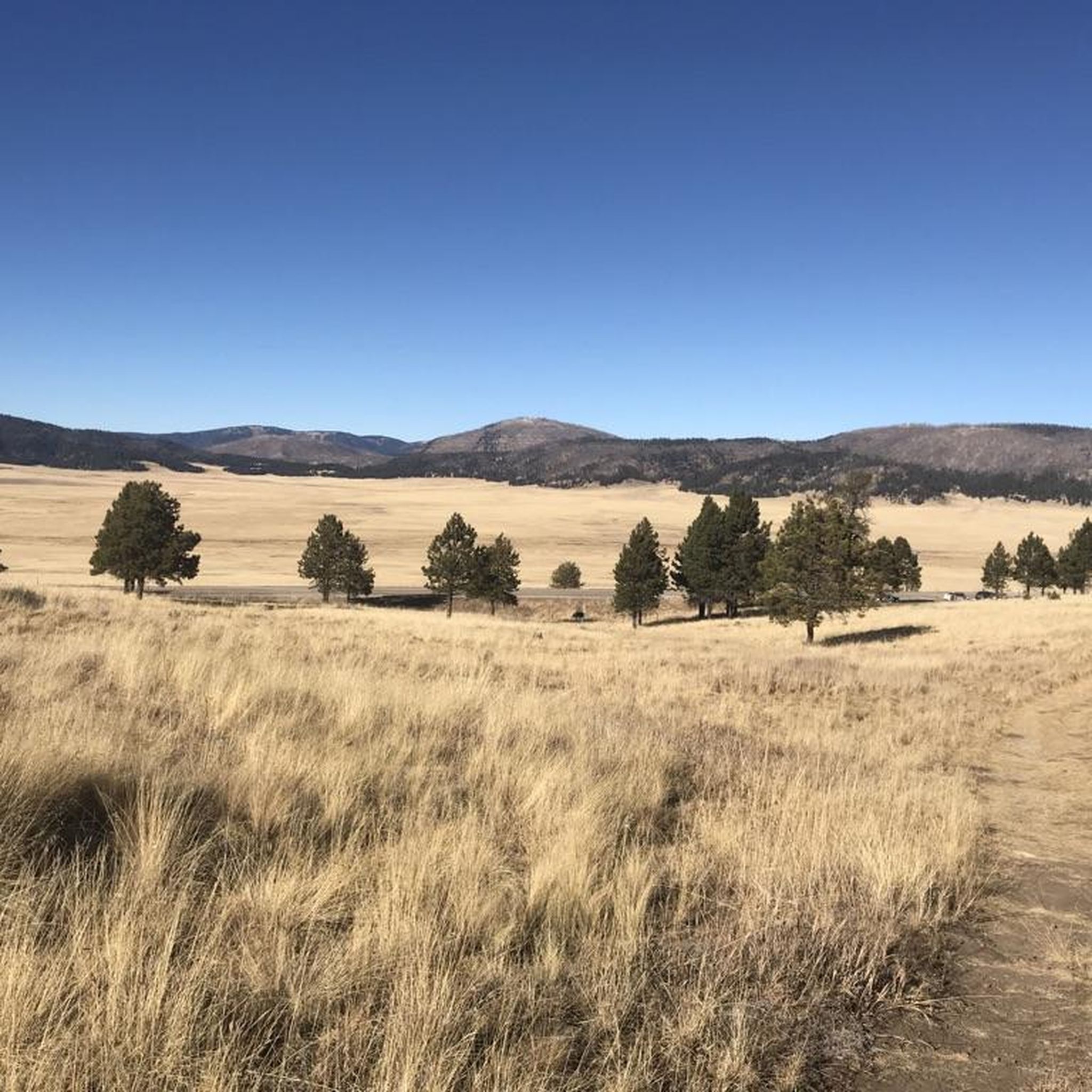
Valles Caldera National Preserve in northern New Mexico is a 13.7-mile-wide volcanic caldera formed by a massive eruption approximately 1.2 million years ago. Now the area is full of mountains, meadows, and interesting geothermal features.
0
0
Sulphur Springs is a ghost town that once was home to a sulfur mine and spa. There is visible geothermal activity, so you could catch some bubbling ponds on your run by here, but beware of strong gases and fumes coming out of the ground.
0
0
This junction gives runners a great view of Redondo Peak and the valley in between. This area does have private houses, so it's important to stay on the trail while taking in the views.
0
0
This junction gives hikers a great view of Redondo Peak and the valley in between. This area does have private houses, so it's important to stay on the trail while taking in the views.
0
0

The Valles Caldera, a twenty kilometer wide circular depression, is a geological gem created by a volcanic eruption that took place around 1.25 million years ago. Today it is a protected area that covers over 39,000 hectares and attracts around 120,000 annual visitors who wish to hike, horseback ride, mountain bike, camp or fish for trout, as well as cross-country skiing and snowshoeing in winter. Located just 22 kilometers west of downtown Los Alamos, the Valles Caldera National Preserve is also a popular hunting destination, as it claims the second largest elk population in the state, and more 400 wild turkeys live in the reserve from April to December. Other wildlife, such as prairie dogs, black bears, and golden eagles, also call this wilderness home.
0
0

South Mesa is one of four beautiful mesas that comprise Los Alamos. This area is home to a diverse range of wildlife and vegetation, with an abundance of Ponderosa pines and over 200 species of birds. Some of the most common birds you might spot here are hummingbirds, woodpeckers, and ravens. If you're lucky, you may even catch a glimpse of the majestic great horned owl known to inhabit this area.
0
0
Frequently Asked Questions
What kind of terrain can I expect on touring cycling routes in Valles Caldera National Preserve?
Touring cycling in Valles Caldera National Preserve offers a diverse range of terrain. You'll encounter expansive grassland meadows, known as "valles," surrounded by forested volcanic domes and old-growth Ponderosa pine groves. Some routes, like the Valle Grande Loop, utilize a mix of maintained gravel backcountry vehicle roads, rougher old ranching roads, and paved sections of New Mexico State Route 4. This means you should be prepared for varied surfaces, from smooth pavement to potentially wet or muddy dirt roads, depending on the season.
Are there touring cycling routes for different skill levels in Valles Caldera National Preserve?
Yes, Valles Caldera National Preserve offers touring cycling routes catering to various skill levels. The guide includes options ranging from easy to difficult. For example, the American Springs Loop is a moderate 11.4-mile trail, while routes like Cerro Piñon – View of Redondo Peak loop from Cerro la Jara and Bike loop from La Cueva are considered difficult, offering more challenging climbs and longer distances.
What natural features and landmarks can I see while cycling in Valles Caldera National Preserve?
While cycling, you can experience the preserve's unique volcanic landscape, including the vast Valles Caldera National Preserve itself, with its expansive meadows and forested volcanic domes. Keep an eye out for wildlife, such as the second-largest elk population in New Mexico, Gunnison prairie dogs, and various birds. Notable viewpoints include View of Redondo Peak and Valle Grande - crater view east. You might also spot a Prairie Dog Colony on Cerro La Jara Trail.
Is parking available for touring cyclists in Valles Caldera National Preserve?
Parking is generally available within Valles Caldera National Preserve, particularly at designated access points and trailheads. However, park roads can be winding and narrow with limited shoulders, and traffic can be heavy at times. It's advisable to check specific parking locations for your chosen route in advance and be prepared for potentially busy areas, especially during peak seasons.
Do I need a permit to go touring cycling in Valles Caldera National Preserve?
Cyclists can access much of the backcountry by bike in Valles Caldera National Preserve without needing a special permit. This allows for extensive exploration of primitive dirt roads and two-tracks. However, always check the official National Park Service website for any updated regulations or specific area restrictions before your visit.
What is the best time of year for touring cycling in Valles Caldera National Preserve?
Touring cycling in Valles Caldera National Preserve is possible year-round, weather permitting. However, some sections may be wet, muddy, or snow-covered seasonally, particularly during winter and early spring. The warmer months, typically late spring through early fall, offer the most favorable conditions for cycling, with drier trails and pleasant temperatures. Always check the local weather forecast before heading out.
Are there family-friendly touring cycling routes in Valles Caldera National Preserve?
While many routes in Valles Caldera National Preserve involve varied terrain and significant elevation changes, there are options suitable for families. Look for routes designated as 'easy' or 'moderate' in difficulty. For instance, the South Mesa loop is a moderate route that could be suitable for families with some cycling experience, offering a good balance of distance and elevation.
Are dogs allowed on touring cycling routes in Valles Caldera National Preserve?
Pets are generally allowed in Valles Caldera National Preserve, but specific rules apply. They must be on a leash no longer than six feet and are typically restricted to roads, developed areas, and designated trails. It's always best to check the official National Park Service guidelines for the most current information regarding pets on trails to ensure compliance and safety for your dog and local wildlife.
Are there amenities like cafes or accommodation near the touring cycling routes?
Valles Caldera National Preserve is a relatively remote area, and amenities like cafes or extensive accommodation options are limited directly within the preserve. It's recommended to bring all necessary supplies, including water and snacks, for your ride. Nearby towns outside the preserve may offer more services. For information on ranger-led activities or visitor services, you can check the official NPS website: nps.gov/vall.
What should I wear when touring cycling in Valles Caldera National Preserve?
Given the varied terrain and potential for changing weather, it's advisable to dress in layers. High-visibility clothing is strongly recommended due to winding roads and potential traffic. Essential gear includes a helmet, appropriate cycling shoes, and sun protection. Be prepared for temperature fluctuations, especially at higher elevations, and carry rain gear if there's a chance of precipitation.
How many touring cycling routes are available in Valles Caldera National Preserve?
There are over 9 touring cycling routes documented in Valles Caldera National Preserve, offering a range of experiences from moderate to difficult. These routes allow cyclists to explore the unique volcanic landscape, expansive meadows, and forested areas of the preserve.
What do other touring cyclists enjoy the most about touring cycling in Valles Caldera National Preserve?
The area is highly rated by the komoot community, with an average score of 5.0 stars. Reviewers often praise the unique volcanic landscape, the expansive mountain meadows, and the sense of solitude found on the trails. The opportunity to spot abundant wildlife, such as elk, and the panoramic views of the caldera are frequently highlighted as memorable aspects of touring cycling here.
Can I explore the backcountry by bike in Valles Caldera National Preserve?
Yes, touring cyclists can access much of the backcountry by bike in Valles Caldera National Preserve. This allows for extended exploration of primitive dirt roads and two-tracks that wind through forests and across meadows, offering customizable routes depending on your time and interest. Always be prepared for remote conditions and ensure you have navigation tools.
Most popular routes in Valles Caldera National Preserve
Most popular attractions in Valles Caldera National Preserve

Get inspired with the komoot mobile app


Explore more
Browse the best Cycling routes in other regions.
