The best running trails in Lost Spring Canyon Wilderness Study Area
4.5
(3)
343
runners
3
runs
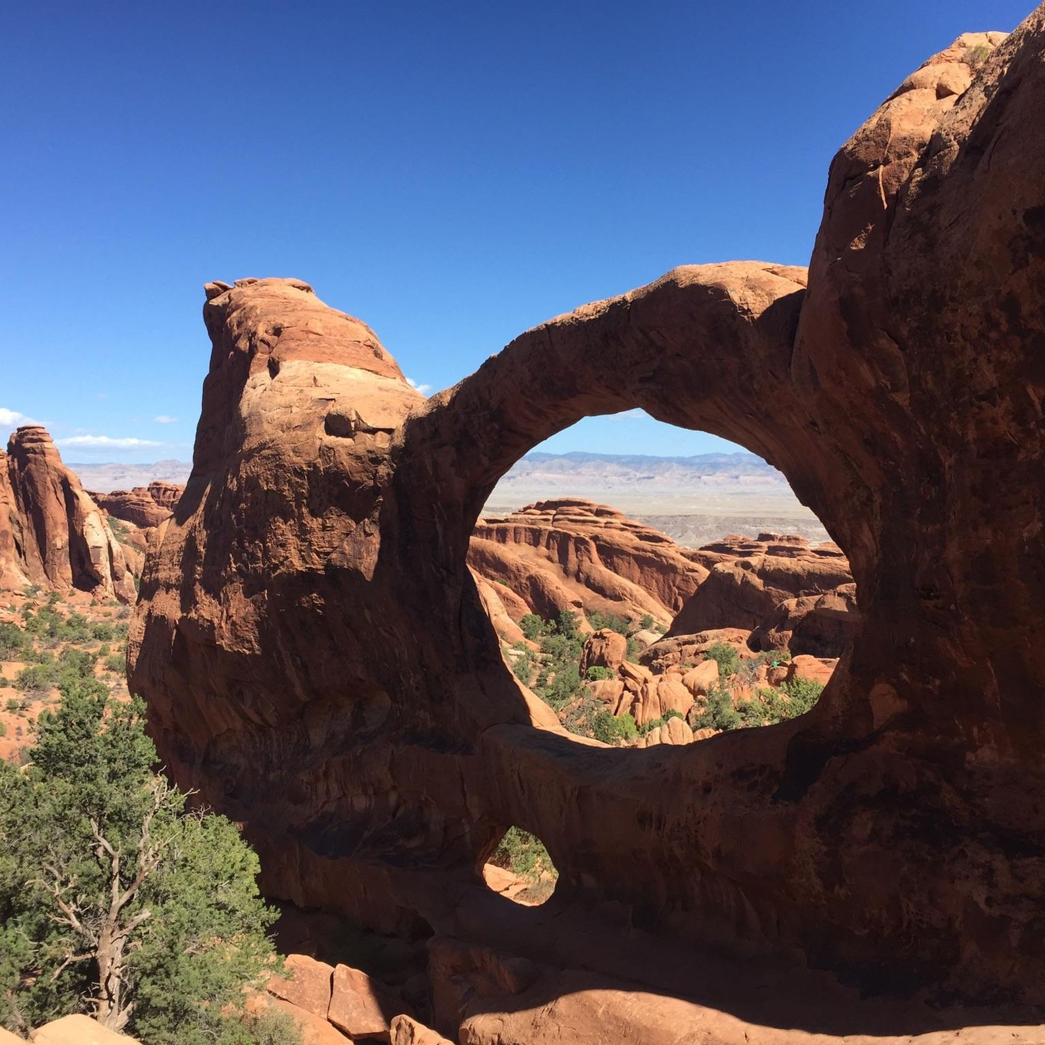
Jogging in Lost Spring Canyon Wilderness Study Area provides access to a landscape characterized by deep canyons, natural sandstone arches, and expansive desert terrain. The region features rugged trails that navigate through unique geological formations, offering a challenging environment for runners. Elevation changes are present, with routes traversing varied surfaces typical of a wilderness study area.
Best jogging routes in Lost Spring Canyon Wilderness Study Area
- The most popular jogging route is Delicate Arch Trail, a 3.3 miles (5.3 km) trail that takes 50 minutes to complete. This route leads to the iconic Delicate Arch, a prominent natural landmark.
- Another top favourite among local runners is Landscape Arch – Partition Arch loop from Skyline Arch, a difficult 4.9 miles (7.9 km) path. This route explores multiple natural arches and rock formations within the canyon system.
- Local runners also love the Devil's Garden Primitive Loop, a 5.5 miles (8.9 km) trail leading through a rugged area of sandstone fins and spires, often completed in about 1 hour 16 minutes.
- Jogging in Lost Spring Canyon Wilderness Study Area is defined by sandstone arches, deep canyons, and desert rock formations. The network offers options primarily for experienced runners seeking challenging routes.
- The routes in Lost Spring Canyon Wilderness Study Area are highly rated by the komoot community with an average score of 4.5 stars from over 3 reviews. More than 300 runners have used komoot to explore Lost Spring Canyon Wilderness Study Area's varied terrain.
Last updated: June 25, 2026
245
runners
5.34km
00:50
160m
160m
Prepare for a difficult jogging experience on the Delicate Arch Trail, covering 3.3 miles (5.3 km) with a challenging 526 feet (160 metres) of elevation gain. You can expect to complete this route in about 50 minutes. The trail begins near the historic Wolfe Ranch and ancient Ute petroglyphs, quickly transitioning to an open slickrock ascent. As you follow the cairns, you will be treated to dramatic desert vistas before the iconic Delicate Arch, a 46-foot high natural monument, finally comes into view.
When planning your visit, remember that the trail offers very little shade, especially during the warmer months. It is crucial to carry at least 2 quarts of water per person and try to avoid jogging during the midday heat. If you plan to visit in winter, be aware that ice can make parts of the route extremely slippery, so consider bringing traction devices for your shoes. Always check current park conditions before heading out.
This route is notable for its dramatic reveal of Delicate Arch, a natural sandstone arch that stands as a prominent symbol of Utah. The trail itself provides a journey through diverse desert terrain, from historical sites to expansive slickrock landscapes. It offers a unique opportunity to experience the raw beauty and geological wonders of Arches National Park up close.
5.0
(1)
18
runners
7.90km
01:02
150m
150m
Hard run. Good fitness required. Sure-footedness, sturdy shoes and alpine experience required.

Sign up for free
4.0
(2)
80
runners
8.88km
01:16
180m
180m
The Devil's Garden Primitive Loop offers an immersive journey through Arches National Park's most concentrated collection of natural arches and towering sandstone fins. You'll navigate a diverse landscape of slickrock, sandy washes, and narrow ledges, with highlights like Tunnel Arch and Pine Tree Arch appearing along the way. This 5.5-mile (8.9 km) route, with 596 feet (182 metres) of elevation gain, is rated difficult and takes about 1 hour and 16 minutes to jog, making it ideal for those seeking a technical and rewarding trail run.
To make the most of your visit, plan to arrive at the Devil's Garden trailhead early in the morning to secure parking and avoid the busiest times. The trail offers very little shade, so carrying plenty of water is essential, especially during warmer months. Starting your jog early also helps you beat the intense desert heat and enjoy the cooler temperatures.
What truly sets this trail apart is its adventurous character; the Primitive Loop section requires good route-finding skills and often involves scrambling over rock fins, providing a more hands-on experience than other park trails. It's a chance to escape the crowds found on the initial sections and discover a deeper solitude amidst the park's unique geological wonders, including the impressive Landscape Arch.
Our route recommendations are based on thousands of hikes, rides, and runs completed by other people on komoot.
Start today with a free account
Your next adventure awaits.
Login or Signup
Popular around Lost Spring Canyon Wilderness Study Area
Tips from the Community

A unique and scenic hike that's definitely worth doing. However, the path isn't always easy, and you'll need to be a good walker.
0
0
The Navajo Arch is located at the end of the Devil Gardens Trail. The path there is not easy and leads over slickrock, among other things. The arch is very impressive and somewhat hidden.
0
0
Another impressive sandstone arch in Devils Garden.
0
0
Pine Tree Arch is located on the Devils Garden Trail. You have to take a short detour from the main trail to reach it.
0
0
The Devil's Garden Trail is the longest and most arched hiking trail in Arches National Park and is considered one of its main highlights. The trail is highly varied and leads through dramatic scenery.
0
0
The Devil's Garden Trail is the longest and most arched hiking trail in Arches National Park and is considered one of its main highlights. The trail is highly varied and leads through a dramatic landscape of towering sandstone "fins," requiring some climbing and a head for heights. The trail accesses the largest concentration of natural stone arches in the park. The first section is a wide, well-maintained trail and leads directly to Landscape Arch, the longest arch in North America.
0
0
Partition Arch is located on a hike that includes numerous other sandstone arches and caves. A very beautiful and interesting hike.
0
0
The Wolfe Ranch in Arches National Park is a historic settlement site and the starting point for the hike to the famous Delicate Arch. A simple log cabin (built in 1906) and other remnants (such as a cellar and a pen) of a small ranch founded by Civil War veteran John Wesley Wolfe in the late 19th century. Located on Salt Wash, northeast of present-day Moab, where Wolfe and his family attempted to raise cattle and farm in isolation, the ranch remains serve as a historical attraction and a parking area and trailhead for the popular Delicate Arch hiking trail and a short trail to petroglyphs (rock carvings). It offers a glimpse into the harsh pioneer life in arid Utah.
0
0
Frequently Asked Questions
What is the general difficulty level of running trails in Lost Spring Canyon Wilderness Study Area?
The running trails in Lost Spring Canyon Wilderness Study Area are primarily designed for experienced runners. All routes listed are rated as difficult, featuring rugged terrain, varied surfaces, and significant elevation changes. This challenging environment is characteristic of a wilderness study area.
Are there any easy running routes for beginners in Lost Spring Canyon Wilderness Study Area?
Based on the available routes, there are no easy running trails in Lost Spring Canyon Wilderness Study Area. All routes are categorized as difficult, making them more suitable for experienced runners seeking a challenge rather than beginners.
How many running routes are available in Lost Spring Canyon Wilderness Study Area?
There are 3 dedicated running routes available in Lost Spring Canyon Wilderness Study Area, all of which are rated as difficult. These include popular options like the Delicate Arch Trail and the Devil's Garden Primitive Loop.
Are permits required for running in Lost Spring Canyon Wilderness Study Area?
As a Wilderness Study Area, specific regulations may apply. It is advisable to check with the Bureau of Land Management (BLM) or relevant local authorities for any permit requirements before planning your run, especially for overnight stays or larger groups.
Is parking available for the running trails in Lost Spring Canyon Wilderness Study Area?
While specific parking details for each trailhead are not provided, access to Wilderness Study Areas typically involves designated parking areas at trailheads or entry points. It's recommended to research specific trail access points before your visit to confirm parking availability.
Are the running trails in Lost Spring Canyon Wilderness Study Area suitable for families?
Given that all running routes in Lost Spring Canyon Wilderness Study Area are rated as difficult, with rugged terrain and elevation changes, they may not be suitable for all families, especially those with young children or individuals new to strenuous outdoor activities. These trails are better suited for experienced and well-prepared individuals.
Can I bring my dog on the running trails in Lost Spring Canyon Wilderness Study Area?
Regulations regarding dogs in Wilderness Study Areas can vary. It's crucial to verify the specific rules for Lost Spring Canyon Wilderness Study Area with the Bureau of Land Management (BLM) or local park authorities. If dogs are permitted, they are typically required to be on a leash to protect wildlife and preserve the natural environment.
What kind of scenery can I expect while running in Lost Spring Canyon Wilderness Study Area?
Runners in Lost Spring Canyon Wilderness Study Area can expect breathtaking desert landscapes characterized by deep canyons, impressive natural sandstone arches, and expansive desert terrain. The routes navigate through unique geological formations, offering stunning views of rock fins, spires, and other desert features.
Are there circular running routes in Lost Spring Canyon Wilderness Study Area?
Yes, there are circular running routes available. For example, the Landscape Arch – Partition Arch loop from Skyline Arch is a difficult 4.9-mile loop that explores multiple natural arches and rock formations.
What is the best time of year to go running in Lost Spring Canyon Wilderness Study Area?
The best time to run in Lost Spring Canyon Wilderness Study Area is typically during the spring (March to May) and fall (September to November) when temperatures are milder. Summer can be extremely hot, and winter can bring cold temperatures and occasional snow, making conditions more challenging.
What are the considerations for winter running in Lost Spring Canyon Wilderness Study Area?
Winter running in Lost Spring Canyon Wilderness Study Area can be challenging due to cold temperatures, potential for ice or snow, and shorter daylight hours. Proper layering, traction devices for footwear, and awareness of weather conditions are essential. Always check forecasts and trail conditions before heading out.
Can I expect to see wildlife while running in Lost Spring Canyon Wilderness Study Area?
As a wilderness area, there is potential to encounter desert wildlife such as various bird species, lizards, snakes, and possibly larger mammals like deer or bighorn sheep. Maintaining a respectful distance and staying on marked trails helps protect both you and the animals.
Are there good viewpoints along the running trails?
Yes, the rugged terrain and unique geological formations of Lost Spring Canyon Wilderness Study Area offer numerous opportunities for scenic viewpoints. Routes often lead to iconic natural arches and elevated positions, providing expansive vistas of the canyons and desert landscape.
What do other runners say about the trails in Lost Spring Canyon Wilderness Study Area?
The running routes in Lost Spring Canyon Wilderness Study Area are highly rated by the komoot community, with an average score of 4.5 stars. Runners often praise the challenging nature of the trails and the stunning, unique desert scenery, particularly the natural arches and rock formations.
Most popular routes in Lost Spring Canyon Wilderness Study Area

Get inspired with the komoot mobile app


Explore more
Browse the best Running Trails & Routes in other regions.
