The best road cycling routes around Stadtilm
4.6
(536)
6,827
riders
14
rides
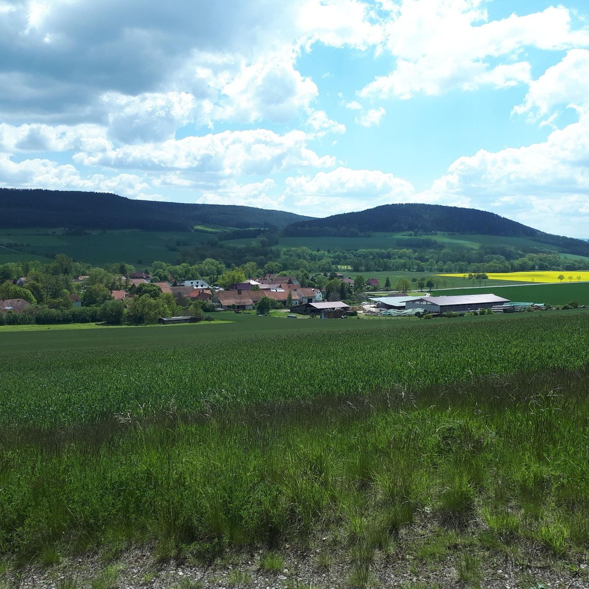
Road cycling routes around Stadtilm are set within a landscape characterized by picturesque hills and green forests, offering varied terrain for cyclists. The region is situated on the edge of the Thuringian Forest, providing both challenging ascents and scenic views. The Ilm river flows through Stadtilm, with routes often following its banks on well-paved roads. This area features scenic valleys and wide panoramic views.
Best road cycling routes around Stadtilm
- The most popular road cycling route is Town Hall Gräfinau-Angstedt…
Last updated: October 12, 2026
5.0
(3)
23
riders
28.2km
01:11
190m
190m
Easy road ride. Great for any fitness level. Mostly well-paved surfaces and easy to ride.
4.0
(1)
15
riders
27.1km
01:19
300m
300m
Moderate road ride. Good fitness required. Some segments of this route may be unpaved and difficult to ride.

13
riders
71.9km
03:11
690m
690m
Moderate road ride. Good fitness required. Mostly well-paved surfaces and easy to ride.
12
riders
53.4km
02:22
480m
480m
Moderate road ride. Good fitness required. Some segments of this route may be unpaved and difficult to ride.
13
riders
28.0km
01:09
120m
120m
Easy road ride. Great for any fitness level. Mostly well-paved surfaces and easy to ride.
Get access to more routes and recommendations from other explorers.
Already have an account?
Our route recommendations are based on thousands of hikes, rides, and runs completed by other people on komoot.
Start today with a free account
Your next adventure awaits.
Tips from the Community

The keystone of the arch bears the year 1747. 😄 👍
0
0

That was the only really beautiful stretch of bike path on this bike tour.
1
0

Beautiful, well-preserved and clearly visible church.
0
0

Hall church with three-sided choir from 1706. Retracted west tower from the previous building from the 15th century
0
0

Impeccable surface, sufficient width for oncoming traffic.
0
0
The road surface is no longer ideal for fast descents. It's better for climbing.
0
0
Be careful on the descent! There are three tricky-to-predict rain gutters across the road. Without brakes, the wheels will be shot to pieces.
0
0
A wonderful section of the cycle path where you'll gladly take advantage of such a well-maintained rest area.
0
0
Frequently Asked Questions
What kind of terrain can I expect on road cycling routes around Stadtilm?
Road cycling routes around Stadtilm feature a diverse landscape of picturesque hills and green forests. You'll find varied terrain, from gentle gradients along the Ilm river to more challenging ascents as you approach the Thuringian Forest. The area also offers scenic valleys and wide panoramic views.
Are there road cycling routes suitable for beginners or families in Stadtilm?
Yes, Stadtilm offers several easy road cycling routes perfect for beginners or families. For instance, the Town Hall Gräfinau-Angstedt – Oberilm Viaduct loop from Niederwillingen is an easy 28.2 km trail with gentle gradients. Another great option is the Kleinhettstedt Mustard Mill – Dienstedt Karst Cave loop from Großhettstedt, which is also classified as easy.
What are the best seasons for road cycling in Stadtilm?
The best seasons for road cycling in Stadtilm are spring and summer, when the weather is warm and sunny, and nature is in full bloom. Autumn also provides wonderful tours with colorful foliage, offering vibrant colors across the landscape.
Are there any challenging road cycling routes for experienced riders?
Yes, for experienced riders seeking a challenge, the region around Stadtilm, particularly towards the Thuringian Forest, offers routes with significant climbs and breathtaking views. While specific challenging routes are not detailed here, the area is known for options like the Rennsteig Pass and Schneekopf, which provide demanding ascents.
What historical or natural attractions can I see along the road cycling routes?
Many road cycling routes in Stadtilm integrate cultural and historical points of interest. You can encounter sights like the Riechheimer Berg Tower and Inn or the Prince Karl-Günther Monument on Langer Berg. Natural features include the Ilm river, and you might even find routes leading to the Strudeltöpfe in the Schwarzatal or the Kammerlöcher Rock Formations.
Are there any circular road cycling routes available?
Many routes around Stadtilm are designed as loops, offering convenient circular tours. For example, the Stadtilm City Wall – Ilm Weir Stadtilm loop from Traßdorf is a moderate 27.2 km circular path. Another option is the longer Hohenfelden Reservoir – View of Niederburg loop from Niederwillingen, which covers 70.9 km.
What do other road cyclists say about the routes in Stadtilm?
The road cycling routes in Stadtilm are highly rated by the komoot community, with an average score of 4.75 stars from over 7 reviews. Cyclists often praise the varied terrain, picturesque landscapes, and the integration of natural and historical attractions into the routes.
Are there any routes that pass by significant viewpoints?
Yes, the region offers routes with wide panoramic views, especially as you ascend into the hillier sections or near the Thuringian Forest. The Riechheimer Berg Summit and Bismarck Monument is a notable viewpoint that can be incorporated into longer rides, offering expansive vistas of the surrounding area.
How many road cycling routes are available in the Stadtilm area on komoot?
There are over 10 road cycling routes available in the Stadtilm area on komoot, catering to various difficulty levels from easy to difficult.
Can I find routes that combine cycling with visits to castles?
Absolutely. The region around Stadtilm is rich in historical sites. While cycling, you might pass by or near castles such as Greifenstein Castle. Routes often lead to or offer views of these historical landmarks, enriching your ride with cultural exploration.
Are there any routes that follow rivers or offer waterside views?
Yes, the Ilm river flows through Stadtilm, and many cycling routes follow its banks. These routes often feature well-paved roads with minimal traffic, providing idyllic natural settings and pleasant waterside views. The renowned Ilmtal cycle path is a prime example of such a route.
Most popular routes around Stadtilm
Most popular attractions around Stadtilm

Get inspired with the komoot mobile app


Explore more
Browse the best Road cycling routes in other regions.
