The best walks and hikes in Franconia Notch State Park
4.7
(326)
5,638
hikers
71
hikes
Hiking in Franconia Notch State Park is set within a mountain pass between the Kinsman and Franconia mountain ranges. The region's terrain is characterized by forested trails, granite gorges, and exposed alpine ridges. Key natural features include the Flume Gorge, Lonesome Lake, and the Pemigewasset River, which carves through the landscape. The park offers diverse landscapes, from deep gorges to high mountain ridges, providing varied hiking experiences.
Best hiking trails in Franconia Notch State Park
- The most popular hiking route is Franconia Ridge Loop, an 8.4 miles (13.6 km) trail that takes 6 hours 54 minutes to complete. This difficult hike follows the second-highest range in the White Mountains.
- Another top favourite among local hikers is North Kinsman, South Peak and Cannon Balls Loop Trail, a difficult 10.9 miles (17.5 km) path. This challenging route explores the Kinsman mountain range, offering extensive views.
- Local hikers also love the Flume Gorge Trail, a 2.2 miles (3.6 km) trail leading through a natural gorge with granite walls, often completed in about 1 hour 5 minutes.
- Hiking in Franconia Notch State Park is defined by its high mountain ridges, deep gorges, and numerous waterfalls. The trail network provides routes for all ability levels, from short walks to challenging alpine traverses.
- The routes in Franconia Notch State Park are highly rated by the komoot community with an average score of 4.6 stars from over 310 reviews. More than 5,000 hikers have used komoot to explore Franconia Notch State Park's varied terrain.
Last updated: October 10, 2026
4.9
(43)
1,007
hikers
13.6km
06:54
1,070m
1,050m
The Franconia Ridge Loop is a truly spectacular hike, renowned for its dramatic alpine ridgeline and panoramic views across the White Mountains. You'll navigate diverse terrain, from waterfall-laden paths like the Falling Waters Trail to steep, rocky ascents leading to exposed summits. The highlight is traversing the narrow ridge connecting Little Haystack Mountain, Mount Lincoln, and Mount Lafayette, where you'll feel on top of the world with expansive vistas in every direction.
This difficult 8.4-mile (13.6 km) loop involves a substantial 3499 feet (1067 metres) of elevation gain, typically taking around 6 hours and 54 minutes. Due to its challenging nature and exposed sections, it's best suited for experienced hikers who are prepared for rapidly changing weather conditions. Arrive early, especially on weekends, as the trailhead parking fills up quickly for this popular route.
Part of the world-famous Appalachian Trail, the Franconia Ridge Loop is a classic New Hampshire experience. The route offers the option to visit the Greenleaf Hut, providing a potential stop for amenities. Its unique combination of challenging terrain, significant elevation, and breathtaking scenic viewpoints makes it a must-do for those seeking an unforgettable adventure in the White Mountains.
4.8
(65)
807
hikers
3.57km
01:06
120m
120m
The Flume Gorge Trail offers a truly unique journey through a narrow, 800-foot-long granite gorge in Franconia Notch State Park. You'll walk on sturdy boardwalks alongside moss-covered walls, experiencing the cool, misty atmosphere and the roar of Avalanche Falls, a 45-foot waterfall. This easy 2.2-mile (3.6 km) loop, with a gentle 387 feet (118 metres) of elevation gain, is a high-payoff hike that takes just over an hour, immersing you in stunning natural beauty.
Planning your visit requires a bit of foresight; reservations are strongly recommended, especially during busy times, as walk-ins are not guaranteed. The trail is well-maintained with paved sections and boardwalks, but be prepared for some uphill walking and stairs. While it's a family-friendly adventure, it's not suitable for strollers, and good grip footwear is advised for potentially slippery boardwalks near the falls.
This trail stands out for its unique geological formation, a granite gorge shaped by glaciers over millions of years. Beyond the main gorge, you'll encounter historic covered bridges, including the Pemigewasset Covered Bridge, and can even explore narrow passages like the "Bear Cave" and "Wolf's Den." It's a highlight of Franconia Notch State Park, offering an intimate view of New Hampshire's natural wonders.

4.5
(8)
95
hikers
17.5km
07:49
1,200m
1,200m
The North Kinsman, South Peak and Cannon Balls Loop Trail is a demanding but incredibly rewarding journey through Franconia Notch State Park. You'll navigate rugged terrain, including steep climbs, rocky sections, and challenging scrambles over the unique Cannonballs. Along the way, the trail offers diverse scenery, from the tranquil waters of Lonesome Lake and Kinsman Pond to the exposed, windy summits providing spectacular 180-degree views of Cannon Mountain and the Franconia Ridge.
This difficult 10.9-mile (17.5 km) loop, with its 3934 feet (1199 metres) of elevation gain, typically takes around 7 hours and 48 minutes, though many hikers find it takes longer. Parking is available at Lafayette Place Campground, a popular trailhead, so an early start is recommended, especially on busy days. Be prepared for potentially wet and muddy sections, and remember that microspikes or snowshoes are crucial if you're tackling this route in colder, icy conditions.
This loop is a prime example of the rugged beauty of the White Mountains, allowing you to summit three New Hampshire 4,000-footers: Cannon Mountain, North Kinsman, and South Kinsman. The route also features the picturesque Lonesome Lake, home to an Appalachian Mountain Club (AMC) hut, offering a chance for a brief respite or even an overnight stay during its full-service season. It's a true test of endurance for experienced hikers seeking a memorable adventure.
5.0
(5)
125
hikers
6.27km
03:39
620m
620m
The Cannon Mountain via Kinsman Ridge Trail offers a rugged and rewarding journey to a prominent White Mountain peak. You'll navigate constantly rough and rocky terrain, including steep grades and sections of rock scrambling, as you ascend through dense woods and open ledges. The payoff is spectacular: 360-degree panoramic views from the summit of Cannon Mountain, showcasing the Franconia Range, Echo Lake, and distant peaks, with the Cannon Cliffs viewpoint providing a memorable vista across Franconia Notch during your climb.
This 3.9-mile (6.3 km) hiking route, rated moderate despite its challenging nature, involves a significant 2046 feet (623 metres) of elevation gain and typically takes around 3 hours and 39 minutes. Parking is available at the trailhead, but it's wise to arrive early, especially on busy days, as this is one of the popular routes to a 4,000-footer. Be prepared for winter conditions, as snow and ice can make the trail particularly difficult, often necessitating microspikes or snowshoes.
Cannon Mountain is notable for being one of the shortest routes to a 4,000-foot peak in the White Mountains, making it a favorite for those seeking a strenuous but relatively quick summit. The mountain also hosts the Cannon Mountain Aerial Tramway and a ski area, adding unique infrastructure to the summit experience, including an observation tower. Historically, it was home to the famous "Old Man of the Mountain" rock formation until its collapse, and it boasts North America's first aerial tramway, built in 1938.
3.7
(3)
75
hikers
4.76km
02:37
730m
0m
The Old Bridle Path offers a classic White Mountains hiking experience, starting in dense forest before transitioning to a steep, rocky ascent. As you climb, the views become increasingly expansive, revealing the stunning Franconia Ridge, including Mount Lafayette and Mount Lincoln, and sweeping vistas across to Cannon Mountain. This moderate 3.0-mile (4.8 km) trail, with its 2399 feet (731 metres) of elevation gain, is a rewarding challenge for those seeking big mountain scenery.
Planning your visit means preparing for a sustained climb on varied terrain. While specific parking information isn't always detailed, expect to find trailhead access within Franconia Notch State Park. Recent "Restore The Ridge" rehabilitation efforts have improved some sections with new rock steps, but the path remains rugged. The AMC Greenleaf Hut, a popular stop along the way, provides a great place to rest and refuel.
This trail is most notable as a crucial segment of the Franconia Ridge Loop, a route recognized globally for its beauty. Completing the Old Bridle Path typically takes around 2 hours and 37 minutes, making it a substantial day hike or a perfect approach to the Greenleaf Hut for an overnight adventure. It's an excellent choice if you want to experience the grandeur of the White Mountains.
Get access to more routes and recommendations from other explorers.
Already have an account?
Our route recommendations are based on thousands of hikes, rides, and runs completed by other people on komoot.
Start today with a free account
Your next adventure awaits.
Other adventures in Franconia Notch State Park

Tips from the Community


At this point in your hike you'll be treated to spectacular, panoramic views of Mount Lafayette to your left, and Mount Lincoln on your right.
0
0
At this point in your hike you'll start to catch sight of Lonesome Lake, and it's incredible natural scenery.
0
0
Lonesome Lake’s still waters reflect the surrounding peaks, creating stunning photo opportunities, especially at sunrise or sunset. Pack a snack and relax on the boardwalk—it's the perfect spot for peaceful mountain views for a break during your hike.
0
0
From this point you can take in a lovely view of Mount Lafayette, with even more striking views on a clear day.
0
0

This is a great lookout over the parkway that traverses Franconia Notch, to your west.
0
0

The Old Bridle path is one of the more famous trails in Franconia Notch in the White Mountains of New Hampshire. This steep, strenuous trail is the most popular route to the summit of Mount Lafayette, and also leads to the AMC Greenleaf Hut. It is also often completed as part of a large, but amazing loop that includes the Falling Waters Trail up to the ridge where you summit Little Haystack, Mount Lincoln, and Lafayette, before heading down the Old Bridle Path.
0
0

Wonderful viewpoint near Little Haystack Mountain. This spot is a great place for a break as you enjoy the great view of several peaks in the White Mountain National Forest.
1
0
Frequently Asked Questions
Are there any easy, family-friendly hikes in Franconia Notch?
Yes, the park has several great options for families. A popular choice is the Sentinel Pine bridge via Flume Gorge Trail loop, a relatively flat 2.2-mile (3.6 km) walk that takes you through the scenic Flume Gorge. Please note that while the trail is accessible, dogs are not permitted in the gorge itself.
Which hike offers the best views without a strenuous climb?
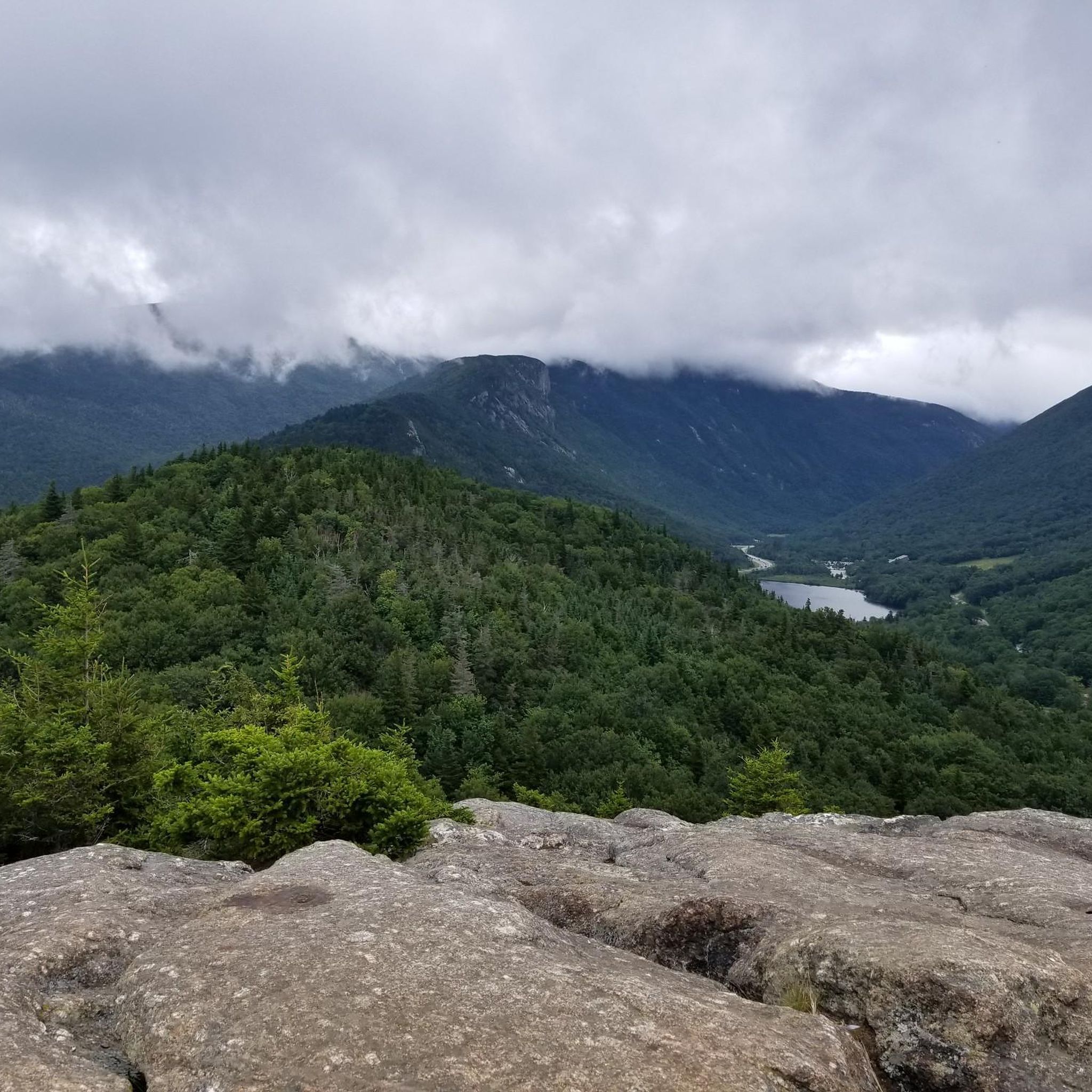
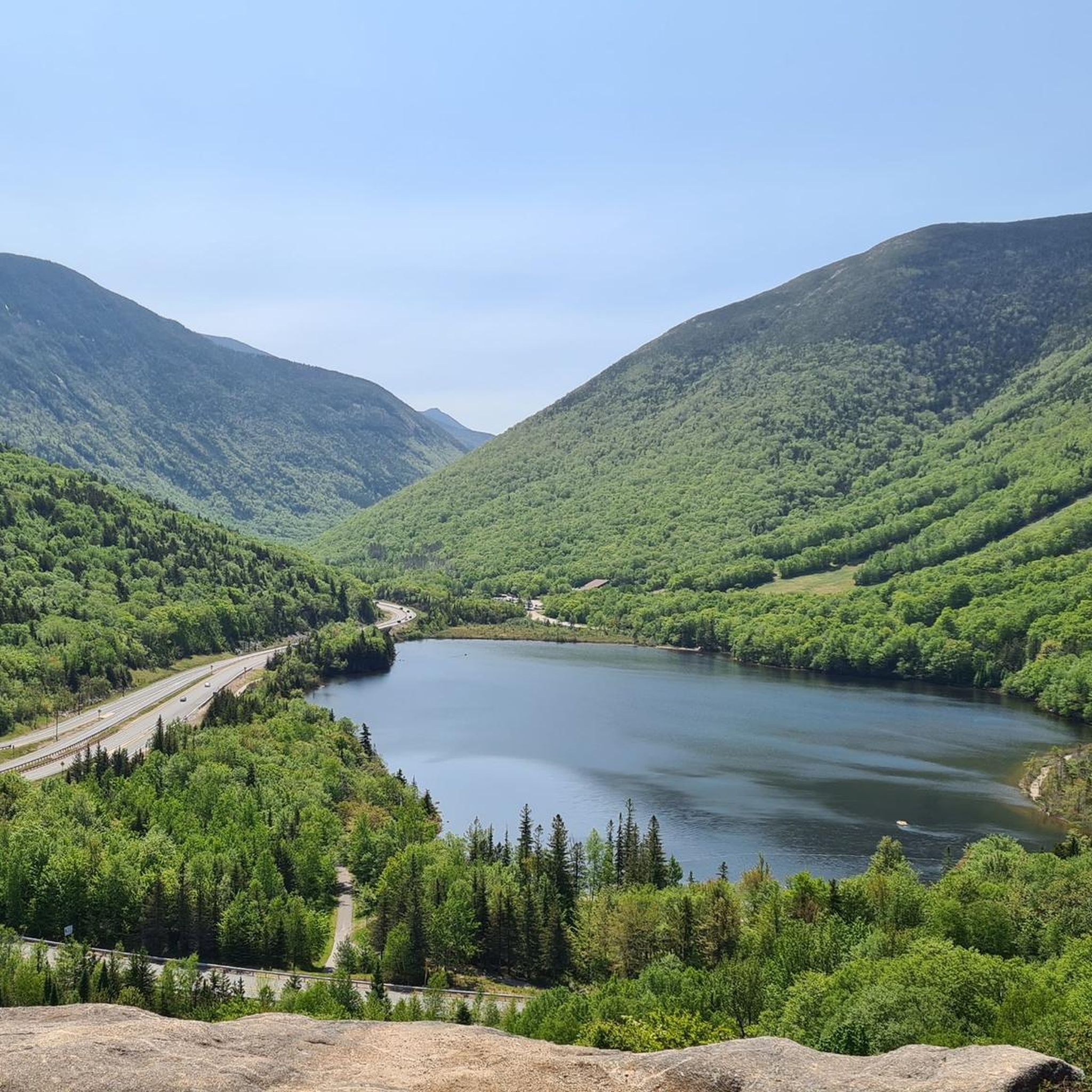
For spectacular views with minimal effort, the Bald Mountain via Artist's Bluff and Loop Trail is an excellent choice. This short 1.4-mile (2.2 km) loop leads to Artist's Bluff, which provides a famous panoramic view over Echo Lake and the surrounding notch.
Are there any good hikes with waterfalls?
Many trails in the park feature waterfalls. The Falling Waters Trail, part of the Mount Lafayette and Franconia Ridge loop, is famous for its series of cascades, including Stairs, Swiftwater, and Cloudland Falls. For a more moderate option, the Basin-Cascades Trail leads to the beautiful Kinsman Falls and Rocky Glen Falls.
Can I bring my dog on the trails?
Dogs are permitted on most trails in Franconia Notch State Park, provided they are on a leash. However, they are not allowed in certain areas, including the Flume Gorge, on the Cannon Mountain Aerial Tramway, or in the swimming area at Echo Lake Beach. Always check the official park regulations before you go.
What are the parking options for popular trailheads?
Parking is available at major trailheads, but lots can fill up very early, especially on weekends and holidays. The lots for the Franconia Ridge Loop (Falling Waters/Old Bridle Path) and Artist's Bluff are particularly popular. It's recommended to arrive early or have a backup hiking plan. Some lots may require a reservation or a fee.
Is there a good moderate day hike with varied scenery?
The Mount Pemigewasset Trail is a fantastic choice. It's a 3.5-mile (5.7 km) out-and-back hike that offers a steady climb to a summit with rewarding views of the surrounding landscape. It provides a good workout without the exposure of the higher ridges.
How many hiking trails are in Franconia Notch State Park?
There are over 70 distinct hiking routes in Franconia Notch State Park recorded on komoot. These range from short, accessible nature walks to strenuous full-day alpine traverses, offering options for every skill level.
What do other hikers enjoy about the trails here?
The trails in Franconia Notch State Park are highly regarded by the komoot community, with an average rating of 4.6 stars. Hikers frequently praise the stunning 360-degree views from the high ridges, the beauty of the numerous waterfalls, and the well-maintained trail network that navigates the park's dramatic mountain scenery.
Are there any circular hikes available?
Yes, the park has several excellent loop trails. For a challenging, full-day adventure, the Franconia Ridge Loop is an iconic choice. For a more moderate but equally scenic option, the Lonesome Lake loop via Pemi & Basin Cascades Trail is a 5.8-mile (9.3 km) route that takes you to a beautiful mountain lake and past several waterfalls.
Can I go hiking here in the winter?
Yes, winter hiking is popular in Franconia Notch, but it requires specific preparation. Trails can be icy and covered in deep snow. You will need appropriate gear such as microspikes, snowshoes, and warm, layered clothing. Always check weather forecasts and avalanche conditions before heading out, as the mountain weather can change rapidly.
What should I pack for a day hike in Franconia Notch?
For any hike, you should carry the essentials: plenty of water, snacks, a map, and a first-aid kit. The weather in the White Mountains can be unpredictable, so pack layers of clothing, including a waterproof jacket, even on a sunny day. For rocky or steep trails, sturdy hiking boots are essential.
Most popular routes in Franconia Notch State Park
Most popular attractions in Franconia Notch State Park

Get inspired with the komoot mobile app


Explore more
Browse the best Hikes in other regions.
