The best walks and hikes in Little River State Park
4.6
(13)
354
hikers
17
hikes
Hiking in Little River State Park offers diverse terrain within the Mt. Mansfield State Forest, characterized by woodlands, hills, and the Waterbury Reservoir. The park's trails navigate through areas with historical significance, including remnants of early 19th-century settlements and Civilian Conservation Corps sites. Hikers can experience a range of landscapes, from gentle paths along Stevenson Brook to routes with moderate elevation changes.
Best hiking trails in Little River State Park
- The most popular hiking route is Stevenson Brook to Hedgehog…
Last updated: July 7, 2026
5.0
(1)
6
hikers
10.5km
03:05
310m
290m
Embark on a moderate hike along the Stevenson Brook, Dalley, and Hedgehog Hill Trail Loop, a 6.5-mile (10.5 km) journey that takes about 3 hours and 4 minutes to complete.…
3.96km
01:10
180m
10m
The Stevenson Brook Trail offers a delightful journey through a cool, shady forest, closely following the babbling Stevenson Brook. You'll encounter a varied path underfoot, with some sections that might…

Sign up for free
5.0
(1)
2
hikers
10.3km
03:01
290m
290m
Hike the moderate 6.4-mile Stevenson Brook to Hedgehog Trail loop in Little River State Park, featuring historic homesteads and vistas.
5.22km
02:01
500m
160m
Prepare for a classic Green Mountain hiking adventure on the Puffer Shelter route. This moderate 3.2-mile (5.2 km) hike will challenge you with 1630 feet (497 metres) of elevation gain,…
2
hikers
9.92km
04:18
910m
910m
This difficult 6.2-mile loop to Mount Hunger and White Rock Mountain offers panoramic views and challenging terrain in Vermont's Worcester R
Get access to more routes and recommendations from other explorers.
Sign up for free
Already have an account?
Our route recommendations are based on thousands of hikes, rides, and runs completed by other people on komoot.
Start today with a free account
Your next adventure awaits.
Login or Signup



Tips from the Community

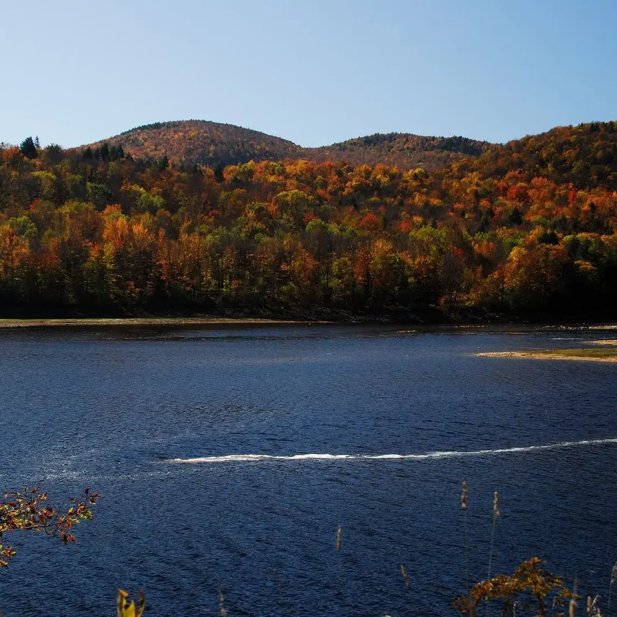
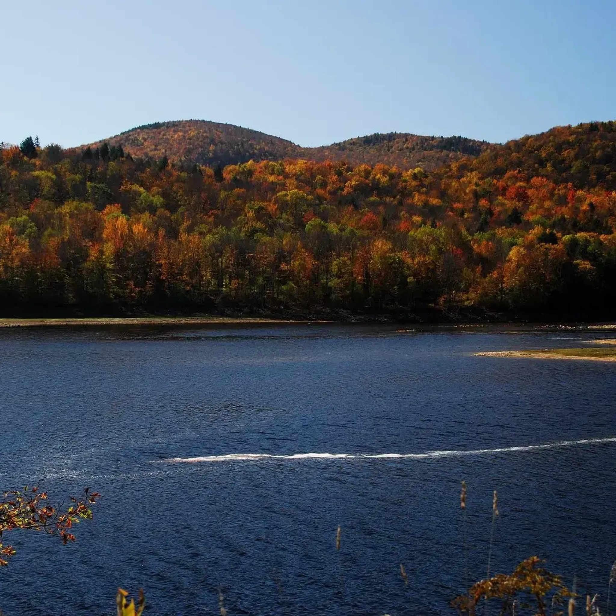
The Waterbury Reservoir offers many recreational opportunities from fishing, canoeing, kayaking, motor-boating, and swimming to hiking and camping. In the warmer months (late spring to early fall), the reservoir is kept at about 850 acres and at a max depth of ~100 feet. In the winter, the surface area is reduced to between 415 - 610 acres to prepare for spring snowmelt and rains. This scenic beach is a great place to relax and dip your feet in the water after a hike in the Little River State Park.
0
0
The Puffer Shelter is a fan favorite among Long Trail Hikers. Although the shelter itself is not particularly impressive (its a three-sided lean-to with room for about six), the stunning sunset views from the shelter help it really stand out.
0
0
Not to be confused with White Rocks in southern Vermont, White Rock Mountain in the Worcester Range stands a little shorter than its neighbor, Mount Hunger, at 3,194 feet tall. Although the actual summit is great and a nice place to rest, one of the best parts of White Rock Mountain is just before the top when you step out of the dense woods, and onto a large, open, flat rock slab surrounded by short, stunted trees. From this "table" you can see great views of Mount Hunger to the north.
0
0
This steep section of trail takes you up/down from the summit of Mount Hunger. Following the blue blazes, you must traverse steep sections of slabby granite rock and through short stunted pine trees. This is a fun, but sometimes wet and icy portion of the Middlesex Trail, so use caution and, as always, check conditions before heading up.
0
0
Mount Hunger is located within the Worcester Range and stands at 3,539 feet. Right before hitting the exposed granite summit, you need to do a little, fun scrambling to the top. From the top you can see Mt. Mansfield, the Camels Hump, a large portion of the Green Mountain Range, and on a clear day the Presidentials in the neighboring state of New Hampshire. The exposed summit is a great place to rest, sip some water, and enjoy the fantastic views!
0
0

Did this route 12.27.2020 Spikes are required equipment, but ascending late in the day may mean the snow over is already scraped off and you’ll need to spike the rock face. Excellent backyard challenge.
0
0
Frequently Asked Questions
How many hiking trails are available in Little River State Park?
Little River State Park offers a diverse network of around a dozen hiking trails. These routes vary in difficulty, ranging from easy strolls to more challenging climbs, catering to different fitness levels.
What are the difficulty levels of trails in Little River State Park?
The trails in Little River State Park cover a range of difficulty levels. You'll find 2 easy routes, 9 moderate routes, and 1 difficult route, ensuring options for both casual walkers and experienced hikers.
Are there any family-friendly hiking options in Little River State Park?
Yes, Little River State Park has family-friendly options. For an easier experience, consider The Trapp Family Lodge – Trapp Family Chapel loop from Trapp Family Lodge, which is 4.1 miles long and typically takes under two hours. The park also offers guided nature programs and a 0.6-mile Nature Trail Loop with interpretive signs, perfect for younger explorers.
Can I bring my dog on the hiking trails in Little River State Park?
Little River State Park is generally dog-friendly, allowing leashed dogs on most trails. It's always a good idea to check specific trail regulations or park signage upon arrival, but many visitors enjoy exploring the park's natural beauty with their canine companions.
What unique natural features can I expect to see while hiking?
Hikers in Little River State Park will encounter diverse natural features. Trails often follow Stevenson Brook, leading past beaver ponds and through varied woodlands. The park is nestled within the vast Mt. Mansfield State Forest, offering opportunities to spot wildlife like moose, deer, and various bird species. The scenic Waterbury Reservoir also forms a prominent backdrop to many routes.
Are there any historical landmarks or points of interest along the trails?
Absolutely. Little River State Park is rich in history. The 'History Hike,' often associated with the Dalley Loop, allows you to explore remnants of an early 19th-century settlement, including old cemeteries, sawmill remains, and numerous cellar holes. Interpretive signs provide insights into the lives of the families who once lived in the Ricker Basin and Cotton Brook areas. The park also has significance related to the Civilian Conservation Corps (CCC), with trails built around former CCC camps.
What do other hikers say about the trails in Little River State Park?
The hiking trails in Little River State Park are highly regarded by the komoot community, holding an average rating of 4.8 stars from over 13 reviews. Hikers often praise the park's blend of natural beauty, historical sites, and well-maintained paths that cater to various skill levels.
Are there any circular routes available for hiking?
Yes, Little River State Park offers several circular routes. A popular choice is the Stevenson Brook to Hedgehog Trail loop in Little River State Park — Mount Mansfield State Forest, a moderate 6.4-mile trail that allows you to experience a variety of the park's landscapes.
What is the best time of year to go hiking in Little River State Park?
Little River State Park offers year-round appeal. Spring and summer are popular for water activities and lush greenery. Autumn is particularly stunning with vibrant fall foliage. In winter, the park transforms into a destination for cross-country skiing, snowshoeing, and fat biking, making it a versatile hiking location throughout the seasons.
Is there parking available at Little River State Park trailheads?
Yes, Little River State Park provides designated parking areas for visitors accessing the trails. There may be day-use fees associated with parking, so it's advisable to check the park's official website or signage upon arrival for current information.
Are there any longer, more challenging hikes in the area?
For those seeking a more strenuous challenge, the region offers routes like Mount Hunger and White Rock Mountain via the Waterbury Trail loop — Stowe, Vermont. This difficult 6.2-mile trail involves significant elevation gain and is typically completed in over four hours, providing a rewarding experience for experienced hikers.
What kind of wildlife might I encounter on the trails?
As Little River State Park is situated within the expansive Mt. Mansfield State Forest, hikers have a good chance of spotting various wildlife. Common sightings include moose, deer, and a diverse array of bird species such as woodpeckers, hermit thrushes, northern goshawks, and even bald eagles, especially near the Waterbury Reservoir.
Most popular routes in Little River State Park

Get inspired with the komoot mobile app


Explore more
Browse the best Hikes in other regions.
