The best road cycling routes in Gunpowder Falls State Park
4.4
(37)
724
riders
153
rides
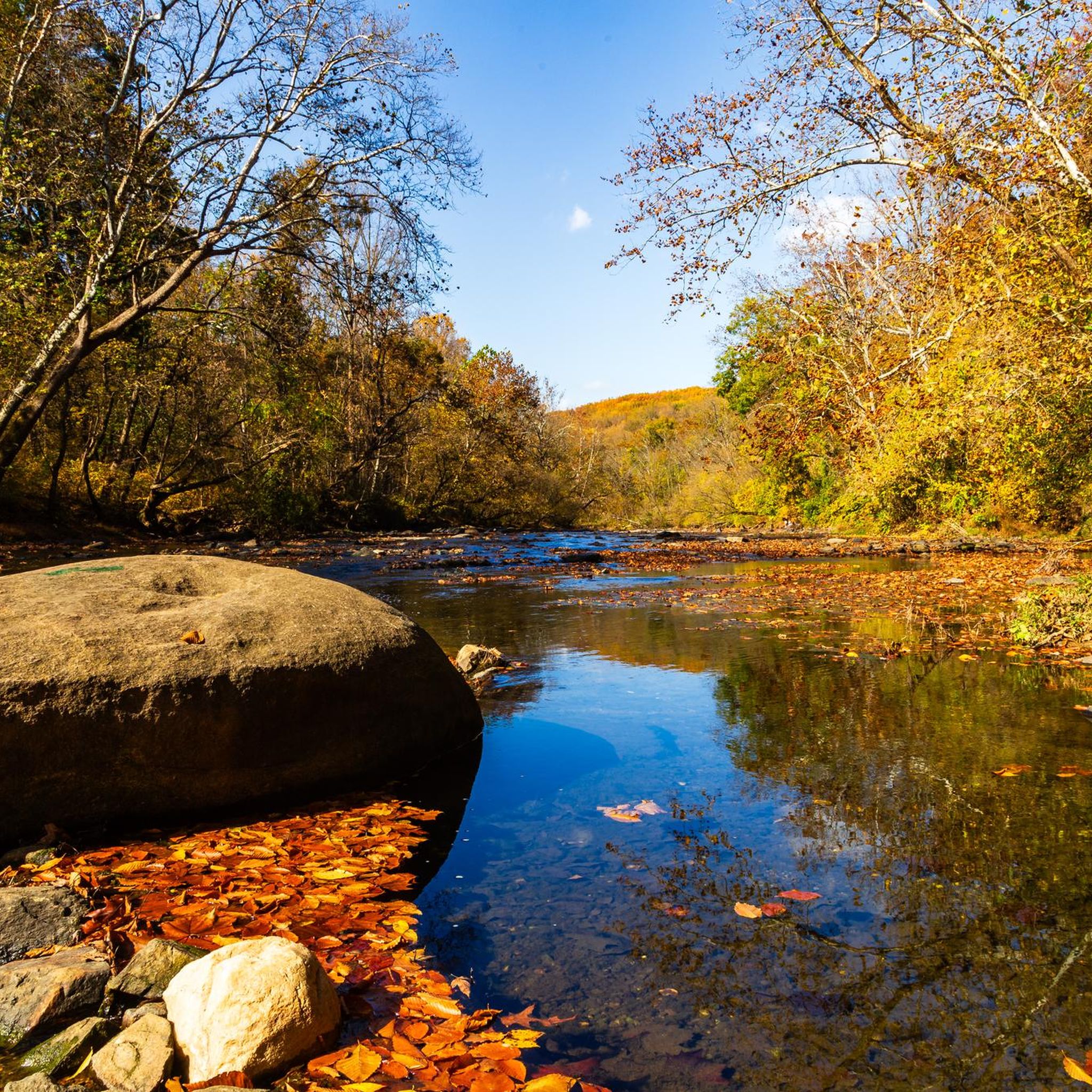
Road cycling routes in Gunpowder Falls State Park traverse a diverse landscape spanning over 18,000 acres, characterized by stream valleys, mixed hardwood forests, and varied terrain. The park features areas ranging from the rugged slopes of the Piedmont to flatter sections of the Coastal Plain. Road cyclists can expect routes that follow waterways like the Big and Little Gunpowder Falls, offering scenic views and a mix of paved surfaces. This varied topography provides options for different cycling preferences and fitness levels.
Best road cycling routes in Gunpowder Falls State Park
- The most popular road cycling route is Loch Raven Reservoir loop, a 13.6 miles (22.0 km) trail that takes about 1 hour to complete. This easy route offers views of the reservoir and features gentle gradients.
- Another top favourite among local road cyclists is East Coast Greenway and 9/11 Trail Loop, a moderate 45.8 miles (73.7 km) path. This route connects significant trails and passes through varied landscapes.
- Local road cyclists also love the Sparks Bank Nature Center – Glencoe Road metal bridge loop from Hereford, a 35.0 miles (56.3 km) trail leading through diverse forests and historic areas, often completed in about 2 hours 39 minutes.
- Road cycling in Gunpowder Falls State Park is defined by stream valleys, mixed hardwood forests, and varied terrain, with options available for different ability levels.
- The routes in Gunpowder Falls State Park are highly rated by the komoot community with an average score of 4.3 stars from more than 20 reviews. More than 600 road cyclists have used komoot to explore Gunpowder Falls State Park's varied terrain.
Last updated: July 7, 2026
4.6
(12)
26
riders
22.0km
00:59
230m
230m
The Loch Raven Reservoir loop offers a delightful road cycling experience, tracing the shores of the expansive 1,600-acre reservoir. You'll pedal along well-paved roads, enjoying peaceful views of the water and the surrounding Loch Raven Wildlife Area, where oaks and wild roses line the route. Keep an eye out for local wildlife, including bald eagles and osprey, adding to the natural charm of this easy 13.7-mile (22.0 km) ride.
Planning your visit is straightforward, though weekend riders should note the special car-free section of Loch Raven Drive. A 1.7-mile segment is closed to vehicles on Saturdays and Sundays, creating a safer and more enjoyable environment for cyclists. This makes weekend mornings an ideal time to tackle the loop, which typically takes about 59 minutes to complete with its gentle 743 feet (226 metres) of elevation gain.
This popular bike loop around Loch Raven Reservoir is a standout for its combination of accessible terrain and scenic beauty, making it suitable for nearly any fitness level. The reservoir itself is a crucial drinking water source for Baltimore, lending a sense of importance to the tranquil landscape. It's a fantastic option for those seeking a relaxing ride with picturesque viewpoints and a chance to connect with nature.
3
riders
73.7km
03:15
520m
520m
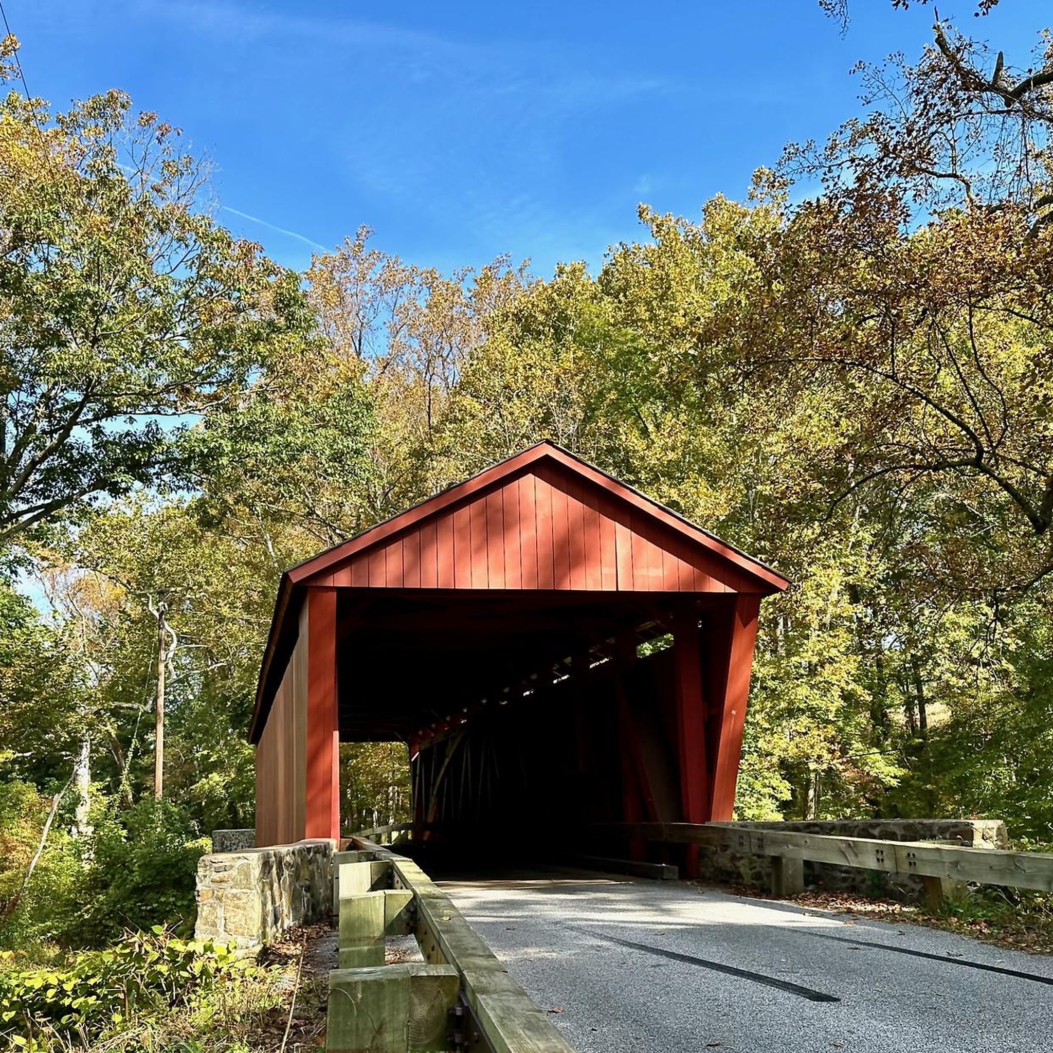
The East Coast Greenway and 9/11 Trail Loop offers a unique road cycling experience, weaving through diverse landscapes that range from natural riverfronts to historical towns. You'll pass notable landmarks like the Jericho Covered Bridge and the Concord Point Light, Maryland's second-oldest lighthouse, which provide scenic views of the Susquehanna River. The route combines sections of the East Coast Greenway and the 9/11 National Memorial Trail, offering a blend of historical significance and varied terrain for cyclists.
This moderate 45.8-mile (73.7 km) road cycling route includes 1703 feet (519 metres) of elevation gain and typically takes around 3 hours and 15 minutes. Be aware that the terrain can vary, with both paved and unpaved sections, and some on-road segments may have busy traffic. Cyclists should consider a bike with wider tires or a gravel bike for optimal comfort on the mixed surfaces.
This loop is part of two nationally significant trail networks: the East Coast Greenway, a 3,000-mile route from Maine to Florida, and the 9/11 National Memorial Trail, a 1,500-mile network connecting the three 9/11 memorial sites. The collaboration between these two projects creates a powerful tribute and a unique opportunity to engage with history while enjoying varied landscapes.

Sign up for free
27
riders
Easy road ride. Great for any fitness level. Mostly well-paved surfaces and easy to ride.
13
riders
Moderate road ride. Good fitness required. Some segments of this route may be unpaved and difficult to ride.
4
riders
60.3km
02:53
700m
700m
Moderate road ride. Good fitness required. Some segments of this route may be unpaved and difficult to ride.
Get access to more routes and recommendations from other explorers.
Sign up for free
Already have an account?
Our route recommendations are based on thousands of hikes, rides, and runs completed by other people on komoot.
Start today with a free account
Your next adventure awaits.
Login or Signup

Tips from the Community

As you ride along the NCR Trail there is an unexpected sight: a hillside full of gnomes and gnome homes! The Gnome Garden is a fun little local landmark that is great for kids and adults alike to stop at as you ride.
0
0

The East Coast Greenway is a 3,000-mile biking and walking trail stretching from Maine to Florida. In Maryland, it covers 163 miles, with 61 miles dedicated to bike paths and the rest on roads shared with vehicles. Highlights include the Jones Falls Trail into Baltimore, the Torrey C. Brown Trail, and the B&A Trail leading to Annapolis. The route traverses historic towns along the Chesapeake Bay. Notably, there is no pedestrian access over the Hatem Bridge for the Susquehanna River crossing, requiring careful planning for bikers.
0
0

Cute garden of gnomes guarding the cycleway and watching over cyclists on their journeys
0
0

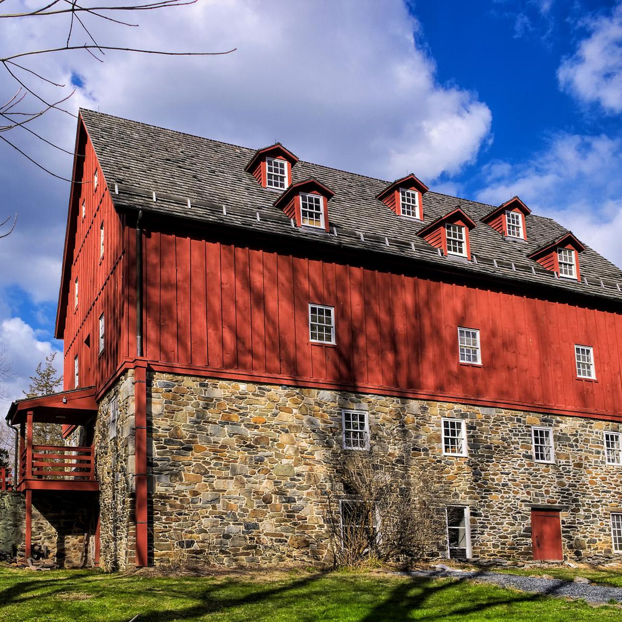
While riding past this spot along Thornton Mill Road, make sure to keep your eyes peeled for Bosley Church. The farmland and old homesteads add to the authenticity of the area.
0
0

If you're cycling in the area or on the Torrey C. Brown Trail, you'll likely pass by this spot where there's a metal deck bridge over the Gunpowder Falls. Although it's not possible to stop in the middle to enjoy the views over the river as cars are passing and it's a single-lane bridge, on one side, there's a small area with grass where you can take a short break.
0
0

Concord Point Light, a 36-foot lighthouse situated in Havre de Grace, Maryland, stands sentinel at the convergence of the Susquehanna River and the Chesapeake Bay. Erected in 1827, it served as a crucial guide for growing maritime traffic in the area. Today, it remains a privately maintained navigational beacon.
0
0

Just off the trail is a pretty outrageous gnome garden. The art installation is really well made and a must-see if you are on the trail! There is a drink and snack station that uses the honor system.
0
0

Here is an old scenic railway station on the NCR Trail (Torrey C Brown Rail Trail). There are bathrooms, a general store, a cafe, and other amenities in Monkton. This a great spot for a pit stops along the rail trail.
0
0
Frequently Asked Questions
How many road cycling routes are available in Gunpowder Falls State Park?
Gunpowder Falls State Park offers a wide selection of road cycling routes, with over 170 different tours available on komoot. These routes cater to various skill levels, from easy to difficult.
What kind of terrain can I expect on road cycling routes in Gunpowder Falls State Park?
The park's road cycling routes traverse a diverse landscape, ranging from the rugged slopes of the Piedmont to flatter sections of the Coastal Plain. You'll find routes with varied elevation gains and mostly paved surfaces, though some areas might present more challenging segments. The Sparks Bank Nature Center – Glencoe Road metal bridge loop from Hereford, for instance, features significant elevation changes.
Are there routes suitable for beginners or families in Gunpowder Falls State Park?
Yes, Gunpowder Falls State Park has several easy road cycling routes perfect for beginners or families. The Loch Raven Reservoir loop is a popular easy option, offering gentle gradients and scenic views. The Torrey C. Brown Rail Trail, while not exclusively a komoot route in this guide, is also known as a 19.7-mile paved, ADA-accessible path ideal for leisurely rides.
What scenic views or landmarks can I see along the road cycling routes?
Many routes offer picturesque views of the park's waterways, including the Big and Little Gunpowder Falls. You can also encounter historical sites like the Jerusalem Mill, one of Maryland's oldest grist mills, and the Jericho Covered Bridge. Routes around Prettyboy Reservoir also provide stunning water views and diverse landscapes.
Can I spot wildlife while road cycling in the park?
Yes, Gunpowder Falls State Park's extensive acreage and diverse habitats support a wide array of flora and fauna. While cycling, you might encounter various wildlife, especially in the mixed hardwood forests and along the stream corridors, making it a great spot for nature observation.
Are there any circular road cycling routes in Gunpowder Falls State Park?
Yes, many road cycling routes in the park are designed as loops, allowing you to start and end at the same point. Examples include the Loch Raven Reservoir loop and the Torrey C. Brown Rail Trail – Glencoe Road metal bridge loop from Hereford, which offers a longer, moderate challenge.
What is the best time of year for road cycling in Gunpowder Falls State Park?
The park's diverse ecosystems make it enjoyable year-round, but spring and fall generally offer the most pleasant temperatures for road cycling. These seasons also provide vibrant foliage or blooming wildflowers, enhancing the scenic beauty of your ride. Summer can be warm and humid, while winter rides are possible but require appropriate gear.
Where can I park when visiting Gunpowder Falls State Park for road cycling?
Gunpowder Falls State Park has numerous access points and parking areas throughout its vast expanse. Specific parking availability will depend on the section of the park or the trailhead you plan to use. For routes like those accessing the Torrey C. Brown Rail Trail, designated parking lots are available in towns like Phoenix, Monkton, and White Hall.
Is public transport available to access road cycling routes in the park?
Public transport options directly into Gunpowder Falls State Park for road cycling access are limited. Most visitors typically arrive by car. However, some sections of the park, particularly those closer to Baltimore County, might be accessible via local bus routes with a short ride to trailheads. It's advisable to check local transit schedules for specific stops near park entrances.
Are there cafes or amenities near the road cycling routes?
Yes, especially along popular routes like the Torrey C. Brown Rail Trail, you'll find charming historic communities such as Phoenix, Monkton, and White Hall. These towns often offer cafes, small shops, and other amenities where you can refuel or take a break during your ride.
Are permits required for road biking in Gunpowder Falls State Park?
Generally, no specific permits are required for road cycling on the designated trails and paved roads within Gunpowder Falls State Park. However, it's always a good practice to check the official Maryland Department of Natural Resources website or park signage for any updated regulations or specific rules for certain areas within the park.
What do other road cyclists enjoy most about road cycling in Gunpowder Falls State Park?
The road cycling routes in Gunpowder Falls State Park are highly rated by the komoot community, with an average score of 4.3 stars from over 20 reviews. More than 600 road cyclists have explored the park using komoot, often praising the diverse terrain, scenic views along the waterways, and the variety of routes suitable for different fitness levels.
Are there longer road cycling routes for experienced riders?
Absolutely. For experienced riders seeking a greater challenge, routes like the East Coast Greenway and 9/11 Trail Loop offer a moderate 45.8 miles (73.7 km) path with significant elevation gains, connecting various landscapes. There are also 24 routes classified as 'difficult' on komoot for those looking for a more strenuous ride.
Most popular routes in Gunpowder Falls State Park
Most popular attractions in Gunpowder Falls State Park

Get inspired with the komoot mobile app


Explore more
Browse the best Road cycling routes in other regions.
