The best running trails in Hunter-West Kill Wilderness
43
runners
14
runs
Jogging in Hunter-West Kill Wilderness offers a diverse range of running routes within the Catskill Mountains. This extensive wilderness area is characterized by rugged mountain peaks, dense forests, and scenic waterways like West Kill Creek and Esopus Creek. Elevations vary significantly, from 1,000 to over 4,000 feet, providing varied terrain for runners. The landscape includes prominent mountains such as Hunter Mountain and West Kill Mountain, along with features like Diamond Notch Falls.
Best jogging routes in Hunter-West Kill Wilderness
- The…
Last updated: October 15, 2026
10
runners
7.41km
01:43
660m
660m
Hard run. Very good fitness required. Sure-footedness, sturdy shoes and alpine experience required.
1
runners
3.13km
00:25
170m
170m
Jog the Tanbark Trail Loop, a moderate 1.9-mile route in Catskill Park with 564 feet of gain and panoramic views over Phoenicia.

4
runners
6.92km
00:44
80m
80m
Moderate run. Good fitness required. Mostly paved surfaces. Suitable for all skill levels.
2
runners
10.3km
01:05
120m
120m
Moderate run. Good fitness required. Mostly paved surfaces. Suitable for all skill levels.
2
runners
9.63km
01:31
560m
560m
A difficult 6.0 miles (9.6 km) jogging route on Tremper Mountain via the Phoenicia Trail, featuring a historic fire tower and panoramic view
Get access to more routes and recommendations from other explorers.
Already have an account?
Our route recommendations are based on thousands of hikes, rides, and runs completed by other people on komoot.
Start today with a free account
Your next adventure awaits.
Popular around Hunter-West Kill Wilderness

Tips from the Community

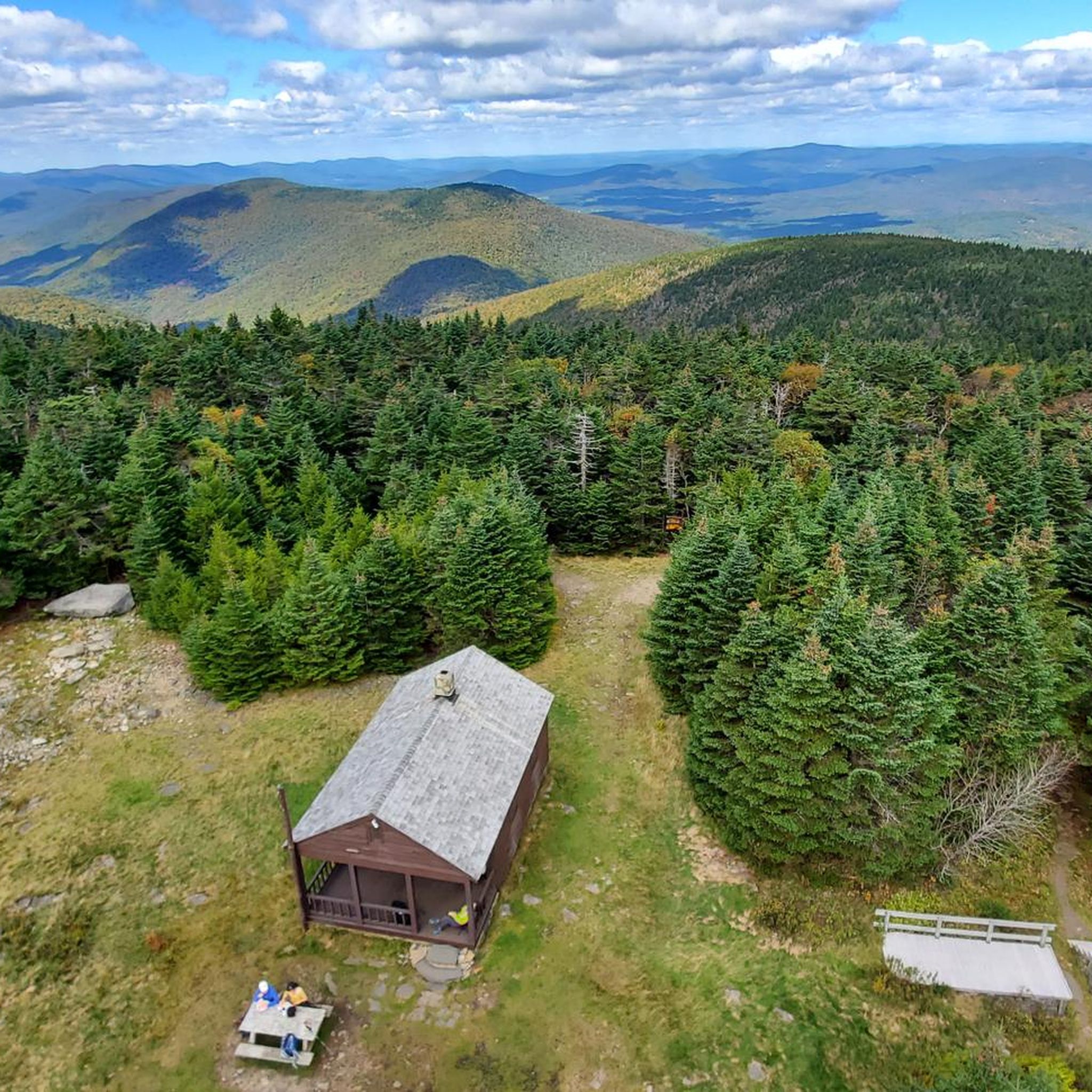
Nestled in the Catskill Mountains, Mount Tremper beckons with serene trails and a captivating fire tower summit. Enjoy natural, scenic beauty, explore, and relish the awe-inspiring views.
0
0
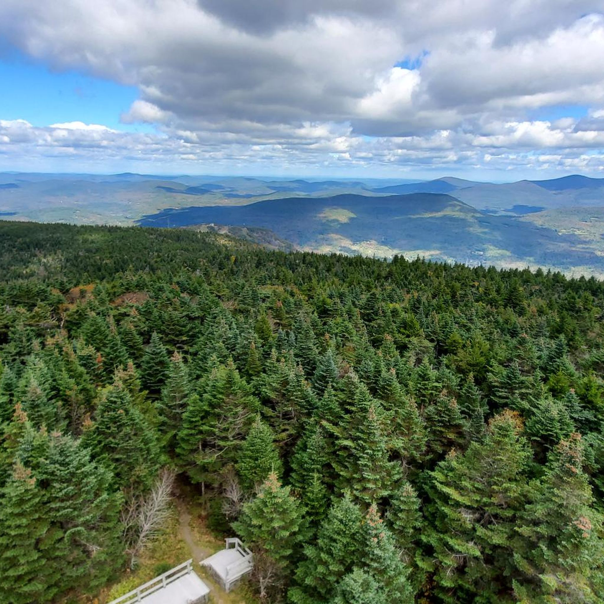
This viewpoint offers sweeping views of the surrounding landscape. In fall and winter, the town of Phoenicia becomes visible through the bare trees, but remains obscured by foliage during the spring and summer months.
0
0

Hunter Mountain is the second highest mountain in the Catskills. From the top of the fire tower, you have views of the surrounding mountains as well as of the Hudson Valley, Massachusetts, and Connecticut. Epic!
1
0
Frequently Asked Questions
What kind of terrain can I expect on running routes in Hunter-West Kill Wilderness?
The Hunter-West Kill Wilderness offers a diverse range of terrain for runners. You'll find everything from moderate paths with varied elevation to rugged trails involving steep climbs and rock scrambles, especially on routes leading to mountain summits. Elevations range from 1,000 to over 4,000 feet, ensuring a challenging and varied experience.
Are there any easy or moderate running routes suitable for beginners in the Hunter-West Kill Wilderness?
Yes, there are several moderate options. For a steady run with varied terrain and moderate elevation gain, consider the Tanbark Trail Loop, which is 1.9 miles (3.1 km) long. Another moderate option is the Running loop from Town of Hunter, a 4.3-mile (6.9 km) route with minimal elevation gain.
What are some notable natural features or landmarks I might see while running in the area?
The wilderness is rich with natural beauty. You can encounter rugged mountain peaks like Hunter Mountain (the second-highest in the Catskills) and West Kill Mountain. Diamond Notch Falls, a picturesque 25-foot waterfall, is another significant draw. Many trails also offer stunning viewpoints like Buck Ridge Lookout and Geiger Point, providing expansive vistas of the surrounding landscape.
Are there any circular running routes in Hunter-West Kill Wilderness?
Yes, several routes offer a circular experience. The Hunter Mountain loop from Stony Clove Notch Unit is a challenging 4.6-mile (7.4 km) loop. For a moderate option, the Tanbark Trail Loop is a 1.9-mile (3.1 km) circular path.
Is the Hunter-West Kill Wilderness suitable for family-friendly running or walking?
While many trails are rugged, some access points, like those off Spruceton Road, offer more family-friendly options for hiking and walking. For running, the Tanbark Trail Loop is a moderate choice that might be suitable for families looking for a less strenuous run or walk.
What is the best time of year to go running in Hunter-West Kill Wilderness?
The Hunter-West Kill Wilderness offers rewarding running experiences throughout much of the year. Spring and fall provide comfortable temperatures and beautiful scenery, with fall foliage being particularly stunning. In winter, some trails may be suitable for running, but conditions can be challenging with snow and ice, requiring appropriate gear and caution. Summer offers lush greenery but can be warm and humid.
Are there specific trails that offer panoramic views?
Absolutely. Trails leading to mountain summits like Hunter Mountain and West Kill Mountain provide rewarding panoramic views. The Tremper Mountain via Phoenicia Trail, a 6.0-mile (9.6 km) route, is known for its panoramic views, especially in fall and winter when the town of Phoenicia is visible through the bare trees. Hunter Mountain also features a historic fire tower, offering expansive vistas.
Where can I park to access the running trails in Hunter-West Kill Wilderness?
The Hunter-West Kill Wilderness has six trailheads with designated parking areas, providing access to the extensive trail network. Specific parking details can often be found on individual route pages or local park information websites.
What are the longest and most challenging running routes in the area?
For a significant challenge, the Giant Ledge - Panther - Fox Hollow Trail is a difficult 9.1-mile (14.6 km) route with substantial elevation gain. Another difficult option is the Hunter Mountain loop from Stony Clove Notch Unit, which is 4.6 miles (7.4 km) with challenging climbs.
How many running routes are available in Hunter-West Kill Wilderness on komoot?
Komoot features over 10 running routes in the Hunter-West Kill Wilderness, catering to various fitness levels. These include 7 moderate routes and 5 difficult routes, offering a wide selection for your next outdoor adventure.
What do other runners say about the routes in Hunter-West Kill Wilderness?
The running routes in Hunter-West Kill Wilderness are highly regarded by the komoot community. Over 20 runners have explored the varied terrain using komoot, often praising the rugged mountain peaks, dense forests, and pristine waterways that define the area's unique wilderness character.
Most popular routes in Hunter-West Kill Wilderness

Get inspired with the komoot mobile app


Explore more
Browse the best Running Trails & Routes in other regions.
